I bundled the dog into the car and drove out to Piddington, a couple of kilometres North of the hashpoint. Cherwell Council advertise a circular walk
that seems to circle from the village (which looked like a good place to park) up to Muswell Hill, the summit of which is near the hashpoint.
She and I walked through Piddington, past the church, and up onto the path. A soggy kilometre or so later we quickly discovered that this was going to be more-challenging than I’d
anticipated. We quickly got bogged down in a flooded field and needed to double-back. With my socks already soaking wet and the dog in a similar condition, we found a different route
that looped around the entire hill and through an alpaca farm (or were they llamas?), then we worked our way up the South face of the hill, over the summit, and down to the hashpoint.
We got there at 11:00 UTC, took a quick look around and pulled the closest thing a dog can manage to a silly grin, and then hacked our way back (by road) to Piddington for the drive
home and some dry clothes.
When I saw this hashpoint appear I thought to myself: that’s eminently achievable! I hoped I might be able to slip away from work for a lunchtime cycle to claim it.
But the gods of technology didn’t approve of my plan and turned my workday into a catastrophe of the kind that only a computer can, and the chance of taking a long lunch evaporated
quickly. But fortune dealt me a second hand when the weather held off into the evening, and I instead opted for a post-dinner huckle in the dark out to this hashpoint.
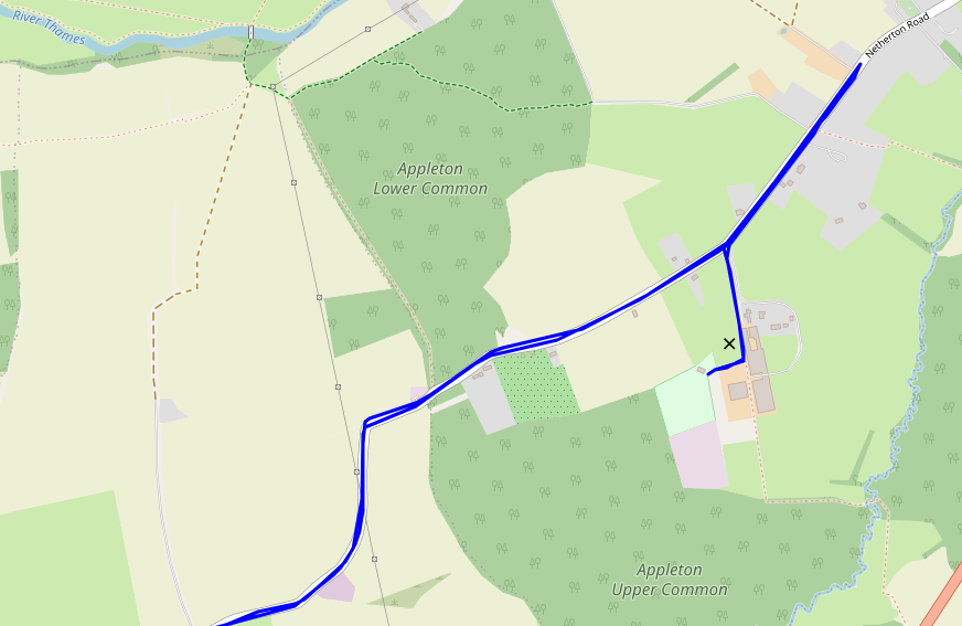
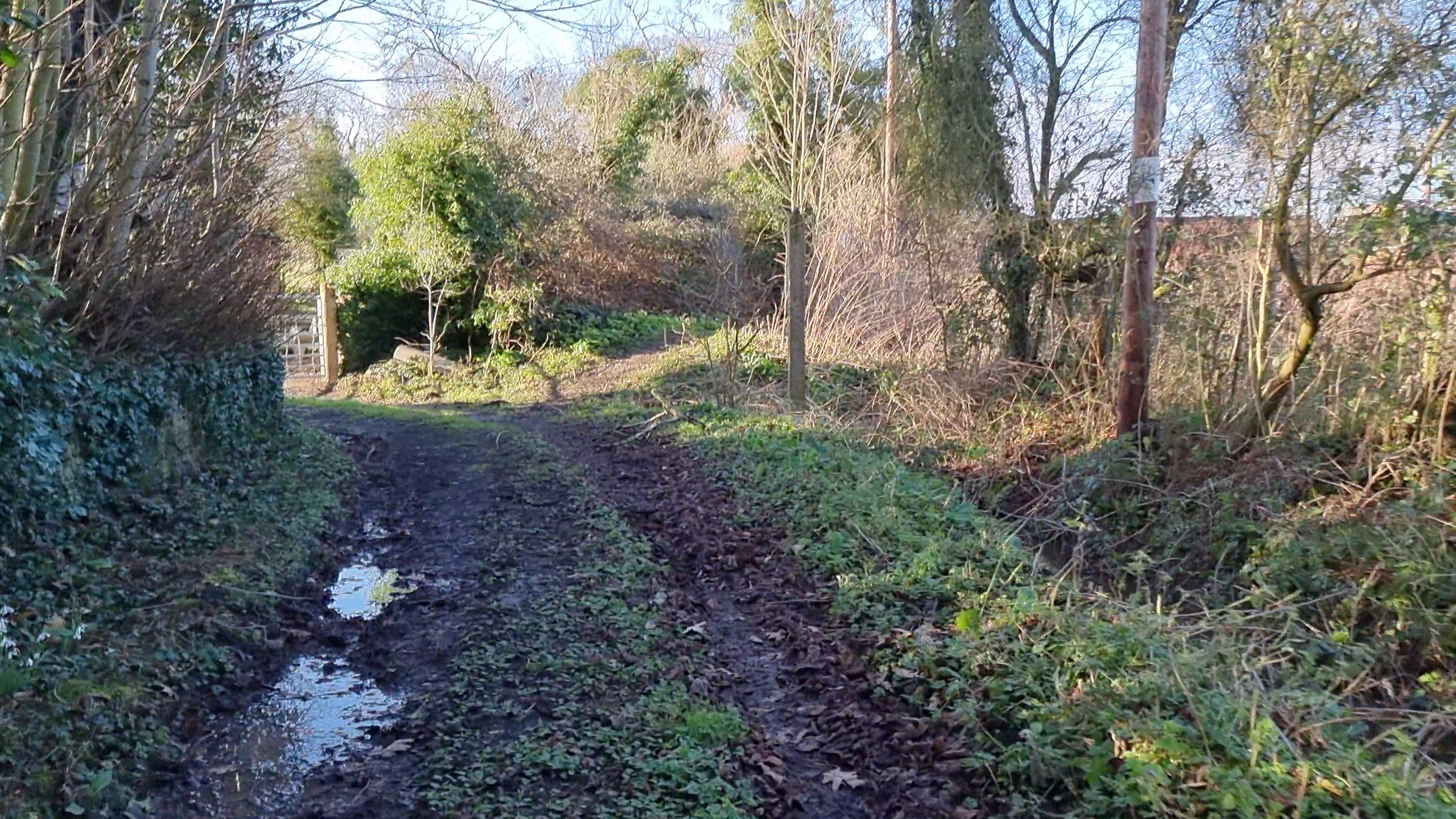
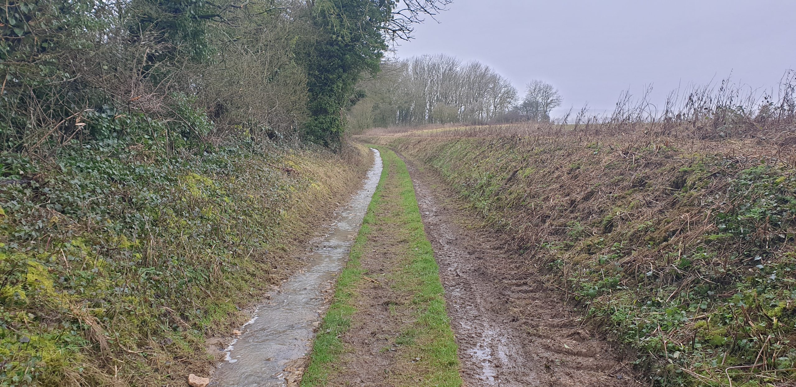
I set out around 18:30, South through Stanton Harcourt then North up the adorably-named Ducklington Road. It took some time to sight the somewhat-concealed bridleway around the hill of
Cokethorpe School. And then, another challenge – navigating by OpenStreetMap I missed my turning and went straight through a farmyard, and had to carry my bike over a fence at the other
end. Turns out the map is wrong and I later found a sign indicating the true course of the bridleway; I’ll get that
corrected.
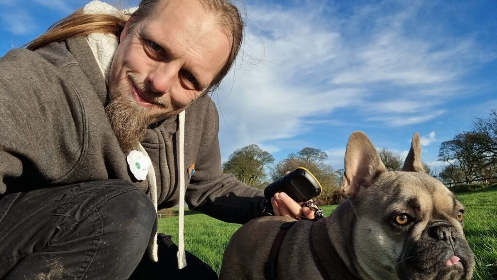
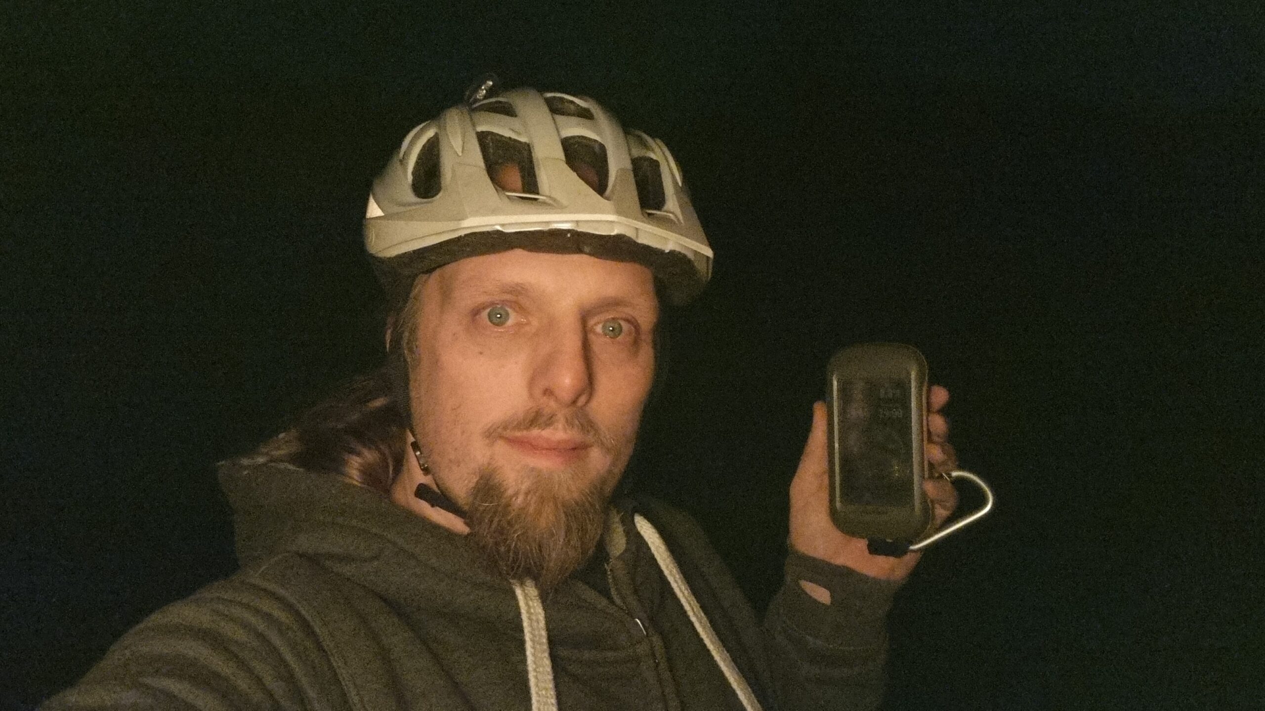
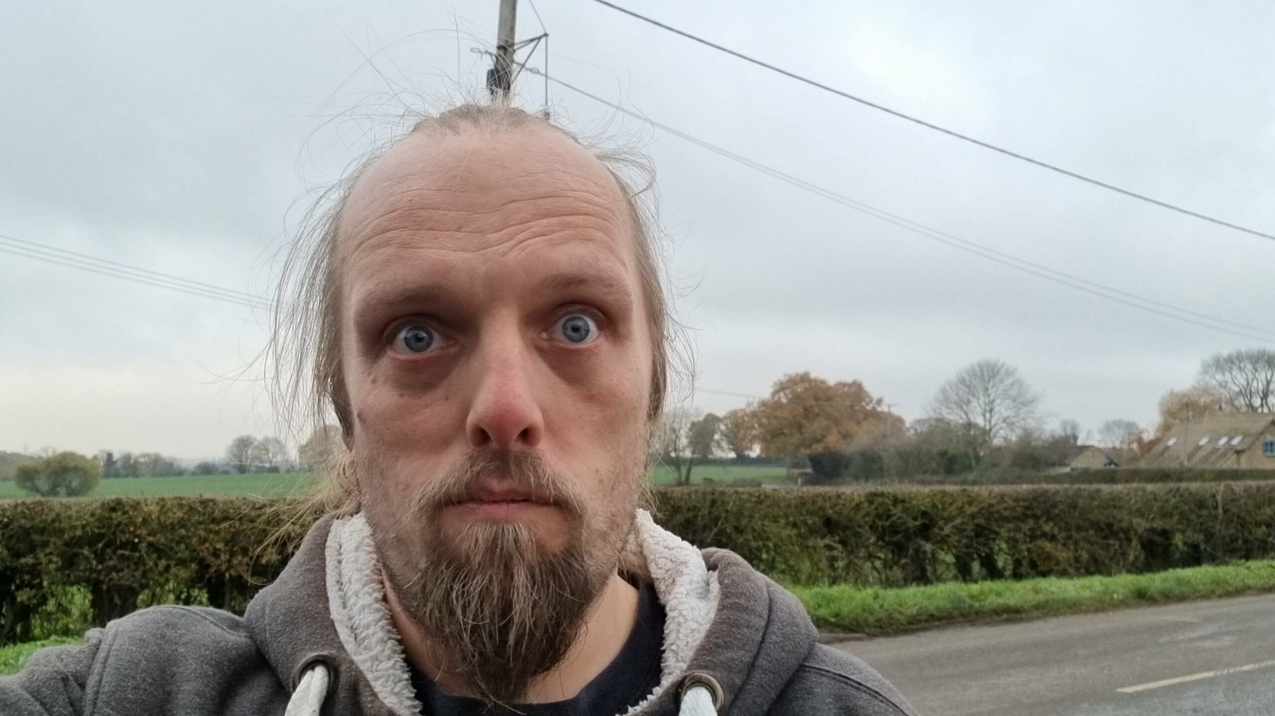
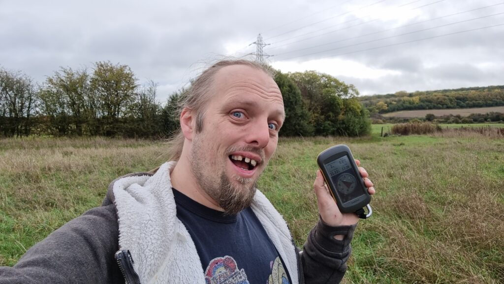
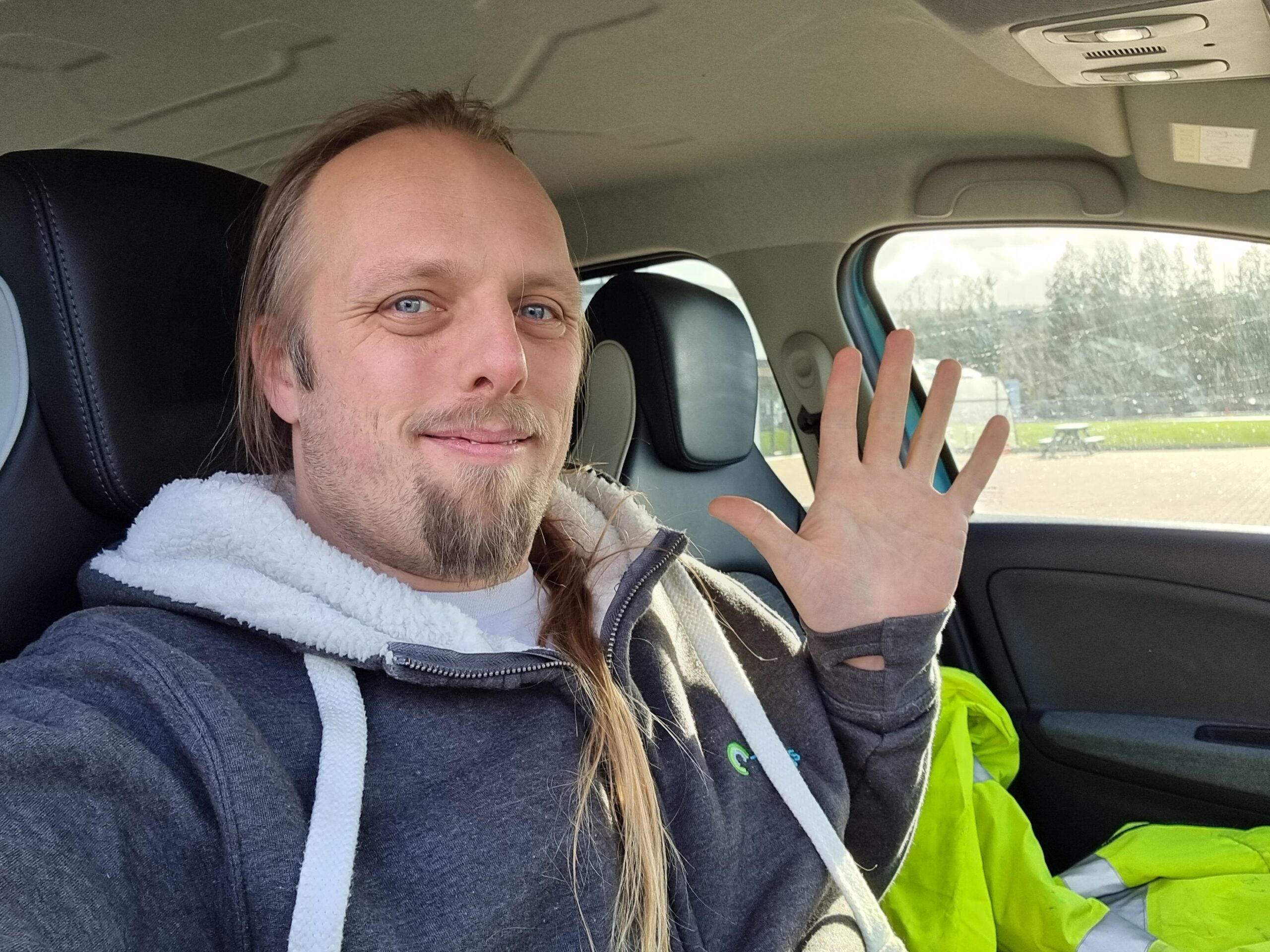
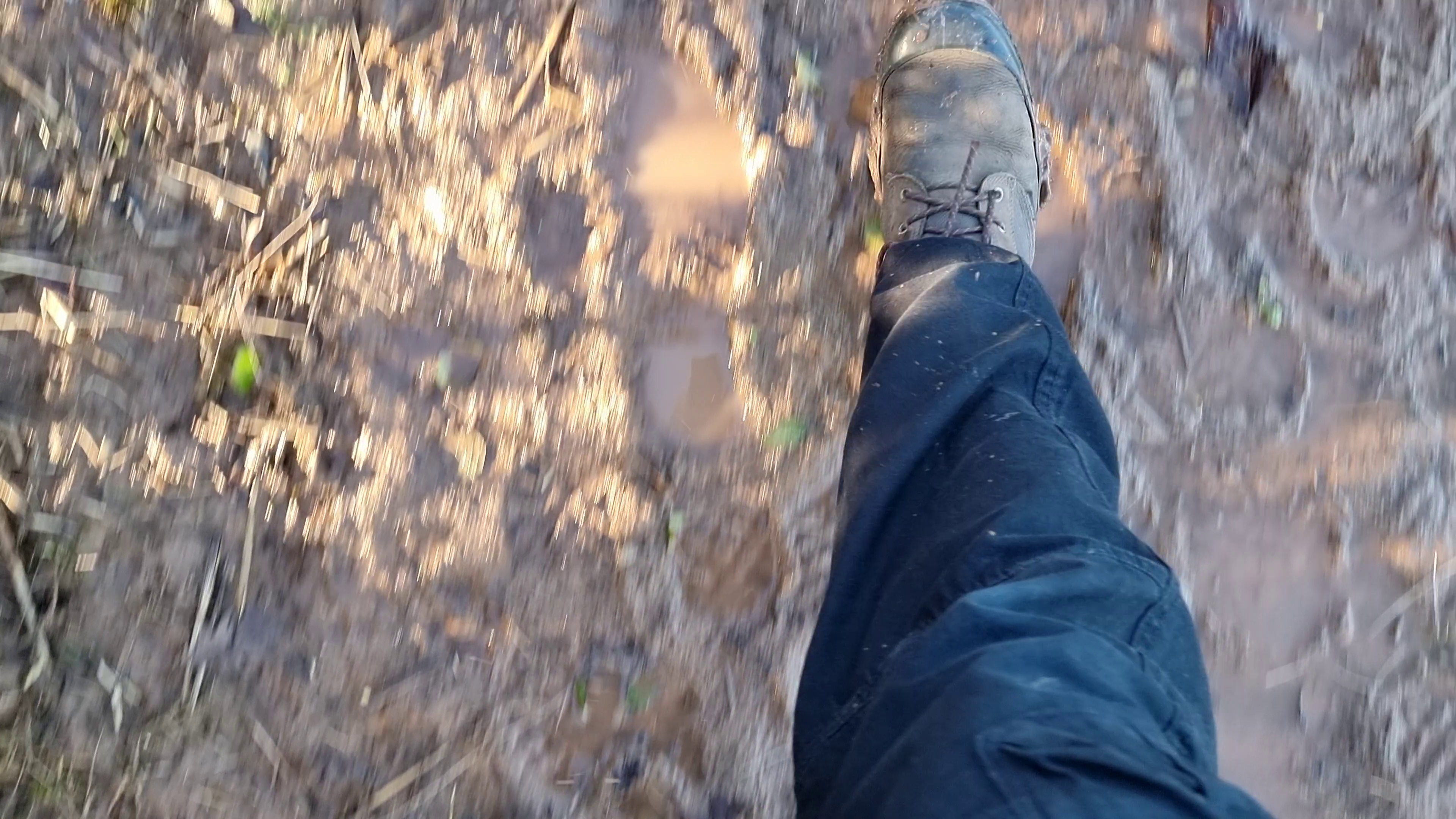
I abandoned my bike for the final 50 metres, trekking through the thick grass of an unmown meadow to the hashpoint and arriving around 19:00. No panoramic photo today it’s too dark –
but you get a silly grin.
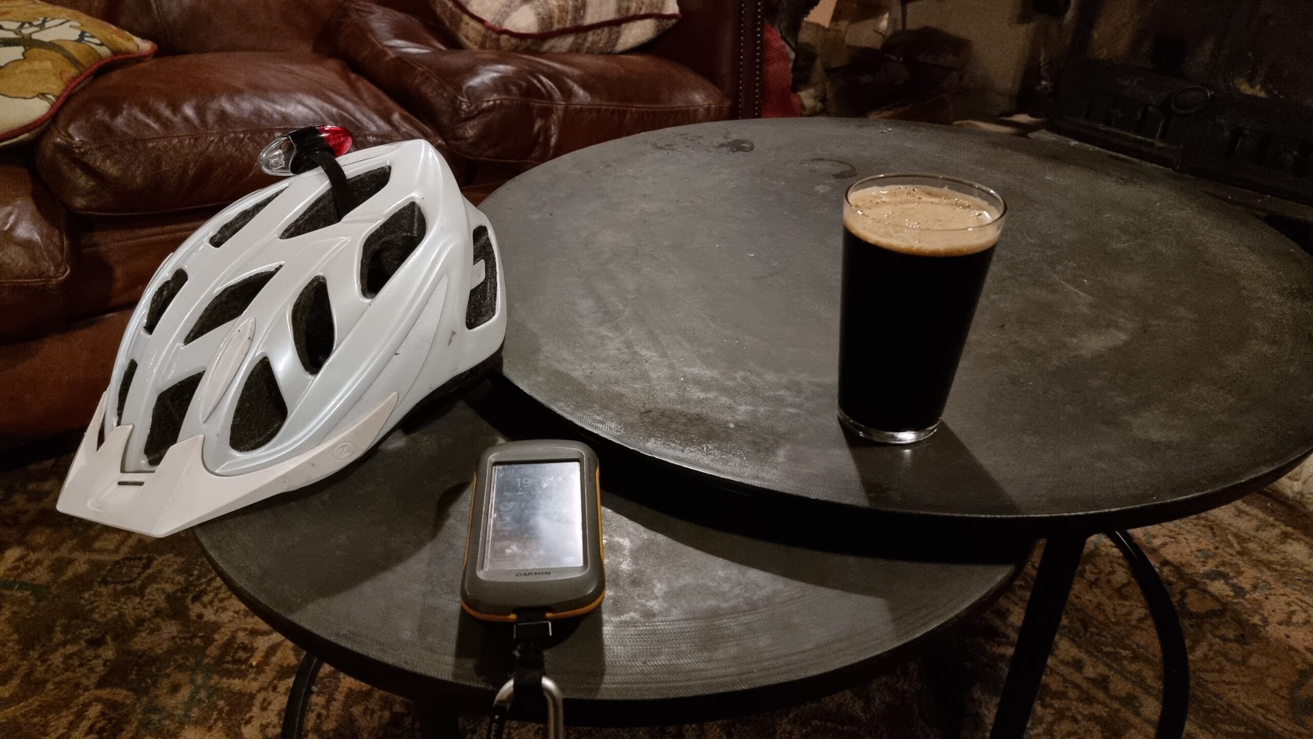
Pleased with this fast expedition, I diverted on my route home to the Harcourt Arms pub for a pint of their surprisingly-delicious
seasonal guest ale, Fairytale of Brew York, which genuinely tastes like stollen. There, I wrote up this
expedition report, but I’ll have to get home before I can extract my GPSr‘s tracklog.
I don’t know if I’ll be able to make it to this one, but if I can I’ll cycle over there on my lunch break or right after work.
Expedition
The dog was making an attention-seeking nuisance of herself while I was trying to work today, so I wrapped up all the critical things I needed to do so I could take her our for a walk
this afternoon to try to wear her out. I’m moderately familiar with Appleton – I have a regular cycle circuit that comes right through it! – but I’ve never been out to the cricket club
and sports field, so I pointed the hashing hound in the right direction and let her lead the way.
At first it looked like this was going to be a successful expedition: the needle on my GPSr pointed almost directly ahead as I walked up
the lane towards Appleton Sports Field. But as I got closer, I realised to my disappointment that the hashpoint was
going to be about 25 metres into the adjacant field, guarded by a trio of bullocks. At 15:00 I declared the expedition a failure. The doggo and I completed an exploration of the lane
and had a look around the sports field, spotted a pair of muntjack deer ambling around, and then headed back home.
I’ll be back in Appleton later today to buy a Christmas tree, so I’ll wave at the cattle as I go past, again.
Tracklog
My GPSr kept a tracklog; note that this was an “on the way” stopoff so the start and end point isn’t the same!
I hope to cycle/walk to the GZ about lunchtime? I’ve an opportunity to pass nearby the GZ between other errands this morning!
Expedition
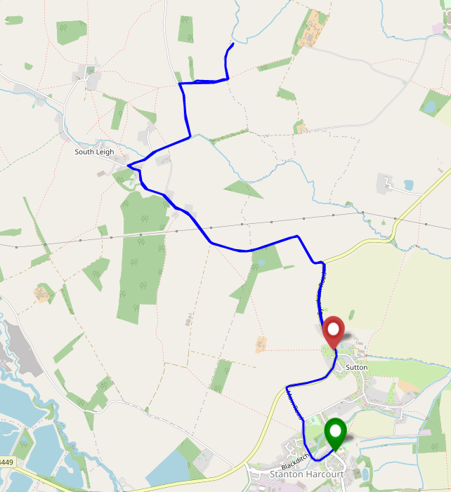
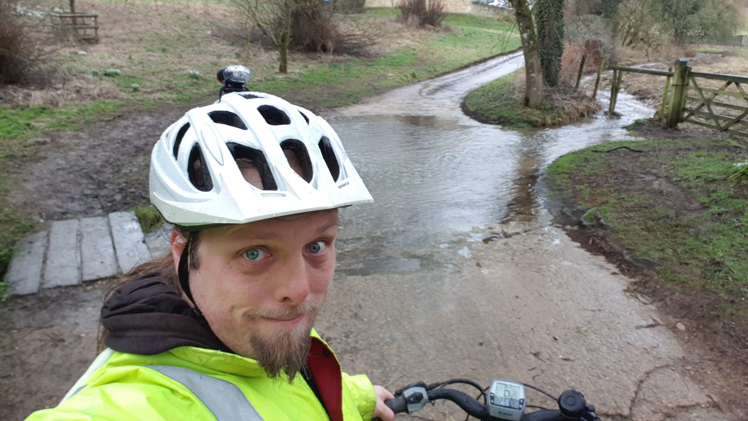
I was excited to see this spot pop up on my radar, because it’s a lovely meadow that I’ve ocassionally walked my dog in, within comfortable cycling distance of my house. As it happened,
I had an even easier route here because a drive this morning to drop the kids off at a half-term activity took me “close enough” to be worth stopping and walking from there.
I parked at The Talbot Inn, just West of the Swinford Toll Bridge (a bizzare old bridge that, for weird historical reasons, continues to use human operators
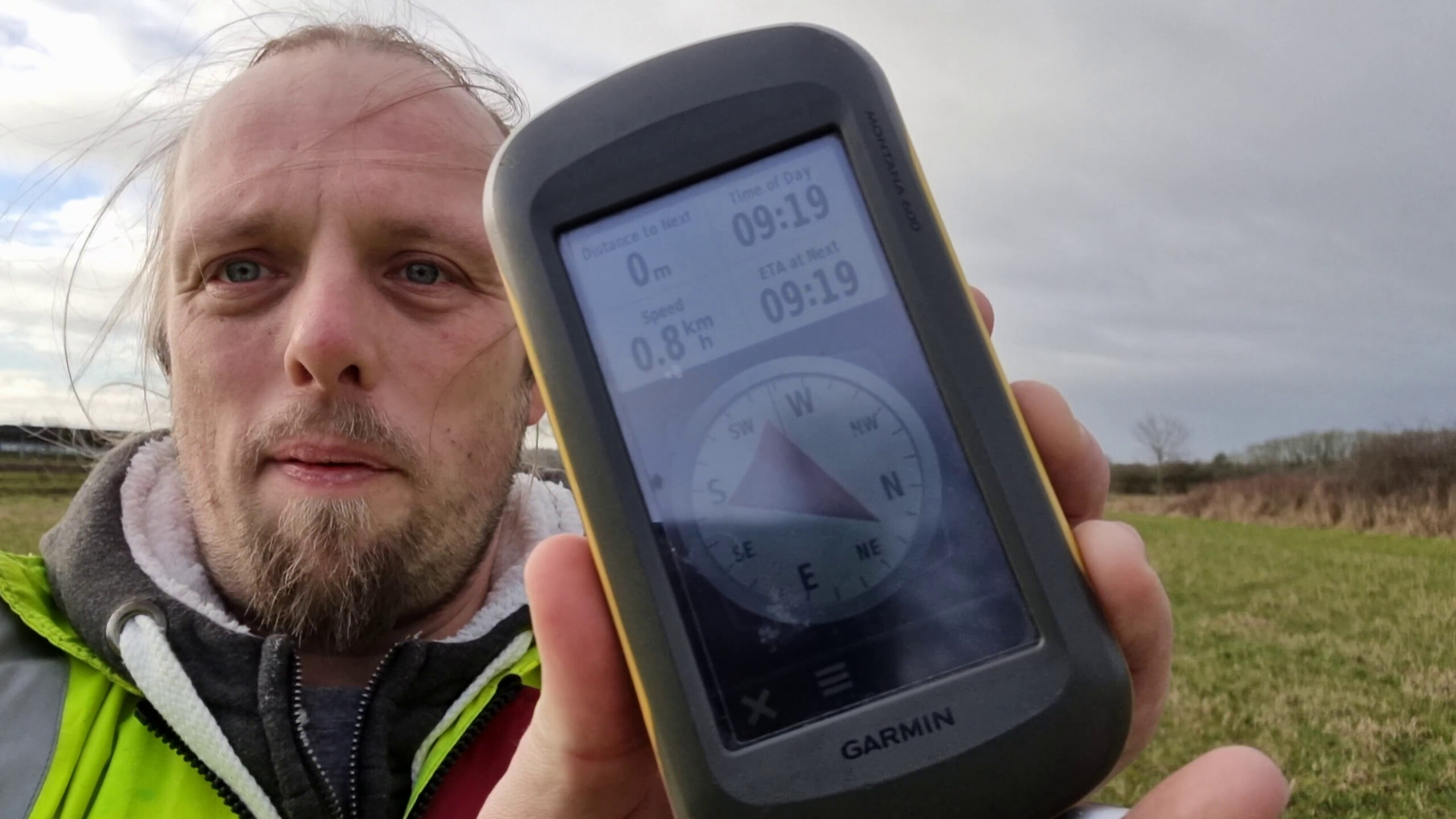
to charge 5 pence per car to cross, which surely cannot be cost-effective!). From here, there’s a footpath along the back of the Seimens buildings in the nearby light industrial estate
which eventually comes out into the Wharf Stream Way circular walk. It was pretty damp out here today and I quickly regretted my choice of light trousers which would have been fine to
drive the kids to their camp and back but wasn’t really a good choice for stomping across the long grass of a damp meadow. Some way across I disturbed some grazing deer, but ultimatey
it was following a deer-trodden trail that eventually provided the best route to the GZ.
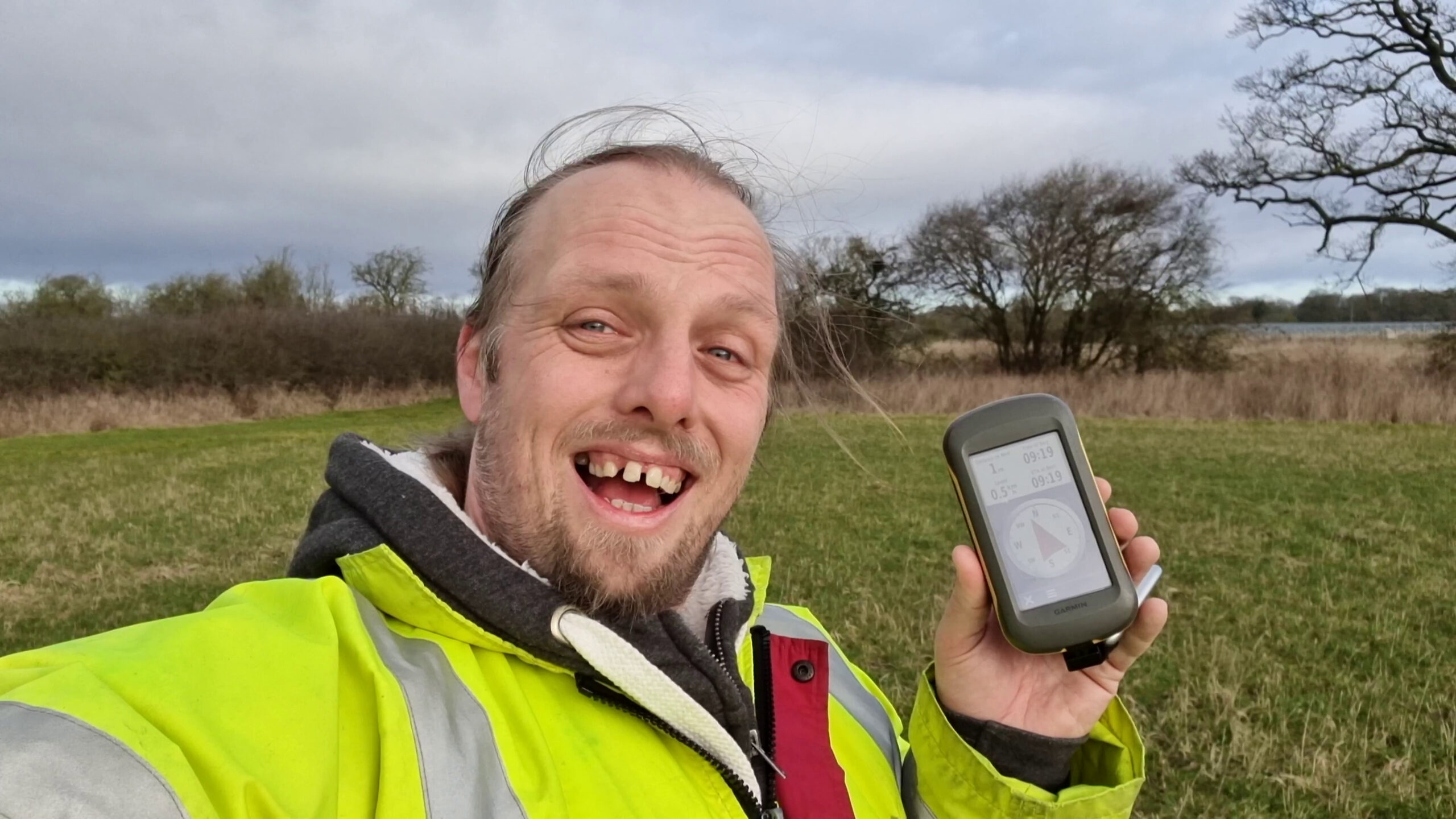
I reached the GZ at 09:19, took a selfie, and then turned around to go and get to work. I also shot a video covering the whole expedition which is presented, unedited, below.
Tracklog
My GPSr kept a tracklog; note that this was an “on the way” stopoff so the start and end point isn’t the same!
I’m hoping to find the 2022-02-19 52 -2 hashpoint one day earlier and one graticule over, and
I think I can stretch the range on the electric car enough to be able to return home via this hashpoint too.
Update: managed to change the car after finding the 2022-02-19 52 -2 point, so I can make
this. Probably be there about midday, weather-permitting.
I didn’t expect much of this hashpoint, but I wanted the excuse to recharge the car before going for another leg of my journey – either a trip up to visit a friend in Lichfield or else
a hashing expedition one graticule further East where today’s hashpoint seemed to be in a graveyard! But more on that later.
I parked at the Morrisons car park at (52.757778, -1.752222) at 14:48 and hooked up to the charger there (once I eventually found it). I had some difficulty making it work, but it
seemed to get started eventually. Then I began my walk to the hashpoint. This was far from the picturesque walk of yesterday, taking me through a series of housing estates that were
nondescript at best, unpleasantly scuzzy at worst. Shooting video as I walked, I was at one point loudly mocked by a group of young men passing in an artificially-loud car, but it was
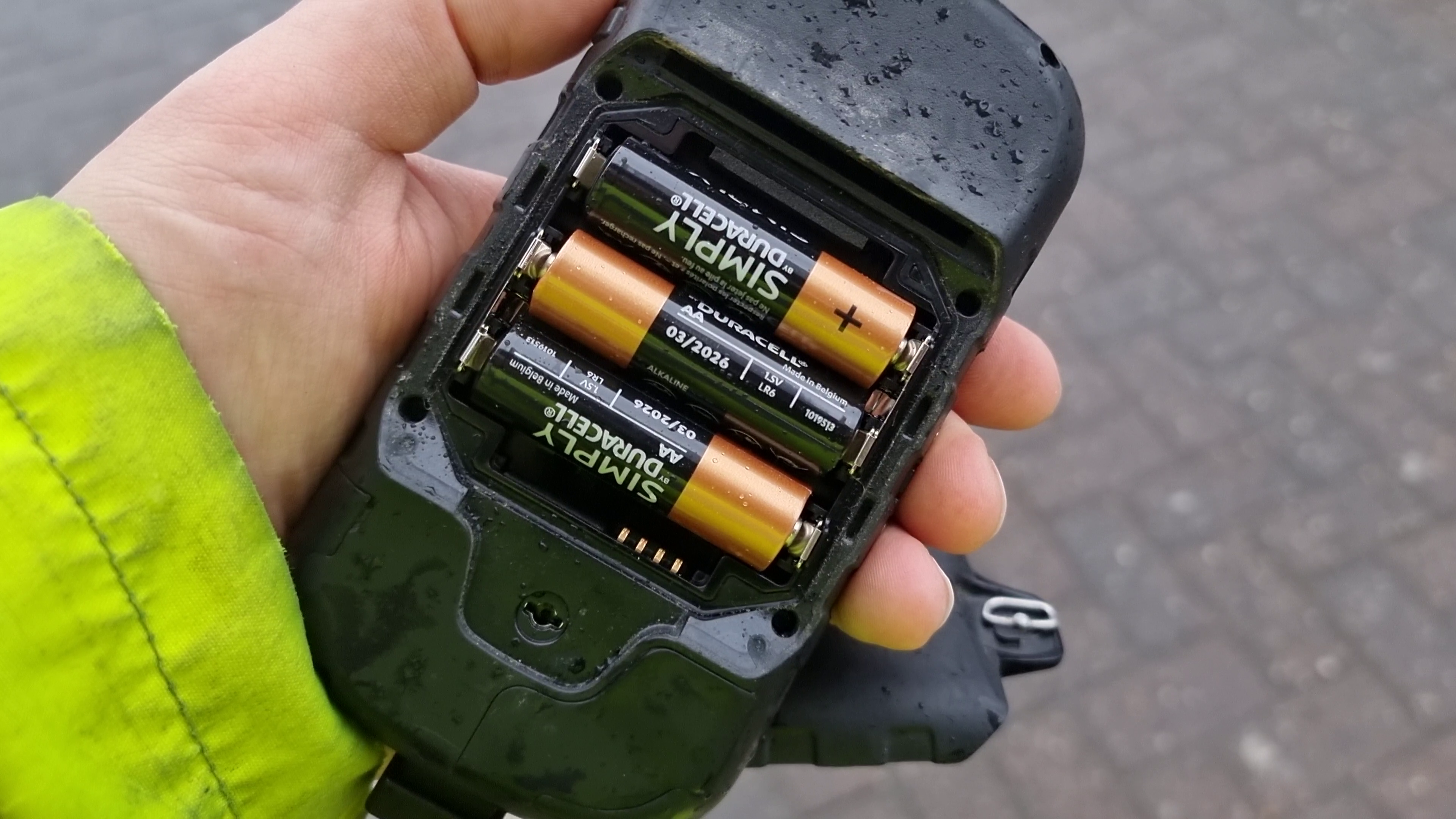
an activity that soon had to end anyway as the rain began to pour down. At around 15:11 my GPSr ran out of battery power (I’d failed to
find its charging cable the night before) and there’s a clear gap in my tracklog: fortunately I was also equipped with not one but two backup devices (my phone, of course, and my
watch), so I was able to continue heading in the right direction, and when I found a convenience store near (52.739167, -1.998333) I bought some AA batteries (my GPSr can have its rechargeable battery removed and 3 × AA batteries put in its place to allow it to continue) and pressed on to the hashpoint.
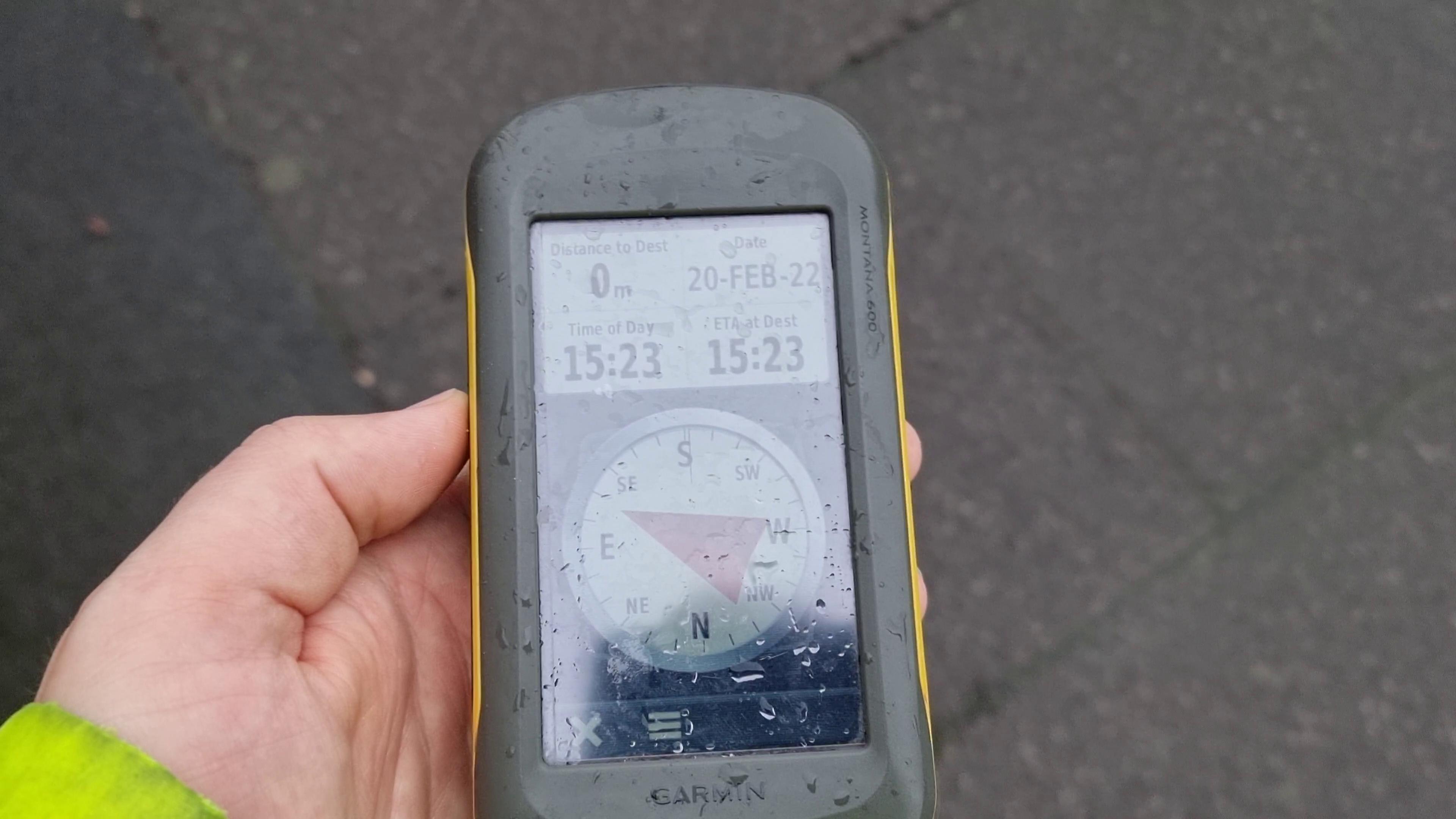
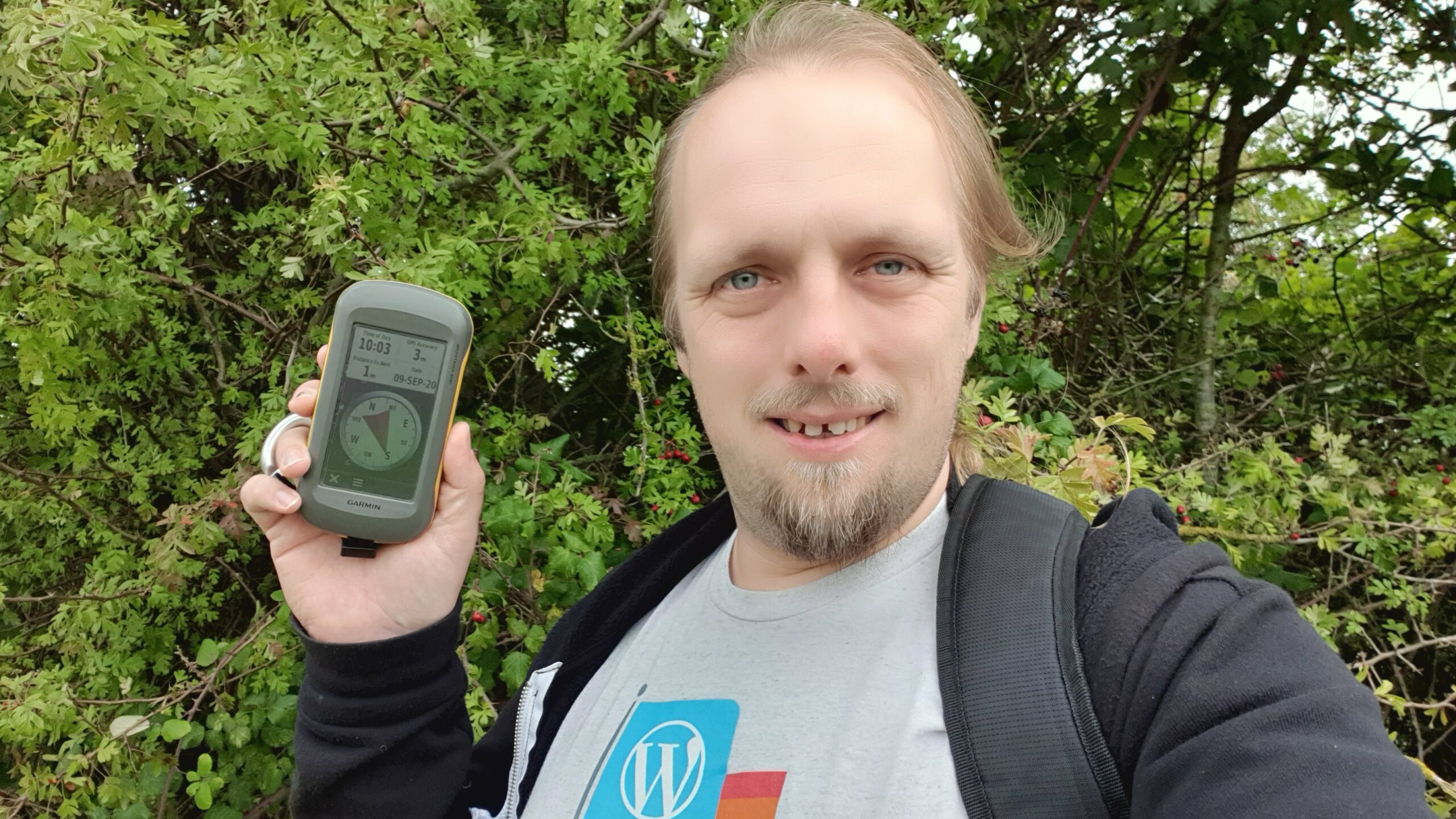
As anticipated, the hashpoint was on a road dividing a light industrial park from a housing estate, right outside a plant specialising in bending plate aluminium; I reached it at
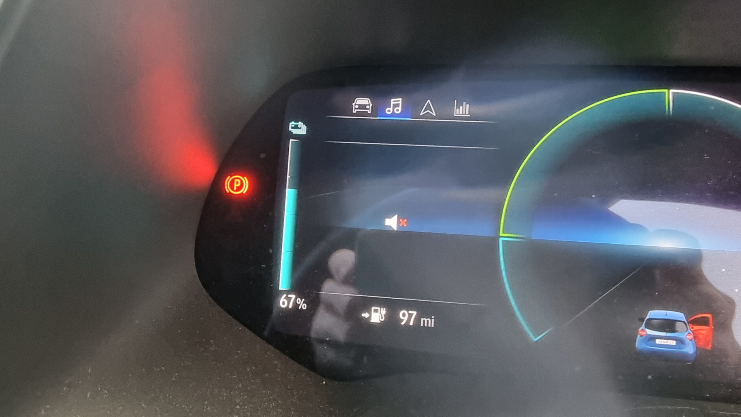
15:23:48. I walked back the same route as the rain began to fall more and more heavily: by the time I reached the car it had become torrential. The dubious charging point I’d used had
taken £16 from my bank card but provided only enough charge to take the car from 66% to 67% battery, which – combined with the rapidly-worsening weather – made me rethink my plans to
visit Lichfield or explore further East and I instead used my remaining distance to take a long (slow, wet, diversion-filled) drive home. Ugh.
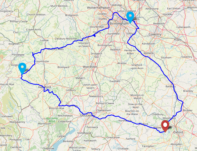
Tracklog
My GPSr kept a tracklog of my entire two-day expedition:
I’ve a rare opportunity today to expand my Minesweeper grid by reaching a hashpoint in 52 -2. Also, to engage in my established tradition of “getting outside and exploring” on 19
February (in memory of my father, the most “get outside and explore” person I ever knew, who died ten years ago today while, you guessed it, getting outside and exploring).
I’ve booked some accommodation nearby with a view to seeing some of the Wye valley while I’m here.
Expedition
It’s become traditional that I mark the anniversary of my father’s death with an outdoors adventure: he was a huge fan of
getting outside and exploring the world (and, indeed, died during a training exercise for a planned expedition to the North Pole). Sometimes (e.g. 2014-02-19 51 -0, 2021-02-19 51 -1) this coincides with a
geohashing expedition; today was one of those days.
I’d originally hoped to spend a long weekend on this, the tenth anniversary of his death, trying to clear two or three of my three unfinished corners of the minesweeper grid centred on my home graticule. This would have involved a possible quick day trip to this graticule followed by a camping expedition along the South coast to try to pick up the remaining two. However, it was clearly not to be: for
a start, all of the weekend’s hashpoints on the South coast graticules turned out to be at sea! But even if that weren’t the case, I was hardly likely to go camping on the coast during
the “red warning” of Storm Eunice! So I revised my plans and changed my expedition to
find this hashpoint (still gaining one more part of my grid), then stay over in the graticule before possibly heading East for one or two more over the coming day(s).
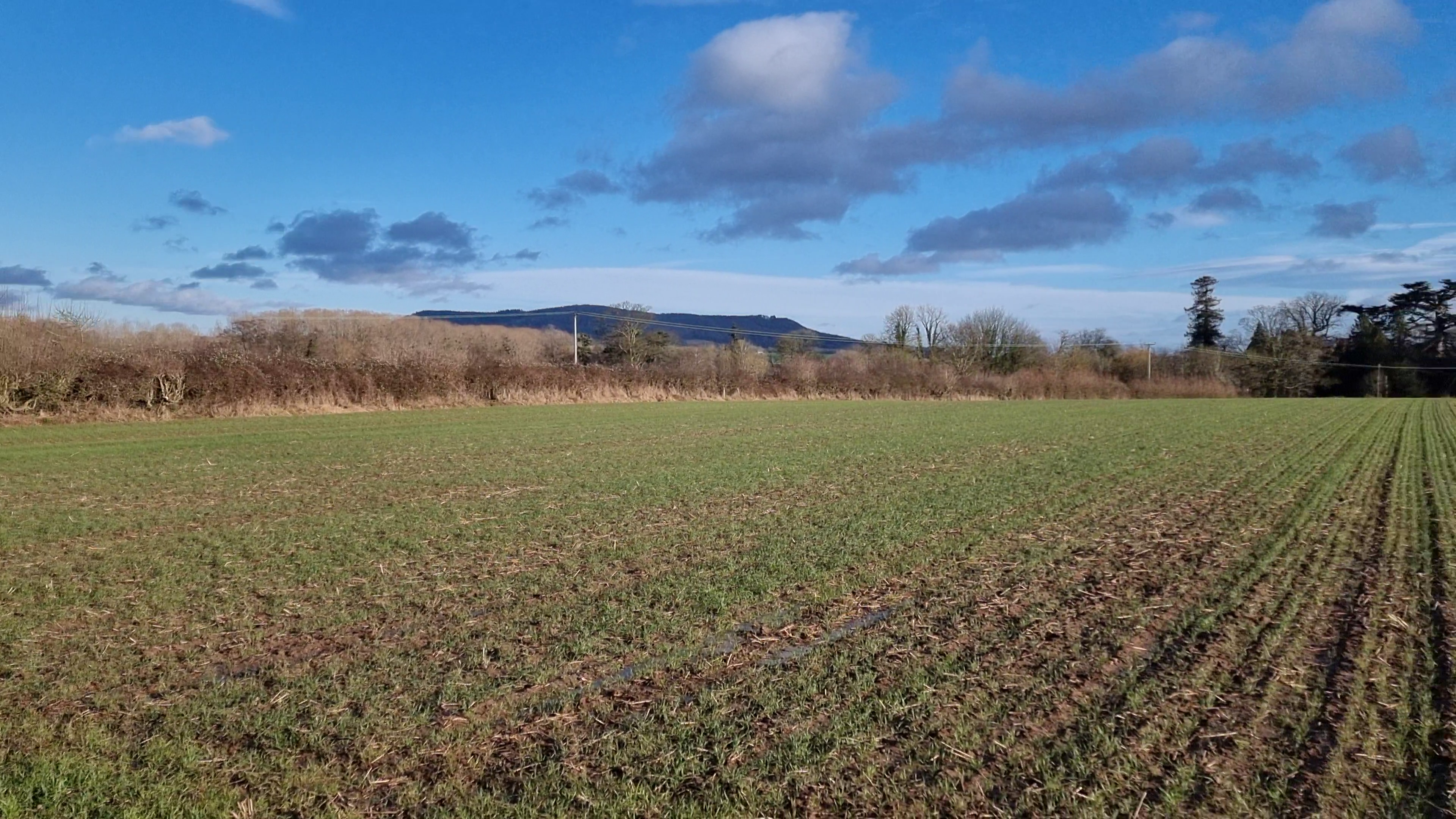
I drove up to the village of Kinnersley and parked at (52.253611, -3.0975) in the car park of
the Church of St James. From there, I walked up the footpath to the North, through three fields, until I reached the edge of the orchards near which I’d surveyed the hashpoint to be.
The fields were incredibly muddy following the recent heavy rain. It soon became apparent that the hashpoint was on the near-side of the hedgerow and thankfully not in the orchard
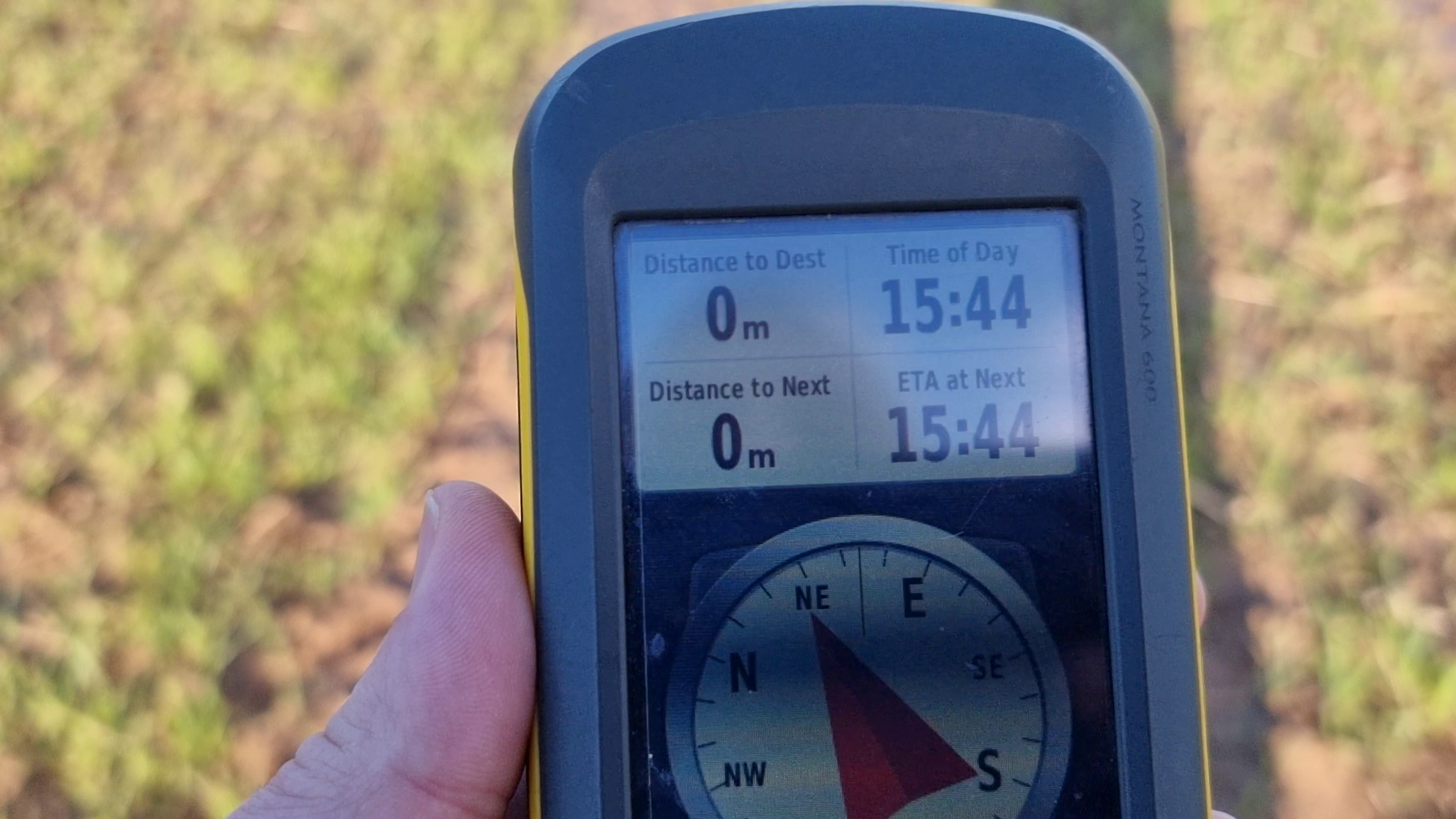
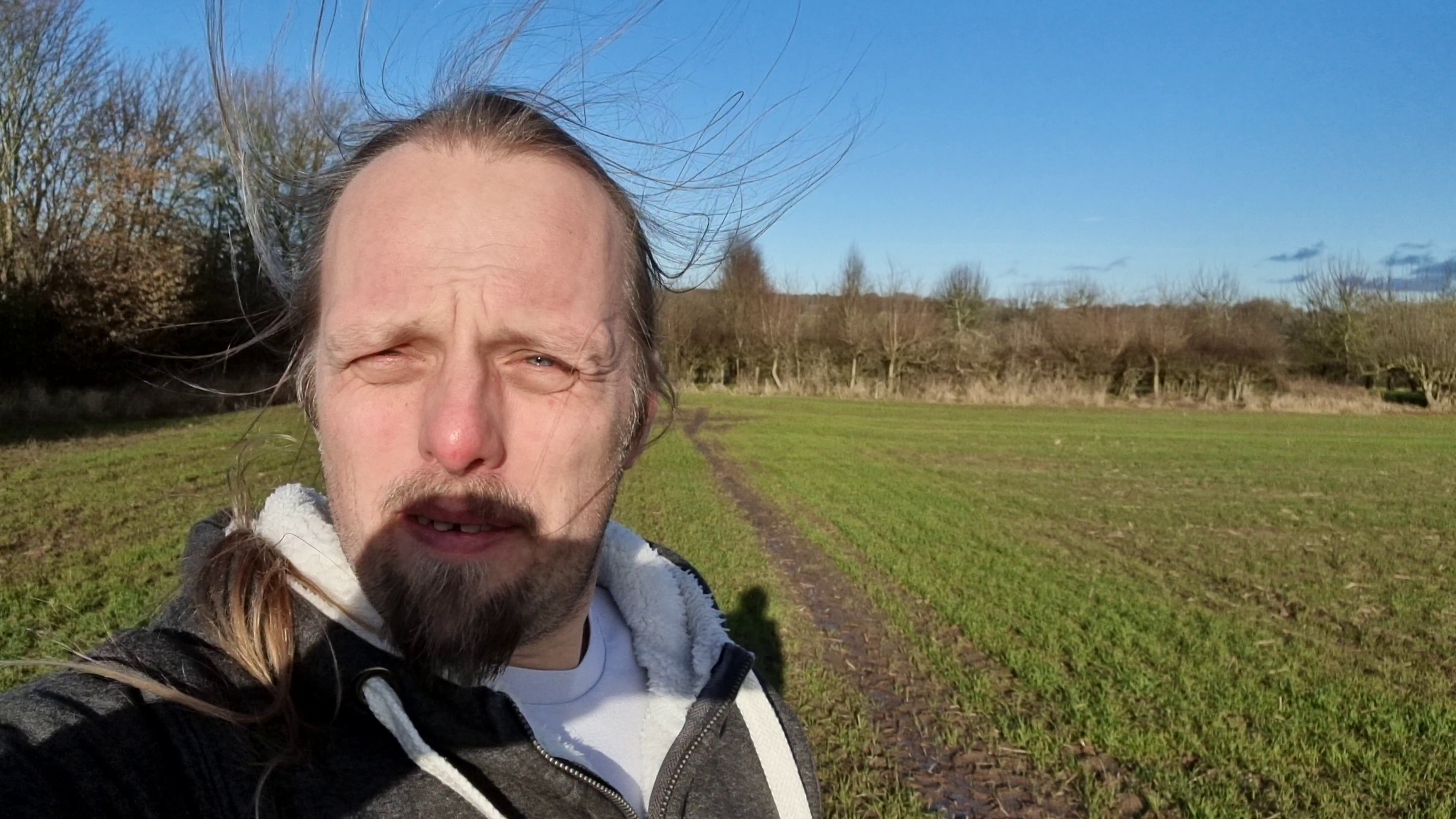
itself, so I walked along the edge of the hedge until I reached it at 15:45:07.
Returning to my car, I drove on to my accommodation, took a walk around the village, then pressed on in the morning to the 2022-02-20 52 -1 hashpoint!
Tracklog
My GPSr kept a tracklog of my entire two-day expedition:
This looks eminently achievable: it’s about half an hour’s cycle from my house: in fact one of my favourite evening cycle routes normally takes me to the nearby junction of the A415 and
Appleton Road before I go the other direction along it, up the hill to Appleton then on to Cumnor. I’ve never been this way down Appleton Road.
At a glance, it looks like the hashpoint is alongside the road, over a dyke. Street level photography makes it look like it’ll be possible to jump over, and the hashpoint is probably on
the “public highway” side of the tree line rather than in the field itself.
The challenge will be timing. My Tuesdays are hectic as I juggle work in the mornings and evenings with childcare in the afternoons. If I can get far enough ahead of my work (e.g.
starting early on Tuesday) I can probably justify the cycle as part of my lunch break. Alternatively, I could come down for a spot of night-hashing after the children are in bed. It’s
hard to commit to which time is best, but as I’m likely to be the only hasher there I don’t think I need to refine my plans any more than that at this point!
Expedition
Made a quick run out here by car, as I was travelling nearby on an errand anyway. Had to be a flying visit because my partner needed the car after me!
Was able to pull into a layby within 60 metres of the hashpoint. It was at the edge of the field, just on the other side of the hedge, but a gap in the hedge allowed me to pop through
for a quick selfie.
Tracklog
(only outbound leg shown, as after this I went elsewhere before circling back home)
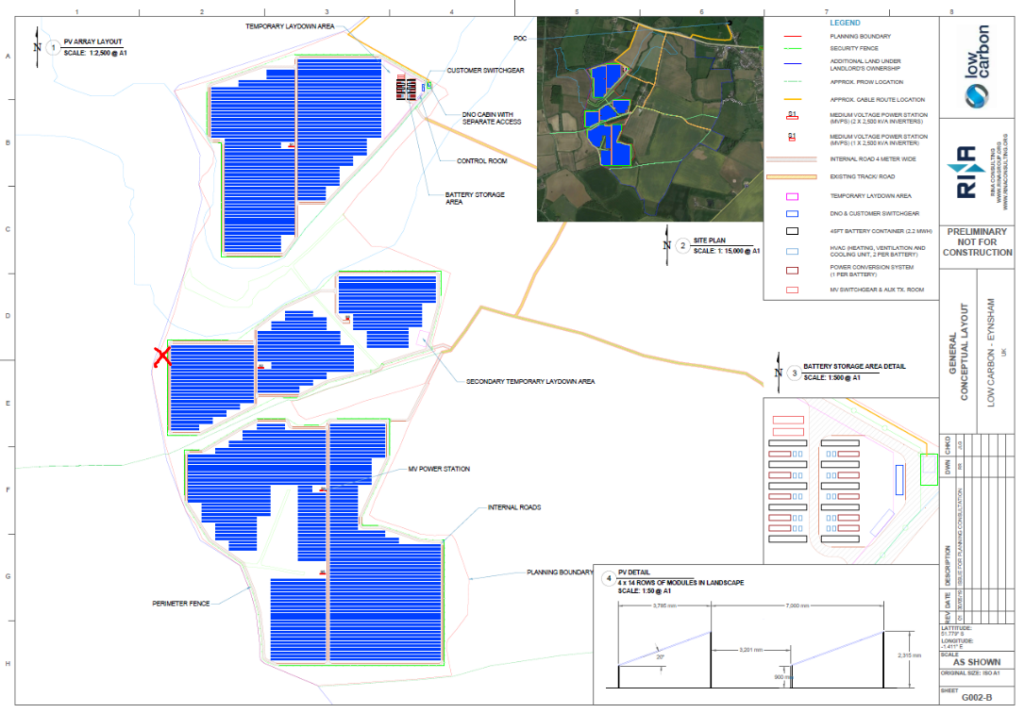
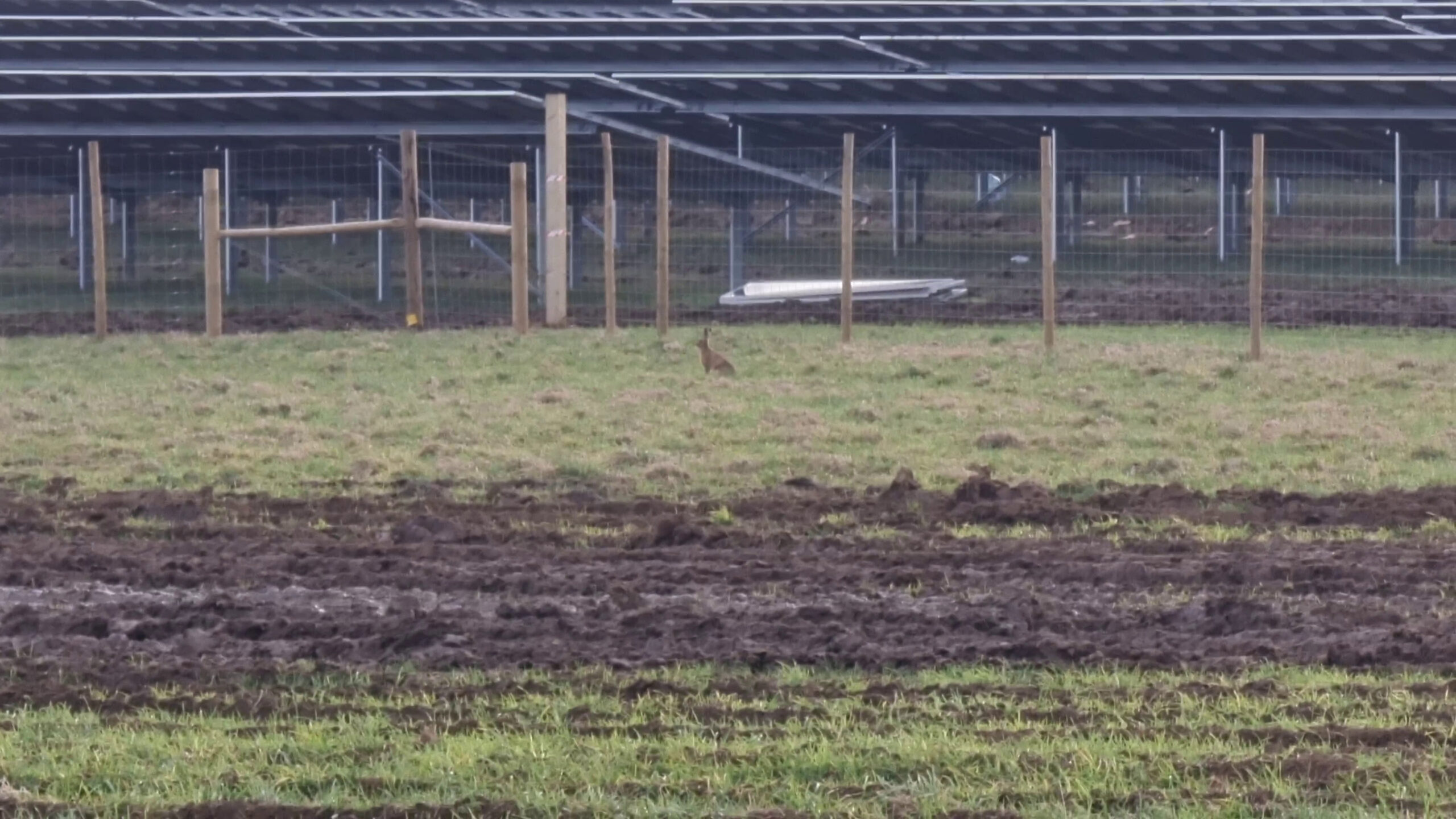
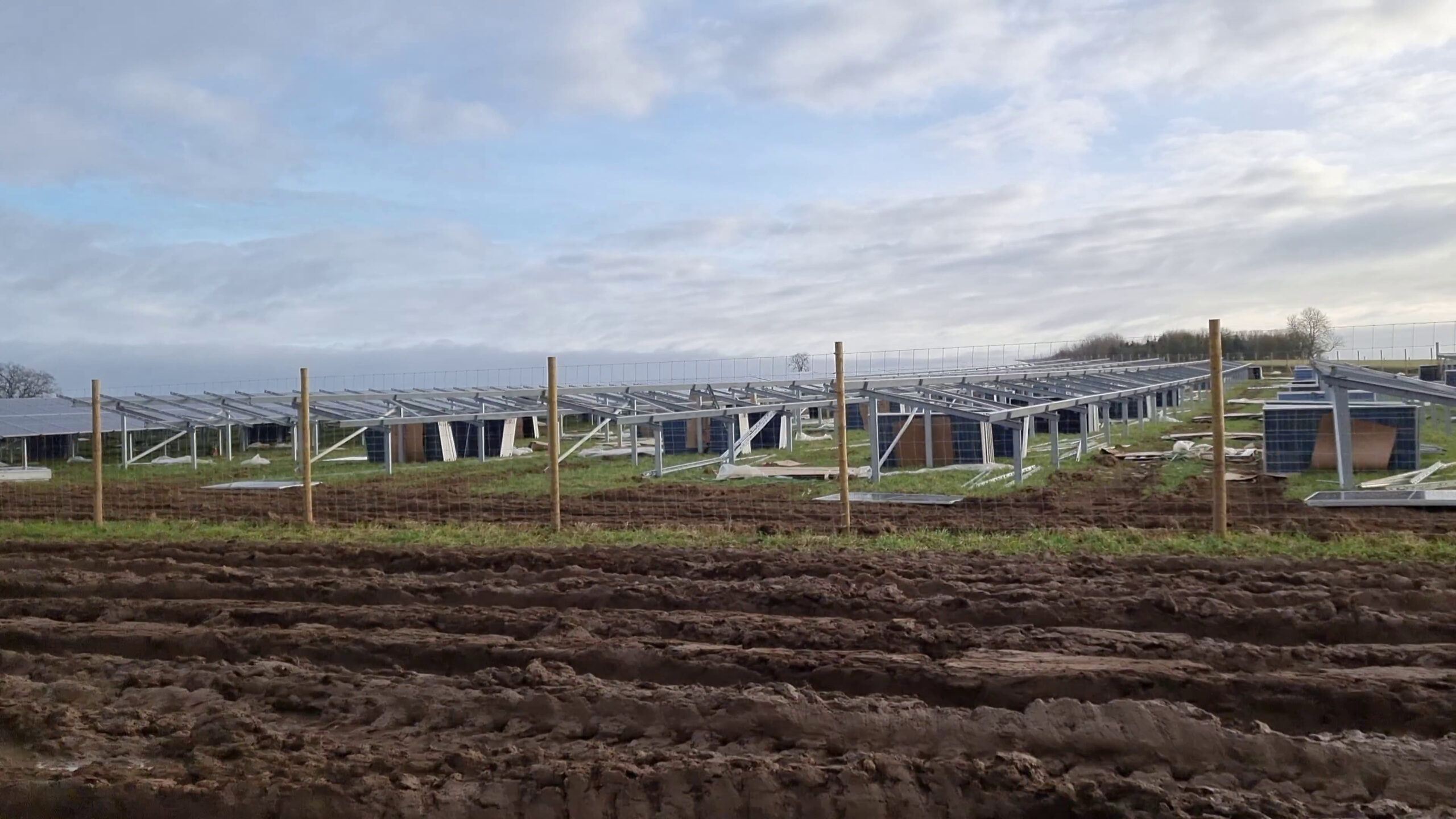
Hashpoint looks like it’s close to the banks of Chill Brook, in the grounds of Twelve Acre Farm. There’s been a lot of changes to the land around here recently owing to the ongoing construction of a new solar
power plant on this land.
Based on planning documents I saw when visiting a presentation about the proposed construction at South Leigh Village Hall last year, I believe the hashpoint is probably
outside the new security fence that’s proposed. I’ve marked the anticipated location of the hashpoint on the diagram below:
Work-permitting, I plan to cycle out to the trailhead at 51.7774,
-1.41957, lock my bike to the “public footpath” sign, cross the footbridge to the East, and trek out to see if the hashpoint itself is accessible. Not sure when I’ll find time,
though: it’s a busy week for both work and home life!
Expedition
I was really sceptical that I’d be able to make it to this hashpoint: with so much construction going on near the GZ and the fact that it
seems pretty ambiguous whether the hashpoint would be inside or outside the fence. With no reliable maps yet existing of the area covered by this new power plant (the best I could find
were planning documents, which did not have accurate grid references but instead used field boundaries as markers), I knew from the outset that it could go either way.
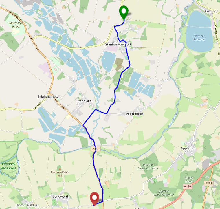
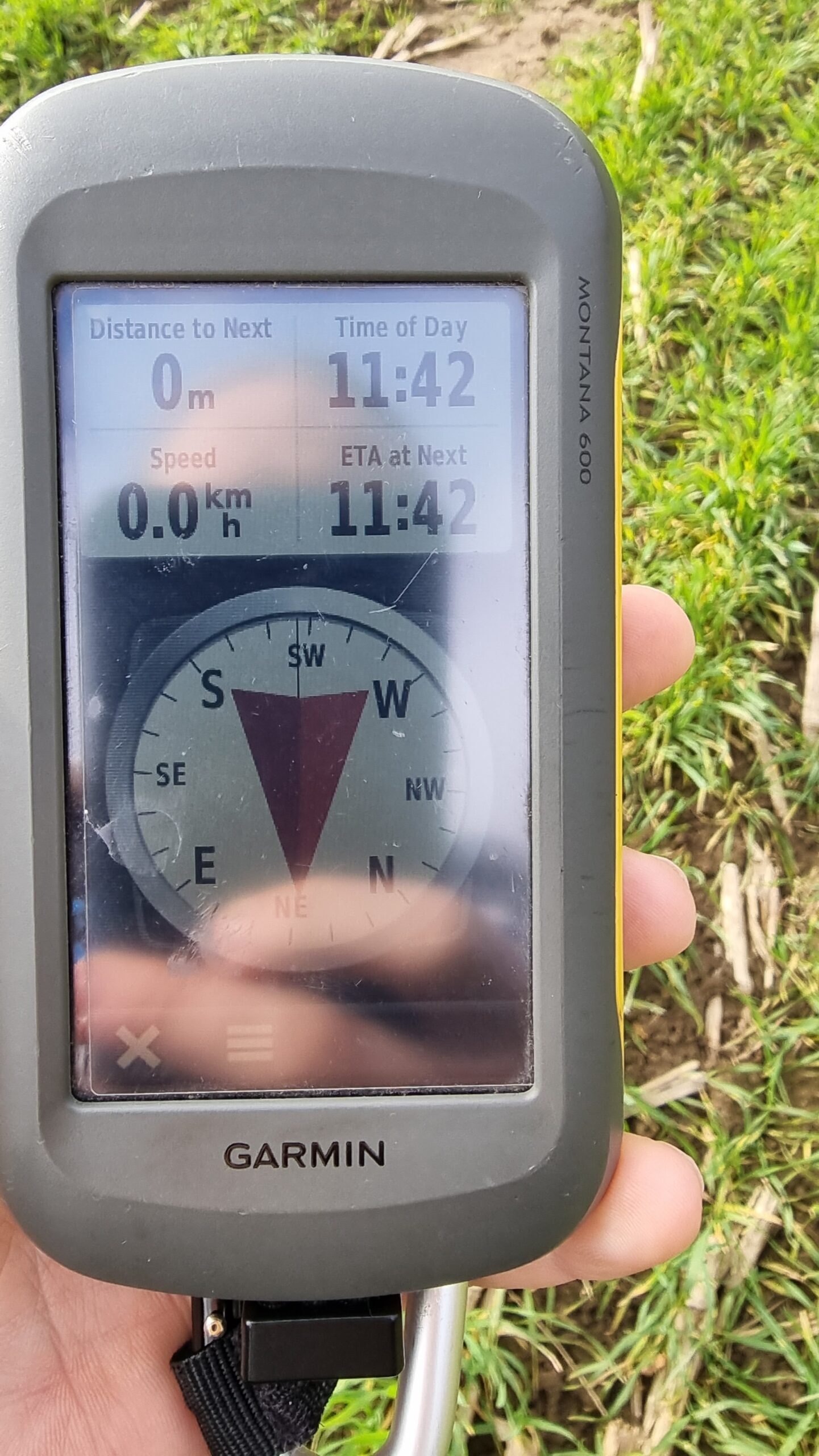
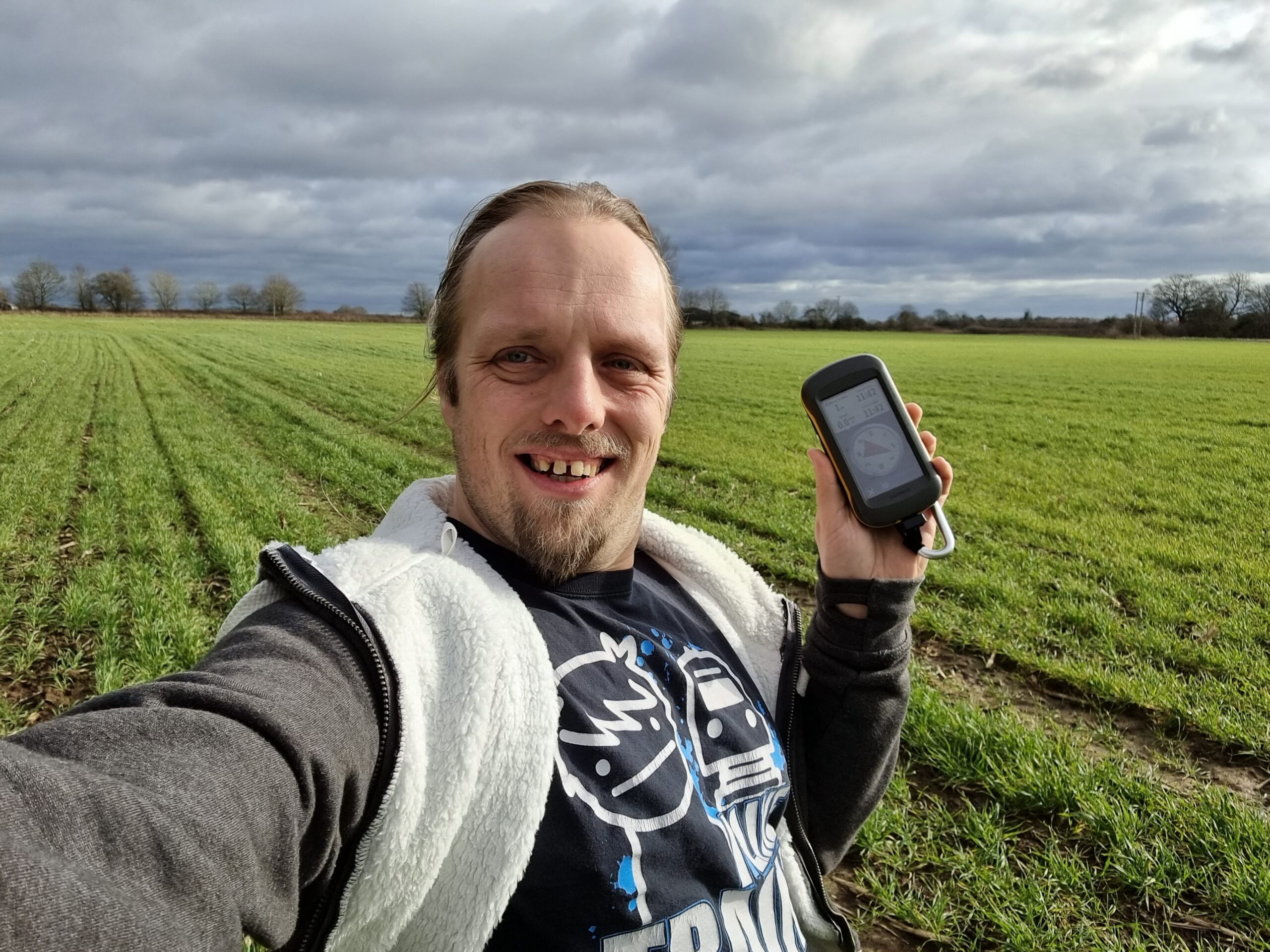
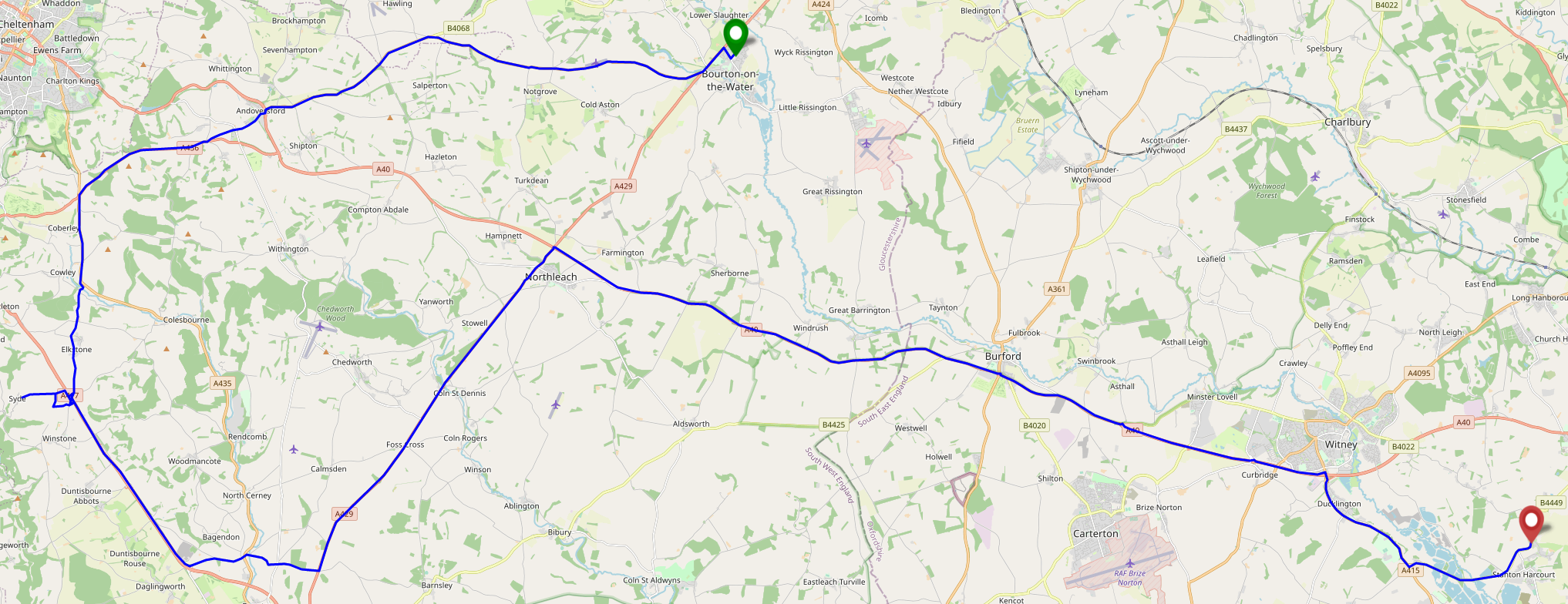
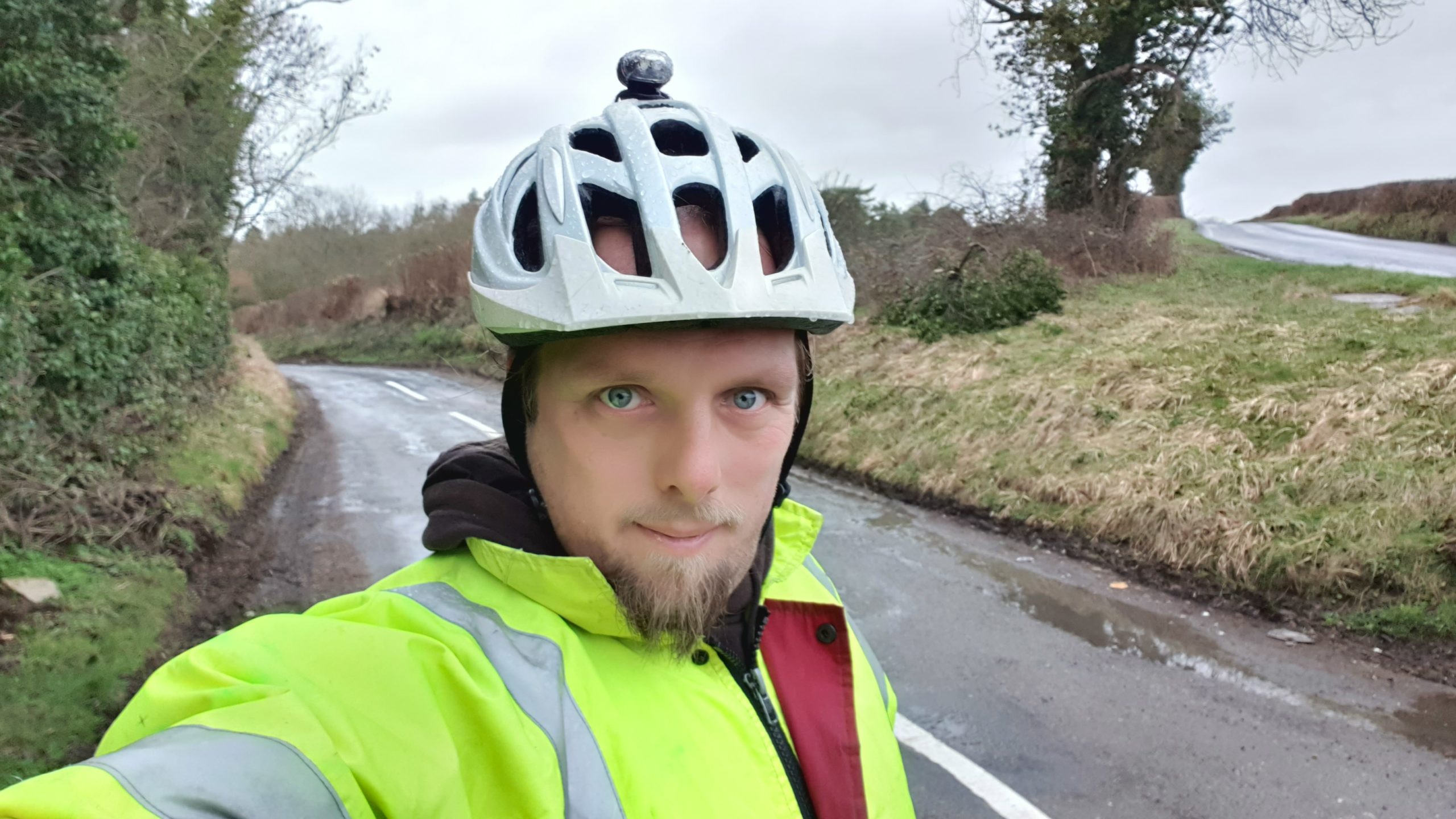
After dropping the kids at school I cycled past my house and on, through South Leigh and up to the start of the footpath that runs closest to the new construction. I locked up my bike
and continued on foot, at least slightly awed by the scale of construction ahead of me: this new solar power plant feels pretty massive! Diverting along the edge of the new fence that’s
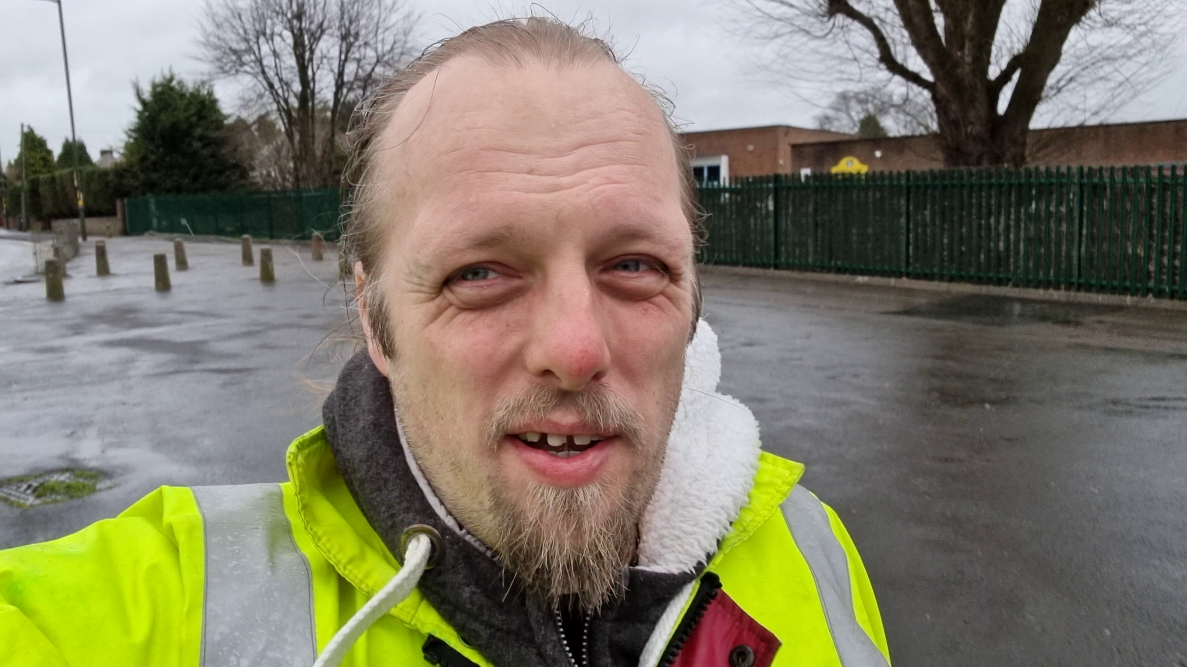
been erected to mark the boundary of the Northernmost part of the site, I was delighted to discover that the hashpoint was very-definitely outside the site itself: fantastic! I
reached the GZ at 09:20, then turned around to head back home to work.
I shot the whole expedition on video, which I’ve condensed to a 3 minute 19 second video you can watch below. Apologies for the wind noise.
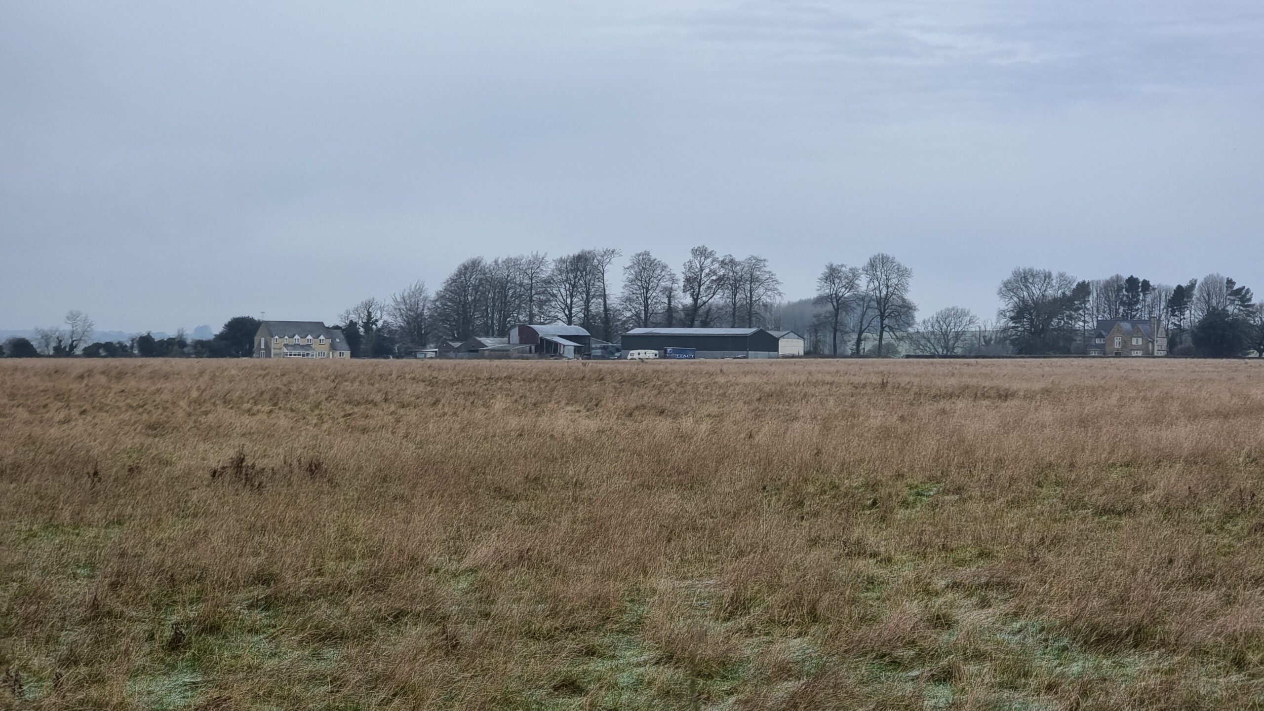
I’m going to be going half way here anyway on an errand. Might as well enjoy a morning hike and expand my Minesweeper grid, if I can.
Expedition
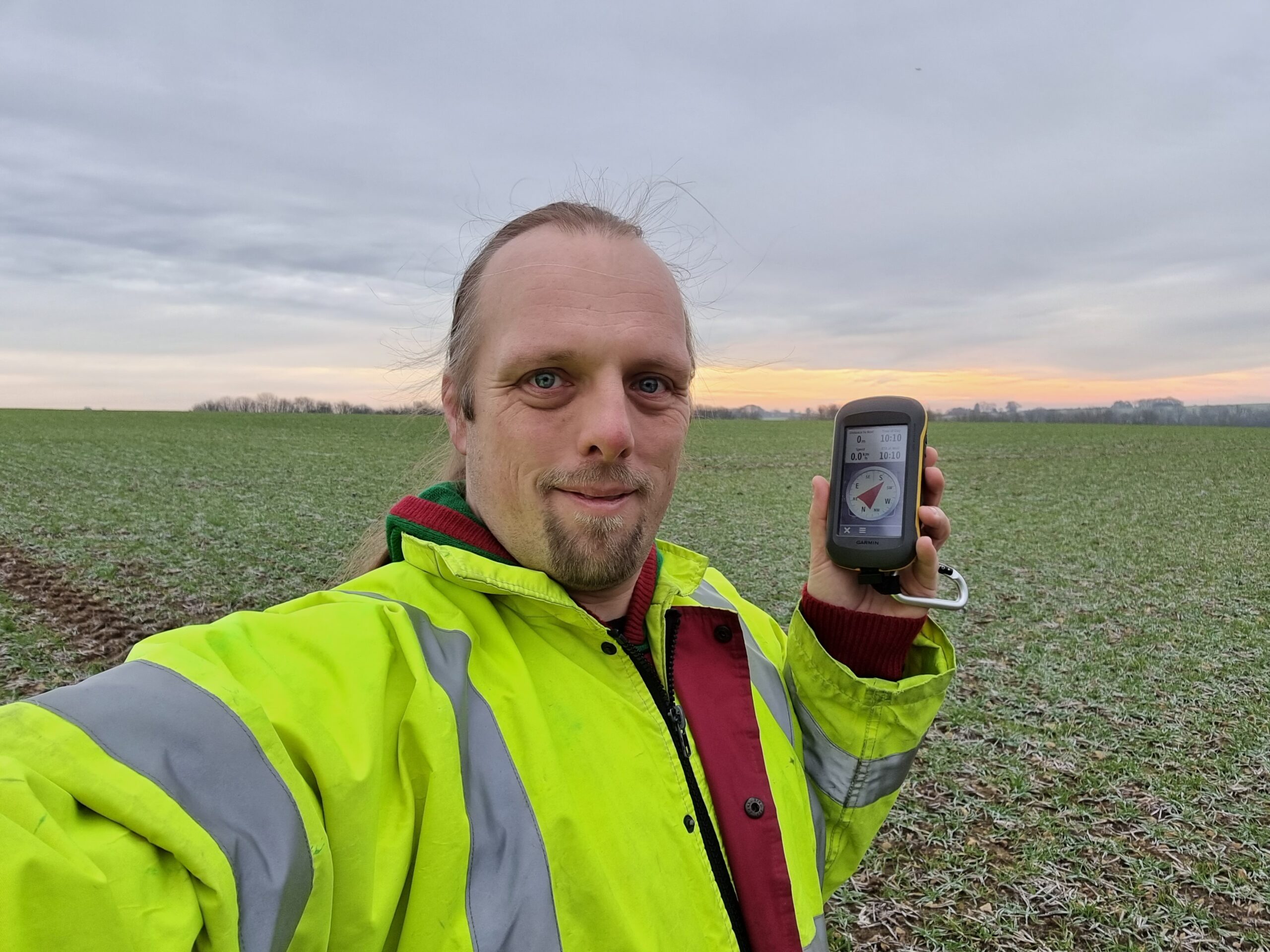
Given that I was driving half way from home to this hashpoint to run an errand anyway, I figured I might as well push the battery on the EV a little further. Coming over the
graticule line would, if successful, expand my Minesweeper score, and as it’s such a
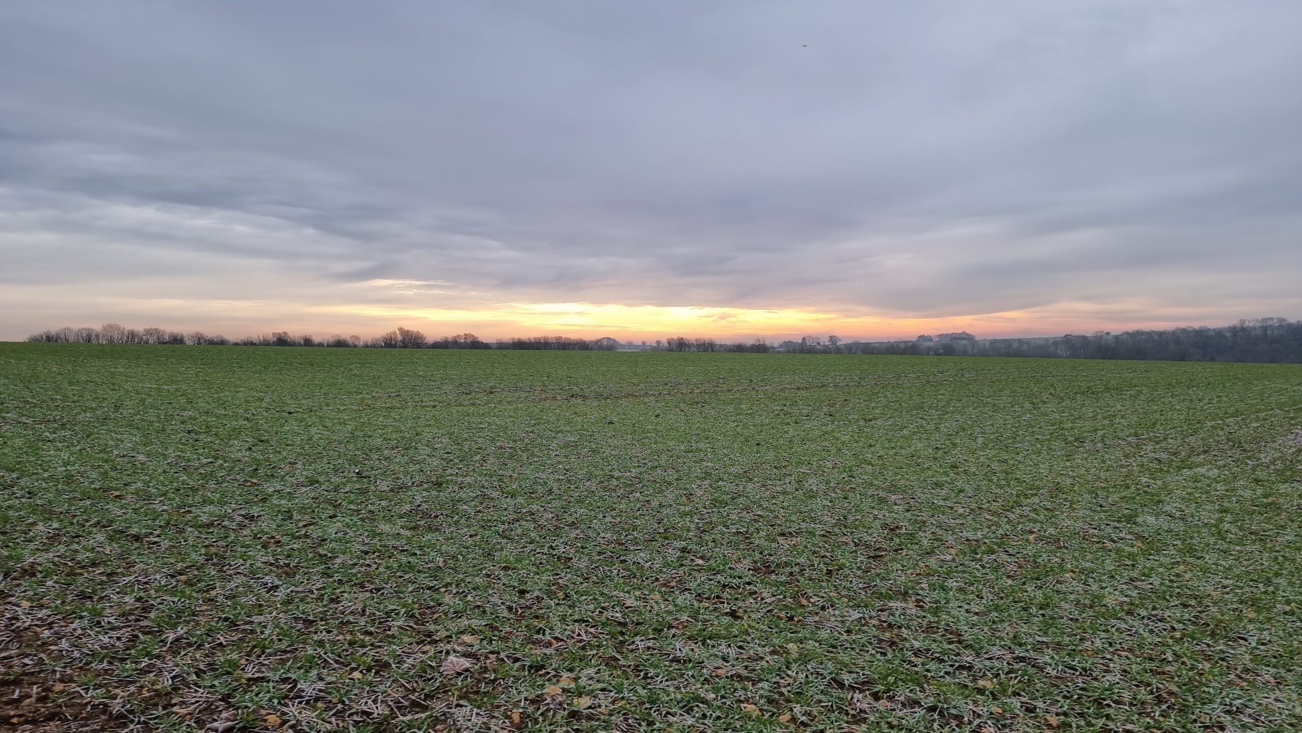
beautiful frosty morning it seemed like great conditions for a bit of an explore.
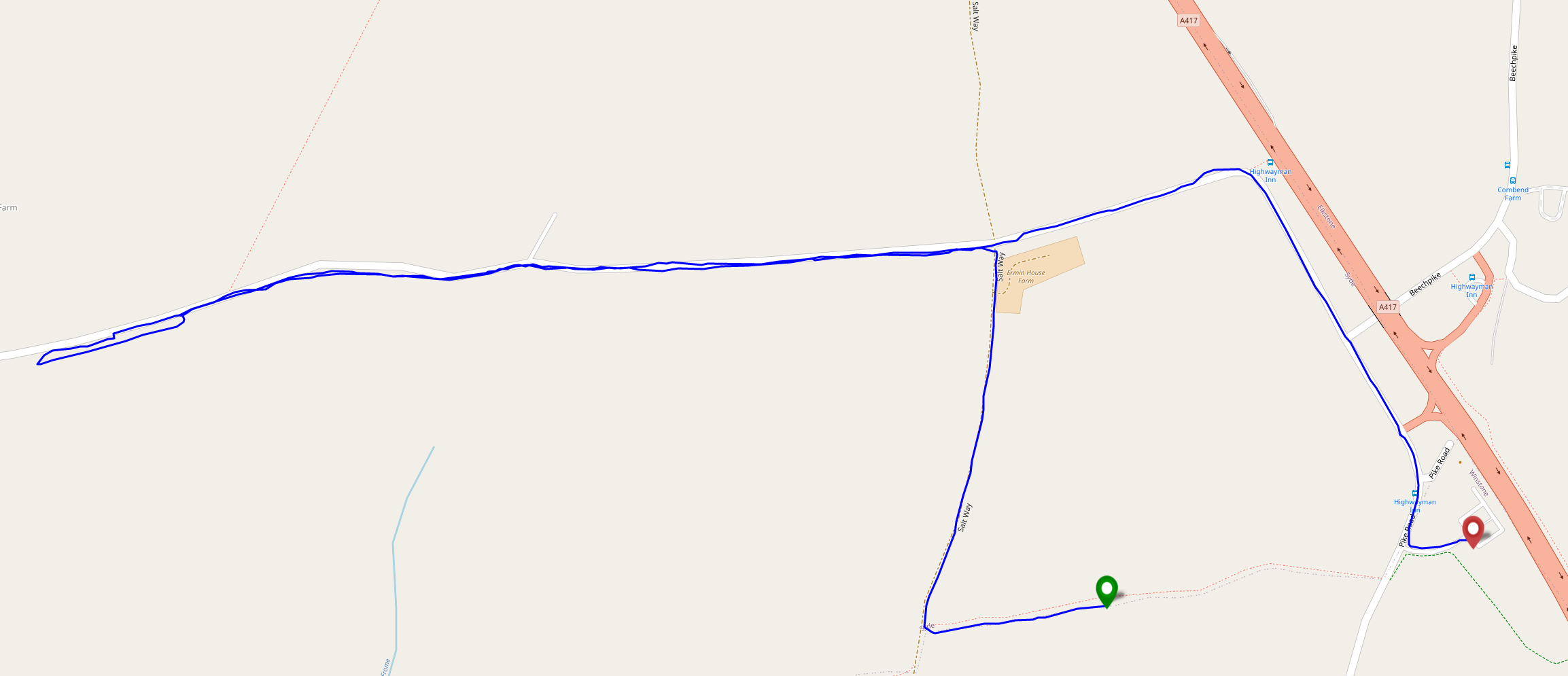
I’d hoped to drive most of the way to the hashpoint and only walk a short distance, but I soon discovered that the nearest road is signposted as being for access to Syde Farm only (and
is narrow enough that passing a vehicle coming the other way would be extremely awkward), so I parked up near geocache GC1WXE1 and hiked along a frozen bridleway to get closer to the hashpoint.
Reached the hashpoint around 10:15, turned around, and headed back, nabbing the geocache on the way. By the time I reached the car my hands were freezing and it was only as I returned my GPSr to my coat pocket that I remembered that I’d
been carrying my gloves all along.
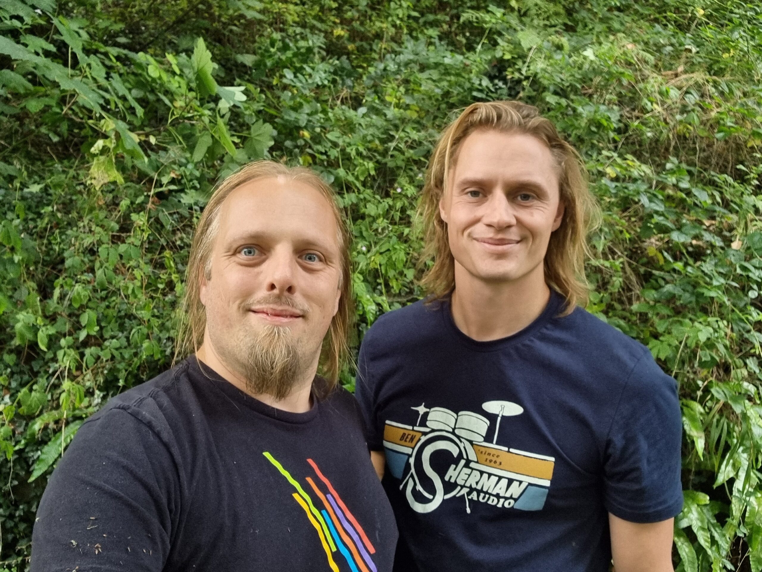
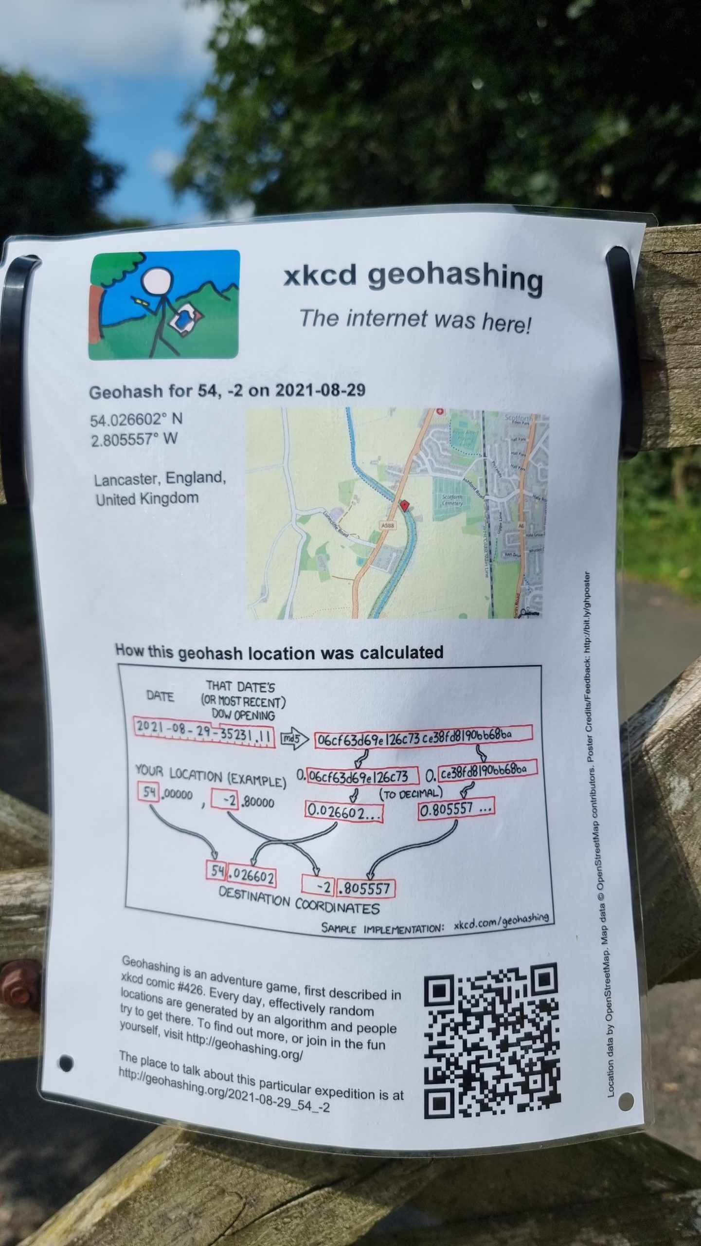
I (Dan Q) am driving my partner’s brother Robin from near Oxford to near Penrith on this day, so I expect to
pass close by this geohashpoint on the M6 twice; at around 13:00 going North then about 15:00 going South. It looks like there’s on-street parking on nearby Ashford Avenue (N 54° 1.71′,
W 2° 48.370′), so I’m thinking we can pull over there, walk to Deep Cutting Bridge, follow a path about 700m Northwest down into the canal cutting, then follow the canal back Southeast
to the hashpoint. Robin’s never been geohashing before, so we’ll see what he makes of it.
The biggest risks to this plan are likely to be (a) if we run late setting off, hit traffic, or are otherwise delayed then we may have to cancel our plans in order to stay on-schedule,
and (b) based on local photos it looks like the towpath floods and/or gets incredibly boggy in wet weather!
Expedition
This all went pretty-much to plan. We parked on Ashford Avenue and walked to the bridge, then onto the long path down. We soon got bored of this trail and took a short-cut down the
cutting slope, then proceeded back under the bridge while Robin told me about how he rowed along this stretch of canal during his recent Lands End to John O’Groats journey.
On the other side of the bridge we discovered that the hashpoint was about 25 metres up a steep bank covered with thorny plants. Not wanting to be defeated at this point, Robin boosted
me up onto the bank and I scrambled painfully through the brambles to reach the hashpoint, which coincided with a tree overlooking the cutting.
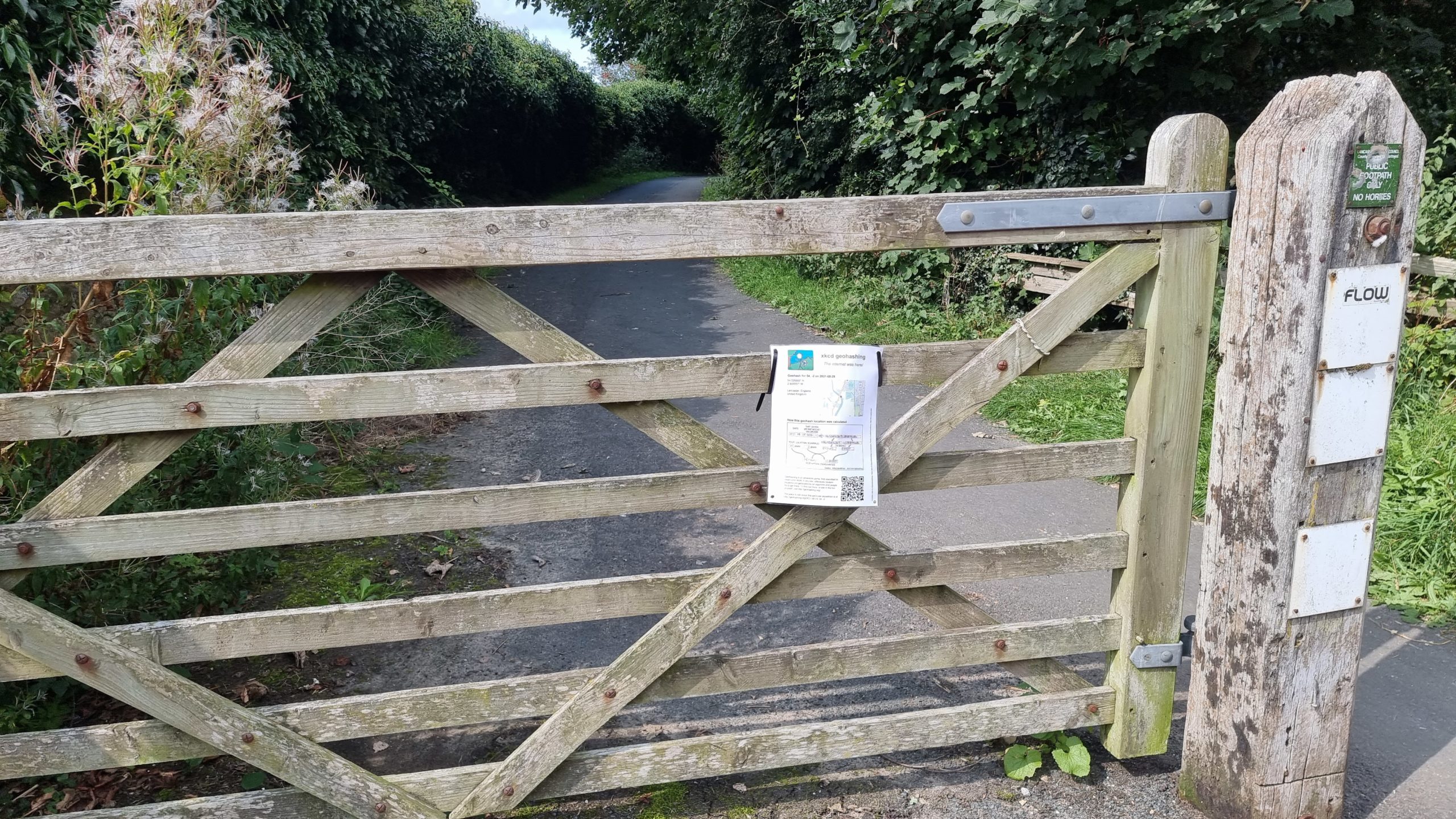
Returning to the car we stopped by geocache GC6WMEW, from whose GZ one can just about see the tree that
marks the hashpoint. We added a “The Internet Was Here” sign to the gate at the path down to the towpath and continued our long journey North-and-back-again.
If I get out early, before I start work, I (Dan Q) might be able to make it to the hashpoint by bike before
about 9am. Most of the fields round here have already been harvested and so nobody’s likely to object if I step into this one for a couple of minutes (it looks like there’s a promising
looking gate at N 51°43.2′, W 1°29.722′).
Expedition
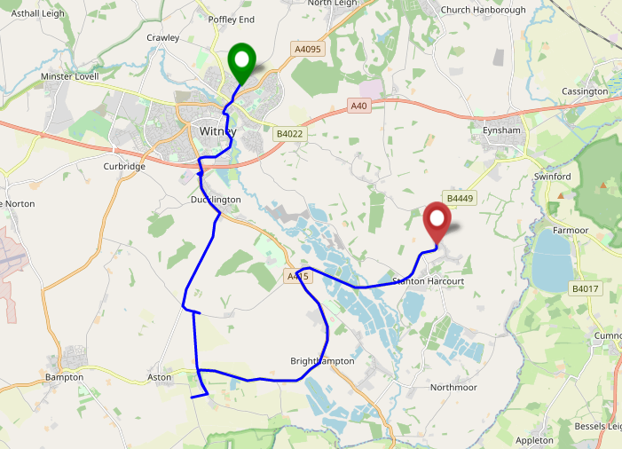
I was out and about anwyay, dropping my kids off at rehearsals for a play they’re in later this week, so I figured it’d do no harm to swing by Cote – the settlement nearest the hashpoint – this morning. Cote turns out to be a delightful and quaint little
hamlet, and when I passed through everybody and their dog seemed to be out on a morning constitutional and I got a few odd looks from the locals who are, on account of their hamlet’s
location, probably unused to “through” traffic and so may well have been wondering who exactly I was visiting!
Round here most of the farms grow wheat, and it’s harvest season. I had to pull aside on one of the narrow roads that criss-cross this part of Oxfordshire to allow a combine harvester –
fully the width of the entire road! – to pass in the opposite direction. It was followed closely by a line of impatient drivers crawling along behind the enormous mechanical beast, and
I was glad to be going the other way! When I first saw that the hashpoint appeared to be in a field I was optimistic that it might be one that had been recently harvested, like all the
ones near my house, or else left fallow, and I’d be able to get close to the hashpoint without causing any disruption.
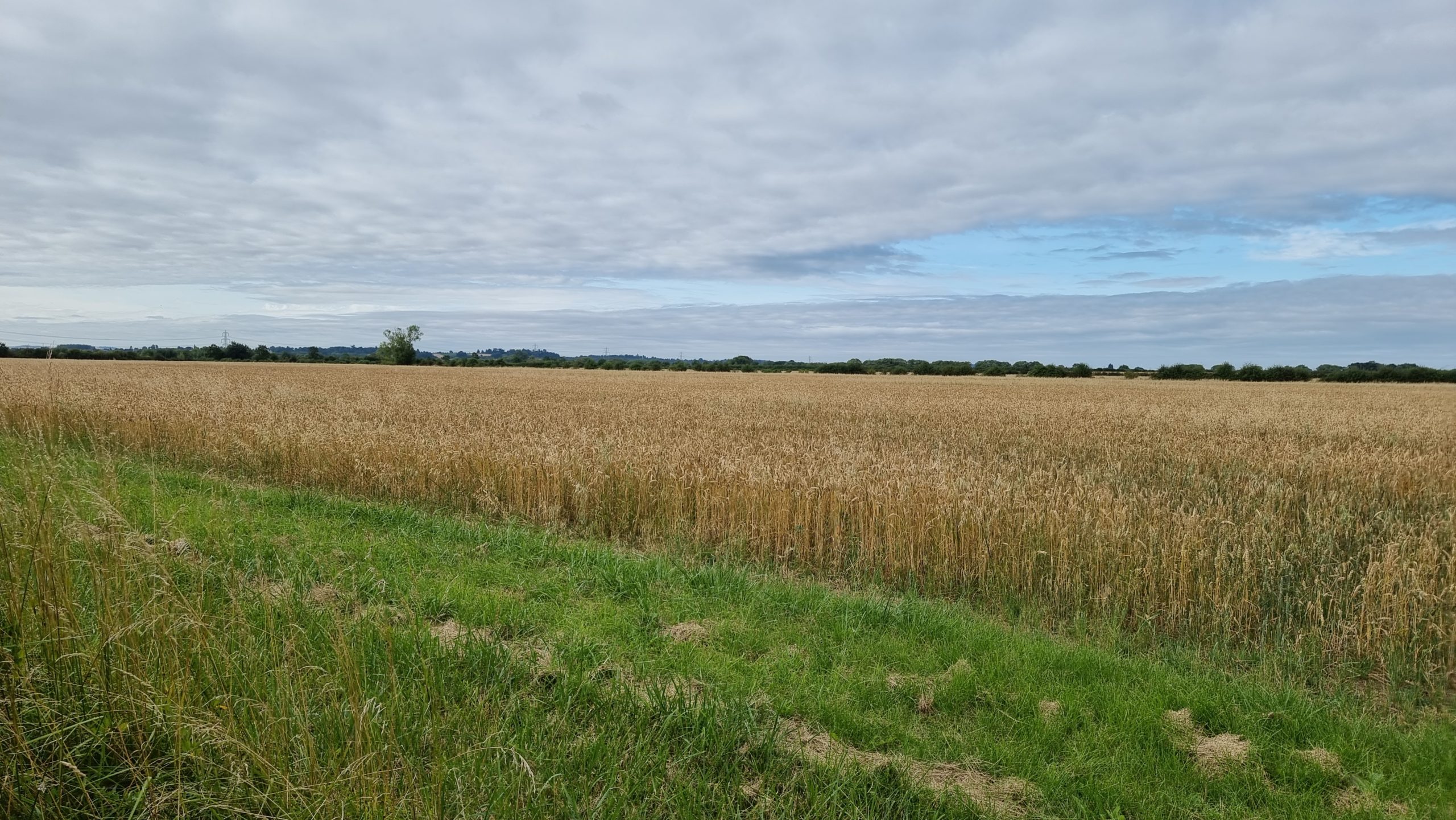
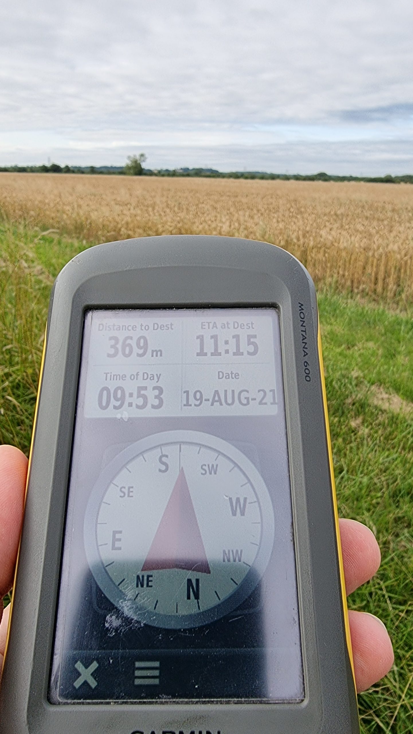
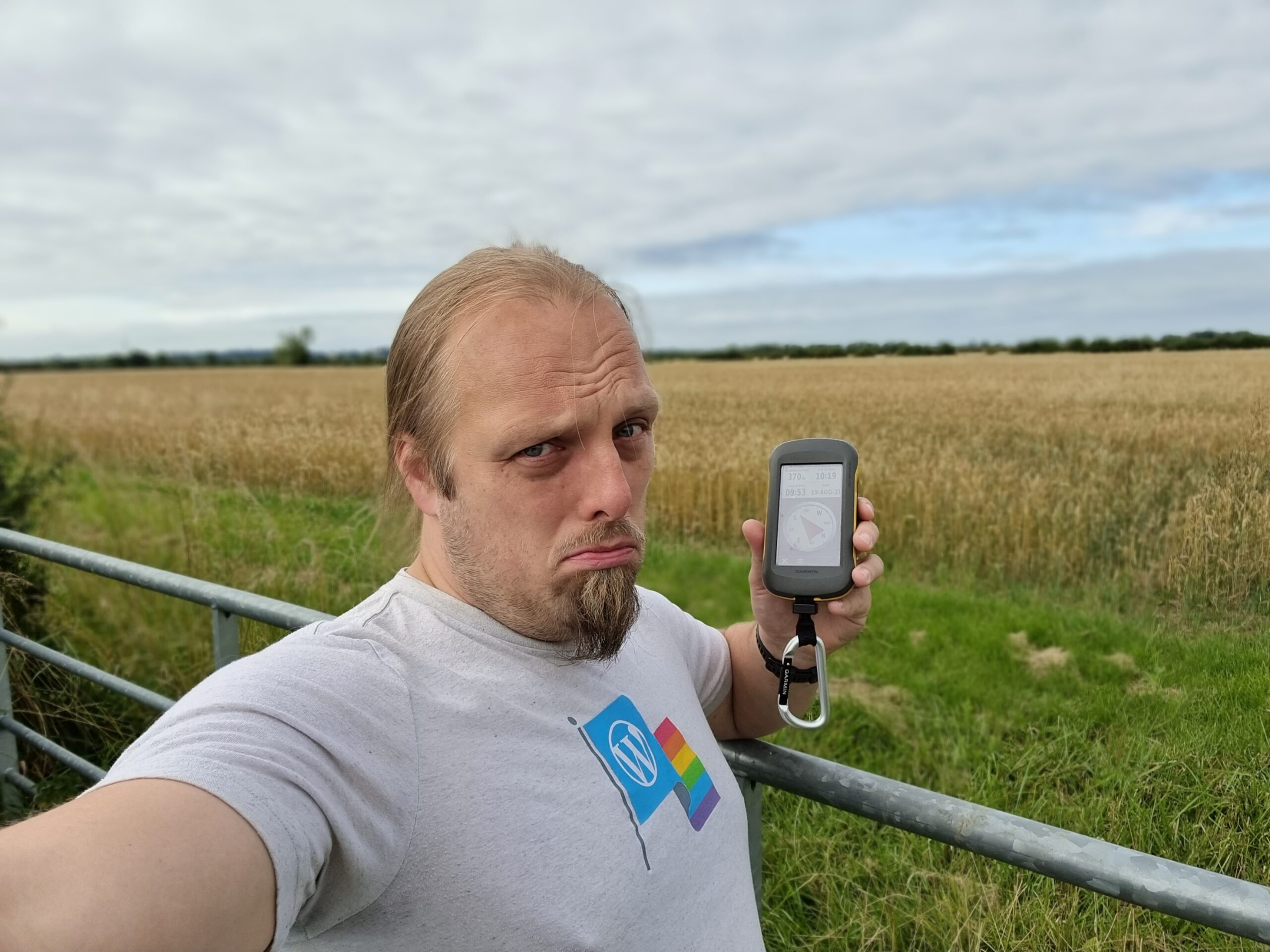
Unfortunately, the field with the hashpoint was very-much still growing, full of corn for harvesting later in the season, so my expedition ended abruptly at the gate. I took a sad-face
photo and attached a “The Internet Was Here” sign to the gate, for good measure (and perhaps as an explanation to the locals who looked at me curiously as I passed!), then continued my
journey home.
Thought I’d get up early and cycle up to the hashpoint and back this morning.
Expedition
Unfortunately I forgot to bring a bike lock, and so when I reached the cycle-inaccessible path across the heath and couldn’t find somewhere to safely leave my bike, I had to give up.
Still a nice ride, though.
Field behind Hill Barn, near the Gom’s Hole public footpath, in the valley beneath the hamlet of Clapton-on-the-Hill. About 4km outside the village of Bourton-on-the-Water,
Gloucestershire.
(Retro) Participants
Dan Q (as a retrohash on the same date but 19 years later, on 2021-02-19)
(Retro)Plans
On the second anniversary of the death of my father, a man who loved to get out into the world and get lost, I undertook my
first geohashing expedition. As this seemed to be a good way to remember him I decided to repeat the experience on this, the ninth anniversary of his death, but the actual
hashpoints for the day didn’t look interesting… so I opted to make my way to what would have been my nearest hashpoint on the day he died.
(Retro)Expedition
The weather looked horrible and the COVID lockdown (and working from home in general in recent years) has put me out of practice at
cycling, so I thought a 40-50 mile round trip through the rolling hills of the Cotswolds was just the thing. This may have been a mistake, as my aching legs were able to testify for
several days.
Cycling through Witney, over the hills behind Burford, and then across the Windrush valley and into Gloucestershire was a long, arduous, and damp journey, but what really got me was the
wind picking up in the afternoon and giving me a headwind to fight against all the way back home.
Near the hashpoint I was able to lock my bike up at the junction between Sherbourne Street and Bourton Hill – a place shown on my map as “Gom’s Hole” which sounds exactly like what a
D&D dungeon master would have a goblin would name his bar. From there I followed the footpath towards Farringdon. As the hashpoint drew closer I began to suspect that it would be
unreachable: tall walls, fences, and hedges stood on both sides of the (flooded) footpath, but at the last minute they gave way to wide meadows. I turned off the path and crossed a dyke
to the hashpoint, where I had a great view of hares and deer in the valley below. Minutes later, the owner of Hill Barn came over with her dog and asked what I was doing around the back
of her land and why I was taking pictures, so I explained that I’d strayed from the footpath (true) because my GPS had told me too (technically true) but I was heading back down to what
I could see was the path, now (true, if misleading).
She continued to watch me all the way back to my bike, so I changed my plans (which had been to eat a sandwich lunch and drink a pint of Guinness: my dad’s beer of choice) near the
hashpoint and instead I cycled away to a nearby layby to have my lunch.
After a 48.3 mile round trip I got back home aching and exhausted, but pleased to have made it to this damp hashpoint.
We’re discussing the possibility of a Subdivision geohash achievement for people who’ve reached every “X in a
Y”, and Fippe pointed out that I’m only a hash in the Vale of White Horse from being able to claim such an
achievement for Oxfordshire’s regions. And then this hashpoint appears right in the Vale of White Horse: it’s like it’s an omen!
Technically it’s a workday so this might have to be a lunchtime expedition, but I think that might be workable. I’ve got an electric vehicle with a hundred-and-something miles
worth of batteries in the tank and it looks like there might be a lay-by nearby the hashpoint (with a geocache in it!): I can drive down there at lunchtime, walk carefully back up the main road, and try to
get to the hashpoint!
Expedition
I worked hard to clear an hour of my day to take a trip, then jumped in my (new) electric car and set off towards the hashpoint. As I passed Newbridge I briefly considered stopping and
checking up on my geocache there but feeling pressed for time I decided to push on. I parked in the lay-by where
GC5XHJG is apparently hidden but couldn’t find it: I didn’t search for long because the farmer in the adjacent field
was watching me with suspicion and I figured that anyway I could hunt for it on the way back.
Walking along the A338 was treacherous! There are no paths, only a verge covered in thick grass and spiky plants, and a significant number of the larger vehicles (and virtually all of
the motorbikes) didn’t seem to be obeying the 60mph speed limit!
Reaching the gate, I crawled under (reckoning that it’s probably there to stop vehicles and not humans) and wandered along the lane. I saw a red kite and a heron doing their thing
before I reached the bridge, crossed Letcombe Brook, and followed the edge of the field. Stuffing my face with blackberries as I went, it wasn’t long before I reached the hashpoint on
one edge of the field.
I took a short-cut back before realising that this would put me in the wrong place to leave a The Internet Was Here sign, so I doubled-back to place it on the gate I’d crawled under.
Then I returned to the lay-by, where another car had just pulled up (right over the GZ of the geocache I’d hoped to find!) and didn’t seem to be going anywhere. Sadly I couldn’t wait
around all day – I had work to do! – so I went home, following the satnav in the car in a route that resulted in a figure-of-eight tracklog.
I’ll be travelling North through England all day on 2020-02-22 and it’s not a huge diversion to go and climb a hill as a break, so long as I set off early enough in the
morning. We’ll see…
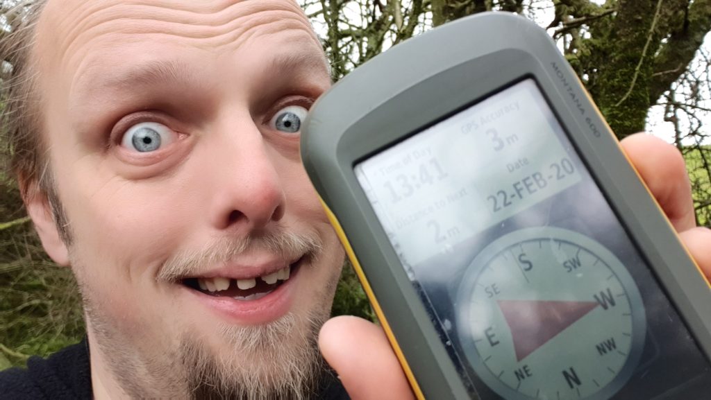
Expedition
It’s a beautiful part of the world, the Peak District, although I could have picked a day when I’d be less-hampered by floods and wind. Nonetheless, I was able to climb a short way up
Haven Hill, divert around an impromptu lake, and scramble into a thicket in order to reach the hashpoint at around 13:40. And to leave a “the Internet was here” sign at the nearest
footpath
Tracklog
Taken by GPSr, but I seem to have lost the charging/data cable for it. Will find at some point.