This checkin to geohash 2012-02-19 51 -1 reflects a geohashing expedition. See more of Dan's hash logs.
Location
Field behind Hill Barn, near the Gom’s Hole public footpath, in the valley beneath the hamlet of Clapton-on-the-Hill. About 4km outside the village of Bourton-on-the-Water, Gloucestershire.
(Retro) Participants
- Dan Q (as a retrohash on the same date but 19 years later, on 2021-02-19)
(Retro) Plans
On the second anniversary of the death of my father, a man who loved to get out into the world and get lost, I undertook my first geohashing expedition. As this seemed to be a good way to remember him I decided to repeat the experience on this, the ninth anniversary of his death, but the actual hashpoints for the day didn’t look interesting… so I opted to make my way to what would have been my nearest hashpoint on the day he died.
(Retro) Expedition
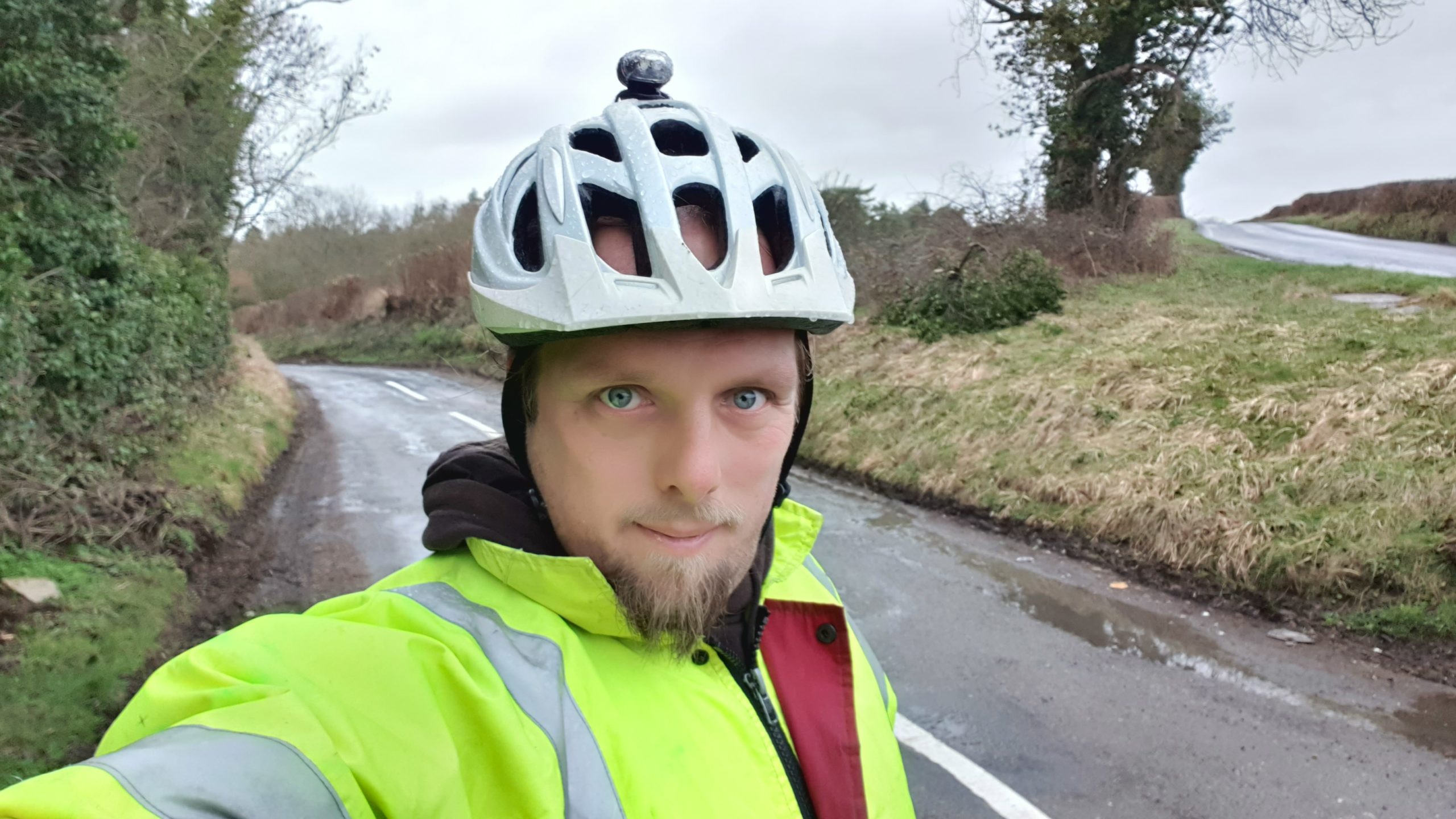
The weather looked horrible and the COVID lockdown (and working from home in general in recent years) has put me out of practice at cycling, so I thought a 40-50 mile round trip through the rolling hills of the Cotswolds was just the thing. This may have been a mistake, as my aching legs were able to testify for several days.
Cycling through Witney, over the hills behind Burford, and then across the Windrush valley and into Gloucestershire was a long, arduous, and damp journey, but what really got me was the wind picking up in the afternoon and giving me a headwind to fight against all the way back home.
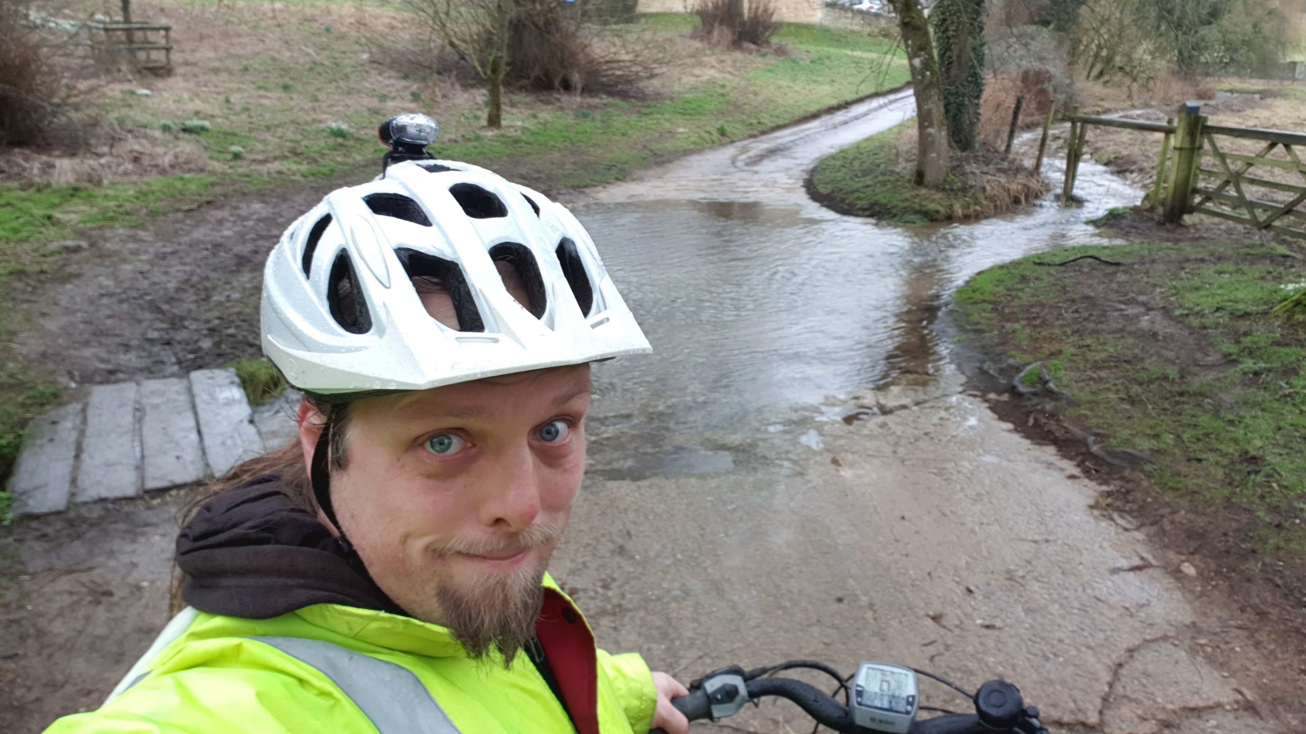
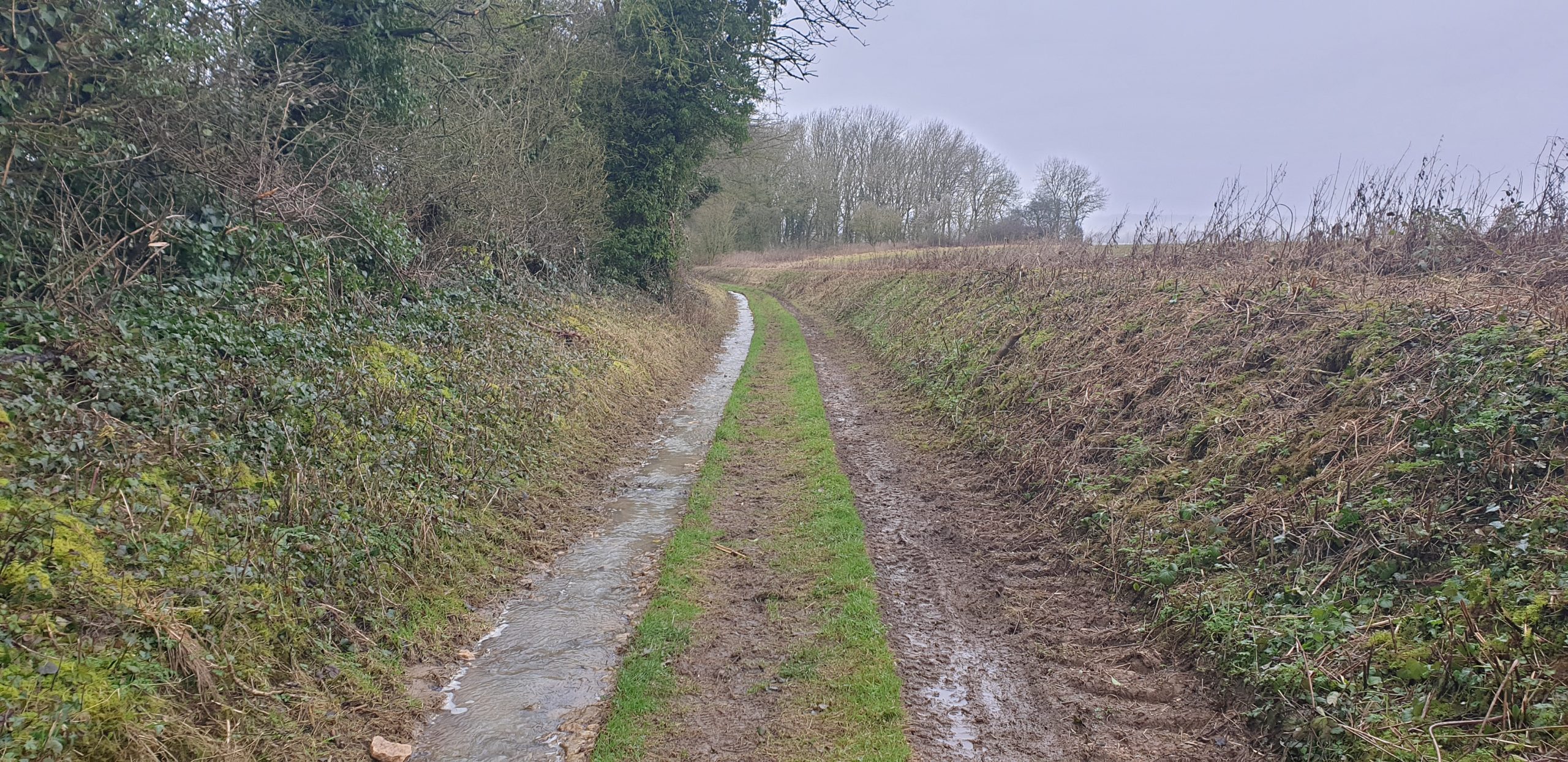
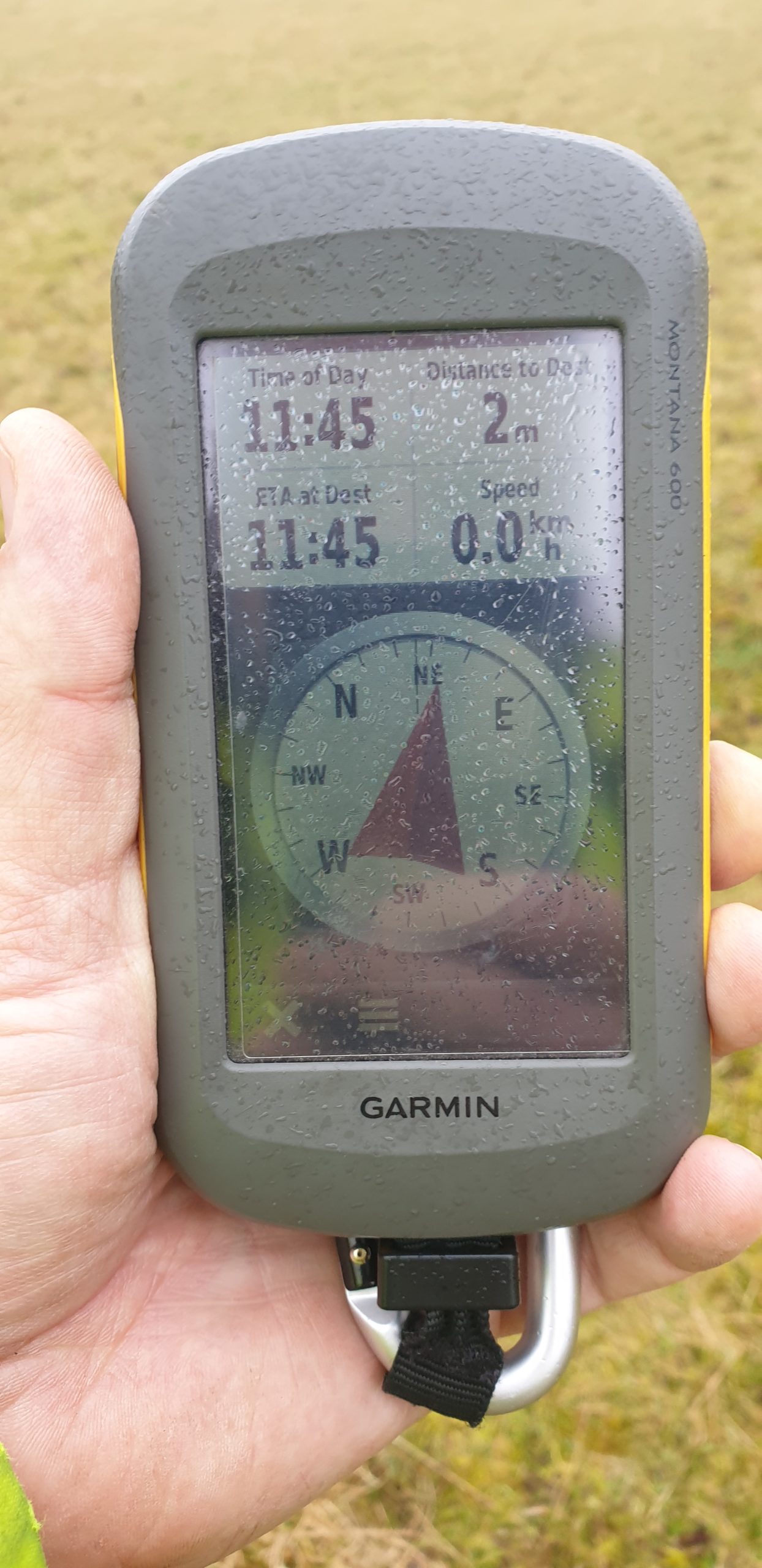
Near the hashpoint I was able to lock my bike up at the junction between Sherbourne Street and Bourton Hill – a place shown on my map as “Gom’s Hole” which sounds exactly like what a D&D dungeon master would have a goblin would name his bar. From there I followed the footpath towards Farringdon. As the hashpoint drew closer I began to suspect that it would be unreachable: tall walls, fences, and hedges stood on both sides of the (flooded) footpath, but at the last minute they gave way to wide meadows. I turned off the path and crossed a dyke to the hashpoint, where I had a great view of hares and deer in the valley below. Minutes later, the owner of Hill Barn came over with her dog and asked what I was doing around the back of her land and why I was taking pictures, so I explained that I’d strayed from the footpath (true) because my GPS had told me too (technically true) but I was heading back down to what I could see was the path, now (true, if misleading).
She continued to watch me all the way back to my bike, so I changed my plans (which had been to eat a sandwich lunch and drink a pint of Guinness: my dad’s beer of choice) near the hashpoint and instead I cycled away to a nearby layby to have my lunch.
After a 48.3 mile round trip I got back home aching and exhausted, but pleased to have made it to this damp hashpoint.
(Retro) Tracklog
GPX tracklog: Track 2021-02-19 RETROHASH 2012.gpx
(Retro) Photos
Have you ever tried explaining geohashing when people are suspicious of you? Why the half-truths? I think this is a lovely way to remember your father.
The half-truths are usually quicker! People get lost all the time!
But yeah, more-often when asked what I’m doing somewhere (doing something weird) I’ll explain the truth. At the 2018-10-16 52 -0 hashpoint I met a local landowner who saw me putting up a “the Internet was here” sign… coincidentally, I was wearing a high-vis jacket and near the site of a controversial wind farm construction project, and he assumed I’d been sent to sneakily put a planning permission application document up! So I was certainly glad to be able to explain to him that no, I wasn’t erecting more windmills in his back yard. (Personally, I’m a big fan [LOL] but I know some folks don’t like them.)
And when I met somebody near the 2019-05-27 51 -1 hashpoint who wondered what I was doing taking photos near the lamp post at the end of their residential cul-de-sac, I explained that I was playing an online game where you have to go to random coordinates, and today’s coordinates were there.
The difference with this retrohash was that (a) I had knowingly strayed from a public footpath without first asking a landowner, which could well be trespassing, and (b) while geohashing can just-about be explained to a stranger (it’s random coordinates!), retrohashing is harder (it’s random coordinates… but I was able to pick which ones, sort-of?) and my justification for possibly-trespassing would be way weaker-sounding! When the woman and her dog came out to meet me they had a definite tone of “what the hell are you doing here?” and I just wanted the quickest resolution: the last thing I wanted would be to have to explain retrohashing to a local copper and making the claim that what I was doing should definitely count as lockdown-suitable “exercise” and not e.g. classed an illegal “picnic” just because I happened to have a sandwich in my backpack.
(I also didn’t want to spend a long time in close proximity to a stranger without our masks on.)
So yeah, this time I opted for a quick and easy lie. But usually, I’m absolutely in favour of introducing people to my strange hobby!