Between dropping the kids off at school and going to the dentist I had a small window of time in the vicinity of this hashpoint. Could I make it? I figured I’d rush out there and find
out. It’d all depend on whether the field was actively in-use (I’m not gonna go tramping through crops!).
Expedition
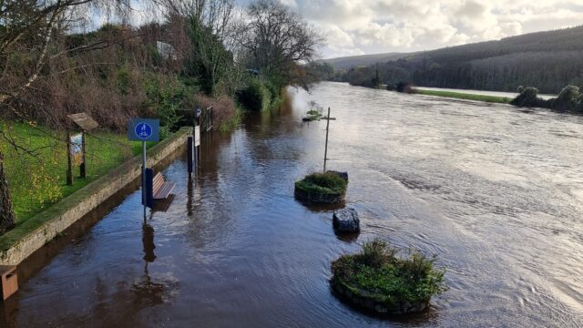
I’ve been sort-of distracted from geohashing after my house flooded and I had to evacuate earlier this year,
so I’ve not had much opportunity to get out and participate. But today, that changed!
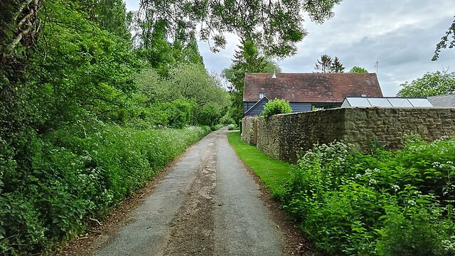
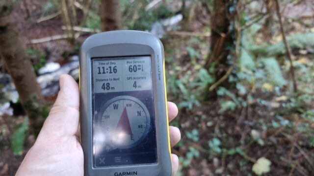
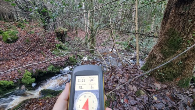
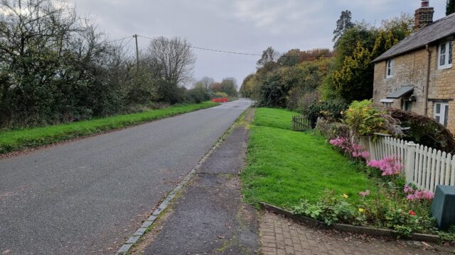
The road stops here and becomes a footpath.
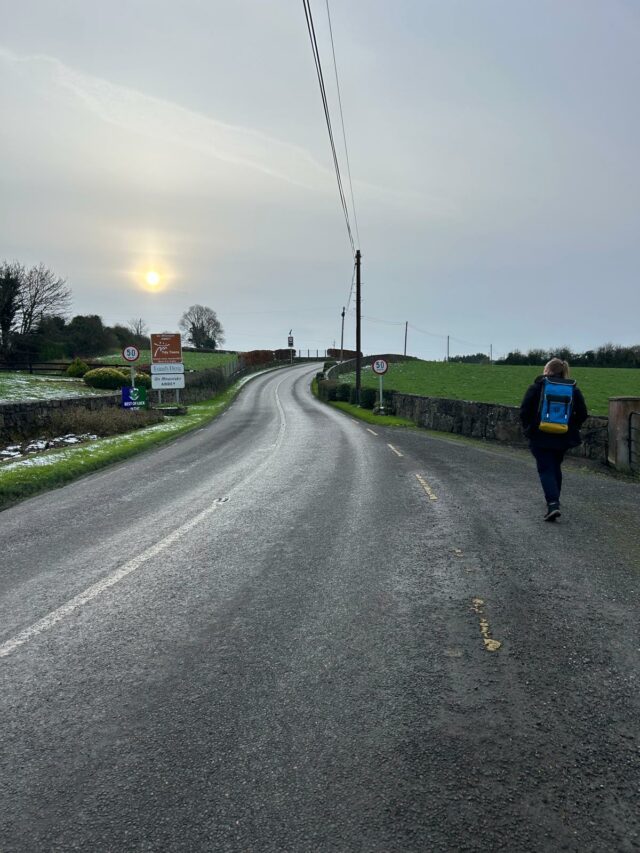
After dropping the kids at their schools I drove to Manor Cottages at 51.746, -1.396 where I knew I’d be able to park, then set off at a jog down the rest of Steadys Lane and onto the
permissive footpath beyond. I waved to a solitary walker coming the other way, and pressed on until I was close to the field.
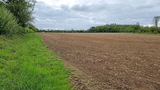
Entering the first field.
Satellite photography suggested that I wouldn’t be able to enter the field directly, so I hopped a gate into the field West of it and was pleased to discover that neither field was
currently cultivated.
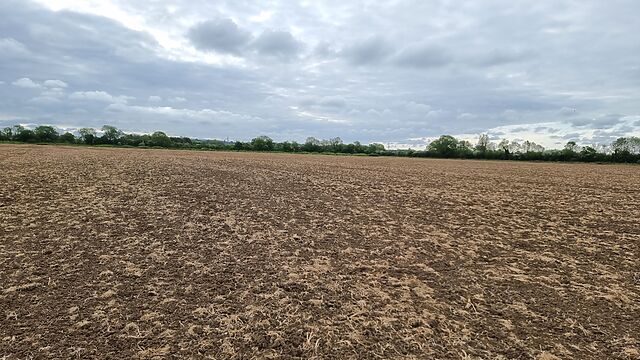
The second field: the hashpoint’s out there!
The hashpoint turned out to be about 700 metres into the field, and it felt sort of open and exposed to go tramping right across the middle of it, but sure enough that’s where I reached
the circle of uncertainty, at 08:53.
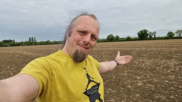
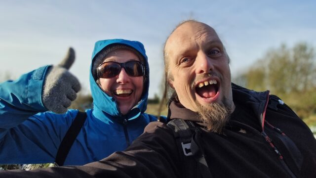
Silly grin!
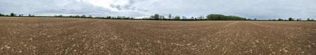
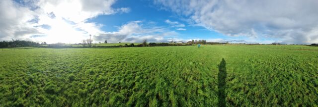
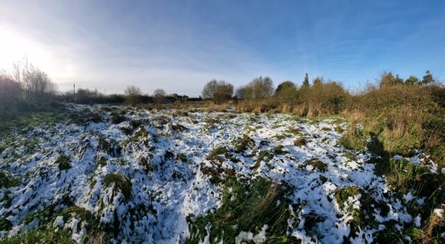
Panoramic view from the hashpoint.
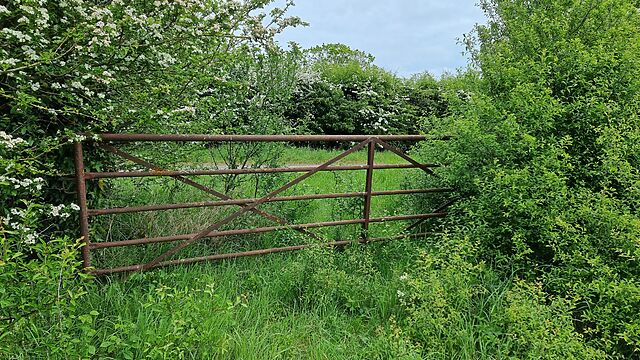
Coming back, I spotted a disused and rusty old gate that provided easier access to the field, which provided a quicker way back to the footpath.
A better-placed gate.
Tracklog
No tracklog today. 😢 I’m not sure if I’ve seen my GPSr since the flood, so I was just working off my my phone.
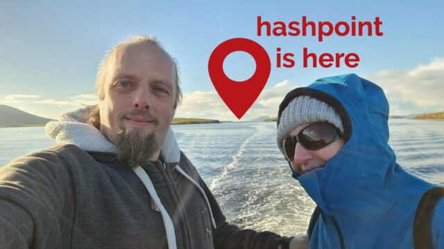
I’ve been on holiday on the islands of Trinidad & Tobago this week. These island nations span graticules that are dominated by the Caribbean and Atlantic Oceans, so it’s little wonder
there’s never been an attempted geohashing expedition in them. So when a hashpoint popped-up in a possibly-accessible location, I had to go for it!
For additional context: Trinidad & Tobago is currently under a state of
emergency as gang warfare and an escalating murder rate has reached a peak. It’s probably ill-advised to go far off the beaten track, especially as somebody who’s clearly a foreign
tourist. The violence and danger is especially prevalent in and around parts of nearby Port of Spain.
As a result, my partner Ruth (wisely) agreed to drive with me to the GZ strictly under the understanding that we’d turn back at a moment’s notice if anything looked remotely sketchy,
and we’d take every precaution on the way to, from, and at the hashpoint area (e.g. keeping car doors locked when travelling and not getting out unless necessary and safe to do so,
keeping valuables hidden out of sight, knowing the location of the nearest police station at any time, etc.).
I don’t have my regular geohashing kit with me, but I’ve got a smartphone, uLogger sending 5-minute GPS location pings (and the ability to send a location when I press a button in the
app, for proof later), and a little bravery, so here we go…
Expedition
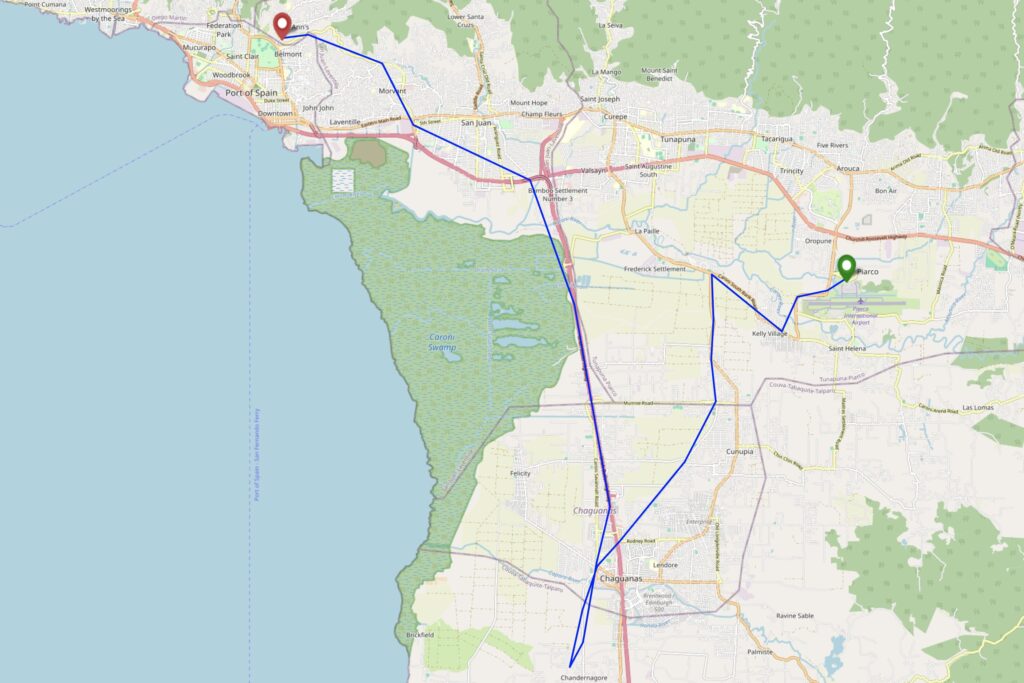
Our plane from Tobago landed around 15:20 local time, following an ahead-of-schedule flight assisted by a tailwind from the Atlantic side. We disembarked, collected our bags, and
proceeded to pick up a hire car.
Our Caribbean Airlines aircraft, landed at Piarco airport.
Our original plan for our stay in Trinidad had been to drive up to an AirBnB near 10.743817, -61.514248 on Paramin, one of Tobago’s highest summits. However,
our experience of driving up Mount Dillon on Tobago earlier in the week showed us that the rural
mountain roads around here can be terrifyingly dangerous for non-locals1,
and so we chickened out and investigated the possibility of arranging a last-minute stay at a lodge on the edge of the rainforest in Gran Couva, or else failing that a fallback plan of
a conventional tourist-centric hotel in the North of Port of Spain.
By this point, we’d determined that the hashpoint was in the old sugar growing region of Caroni, in which our originally-intended accommodation at Gran Couva could be found, and so it
seemed feasible that we might be able to safely deviate from our route only a little to get to the hashpoint before reaching our beds. We were particularly keen to be at a place of
known safety before the sun set, here in an unusual part of an unfamiliar country! So when the owner of our proposed lodge in Gran Couva called to say that he couldn’t accept our
last-minute booking on account of ongoing renovations to his property, we had to quickly arrange ourself a room at our backup hotel.
This put us in an awkward position: now the hashpoint really wasn’t anything-like on the way from the airport to where we’d be staying, and we’d doubtless be spending longer
than we’d like to be on the road and increasing the risk that we’d be out after dark. I reassured Ruth, whose appetite for risk is somewhat lower than mine, that if we set out for the
hashpoint and anything seemed “off” we could turn around at any time, and we began our journey.
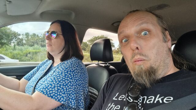
Putting a brave/excited face on as we set off in our rental car.
Boosted by her experience of driving on Tobago, Ruth continued to show her rapidly-developing Trinbagonian road skills2.
Driving down a network of crisscrossing roads.
Despite increasingly heavy traffic on our minor roads, possibly resulting from a crash that had occurred on the Southbound carriageway of the nearby Uriah Butler Highway which was
causing drivers to seek a shortcut through the suburbs, we made reasonable time, and were soon in the vicinity of the hashpoint: a mixed-use residential/light commercial estate of the
kind that apparently sprung up in places that were, until very late in the 20th century, lands used for sugar cane plantations.
At this point, the maps started to become less and less useful: Google Maps, OpenStreetMap, and Bing Maps completely disagreed as to whether we were driving on Bhagan Trace, Cemetery
Street, or Roy Gobin Fifth Avenue, as well as disagreeing on whether we were driving into a cul-de-sac or whether it was possible to loop around at the end to return back to the main
roads. It was now almost 17:00 and we were greeted by a large number of cars coming out of the narrow street in the opposite direction to us, going in, and squeezing past us: presumably
workers from one of the businesses down here going home for the evening.
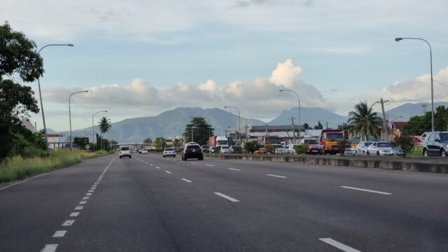
There are highways we’d been recommended to avoid because of the safety situation here, but this one was okay.
My GPS flickered as it tried to make sense of the patchwork of streets, and I asked Ruth to slow down and pull over a couple of times until I was sure that we’d gotten as close as we
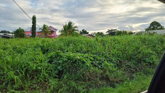
could, by road. Looking out of my window, I saw the empty lot that I’d scouted from satellite photography, but it was hopelessly overgrown. If the hashpoint was within it, it’d take
hours of work and a machete to cut through. The circle of uncertainty jumped around as I tried to finalise the signal without daring to do the obvious thing of holding my phone outside
the car window. A handful of locals watched us, the strange white folks sitting in a new car, as I poked at my devices in an effort to check if we were within the circle, or at least if
we would be when, imminently, we were forced to park even closer to the side to let a larger vehicle force its way through next to us!
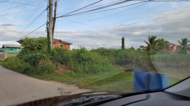
Pulled up at the hashpoint.
At the point at which I thought we’d made it, I hit the “save waypoint” at 17:06 button and instructed Ruth to drive on. We turned in the road and I started navigating us to our hotel,
only thinking to look at the final location I’d tagged later, when we felt safer. We drove back into Port of Spain avoiding Laventille (another zone we’d been particularly recommended
to stay away from) while I resisted the urge to double-check my tracklog, instead focussing on trying to provide solid directions through not-always-signposted streets: we had a wrong
turning at one point when we came off the highway at Bamboo Settlement No. 1 (10.627952, -61.429083) but thankfully this was an easy mistake to course-correct from.
View of the hashpoint again as we turn to go home
It was only when I looked at my tracklog, later, that I discovered that the point I’d tagged was exactly 8.59 metres from the hashpoint, plus or minus a circle of uncertainty of… 9
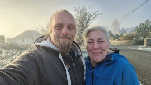
metres. Amazingly, we’d succeeded without even being certain we’d done so. Having failed to get a silly grin photo at the hashpoint, we sufficed to get one while we drank
celebratory Prosecco and ate tapas on the rooftop bar of our hotel, looking down on the beautiful bay and imposing mountains of this beautiful if intimidating island.
Silly drinky grins atop our hotel North of Port of Spain
Tracklog
I didn’t bring my primary GPSr, but my phone keeps a general-purpose tracklog at ~5min/50m
intervals, and when I prompt it to. Apologies that this makes my route map look “jumpier” than usual, especially when I’m away from the GZ.
Achievements
Footnotes
1 Often, when speaking to locals, they’d ask if it was our first time in Trinidad &
Tobago, and on learning that it was, they’d be shocked to hear that we’d opted to drive for ourselves rather than to hire drivers to take us places: it turns out that the roads are in
very-variable condition, from wonderfully-maintained highways to rural trails barely-driveable without a 4×4, but locals in both drive with the same kind of assertive and sometimes
reckless attitude.
2 tl;dr of driving in Trinidad & Tobago, as somebody who learned to drive in the UK: (1)
if you need to get out of anywhere, don’t wait for anybody to yield because they won’t, even if you theoretically have the right of way: instead, force your way out by obstructing
others, (2) drive in the middle of the road wherever possible to make it easier to dodge potholes and other hazards, which are clustered near the soft verges, and swing to your own
side of the road only at the last second to avoid collisions, and (3) use your horn as often as you like and for any purpose: to indicate that you want to turn, to warn somebody that
you’re there, to tell somebody to move, to say hello to a nearby pedestrian you recognise, or in lieu of turning on your headlights at night, for example. The car horn is a universal
language, it seems.
A quick and easy find on our way to the airport at Knock to end our Irish adventure, this morning.
Expedition
Finding the hashpoint was easy. We drove to it, arriving at 10:31, overshooting very slightly and walking back 20 metres (we could’ve done it without even getting out of the car if we’d
cared to). Then we were done.
It’s pretty cold out.
What happened next is where things went wrong. We stopped in Ballyhaunis, half-way between the hashpoint and the airport at Knock, for a comfort break and to find a local geocache. Then
we hiked out to find a second nearby geocache, but the icy conditions on the way back slowed us down considerably (and my mother fell over at least once). We stepped into a cafe for a
quick drink, and apparently my attitude to our imminently-departing flight was so laid-back (in actual fact, I thought we had about half an hour more in-hand than we did) that my mother
decided to reflect it and play laid-back too. Sarcastically, she suggested we stay around Ballyhaunis for a round of cakes, too, and I – not recognising her tone as sarcastic – agreed.
In fact, I thought that her relaxed attitude was because we had a long time until our flight, too. (tl;dr: when two people famed for their sarcasm communicate
sarcastically with one another, they should be careful not to, y’know, completely fuck up their plans for the rest of the day by accident)
As we digested our scones and my mother prepared to pour a second mug of tea, I pulled out my phone and realised to my horror that our plane was scheduled to depart in a little over 40
minutes: I’d got the departure time wrong. She said, “I thought you knew it was close, but you knew something I didn’t, like that it was really late!?” Nope.
We ran as fast as the icy ground would permit us to back to the car and drove at great speed to the airport, just in time to miss the closure of the departure desk. We’d just missed the
last and indeed only flight out of Knock airport that day. Fuck.
Anyway, all of which is to say that we extended the rental on our car, arranged to drop it off at Dublin airport, and drove coast-to-coast across Ireland to get to a more-favourable
airport and a last-minute AirBnB, where we dropped out bags then went out for pizza in a dangerously underlit bar
before listening to some Irish folks music in a different bar and going to bed.
Tomorrow. Tomorrow… we’ll leave the country. I promise.
This can’t be done. Right? Right?! Except maybe it can. I’ve found a few folks with boats and I’m going to phone-around in the morning and see about chartering one.
Expedition
I left lots of voicemails and messages lots of people, but nobody could offer me a lift to this random spot on the edge of Ireland. We later took a tour boat out into the bay but it
didn’t go near it either (but was a delightful ride, and we just-about came within sight of the hashpoint).
It’s actually about 10km away at this point. We could’ve gotten closer, but we couldn’t quite get close enough.
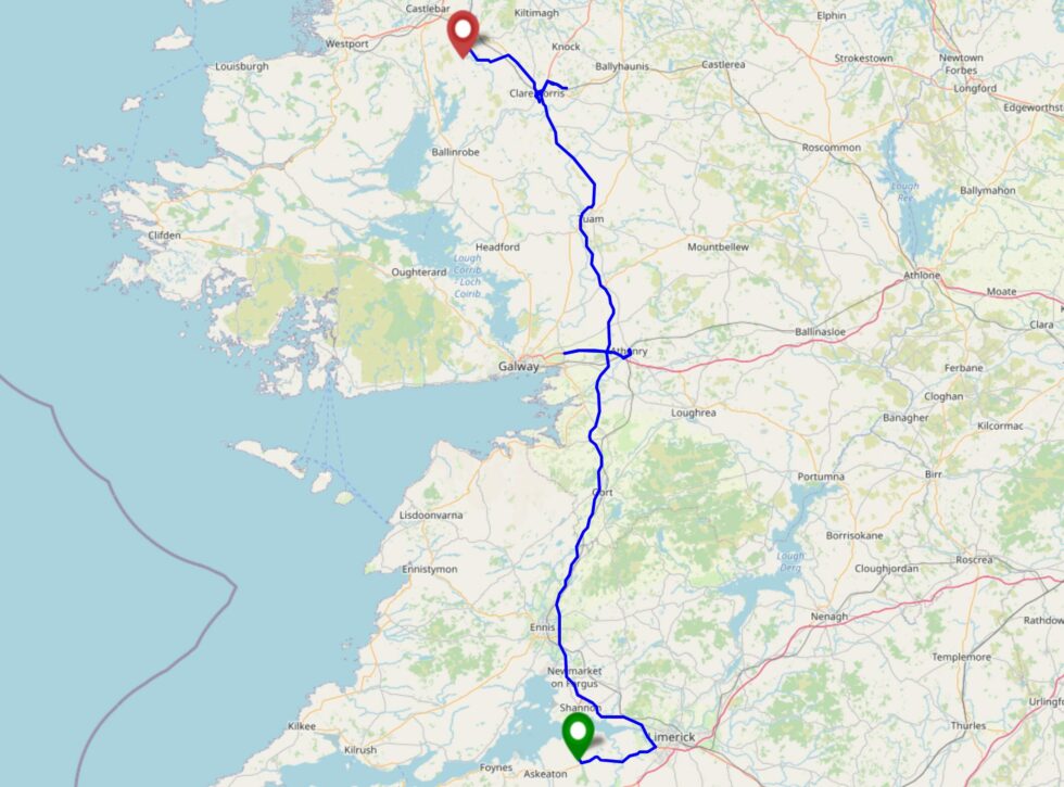
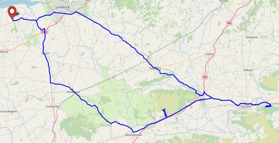
Today we need to drive North up the entire length of the M18 and M17 to get to our next accommodation. If we take only a minor diversion at Tuam we can see how accessible this hashpoint
is, on the way!
Expedition
On today’s leg of my mother and I’s expedition to go hashing around the West coast of Ireland (hampered only by the floods of Storm Bert) we were scheduled to drive a few hours up the
country to move from our old accommodation of the last few nights to our new accommodation of the next two. On our way we accidentally drove the wrong way down the M6 for a spell (as
you can see on our tracklog) as we intended to visit Athenry for some geocaching, before pushing on to the hashpoint.
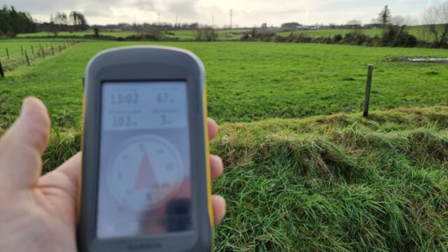
102 metres to go, but we’ll need to find a gate… and some better footwear…
We drove past the field with the hashpoint in order to dodge an incoming tractor and to scout out safe parking spaces. Finding a suitable verge, we pulled up and took a look at the
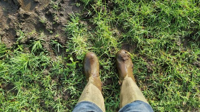
pasture with the hashpoint. The gate into it was seriously churned up with mud, so I switched to my wellies and my mother pulled on a pair of waterproof trousers, and we waded out.
Some of the early bits of the field would suck us ankle-deep, but by this point things were better.
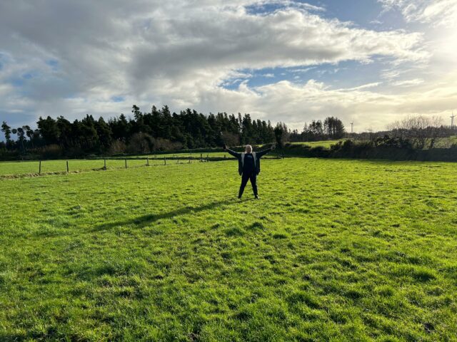
Once past the gate, it got a lot easier and we were able to quickly find our way to the hashpoint at 13:10.
One great thing about having a geohashing buddy is they can take a “victory pose” picture of you!
It was the middle of a muddy field. Not exciting, but a good view of rolling countryside and wind farms.
Fields as far as the eye can see. Until you hit the treeline.
We swiftly made our way back to our car to avoid any questions from passing farmers about what we might be doing hanging our near a piece of mystery agricultural equipment we were near.
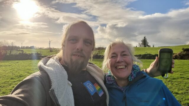
Requisite silly grins, as required by geohashing law.
Then, after changing back into our regular footwear so we didn’t bring tonnes of mud into our rental car, made our way down into Claremorris. There, we enjoyed a celebratory carvery
lunch, toured a handful of local geocaches, explored a path that Google Maps (only) claims exists – possibly a trap street? – and walked around a lake with lots of scultpures until we discovered that the route we’d planned to take was underwater. At that point, we figured it
was time to go check-in to our new AirBnB and returned to our car to set off.
I had the curry, but my mother managed to order a portion of gammon and mash slightly larger than her own head.
A highly-successful trip.
Tracklog
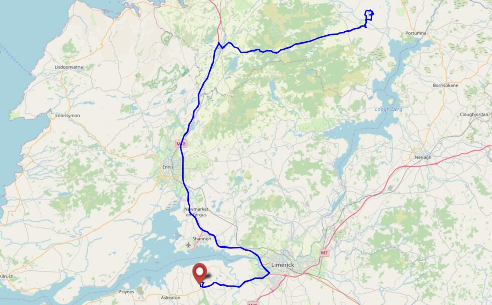
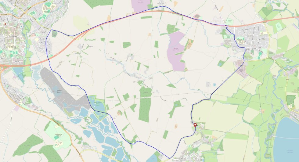
Full journey
(includes drive from old
accommodation, geocaching, hiking, drive to new accommodation, etc)
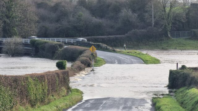
Day three of our geohashing-focussed holiday in Ireland, and the other hashpoints near us look likely to be inaccessible to owing to flooding, but this one’s in a hillside forest.
Should be easy, right?
Expedition
It took us around an hour and a half to drive from our accomodation out to Kilsheelan, from which we’d planned to cross the bridge and ascend the hill into the forest where the
hashpoint could be found.
The route up the hill into the forest wasn’t especially steep, but it seemed to take a while.
We’d originally anticipated that we’d tackle the trail of geocaches alongside the River Suir afterwards, but looking down from the bridge made it clear that this was not going to be
possible: the riverside path was completely underwater where the river had broken its banks.
Yeah, we’re not walking along that footpath.
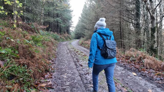
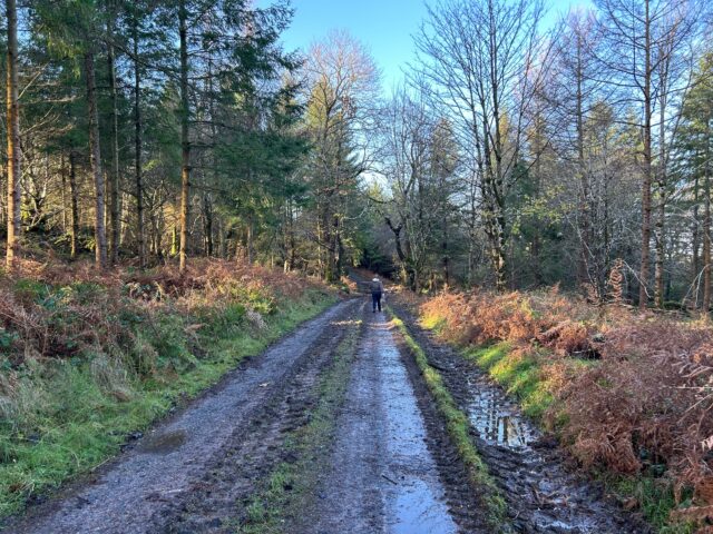
We pressed on up and into the forest. It’s mostly a managed pine forest, surrounded by pockets of native deciduous trees. The trails are, for the most part, wide enough for the forestry
vehicles to traverse, and – apart from the points at which streams has escaped their culverts and flooded the path – it was mostly dry and easy walking.
The trails were muddy, but very navigable.
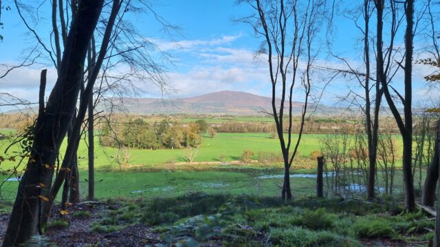
The maps indicated the the fastest route to where the hashpoint could be found would have been along a road, but we opted to climb to an altitude of about 150m to take a forest trail
parallel to the road, instead, and it was certainly a more-welcome view.
Especially impressive was the view of Slievenamon across the valley, which I shared from the field.
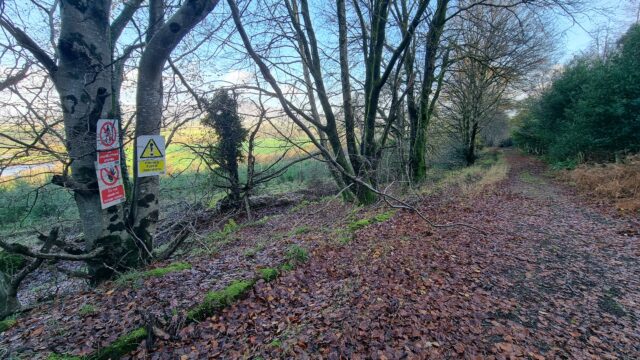
Getting closer to the cache, we found a trail leading down and began to approach it. We seemed to be endlessly stuck at around 370 metres away as our track wound back and forth with the
contours of the hill, but eventually we began to approach it. I was momentarily panicked when we disovered an area of new plantation, surrounded by a 3-metre tall wire fence, because it
looked as though the hashpoint might turn out to be inside it and therefore inaccessible, but as we continued to walk we discovered to our delight that it would, instead, be in
one of the mature parts of the managed forest instead.
Uh-oh, this fence looks like trouble.
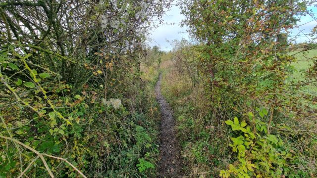
We broke off the track with around 50 metres to go and began to hack our way through the slippery mud and tangled undergrowth.
We need to go… thisaway!
Before long, we came across a stream, converted into a torrent by the floodwater and the mountaintop’s melting snow!
This stream could be a problem…
After scouting for the narrowest point (and giving up on attempting to construct a bridge) I leapt across, and then reached back to help my mother do the same.
“You think we can jump it?” “I think I can jump it, but I don’t know about you.” “Can you… pull me over?”
“We got over it!”
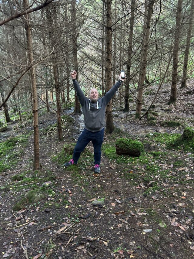
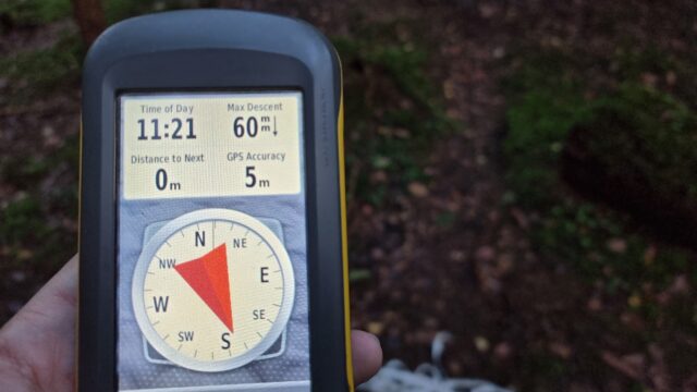
Now we were able to pick our way around decaying wood and slippery leaves to finally get to the hashpoint. We arrived at 11:20.
Victory pose!
Ground Zero!
A panorama from the hashpoint.
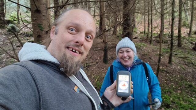
Requisite silly grins.
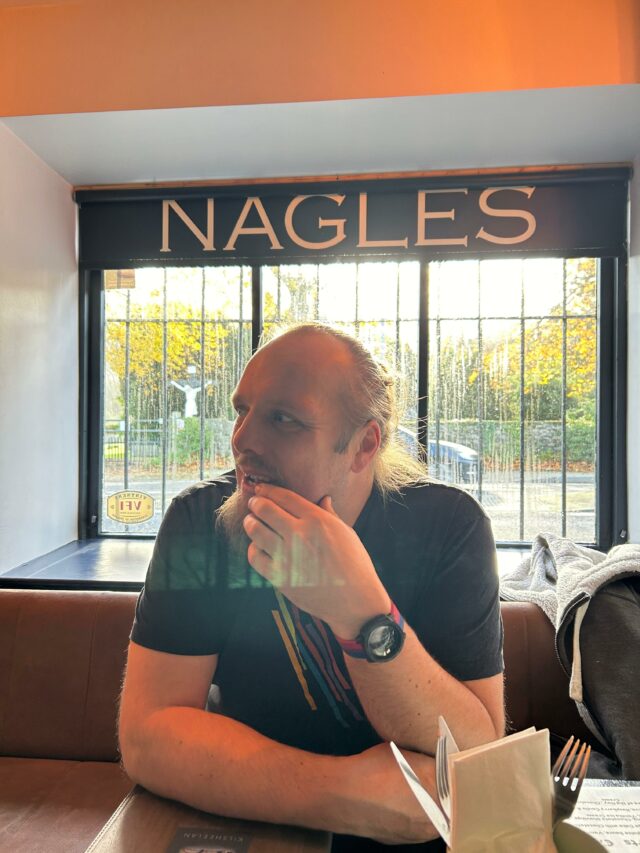
Retracing our steps to the path and continuing our descent, we returned via the road to the bridge we’d crossed at. We enjoyed a spectacular view of Slievenamon to the North, a mountain that towers over the valley. Returning to Kilsheelan, we had a great lunch at Nagle’s
Bar, then continued on our day’s adventures: taking in some history at Cahir Castle (and finding a nearby geocache), dodging the rain at coffee shop Keep Coffee, and then taking on a
challenging series of caches on the Millennium Loop of Glengarra Woods, where we almost found ourselves stranded by the setting sun, short on batteries for either GPS, phone, or torch
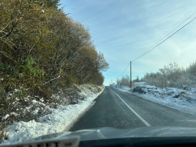
use, and having to carefully pick our way back to the car before a long dark drive over the winding Kilmallock road to get back to home, beer, and baths.
Lunchtime!
A wonderful adventure that’s left me heavy of foot and light of spirit.
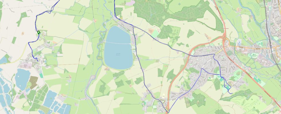
Tracklog
Full journey
(includes the driving sections and our other expeditions, including some lunch, touring a castle, and geocaching a valley)
(just the bit from where we parked up into the forest, to the hashpoint, and down again; minus a bit at the start where I forgot to turn my backup GPSr on)
On the second full day of our geohashing tour of Western Ireland, we’ll try to drive to somewhere close to this hashpoint (maybe up towards Knockaderry?) and see if we can walk to it
(and if it’s accessible when we get there).
Expedition
This part of Ireland’s been under moderate snow cover for several days, but overnight that turned to rain and as it warmed up early in the morning, the snow rapidly melted and poured
down into the valleys. The River Arra burst its banks in several places, and our first, second, and third attempts to find places to cross it to get closer to the hashpoint were foiled
by floods (too deep and fast-flowing to safely ford) and closed roads.
Yeah… I don’t think I’m gonna chance that (especially in a rental car!).
After seeing several fields of about the altitude of our target also deeply flooded, we opted to give up on this expedition for our own safety! Instead, we went geocaching in Newcastle
West and then went up to Foyle where we visited the museum of maritime history and learned about the history of the flying boats that were stationed there in the inter-war years.
A geocacher’s most-valuable skills include map reading, trail-finding, and rummaging around behind fence posts.
Hey look, I found a flying boat.
Where, I wondered, could I find a cluster of mostly-land graticules (“square” degree of latitude and longitude) in which nobody had ever logged a successful expedition? I’ve been
geohashing for ten years now and I’ve never yet scored a “Graticule Unlocked” achievement for being the first to reach any hashpoint in a given graticule.
So this week, we’re holidaying on the West coast of Ireland, doing a variety of activities that take our fancy and, hopefully, finding a geohashpoint or two in previously-unexplored
graticules!
Looking at the nearby hashpoints, we decided that this was our best bet. An hour and a half’s drive from our accomodation to a village near the hashpoint and we might be able to make
the rest of the way on foot.
Expedition
Driving conditions were sometimes suboptimal, but okay.
My mother’s never been hashing before, but unlike most people I’ve told about the hobby she didn’t turn her nose up at the idea so she was happy to accompany me on this unusual
adventure.
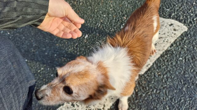
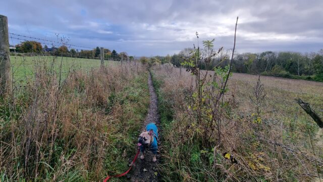
We met a surprising number of dogs out, alone, “taking themselves for a walk’. Like this one.
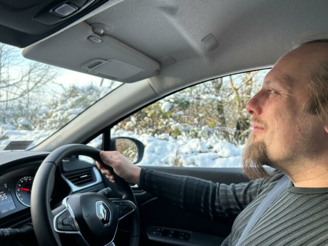
Our rental car did a pretty good job.
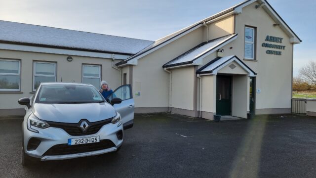
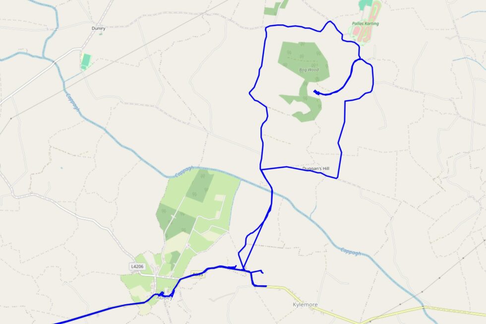
We drove to Abbey, which turns out to be a delightful village, and parked outside the community centre (where my mother was able to use the bathroom).
Parking was plentiful in Abbey.
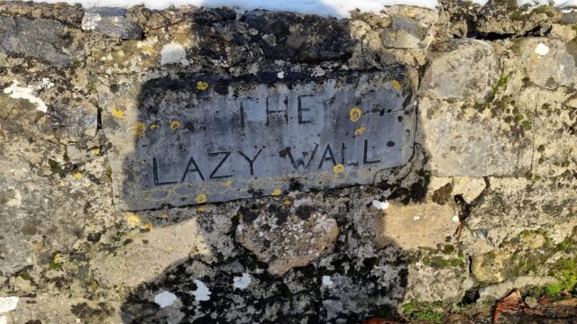
We still don’t know what makes this wall “lazy”.
Then we switched to foot, walking along the banks of the stream and following the road to the East, towards the field where we’d hoped to find the hashpoint.
We anticipated there being nowhere closer than Abbey to park and get to the hashpoint, so we spent most of our time on foot.
A quick survey around the outskirts of the area suggested that it was, indeed, in what had once been an active pasture but had been abandoned and disused for many years. The grass and
brambles grew high and were caked in snow, but we hopped the gate and pressed on for the final hundred metres.
Very close…!
We made the right choice: the hashpoint was just barely inside the disused old field, and we were able to get to it with only slightly wet feet and without disturbance (except for some
kind of nesting bird that was unhappy to see us, and some kind of medium-sized mammal – possibly a fox – that ran away as we approached).
View from the hashpoint.
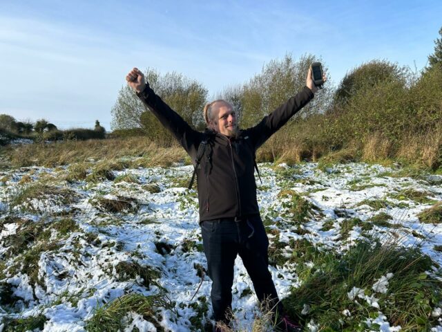
We reached the hashpoint at 11:24.
Obligatory silly grins.
Flushed with success at this relatively easy victory, we continued our walk to a nearby dairy to see if they’d sell us some cheese (their farm shop was shut), and then crossed the river
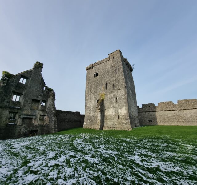
and climbed the nearby hill to find the fantastic geocache at Pallas Castle.
The castle was a wonderful diversion on our way back.
Circling around from the hilltop to return to the car, we drove back home, completing our expedition (hashpoint, cache, and all) in a little under 7 hours.
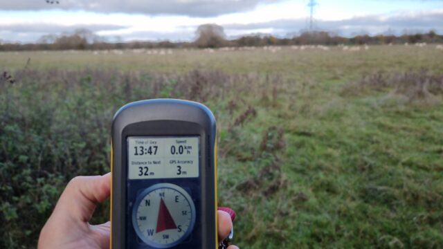
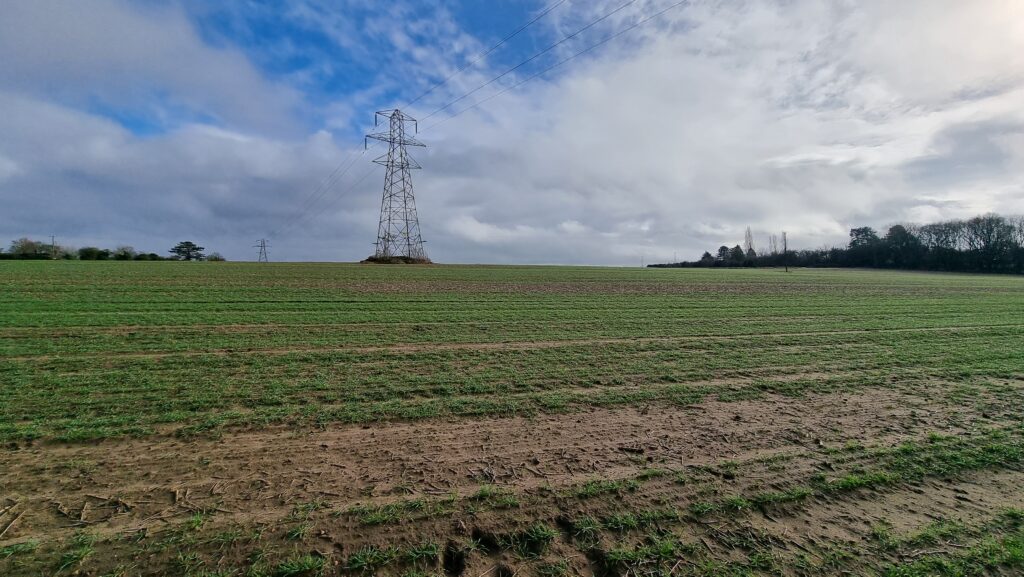
The dog and I drove out to Ducklington, parking near the church, and walked out to these fields. Unfortunately the hashpoint turns out to be 33+ metres into a field full of sheep. That
_might’ve_ been the kind of trespassing I’d have been willing to consider, were it not for the combination of the amount of pedestrian traffic (a whole platoon of birdwatchers, armed
with extra-long camera lenses, and every dog walker under the sun!) and the fact that I had the dog with me (who’d have to have waited unhappily outside the field: not taking her _into_
a field of sheep, even by only 33 metres).
So near, and yet so far…
Instead, then, we took a pleasant walk around Ducklington and found the GC656RM “Church Micro 8564…Ducklington”
geocache, so it wasn’t entirely a wasted trip. The dog’s come home and zonked out in her basket after a decent walk, anwyay!
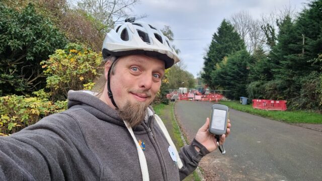
After brunch, I reckon I can get to and from this hashpoint… Tron-style!
Expedition
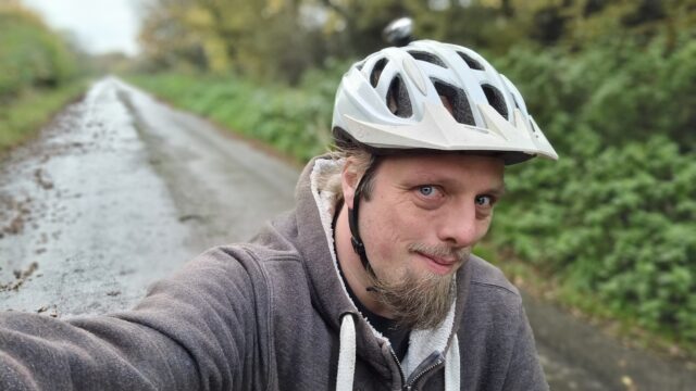
I planned a slightly circuitous route to this hashpoint in order to make a Tron achievement possible. I got my bike lightcycle out of
the garage, checked the brakes and tyres, and set off in the opposite direction of the hashpoint! My thinking was I could cut up Tar Lakes Road to Cogges Farm, join the A40 cyclepath at
Witney, follow it all the way to Barnard Gate, and – after passing through the hamlet and hopefully the hashpoint – turn _back_ along the opposite side of A40 (for the section that
doesn’t have a cyclepath) and then cut through South Leigh to get back home.
My first hazard came just three minutes out of my door, where a motorist failed to give way to me at Stanton Harcourt Roundabout, entering the junction even though I was already
half-way across it from the other direction. They had to slam on their brakes to avoid smashing into the side of me, and I’ll admit I may have sworn at them at least a little as they
pulled guiltily away.
The Tar Lakes road remains a delightful route from Stanton Harcourt to Witney, which I’ve enjoyed cycling many times. It was a little busier than usual, perhaps because it’s Sunday and
folks were off to and from the fishing lakes along its path to do some angling or to walk their dogs, but it was still a fast and easy journey. Reaching Cogges, I turned back towards
the hashpoint and joined the A40 cyclepath which, I hoped, would bring me right through it.
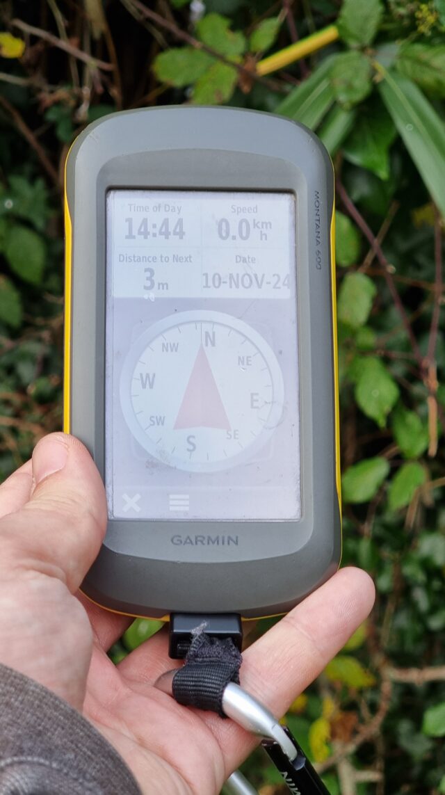
Approaching the hashpoint, I was concerned to see that the road was closed ahead, but a sign reassured me that it was still open to pedestrians, so I dismounted my bike. This also
provided an excuse for me to slow down and pay attention to my GPSr as I counted down the metres. I got within the circle of uncertainty at ~3m away, as I leaned over the dyke that
separates Pear Tree Cottage’s garden from the byway.
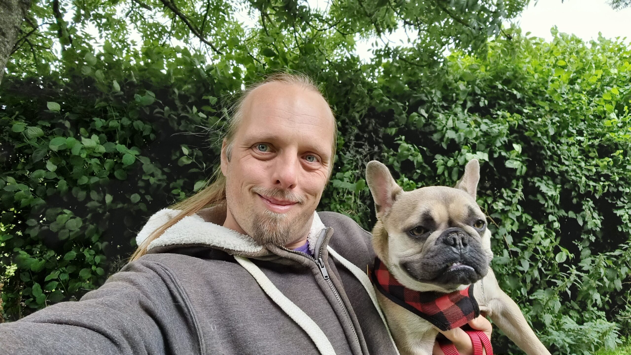
I snapped the regulation silly grin selfie at 14:44.
Photo taken, I then had to continue to push my bike all the way through the roadworks: the fastest way home would have been to turn around, at this point, but I didn’t want to be robbed
of my shot at the Tron achievement, so I pressed on.
At the far end of Barnard Gate I determined that cycling back along the A40 without the benefit of a cyclepath was perhaps a little too dangerous (especially after my scare earlier), so
I adapted my route to instead head East towards Eynsham, crossing the main road at the Evenlode pub to get onto Old Witney Road, through Eynsham, and back onto the road home.
Returning home, I made sure to cut the corner short as I turned into my driveway so I didn’t cross the path I’d taken as I’d initially exited, an hour earlier. A successful trip, and a
fresh achievement!
I’m on sabbatical from work right now, so I’m hoping to be able to get out to this hashpoint while the kids are at school.
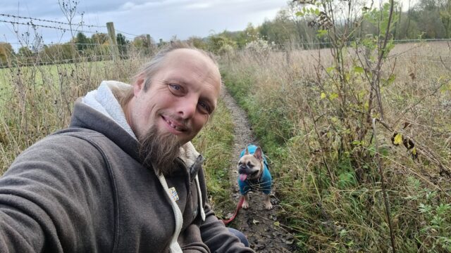
Expedition
After dropping the kids off at school, the geopup/hashhound and I set out for the hashpoint. Coming up the “short side” of the bridleway from Botley would be a shorter walk, but we
opted to park in Cumnor and come up the “long side” of Harcourt Hill to avoid Oxford’s traffic (and the inevitable fee for parking on the city’s side of the hill).
Harcourt Hill (like my village of Stanton Harcourt) doubtless gets its name from the Harcourt Family, who supported William the Conqueror during his conquest of Great Britain back in
1066 and were ultimately granted huge swathes of land around this part of the world in recognition of their loyalty. To this day, you find “Harcourt” in a lot of place names in this
neck of the woods.
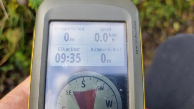
The hashpoint was so easy to find, we almost walked right over it: it’s right in the centre of the footpath/bridleway. Even my dog, who often doesn’t like long walks or muddy paths,
didn’t get a chance to complain before we got there. We arrived at 09:35 and took the requisite photos, which can be found below. We also kept a GPS tracklog and vlogged our experience,
all of which you can see below.
I’ve not properly hashed in a long while, so it was great to get back out there!
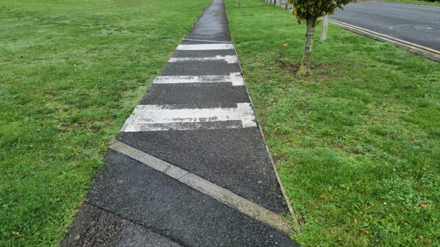
What’s the point of this crossing? Do rabbits pass very fast through this junction?
View East from the hashpoint (plus dog).
View West from the hashpoint.
Right in the middle of the circle of uncertainty.
Silly grin/silly tongue-sticking-out.
I originally though I’d cycle out here in the evening and see if I could reach the hashpoint, but with the weather so delightful (and the dog clamouring for a walk) I opted to adapt my
lunchtime plans to go to Standlake Post Office (rather than the only-slightly-closer Eynsham Post Office) to post a parcel and take the dog for a walk… and check out the hashpoint at
the same time!
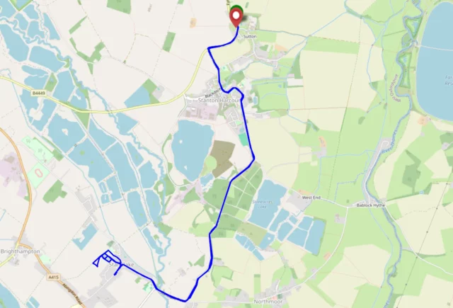
Expedition
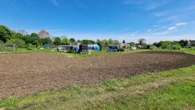
Success! The dog and I parked near the Post Office, and tired firstd walking through the allotments, but they don’t go as far back as I thought they might and we couldn’t really get
close to the hashpoint. So we doubled back, with the anticipation of going via the churchyard, when I spotted a convenient footpath sign (for a footpath not marked on my map), so we
followed that. Conveniently it turned out to be a shortcut to Horns Way, the alternative route I’d considered to try to get close to the hashpoint. Travelling along it, we found an
(also not on the map) back gate into the allotments: we could’ve just come this way, after all! We’d later use this route to get back home.
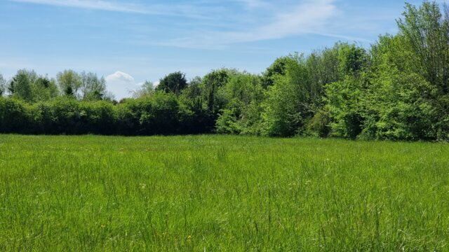
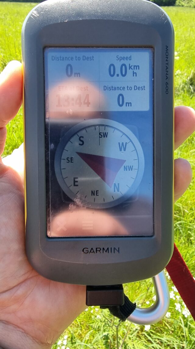
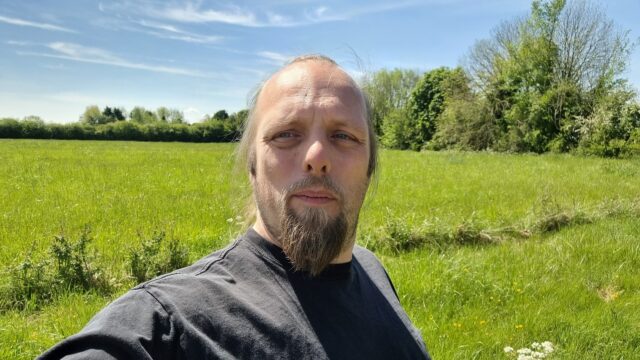
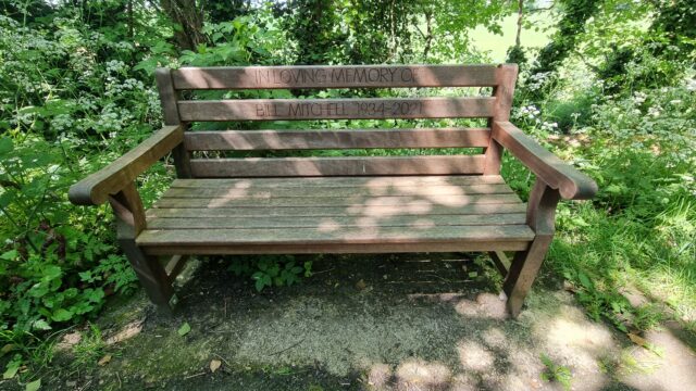
Approaching the hashpoint, we needed to push through a thicket of trees and jump a ditch, but this delivered us into a delightful meadow. We reached the hashpoint at 13:44, took the
requisite silly photo, and set off back. On returning to the footpath (by a decidedly inferior route) we discovered a bench (with a dedication on it) that also wasn’t listed on
OpenStreetMap nor on OpenBenches. I took a photo and pushed it to OpenBenches. There should be an achievement for that.
I haven’t hashed for long enough that my home graticule got marked as inactive. I’ve got a little free time this morning, so let’s fix that!
Expedition
It took two attempts to reach this hashpoint.
The first attempt saw me set off around 09:40, with a plan to drive over the world’s
stupidest toll bridge (paying 5p for the privilege), park up in Cumnor somewhere, then work down the Cumnor-Appleton footpath before dipping into the fields (which are likely to be
fallow this time of year) to claim the hashpoint. I suggested to take the dog, and the 7-year-old child asked if he could join me too, so the three of us with our eight legs set off.
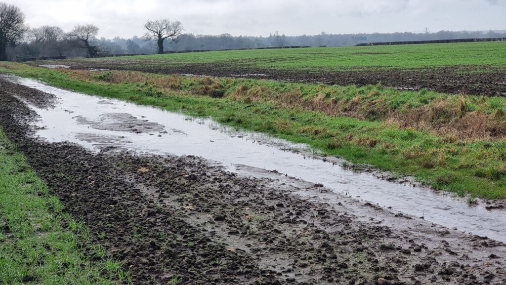
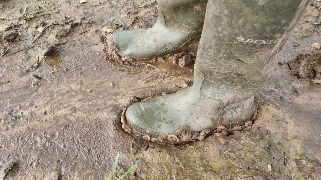
This winter’s seen heavy rain around these parts, and the stream that runs alongside the footpath had broken its banks and flooded the fields. The water had receded, but the ground
remained extremely boggy. That kind of thick, wellie-sucking mud that means that if you stop walking for more than a couple of seconds, you might as well give up and say you live there
now because your boot is never coming back.
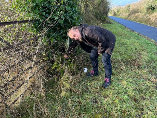
The kid found the going especially-tough, especially after a particularly-deep puddle splashed over the edge of his wellies, and asked to turn back. The dog was finding it a bit
challenging too! So we doubled-back and found a geocache a little way off the
path. We’ve generally been disappointed by Cumnor’s geocaches and especially this series, finding them to be ill-maintained or completely absent, but it looks like the cache owner
has been working on repairing and replacing them towards the tail end of last year and this one was soon found. I drove the dog and child home (back across the toll bridge), then came
back out myself (paying the fivepence toll a third time). So began the second attempt:
Unburdened by short-legged dogs and damp-footed kids, I made better progress. At points, the path was completely flooded-out, but this gave me an excuse to walk along the “tramlines” of
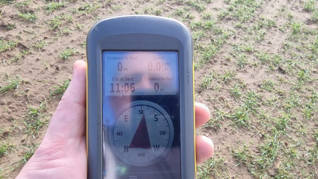
the cultivator that must’ve been working in the field last year, which put me on a better course to reach the hashpoint. By 11:06 I was well within the circle of uncertainty and
declared the mission a success.
Then I plodged back through the mud, changed my footwear, and drove over the toll bridge a fourth time. The attendant, clearly sick of seeing me driving back and forth, took
pity on me and let me off without paying yet another 5p piece, so that was nice.
This “path” seems to be a stream.
Muddy boots
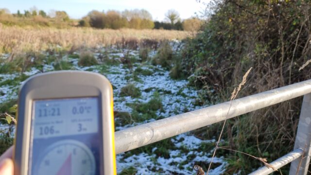
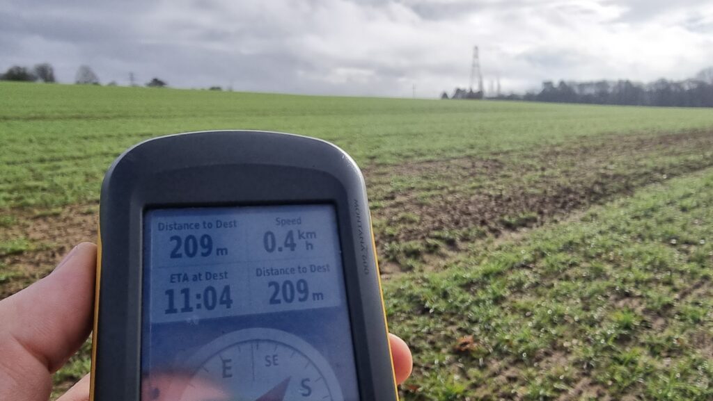
200 metres to go.
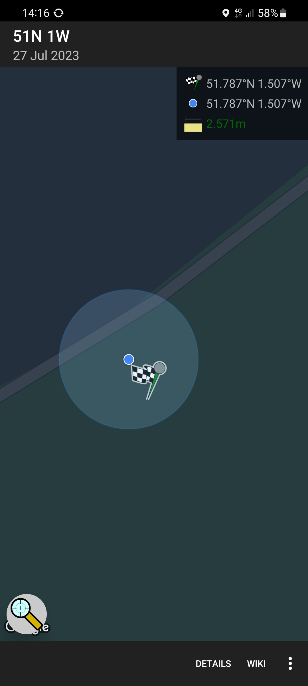
Zero point!
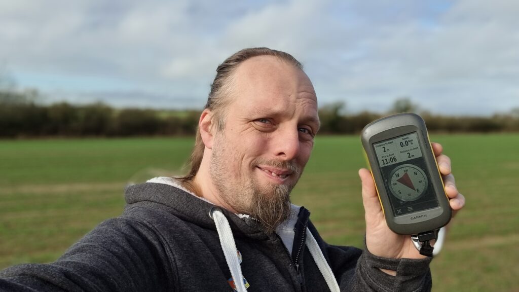
Silly grin
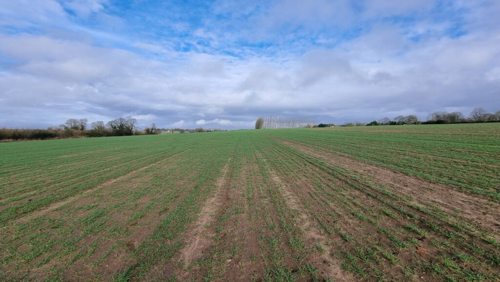
View North from the hashpoint.
View East from the hashpoint.
View South from the hashpoint.
View West from the hashpoint.
I wasn’t supposed to be here. I was supposed to be on the Isle of Man with my partner, celebrating our 0x10th anniversary. But
this week’s been a week of disasters: my partner lost her job, our plane to the Isle of Man got cancelled, and then I got sick (most-likely, I got to catch airport germs from people I
got to sit next to on an aircraft which was then cancelled before it had a chance to take off). So mostly this week I’ve been sat at home playing video games.
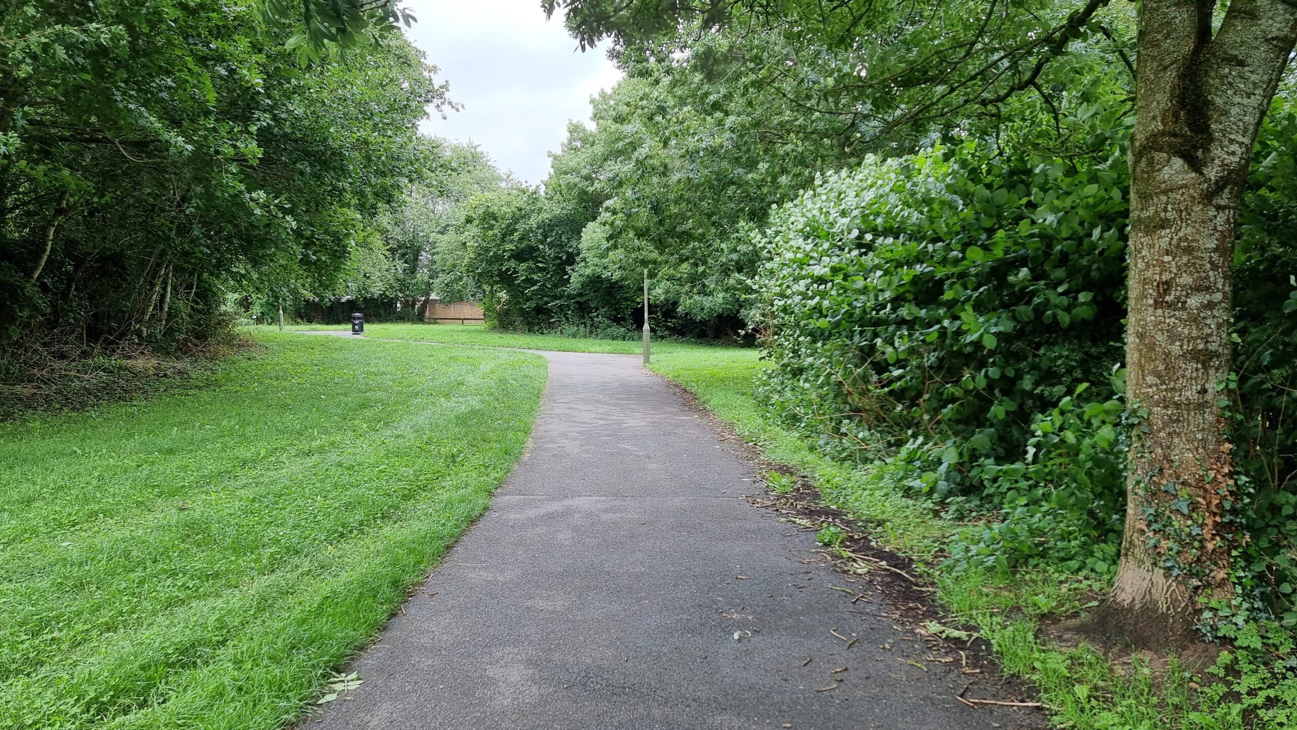
But the dog needed a walk, and my partner needed to go to the supermarket, so I had her drop me and the geopooch off in West Witney to find the hashpoint and then walk to meet them
after she’d collected the shopping. I couldn’t find my GPSr, so I used my phone, and it was reporting low accuracy until I rebooted it, by which time I’d walked past the hashpoint and had to
double-back, much to the doggo’s confusion.
I reached the hashpoint at 14:16 BST (and probably a few points before than, owing to my navigation failure). I needed to stand
very close to the fence to get within the circle of uncertainty, but at least I didn’t have to reach through and into the school grounds.
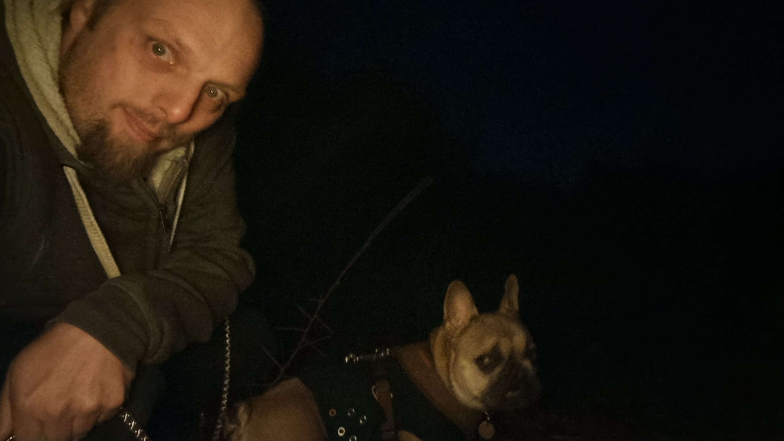
My evening just freed up, so – weather-permitting – I might brave the sleet and cold and cycle out to this hashpoint this evening.
Expedition
Our dog had surgery at the start of the week and has now recovered enough to want a short walk, so I changed my plan to cycle for one to drive (with the dog) out to somewhere near the
hashpoint and take her for a walk to and around it. Amazingly, I might have been faster to cycle: a crash on the A40 had lead to lots of traffic being re-routed along the exact same
back roads that was to be my most-direct route, and on the local rat run through South Leigh I got trapped behind a line of folks who weren’t familiar with this particular unlit and
twisty road and took the entire derestricted section at an average of 25mph. Ah well.
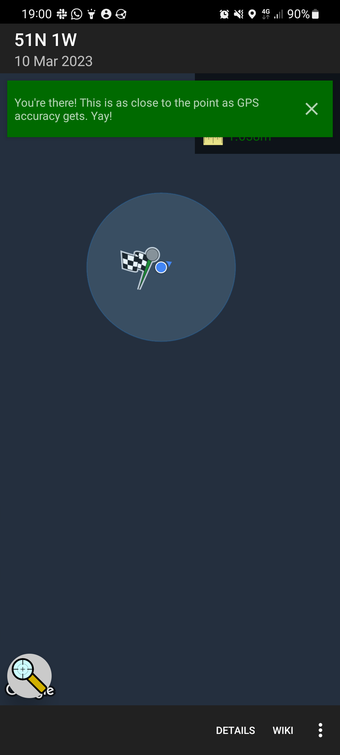
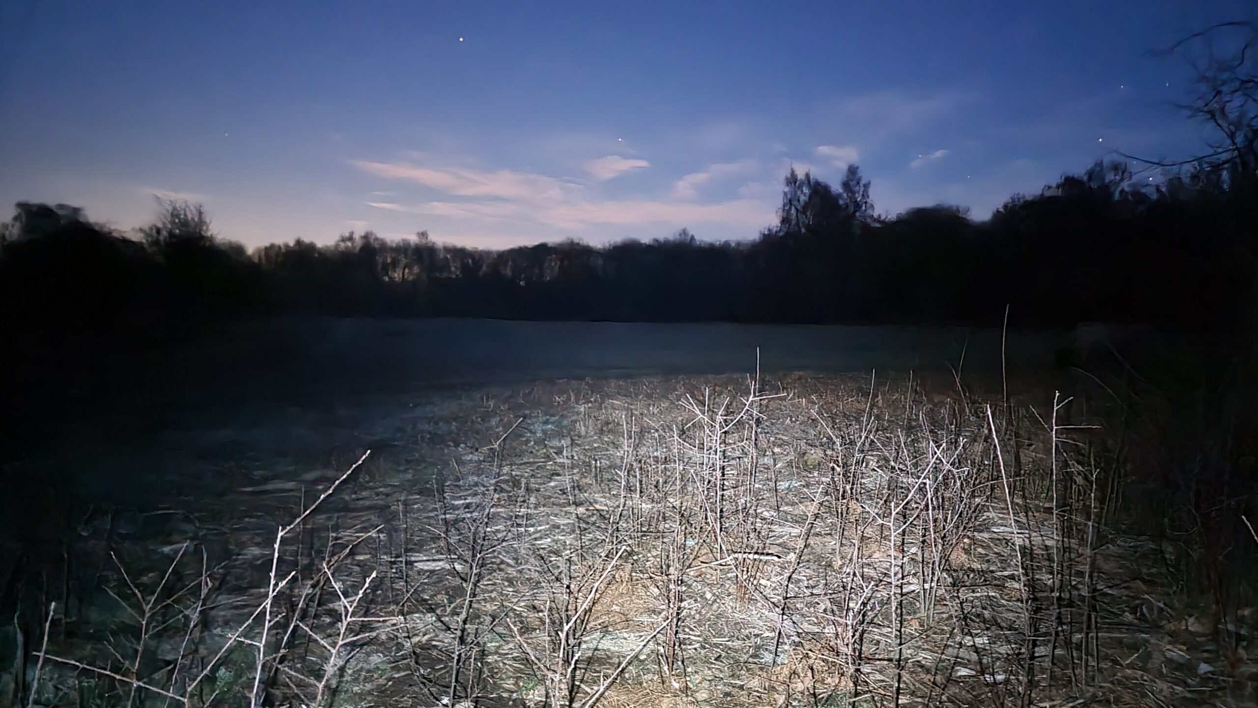
Out of laziness, I didn’t bring my GPSr or make a tracklog; I just used the Geohashdroid app and took a screenshot when I got there. South Leigh Common is pleasant, but it was dark, and
my photos are all a little bit hard to make out! But the stars were beautiful tonight, and the dog loved one of her first outings since her surgery and enjoying running around in the
long wet grass and sticking her head into rabbit holes. At 19:00 precisely I got within about a metre and a half of the hashpoint – well within the circle of uncertainty – and turned to
head home.
I also took the time while there to update OpenStreetMap by drawing in the
boundaries of the common, replacing the nondescript “point” that had marked it before.
Photos
Proof from Geohashdroid
Silly grins in the dark from a man and his dog
Long exposure, with flashlight on, showing the hashpoint and the Common beyond