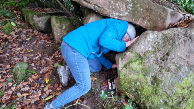
Sent my mother in to to a variety of holes in boulders to try to find this one before we picked it up and had the cache – and its bonus number – in-hand!
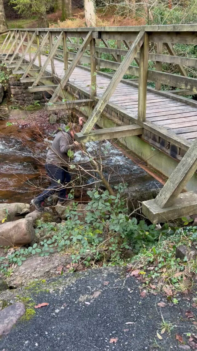
Power-walking on around the trail we quickly found the clue object. I figured it was worth braving the (high) water and getting below the bridge, so I scrambled down and soon found the
cache. Good location!
My mother and I are visiting Ireland (from Lancashire, UK and Oxfordshire, UK, respectively) on a mission to find geohashpoints in previously-unexplored graticules, and find a few
carefully-selected geocaches along the way. Today we were our near Kilsheelan, down the Suir Valley, making a successful
expedition for the 2024-11-24 52 -7 geohashpoint which turned out to be deep within a forest on the hills over the River Suir. Flushed with success, we had our lunch, visited Cahir
Castle (and found its nearest geocache), and then made our way over here to attempt this circuit of caches.
We knew we were starting late and were risking the mercy of the setting sun, but we figured that powerwalking and quick finds might see us through. We parked right next to this first
cache, found it (it doesn’t have a logbook, by the way!), retrieved the first number, and marched on. Could we do it? Time would tell!
(FP awarded on behalf of the series, which was excellent)
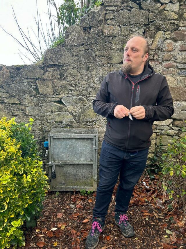
QEF for my mum and I on our way from this graticule’s hashpoint (after a successful geohashing expedition) to visit the castle. Logbook very full, will soon need replacing. TFTC.
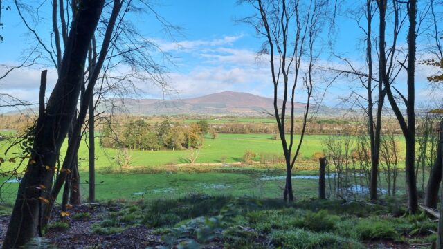
Gorgeous view of Slievenamon towering over Kilsheelan, Co. Tipperary, Ireland, as seen from Gurteen Wood, where my mother and I are just on our way back from our successful expedition
to the 2024-11-24 52 -7 geohashpoint.
Day three of our geohashing-focussed holiday in Ireland, and the other hashpoints near us look likely to be inaccessible to owing to flooding, but this one’s in a hillside forest.
Should be easy, right?
Expedition
It took us around an hour and a half to drive from our accomodation out to Kilsheelan, from which we’d planned to cross the bridge and ascend the hill into the forest where the
hashpoint could be found.
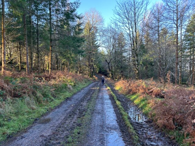
The route up the hill into the forest wasn’t especially steep, but it seemed to take a while.
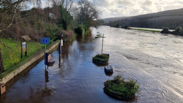
We’d originally anticipated that we’d tackle the trail of geocaches alongside the River Suir afterwards, but looking down from the bridge made it clear that this was not going to be
possible: the riverside path was completely underwater where the river had broken its banks.
Yeah, we’re not walking along that footpath.
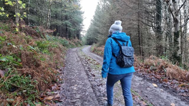
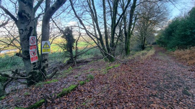
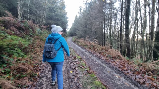
We pressed on up and into the forest. It’s mostly a managed pine forest, surrounded by pockets of native deciduous trees. The trails are, for the most part, wide enough for the forestry
vehicles to traverse, and – apart from the points at which streams has escaped their culverts and flooded the path – it was mostly dry and easy walking.
The trails were muddy, but very navigable.
The maps indicated the the fastest route to where the hashpoint could be found would have been along a road, but we opted to climb to an altitude of about 150m to take a forest trail
parallel to the road, instead, and it was certainly a more-welcome view.
Especially impressive was the view of Slievenamon across the valley, which I shared from the field.
Getting closer to the cache, we found a trail leading down and began to approach it. We seemed to be endlessly stuck at around 370 metres away as our track wound back and forth with the
contours of the hill, but eventually we began to approach it. I was momentarily panicked when we disovered an area of new plantation, surrounded by a 3-metre tall wire fence, because it
looked as though the hashpoint might turn out to be inside it and therefore inaccessible, but as we continued to walk we discovered to our delight that it would, instead, be in
one of the mature parts of the managed forest instead.
Uh-oh, this fence looks like trouble.
We broke off the track with around 50 metres to go and began to hack our way through the slippery mud and tangled undergrowth.
We need to go… thisaway!
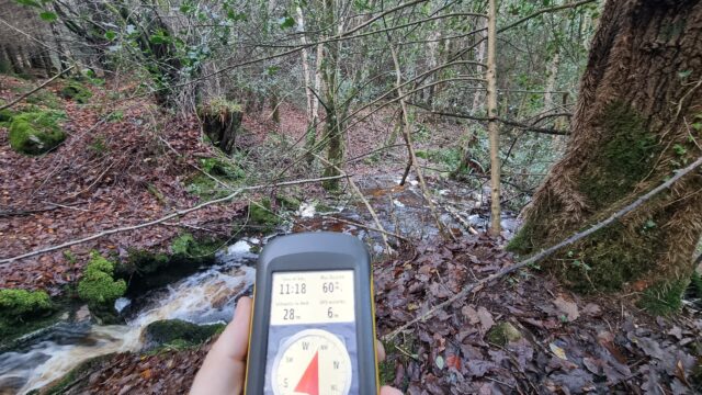
Before long, we came across a stream, converted into a torrent by the floodwater and the mountaintop’s melting snow!
This stream could be a problem…
After scouting for the narrowest point (and giving up on attempting to construct a bridge) I leapt across, and then reached back to help my mother do the same.
“You think we can jump it?” “I think I can jump it, but I don’t know about you.” “Can you… pull me over?”
“We got over it!”
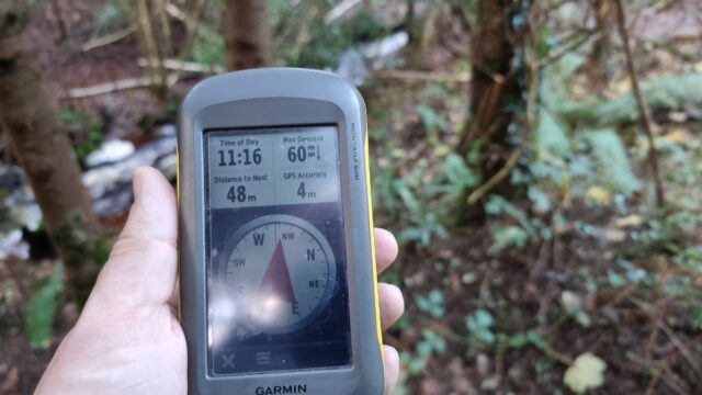
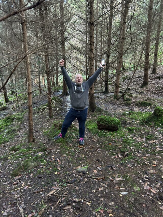
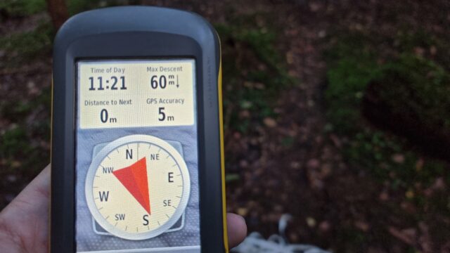
Now we were able to pick our way around decaying wood and slippery leaves to finally get to the hashpoint. We arrived at 11:20.
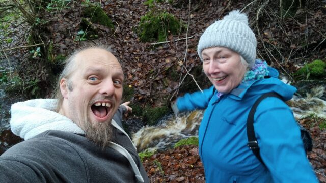
Victory pose!
Ground Zero!
A panorama from the hashpoint.
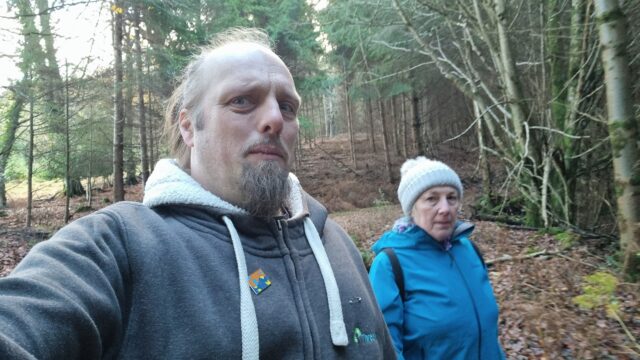
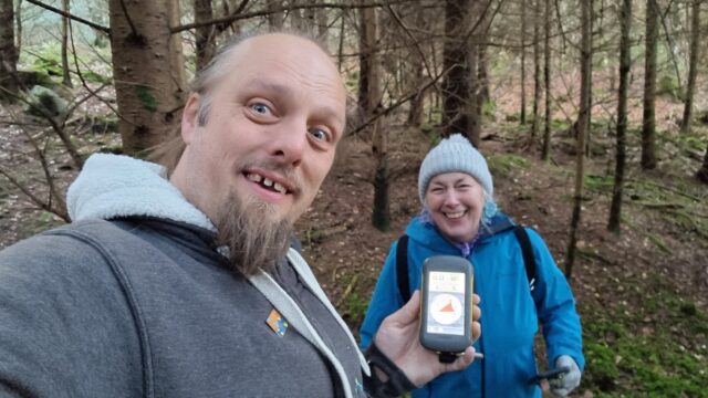
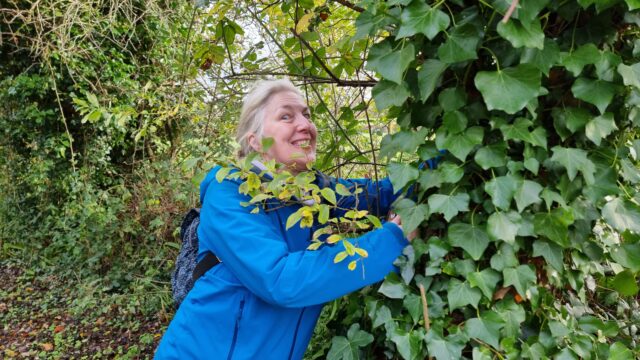
Requisite silly grins.
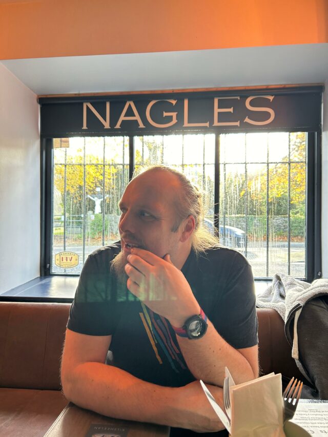
Retracing our steps to the path and continuing our descent, we returned via the road to the bridge we’d crossed at. We enjoyed a spectacular view of Slievenamon to the North, a mountain that towers over the valley. Returning to Kilsheelan, we had a great lunch at Nagle’s
Bar, then continued on our day’s adventures: taking in some history at Cahir Castle (and finding a nearby geocache), dodging the rain at coffee shop Keep Coffee, and then taking on a
challenging series of caches on the Millennium Loop of Glengarra Woods, where we almost found ourselves stranded by the setting sun, short on batteries for either GPS, phone, or torch
use, and having to carefully pick our way back to the car before a long dark drive over the winding Kilmallock road to get back to home, beer, and baths.
Lunchtime!
A wonderful adventure that’s left me heavy of foot and light of spirit.
Tracklog
Full journey
(includes the driving sections and our other expeditions, including some lunch, touring a castle, and geocaching a valley)
(just the bit from where we parked up into the forest, to the hashpoint, and down again; minus a bit at the start where I forgot to turn my backup GPSr on)
With Storm Bert raining off our plans for geohashing in Co. Limerick, my mother and I are off into a forest in Co. Tipperary in search of a hashpoint over this way. It’s still pretty
wet though.
if [the option of a balance bike] isn’t available, you can convert a normal bike into a balance bike by removing the pedals and lowering the seat. Once the kids has learned how to
balance as they roll, add the pedals, raise the seat, and watch them go.
…
An excellent suggestion from fellow RSS Club member Sean McP (he’s been full of those lately; I’ve been enjoying encouraging drivers
through our village to slow down by smiling and waving, too).
Like Sean, I learned to ride a bike using training wheels (“stabilisers” on this side of the pond). Unlike him, I didn’t have any trouble with them, and so when I came to hear about
balance bikes as an alternative learning approach I figured they were just two different approaches to the same thing.
But when our eldest learned using stabilisers, she really struggled, and only eventually “got it” with an un-stabilised bike and lots and lots of practice. It’s true what Sean
says: for most children, learning to balance atop a bicycle is harder than learning to pedal and/or steer, so that’s the bit we should be focussing on.
Our youngest is (finally) ready and keen to learn to cycle, and so I’m thinking that when I get him his first bike (maybe for Christmas!) I’ll get him one that, were I to put the seat
into its lowest position and remove the pedals, he could use as a balance bike for a day or two to get the feel of the thing before re-attaching them and letting him try the full
experience.
My mother and I are out in the West of Ireland in search of geohashpoints. Today’s attempt to find the 2024-11-22 52 -8
hashpoint was blocked by the river Arra breaking its banks and flooding our route, so instead we did some geocaching in Newcastle West then came up to Foyle to visit the nearby
maritime museum and learn about the history of the flying boats.
After leaving the museum we figured we’d come up here for one last cache before the rain really set in. We tried coming at this cache from one path, then another, and eventually after a
slippery scramble up a hill we had the cache in hand. SL, TNLN, TFTC, and greetings from Lancashire (my mum) and Oxfordshire (me), UK.
We almost gave up trying to find the hint object before spotting something that once had the colour of a buttercup but has since enjoyed some extra camouflage! Retrieving the
cache was a bit challenging for my fat hands but my mum managed to help. FP awarded for this more-imaginative hiding place! TFTC.