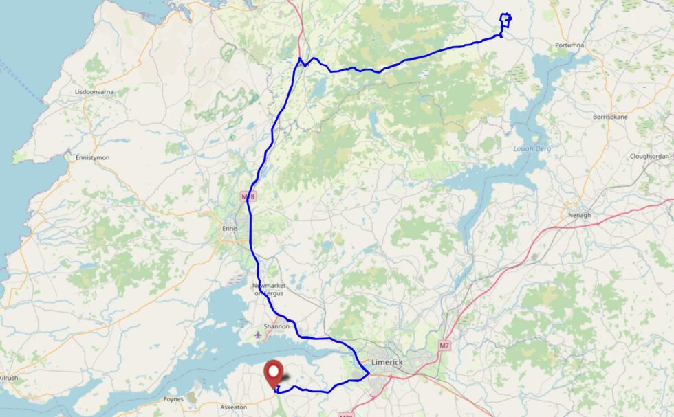
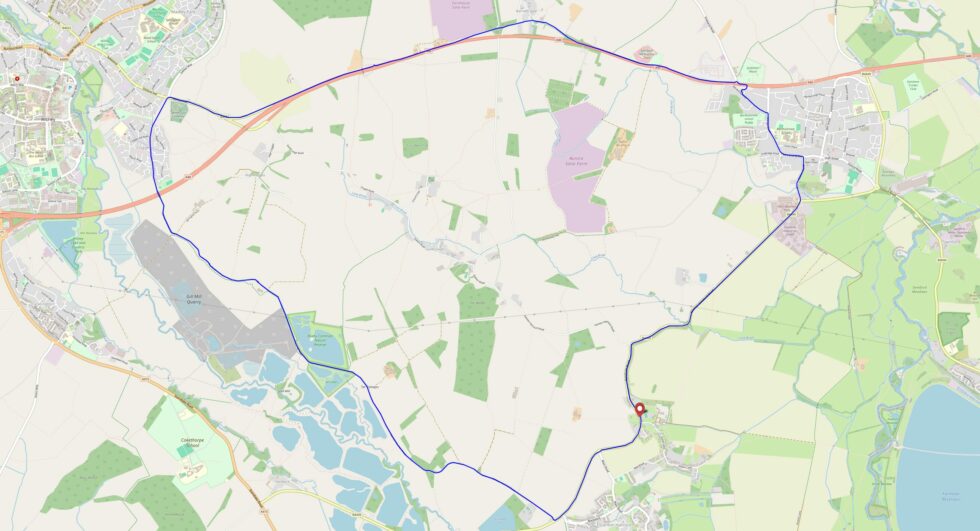
On the second full day of our geohashing tour of Western Ireland, we’ll try to drive to somewhere close to this hashpoint (maybe up towards Knockaderry?) and see if we can walk to it
(and if it’s accessible when we get there).
Expedition
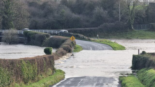
This part of Ireland’s been under moderate snow cover for several days, but overnight that turned to rain and as it warmed up early in the morning, the snow rapidly melted and poured
down into the valleys. The River Arra burst its banks in several places, and our first, second, and third attempts to find places to cross it to get closer to the hashpoint were foiled
by floods (too deep and fast-flowing to safely ford) and closed roads.
Yeah… I don’t think I’m gonna chance that (especially in a rental car!).
After seeing several fields of about the altitude of our target also deeply flooded, we opted to give up on this expedition for our own safety! Instead, we went geocaching in Newcastle
West and then went up to Foyle where we visited the museum of maritime history and learned about the history of the flying boats that were stationed there in the inter-war years.
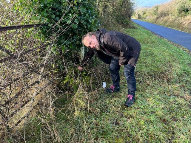
A geocacher’s most-valuable skills include map reading, trail-finding, and rummaging around behind fence posts.
Hey look, I found a flying boat.
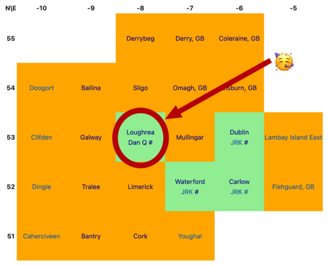
I’m on the map! No matter what else my mother and I achieve this week, my name will forever be recorded as the unlocker of the Loughrea graticule in Ireland: https://geohashing.site/geohashing/Ireland
Where, I wondered, could I find a cluster of mostly-land graticules (“square” degree of latitude and longitude) in which nobody had ever logged a successful expedition? I’ve been
geohashing for ten years now and I’ve never yet scored a “Graticule Unlocked” achievement for being the first to reach any hashpoint in a given graticule.
So this week, we’re holidaying on the West coast of Ireland, doing a variety of activities that take our fancy and, hopefully, finding a geohashpoint or two in previously-unexplored
graticules!
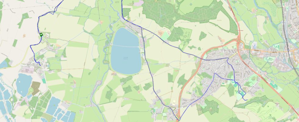
Looking at the nearby hashpoints, we decided that this was our best bet. An hour and a half’s drive from our accomodation to a village near the hashpoint and we might be able to make
the rest of the way on foot.
Expedition
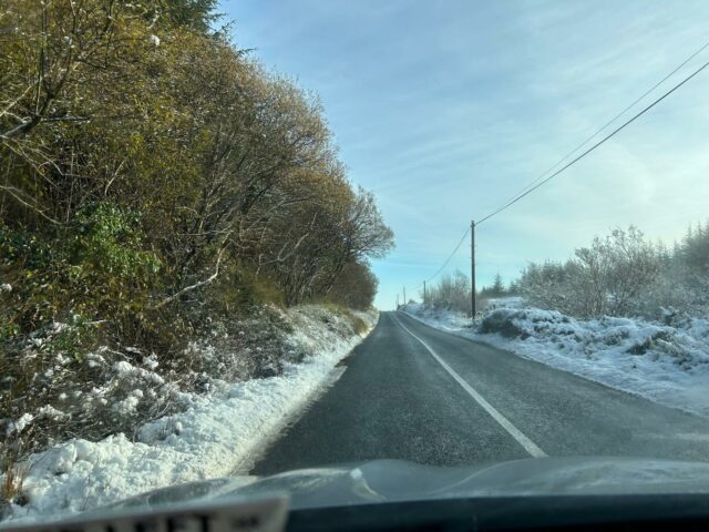
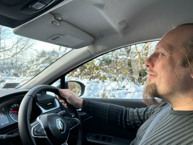
Driving conditions were sometimes suboptimal, but okay.
My mother’s never been hashing before, but unlike most people I’ve told about the hobby she didn’t turn her nose up at the idea so she was happy to accompany me on this unusual
adventure.
We met a surprising number of dogs out, alone, “taking themselves for a walk’. Like this one.
Our rental car did a pretty good job.
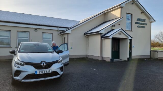
We drove to Abbey, which turns out to be a delightful village, and parked outside the community centre (where my mother was able to use the bathroom).
Parking was plentiful in Abbey.
We still don’t know what makes this wall “lazy”.
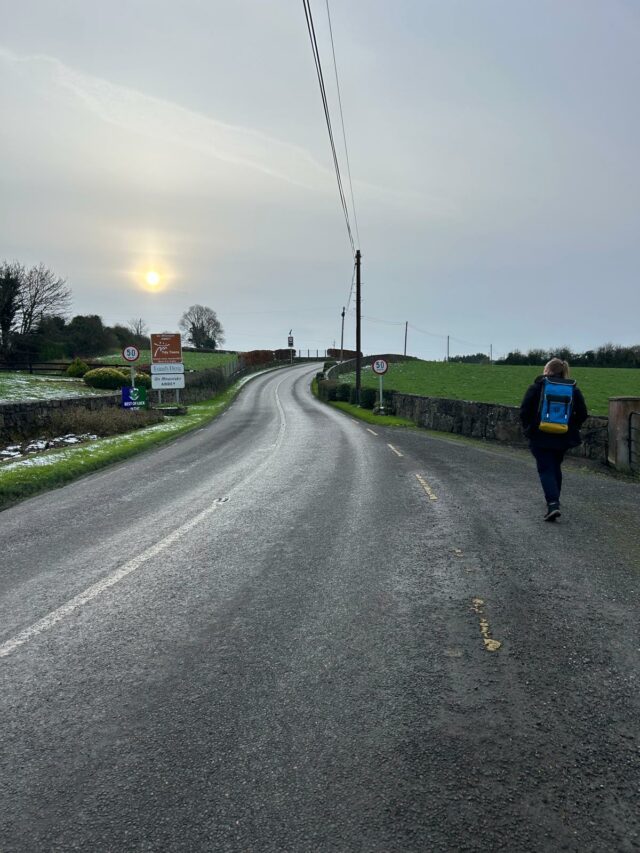
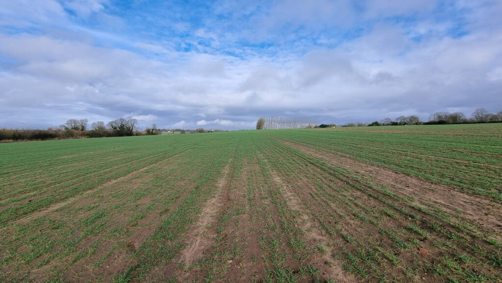
Then we switched to foot, walking along the banks of the stream and following the road to the East, towards the field where we’d hoped to find the hashpoint.
We anticipated there being nowhere closer than Abbey to park and get to the hashpoint, so we spent most of our time on foot.
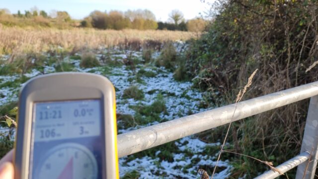
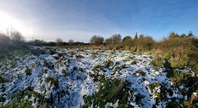
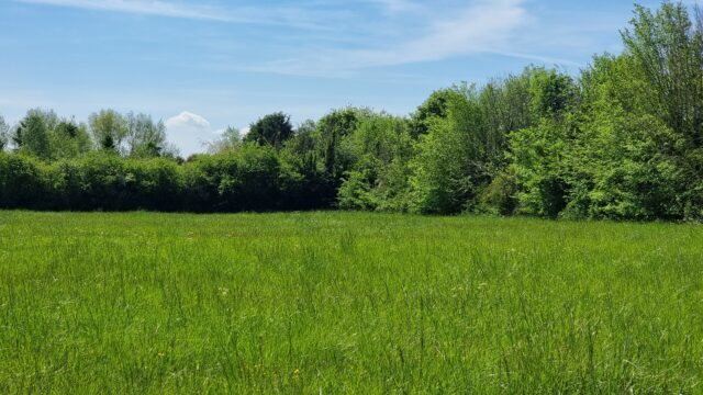
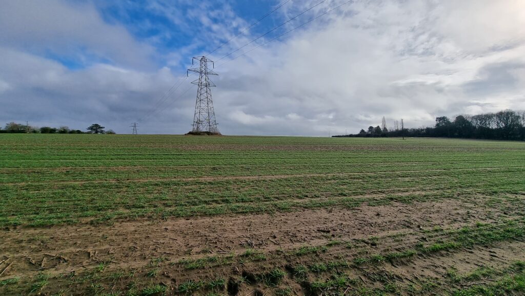
A quick survey around the outskirts of the area suggested that it was, indeed, in what had once been an active pasture but had been abandoned and disused for many years. The grass and
brambles grew high and were caked in snow, but we hopped the gate and pressed on for the final hundred metres.
Very close…!
We made the right choice: the hashpoint was just barely inside the disused old field, and we were able to get to it with only slightly wet feet and without disturbance (except for some
kind of nesting bird that was unhappy to see us, and some kind of medium-sized mammal – possibly a fox – that ran away as we approached).
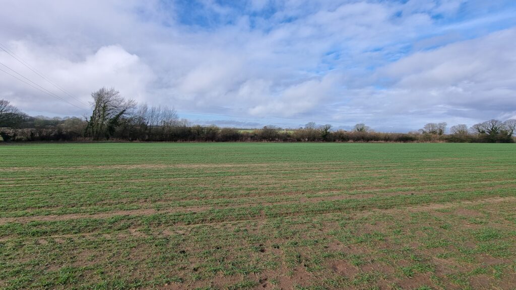
View from the hashpoint.
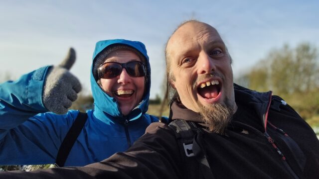
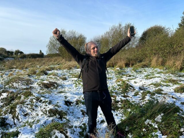
We reached the hashpoint at 11:24.
Obligatory silly grins.
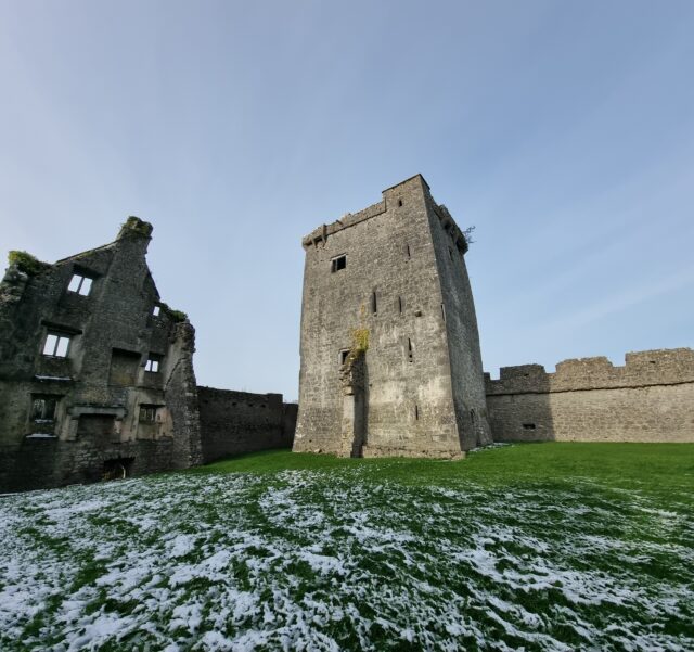
Flushed with success at this relatively easy victory, we continued our walk to a nearby dairy to see if they’d sell us some cheese (their farm shop was shut), and then crossed the river
and climbed the nearby hill to find the fantastic geocache at Pallas Castle.
The castle was a wonderful diversion on our way back.
Circling around from the hilltop to return to the car, we drove back home, completing our expedition (hashpoint, cache, and all) in a little under 7 hours.
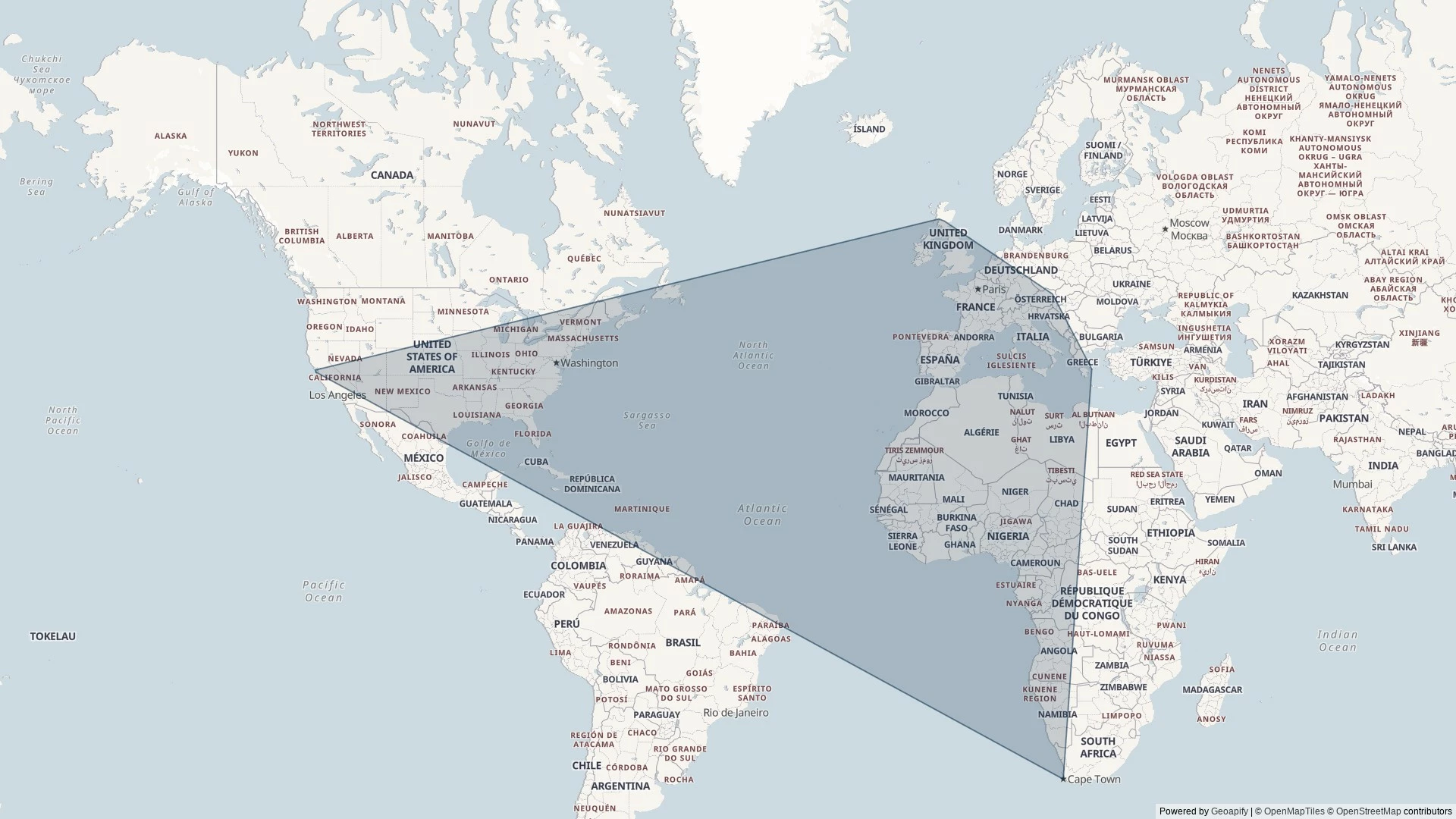
When my mother proposed that we take a holiday together somewhere, and that I could choose the destination, I started by looking at the Geohashing Expeditions Map.
Where, I wondered, could I find a cluster of mostly-land graticules (“square” degree of latitude and longitude) in which nobody had ever logged a successful expedition?
I’ve been geohashing for ten years now and I’ve never yet scored a “Graticule Unlocked” achievement for being the first to reach any hashpoint in a given graticule.
Over the next week, if the fluctuations of the Dow Jones and the variable Irish weather allow, I’ll be changing that.
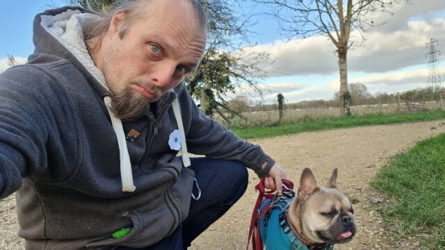
The dog and I drove out to Ducklington, parking near the church, and walked out to these fields. Unfortunately the hashpoint turns out to be 33+ metres into a field full of sheep. That
_might’ve_ been the kind of trespassing I’d have been willing to consider, were it not for the combination of the amount of pedestrian traffic (a whole platoon of birdwatchers, armed
with extra-long camera lenses, and every dog walker under the sun!) and the fact that I had the dog with me (who’d have to have waited unhappily outside the field: not taking her _into_
a field of sheep, even by only 33 metres).
So near, and yet so far…
Instead, then, we took a pleasant walk around Ducklington and found the GC656RM “Church Micro 8564…Ducklington”
geocache, so it wasn’t entirely a wasted trip. The dog’s come home and zonked out in her basket after a decent walk, anwyay!
Maybe it’s just that my sabbatical is making me pay more attention then usual, but it feels like I’m getting very lucky with nearby geohashpoints lately. Tomorrow’s hashpoint in my
graticule might be achievable!
This is a good omen, perhaps, for next week. Next week my mother and I are going to hop over to the West coast of Ireland where there are several contiguous mostly-land graticules that
have never seen a successful expedition. We could be the first! 🤞
theimprobable.blog, which I look after on behalf of my partner’s brother after using it to GPS-track his adventures
I think that’s all of them, but it’s hard to be sure…
Footnotes
1 Maybe I’ve finally shaken off my habit of buying a domain name for everything.
Or maybe it’s just that I’ve embraced subdomains for more stuff. Probably the latter.
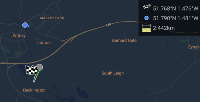
After brunch, I reckon I can get to and from this hashpoint… Tron-style!
Expedition
I planned a slightly circuitous route to this hashpoint in order to make a Tron achievement possible. I got my bike lightcycle out of
the garage, checked the brakes and tyres, and set off in the opposite direction of the hashpoint! My thinking was I could cut up Tar Lakes Road to Cogges Farm, join the A40 cyclepath at
Witney, follow it all the way to Barnard Gate, and – after passing through the hamlet and hopefully the hashpoint – turn _back_ along the opposite side of A40 (for the section that
doesn’t have a cyclepath) and then cut through South Leigh to get back home.
My first hazard came just three minutes out of my door, where a motorist failed to give way to me at Stanton Harcourt Roundabout, entering the junction even though I was already
half-way across it from the other direction. They had to slam on their brakes to avoid smashing into the side of me, and I’ll admit I may have sworn at them at least a little as they
pulled guiltily away.
The Tar Lakes road remains a delightful route from Stanton Harcourt to Witney, which I’ve enjoyed cycling many times. It was a little busier than usual, perhaps because it’s Sunday and
folks were off to and from the fishing lakes along its path to do some angling or to walk their dogs, but it was still a fast and easy journey. Reaching Cogges, I turned back towards
the hashpoint and joined the A40 cyclepath which, I hoped, would bring me right through it.
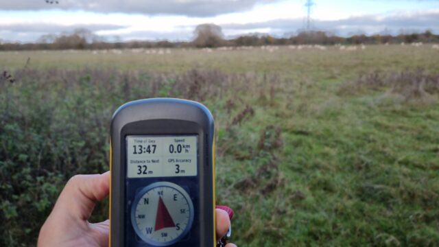
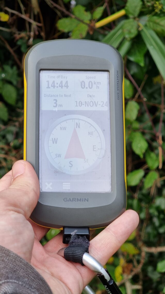
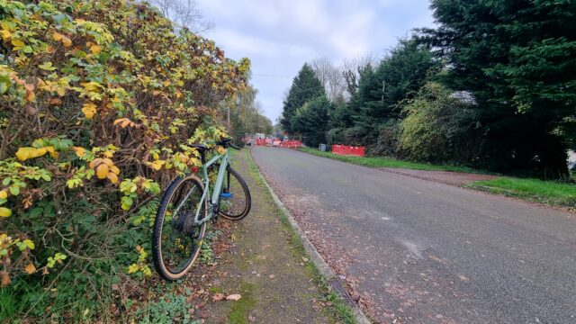
Approaching the hashpoint, I was concerned to see that the road was closed ahead, but a sign reassured me that it was still open to pedestrians, so I dismounted my bike. This also
provided an excuse for me to slow down and pay attention to my GPSr as I counted down the metres. I got within the circle of uncertainty at ~3m away, as I leaned over the dyke that
separates Pear Tree Cottage’s garden from the byway.
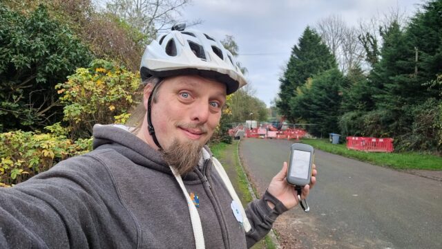
I snapped the regulation silly grin selfie at 14:44.
Photo taken, I then had to continue to push my bike all the way through the roadworks: the fastest way home would have been to turn around, at this point, but I didn’t want to be robbed
of my shot at the Tron achievement, so I pressed on.
At the far end of Barnard Gate I determined that cycling back along the A40 without the benefit of a cyclepath was perhaps a little too dangerous (especially after my scare earlier), so
I adapted my route to instead head East towards Eynsham, crossing the main road at the Evenlode pub to get onto Old Witney Road, through Eynsham, and back onto the road home.
Returning home, I made sure to cut the corner short as I turned into my driveway so I didn’t cross the path I’d taken as I’d initially exited, an hour earlier. A successful trip, and a
fresh achievement!
I’m on sabbatical from work right now, so I’m hoping to be able to get out to this hashpoint while the kids are at school.
Expedition
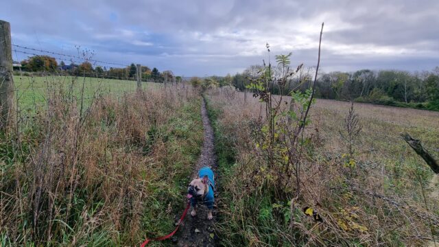
After dropping the kids off at school, the geopup/hashhound and I set out for the hashpoint. Coming up the “short side” of the bridleway from Botley would be a shorter walk, but we
opted to park in Cumnor and come up the “long side” of Harcourt Hill to avoid Oxford’s traffic (and the inevitable fee for parking on the city’s side of the hill).
Harcourt Hill (like my village of Stanton Harcourt) doubtless gets its name from the Harcourt Family, who supported William the Conqueror during his conquest of Great Britain back in
1066 and were ultimately granted huge swathes of land around this part of the world in recognition of their loyalty. To this day, you find “Harcourt” in a lot of place names in this
neck of the woods.
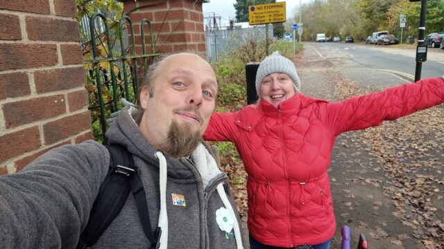
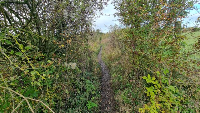
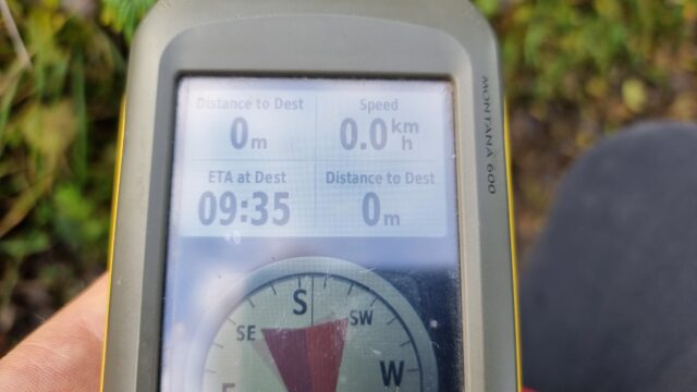
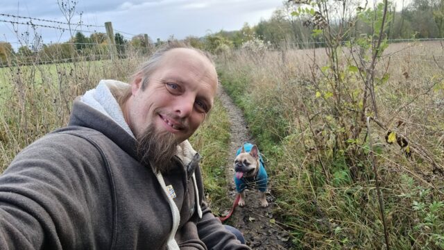
The hashpoint was so easy to find, we almost walked right over it: it’s right in the centre of the footpath/bridleway. Even my dog, who often doesn’t like long walks or muddy paths,
didn’t get a chance to complain before we got there. We arrived at 09:35 and took the requisite photos, which can be found below. We also kept a GPS tracklog and vlogged our experience,
all of which you can see below.
I’ve not properly hashed in a long while, so it was great to get back out there!
What’s the point of this crossing? Do rabbits pass very fast through this junction?
View East from the hashpoint (plus dog).
View West from the hashpoint.
Right in the middle of the circle of uncertainty.
Silly grin/silly tongue-sticking-out.
tl;dr: I’m tidying up and consolidating my personal hosting; I’ve made a little progress, but I’ve got a way to go – fortunately I’ve got a sabbatical coming up at
work!
At the weekend, I kicked-off what will doubtless be a multi-week process of gradually tidying and consolidating some of the disparate digital things I run, around the Internet.
I’ve a long-standing habit of having an idea (e.g. gamebook-making tool Twinebook, lockpicking puzzle game Break Into Us, my Cheating Hangman game, and even FreeDeedPoll.org.uk!),
deploying it to one of several servers I run, and then finding it a huge headache when I inevitably need to upgrade or move said server because there’s such an insane diversity of
different things that need testing!
DNDle, my Wordle-clone where you have to guess the Dungeons & Dragons 5e monster’s stat block, is now hosted by GitHub Pages. Also, I
fixed an issue reported a month ago that meant that I was reporting Giant Scorpions as having a WIS of 19 instead of 9.
Abnib, which mostly reminds people of upcoming birthdays and serves as a dumping ground for any Abnib-related shit I produce, is now hosted by
GitHub Pages.
RockMonkey.org.uk, which doesn’t really do much any more, is now hosted by GitHub Pages.
Sour Grapes, the single-page promo for a (remote) murder mystery party I hosted during a COVID lockdown, is now hosted by GitHub
Pages.
A convenience-page for giving lost people directions to my house is now hosted by GitHub Pages.
Dan Q’s Things is now automatically built on a schedule and hosted by GitHub Pages.
Robin’s Improbable Blog, which spun out from 52 Reflect, wasn’t getting enough traffic to justify
“proper” hosting so now it sits in a Docker container on my NAS.
My μlogger server, which records my location based on pings from my phone, has also moved to my NAS. This has broken
Find Dan Q, but I’m not sure if I’ll continue with that in its current form anyway.
All of my various domain/subdomain redirects have been consolidated on, or are in the process of moving to, to a tinyLinode/Akamai
instance. It’s a super simple plain Nginx server that does virtually nothing except redirect people – this is where I’ll park the domains I register but haven’t found a use for yet, in
future.
I was pretty proud of EGXchange.org, but I’ll be first to admit that it’s among the stupider of my throwaway domains.
It turns out GitHub pages is a fine place to host simple, static websites that were open-source already. I’ve been working on improving my understanding of GitHub Actions
anyway as part of what I’ve been doing while wearing my work, volunteering, and personal hats, so switching some static build processes like DNDle’s to GitHub
Actions was a useful exercise.
Stuff I’m still to tidy…
There’s still a few things I need to tidy up to bring my personal hosting situation under control:
DanQ.me
You’re looking at it. But later this year, you might be looking at it… elsewhere?
This is the big one, because it’s not just a WordPress blog: it’s also a Gemini, Spartan, and Gopher server (thanks CapsulePress!), a Finger server, a general-purpose host to a stack of complex stuff only some of which is powered by Bloq (my WordPress/PHP integrations): e.g.
code to generate the maps that appear on my geopositioned posts, code to integrate with the Fediverse, a whole stack of configuration to make my caching work the way I want, etc.
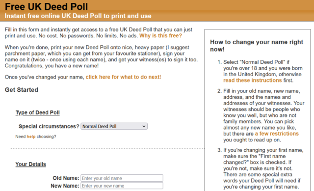
FreeDeedPoll.org.uk
Right now this is a Ruby/Sinatra application, but I’ve got a (long-running) development branch that will make it run completely in the browser, which will further improve privacy, allow
it to run entirely-offline (with a service worker), and provide a basis for new features I’d like to provide down the line. I’m hoping to get to finishing this during my Automattic
sabbatical this winter.
The website’s basically unchanged for most of a decade and a half, and… umm… it looks it!
A secondary benefit of it becoming browser-based, of course, is that it can be hosted as a static site, which will allow me to move it to GitHub Pages too.
When I took over running the world’s geohashing hub from xkcd‘s Randall Munroe (and davean), I flung the site together on whatever hosting I had sitting
around at the time, but that’s given me some headaches. The outbound email transfer agent is a pain, for example, and it’s a hard host on which to apply upgrades. So I want to get that
moved somewhere better this winter too. It’s actually the last site left running on its current host, so it’ll save me a little money to get it moved, too!
Geohashing’s one of the strangest communities I’m honoured to be a part of. So it’d be nice to treat their primary website to a little more respect and attention.
Right now I run this on my NAS, but that turns out to be a pain sometimes because it means that if my home Internet goes down (e.g. thanks to a power cut, which we have from time to time), I lose access to the first and last place I
go on the Internet! So I’d quite like to move that to somewhere on the open Internet. Haven’t worked out where yet.
Next steps
It’s felt good so far to consolidate and tidy-up my personal web hosting (and to rediscover some old projects I’d forgotten about). There’s work still to do, but I’m expecting to spend
a few months not-doing-my-day-job very soon, so I’m hoping to find the opportunity to finish it then!
I originally though I’d cycle out here in the evening and see if I could reach the hashpoint, but with the weather so delightful (and the dog clamouring for a walk) I opted to adapt my
lunchtime plans to go to Standlake Post Office (rather than the only-slightly-closer Eynsham Post Office) to post a parcel and take the dog for a walk… and check out the hashpoint at
the same time!
Expedition
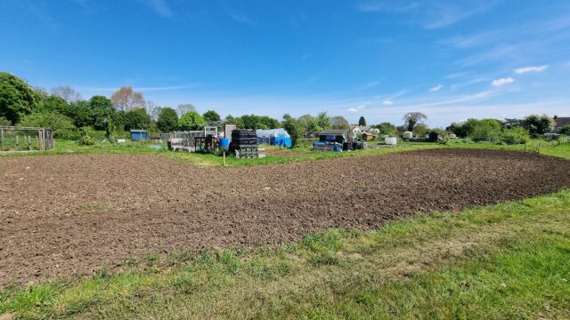
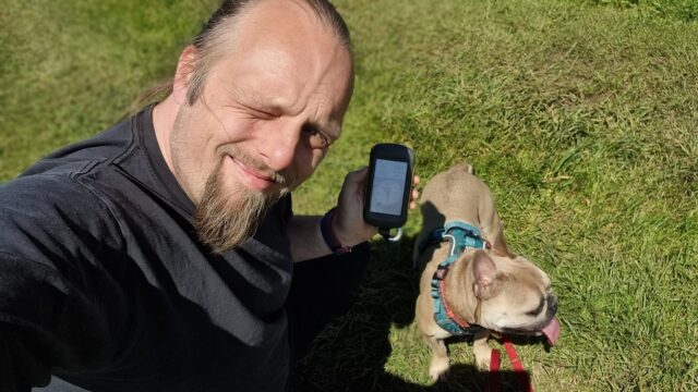
Success! The dog and I parked near the Post Office, and tired firstd walking through the allotments, but they don’t go as far back as I thought they might and we couldn’t really get
close to the hashpoint. So we doubled back, with the anticipation of going via the churchyard, when I spotted a convenient footpath sign (for a footpath not marked on my map), so we
followed that. Conveniently it turned out to be a shortcut to Horns Way, the alternative route I’d considered to try to get close to the hashpoint. Travelling along it, we found an
(also not on the map) back gate into the allotments: we could’ve just come this way, after all! We’d later use this route to get back home.
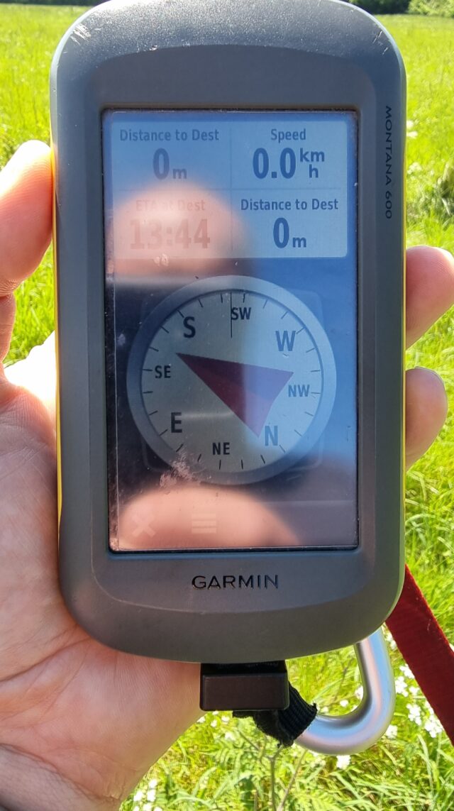
Approaching the hashpoint, we needed to push through a thicket of trees and jump a ditch, but this delivered us into a delightful meadow. We reached the hashpoint at 13:44, took the
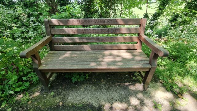
requisite silly photo, and set off back. On returning to the footpath (by a decidedly inferior route) we discovered a bench (with a dedication on it) that also wasn’t listed on
OpenStreetMap nor on OpenBenches. I took a photo and pushed it to OpenBenches. There should be an achievement for that.
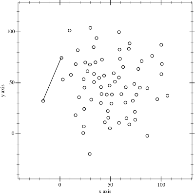
I thought it might be fun to try to map the limits of my geocaching/geohashing. That is, to draw the smallest possible convex polygon that surrounds all of the
geocaches I’ve found and geohashpoints I’ve successfully visited.
Mathematically, such a shape is a convex hull – the smallest polygon encircling a set of points without concavity. Here’s how I made it:
1. Extract all the longitude/latitude pairs for every successful geocaching find and geohashpoint expedition.I keep them in my blog database, so I was able to use some SQL to
fetch them:
SELECTDISTINCT coord_lon.meta_value lon, coord_lat.meta_value lat
FROM wp_posts
LEFTJOIN wp_postmeta expedition_result ON wp_posts.ID = expedition_result.post_id AND expedition_result.meta_key ='checkin_type'LEFTJOIN wp_postmeta coord_lat ON wp_posts.ID = coord_lat.post_id AND coord_lat.meta_key ='checkin_latitude'LEFTJOIN wp_postmeta coord_lon ON wp_posts.ID = coord_lon.post_id AND coord_lon.meta_key ='checkin_longitude'LEFTJOIN wp_term_relationships ON wp_posts.ID = wp_term_relationships.object_id
LEFTJOIN wp_term_taxonomy ON wp_term_relationships.term_taxonomy_id = wp_term_taxonomy.term_taxonomy_id
LEFTJOIN wp_terms ON wp_term_taxonomy.term_id = wp_terms.term_id
WHERE wp_posts.post_type ='post'AND wp_posts.post_status ='publish'AND wp_term_taxonomy.taxonomy ='kind'AND wp_terms.slug ='checkin'AND expedition_result.meta_value IN ('Found it', 'found', 'coordinates reached', 'Attended');
2. Next, I determine the convex hull of these points. There are an interesting variety of
algorithms for this so I adapted the Monotone Chain approach (there are
convenient implementations in many languages). The algorithm seems pretty efficient, although that doesn’t matter much to me because I’m caching the results for a fortnight.
I watched way too many animations of different convex hull algorithms before selecting this one… pretty-much arbitrarily.
An up-to-date (well, no-more than two weeks outdated) version of the map appears on my geo* stats page. I don’t often get to go caching/hashing
outside the bounds already-depicted, but I’m excited to try to find opportunities to push the boundaries outwards as I continue to explore the world!
(I could, I suppose, try to draw a second larger area of places I’ve visited: the difference between the smaller and larger areas would represent all of the opportunities I’d missed to
find a hashpoint!)
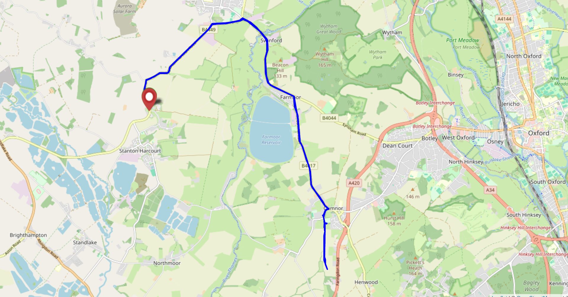
I haven’t hashed for long enough that my home graticule got marked as inactive. I’ve got a little free time this morning, so let’s fix that!
Expedition
It took two attempts to reach this hashpoint.
The first attempt saw me set off around 09:40, with a plan to drive over the world’s
stupidest toll bridge (paying 5p for the privilege), park up in Cumnor somewhere, then work down the Cumnor-Appleton footpath before dipping into the fields (which are likely to be
fallow this time of year) to claim the hashpoint. I suggested to take the dog, and the 7-year-old child asked if he could join me too, so the three of us with our eight legs set off.
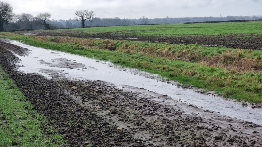
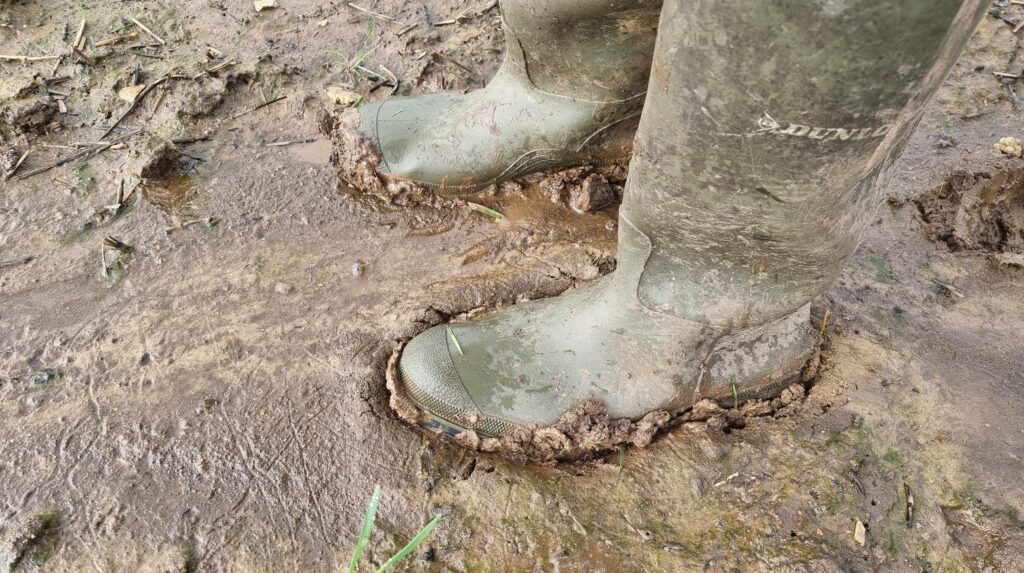
This winter’s seen heavy rain around these parts, and the stream that runs alongside the footpath had broken its banks and flooded the fields. The water had receded, but the ground
remained extremely boggy. That kind of thick, wellie-sucking mud that means that if you stop walking for more than a couple of seconds, you might as well give up and say you live there
now because your boot is never coming back.
The kid found the going especially-tough, especially after a particularly-deep puddle splashed over the edge of his wellies, and asked to turn back. The dog was finding it a bit
challenging too! So we doubled-back and found a geocache a little way off the
path. We’ve generally been disappointed by Cumnor’s geocaches and especially this series, finding them to be ill-maintained or completely absent, but it looks like the cache owner
has been working on repairing and replacing them towards the tail end of last year and this one was soon found. I drove the dog and child home (back across the toll bridge), then came
back out myself (paying the fivepence toll a third time). So began the second attempt:
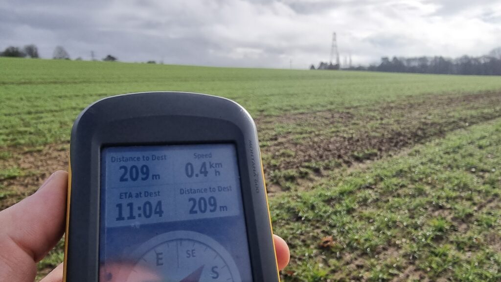
Unburdened by short-legged dogs and damp-footed kids, I made better progress. At points, the path was completely flooded-out, but this gave me an excuse to walk along the “tramlines” of
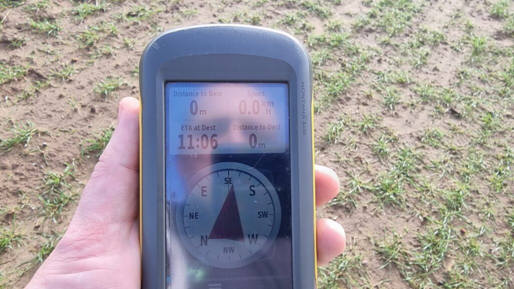
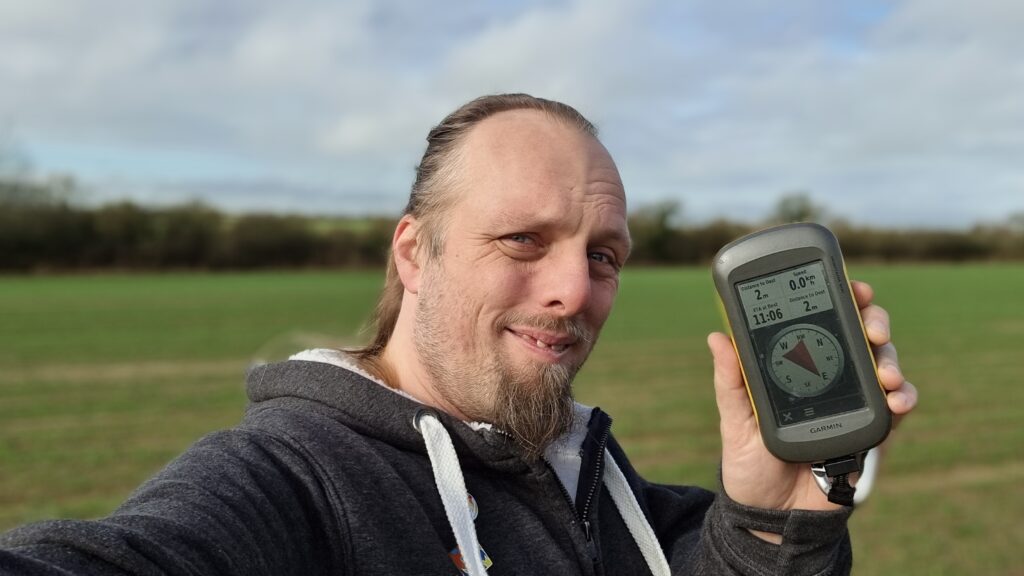
the cultivator that must’ve been working in the field last year, which put me on a better course to reach the hashpoint. By 11:06 I was well within the circle of uncertainty and
declared the mission a success.
Then I plodged back through the mud, changed my footwear, and drove over the toll bridge a fourth time. The attendant, clearly sick of seeing me driving back and forth, took
pity on me and let me off without paying yet another 5p piece, so that was nice.
This “path” seems to be a stream.
Muddy boots
200 metres to go.
Zero point!
Silly grin
View North from the hashpoint.
View East from the hashpoint.
View South from the hashpoint.
View West from the hashpoint.
What topical timing, given that it’ll be my birthday in four days!
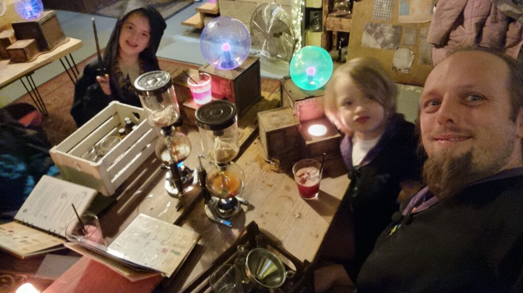
My birthday is slightly overshadowed by the proximity to it of our eldest child’s birthday, but we can still find enough overlap of interest to do some fun things. Here we are last
year, for example, at a magic-themed cocktail-making
workshop (with non-alcoholic recipes for the kids, of course).
Of the things I have least but treasure most, perhaps the biggest is time. Between work, volunteering, and childcare, I often find myself rushing to cram-in any of the diversity of “play” activities I engage in.1
I always feel particularly guilty if I step away to do “me things” that put me out of reach, because I know that while I’m off having fun, my absence necessarily means that
somebody else has to be the one to break up whatever child squabble is happening right now2. It feels particularly
extravagant to, for example, spend a weekend in pursuit of a distant geohash point or two3.
A fancy dinner in a hotel bar in the middle of a two-day geohashing expedition across the Midlands, as far from work and home responsibilities as I can manage? Yes please!
So one of the best gifts I ever received was for my birthday the year before last, when Ruth gave me “a weekend off”4, affording me the opportunity to do
exactly that. I picked some dates and she, JTA, and the kids vanished, leaving me free to spend a few days hacking my way
from Herefordshire to somewhere near Birmingham in what turned out to be the
worst floods of the year. It was delightful.5
Most people can’t give me “time”: it doesn’t grow on trees, and I haven’t found a place to order it online. It’s not even always practical to help me reclaim my own time by taking fixed
timesinks off my to-do list6. But for those
that can, it’s a great gift that I really appreciate.
It’s my birthday on Monday, if anybody wants to volunteer for childminding duties at any point. Just sayin’. 😅
2 Ours can be a particularly squabbly pair, and really know how to push one another’s
buttons to escalate a fight!
3 Unless I were to take the kids with me: then if feels fine, but then I’ve got a
different problem to deal with! The dog’s enough of a handful when you’re out traipsing through a bog in the rain!
5 I think that Ruth feels that her gift to me on my 41st birthday was tacky, perhaps
because for her it was a “fallback”: what she came up with after failing to buy a more-conventional gift. But seriously: a scheduled weekend to disconnect from everything
else in my life was an especially well-received gift.
6 Not least because I’m such a control freak that some of the biggest timesinks in my life
are things I would struggle to delegate or even accept help with!