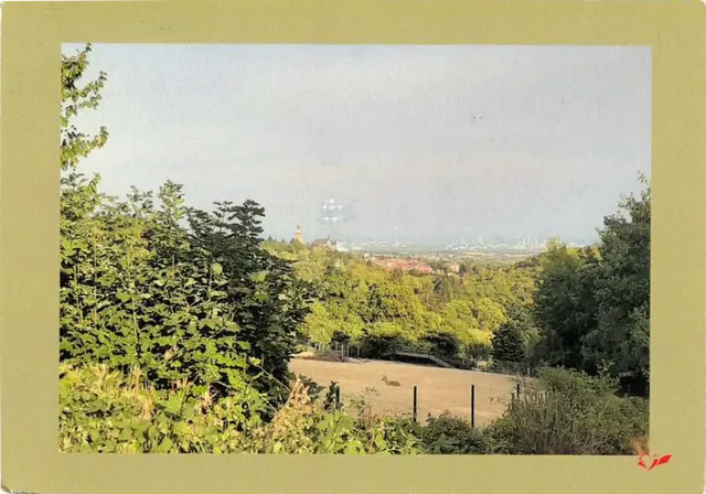
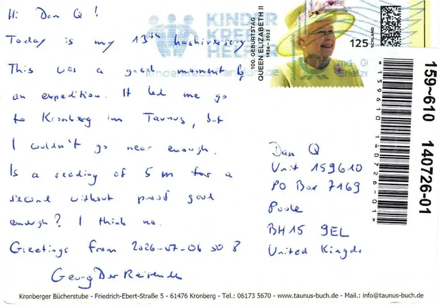
Well: today I received my second hashcard (and tenth “postcard from the Internet”)! This one came from GeorgDerReisende, whose 800+ expeditions are more than a little intimidating! He’d spent his 13th hashiversary on an expedition to a location outside
Frankfurt earlier this month, where he narrowly failed to reach the hashpoint because it was just slightly too far into somebody’s private property.
But at least he was able to claim the hashcard achievement (although not for the first time)! Well done,
GeorgDerReisende!
Between dropping the kids off at school and going to the dentist I had a small window of time in the vicinity of this hashpoint. Could I make it? I figured I’d rush out there and find
out. It’d all depend on whether the field was actively in-use (I’m not gonna go tramping through crops!).
Expedition
I’ve been sort-of distracted from geohashing after my house flooded and I had to evacuate earlier this year,
so I’ve not had much opportunity to get out and participate. But today, that changed!
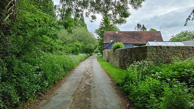
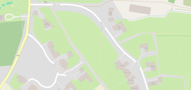
The road stops here and becomes a footpath.
After dropping the kids at their schools I drove to Manor Cottages at 51.746, -1.396 where I knew I’d be able to park, then set off at a jog down the rest of Steadys Lane and onto the
permissive footpath beyond. I waved to a solitary walker coming the other way, and pressed on until I was close to the field.
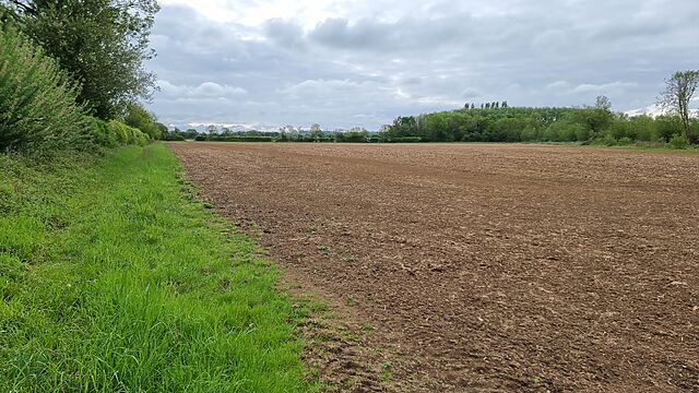
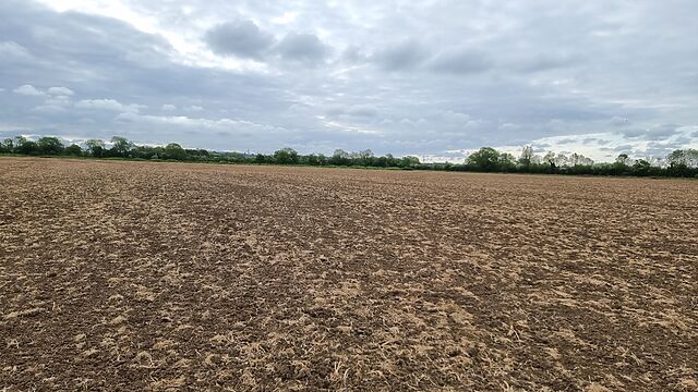
Entering the first field.
Satellite photography suggested that I wouldn’t be able to enter the field directly, so I hopped a gate into the field West of it and was pleased to discover that neither field was
currently cultivated.
The second field: the hashpoint’s out there!
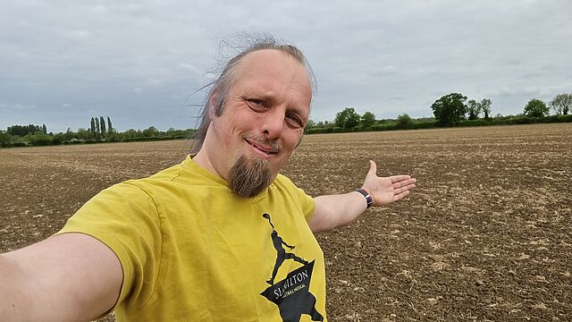
The hashpoint turned out to be about 700 metres into the field, and it felt sort of open and exposed to go tramping right across the middle of it, but sure enough that’s where I reached
the circle of uncertainty, at 08:53.
Silly grin!
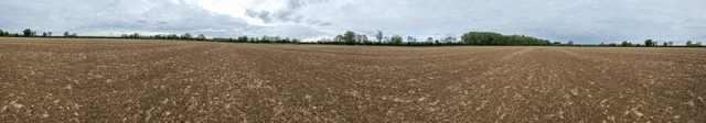
Panoramic view from the hashpoint.
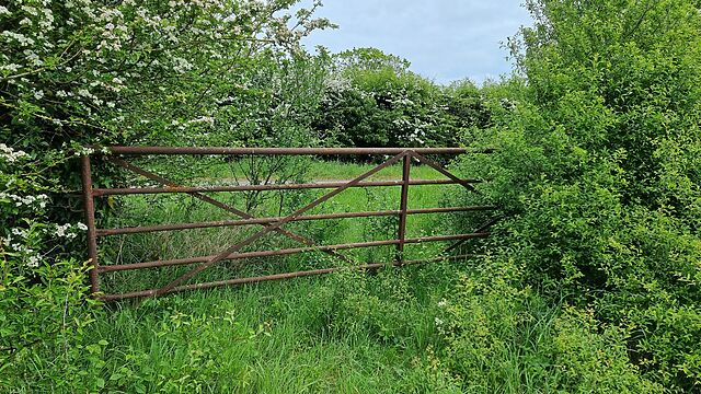
Coming back, I spotted a disused and rusty old gate that provided easier access to the field, which provided a quicker way back to the footpath.
A better-placed gate.
Tracklog
No tracklog today. 😢 I’m not sure if I’ve seen my GPSr since the flood, so I was just working off my my phone.
I took the dog out for a walk from the Chicory House yesterday. At one point, we found ourselves on a familiar-looking footpath: I couldn’t place
exactly why I’d been there before. Geocaching, possibly: I couldn’t see any on the map but perhaps they’d been since archived?
Personal location tracking continues to be awesome. Being able to both forwards-search (“where was I on this date?”) and reverse-search (“when was I last within this area?”) unlocks a
wealth of aides mémoire that are otherwise hard to come by.
It’s hard to sell people on the idea, probably because it’s a slow-burner – you need lots of data before it starts to pay off! – but I still recommend it.
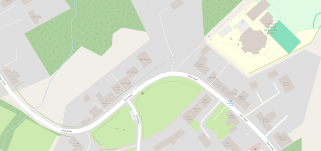
Especially outside of urban centres, and especially if you’re on foot, OpenStreetMap is way better than Google Maps, Bing Maps,
Apple Maps, or what-have-you.
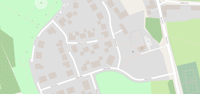
The area at the North end of Sutton Lane, near where I live, is mostly just a huge expanse of nothing in Google Maps, but OpenStreetMap shows footpaths, gates, bridges, house names,
driveways, and land use indicators.
OpenStreetMap is especially good for walkers, with its more-comprehensive coverage of public footpaths as well as the ability to drill-down for accessibility information: whether a path
ends in a gate or a stile matters a lot if you can’t climb the latter (or you’re walking with a small-but-muddy dog who’ll need lifting over).
Sure, you don’t get (as much) street view photography. But how often do you use that, anyway?1
Of course, some of the places near me at which OpenStreetMap especially excels are… because of me! A little amateur cartography can go a long way.
I’ve heard it argued that OpenStreetMap, with its Wikipedia-like “anybody can edit it” model, cannot be relied upon. And sure, if you’re looking for an “official” level of accuracy and
the alternative is an Ordinance Survey map, then that’s what you should go for.
But there’s nothing specific to, say, Google Maps that makes it fundamentally more “accurate” for most2
geographic features than OpenStreetMap. The vast of cartographic data on Google Maps is produced by humans, looking at satellite photos, and then tracing the features on them, probably
with AI assistance. And the vast majority of cartographic data on OpenStreetMap is produced… exactly the same way, although without the AI “helping”.
Google Maps has mistakes, just like every map3. And it’s
got trap streets, like most commercially-produced maps (including the Ordinance Survey). Google Maps’ mistakes tend to be made by somebody on the other side of the world
from the feature, doing a bad job of tracing what they think might be a road… while OpenStreetMaps’ mistakes are for the most part omissions in areas that are under-explored by
local contributors. And there are plenty of areas – like those near where I live, especially if you’re on foot – where the latter mistakes are much less-troublesome.
If you’re looking to make a delivery to my village, where most buildings are named rather than numbered, postcode areas are broad, and it’s not always clear where it’ll be safe to
park… you’d do a lot better to use OpenStreetMap than any other digital map.
I fixed a couple of omissions on OpenStreetMap just earlier today. While I was out walking the dog, earlier, I added the names of two houses whose identities weren’t specifically marked on the map, and I
added detail to the newly-constructed Deansfield estate. Google Maps shows there being only
two houses on Deansfield Estate, among other inaccuracies, even though they’ve got up-to-date aerial and street photography.
Google Maps is fine if you want to drive to Sheffield, you need public transport connections to Plymouth4, or you’re looking for a restaurant nearby and you want
the data about them to be accurate. But next time you’re walking somewhere, or when you’re looking for a specific address… I’d suggest you give OpenStreetMap a go. You
might be pleasantly surprised.
Footnotes
1 I say that as somebody who uses street view and satellite photography a more
than average amount, for geohashing purposes. But I can switch mapping software on-the-fly; nobody’s stopping me looking at “ostrich” photos when I need them.
2 The place that Google Maps really beats OpenStreetMap, in my mind, is in the integration
of its business directory. If you search for a business in Google Maps, you’ll probably find it and get reasonably-accurate opening hours and contact details. But that’s a
factor of two things: the Google My Business directory, and – more importantly – the popularity of the application and the fact that the mobile app “nudges” people to check on the
places around them. By the way: if you want to contribute to making maps better in that way without becoming an unpaid researcher working to line Google’s pockets, StreetComplete is an app that helps fill-out business and related information on OpenStreetMap!
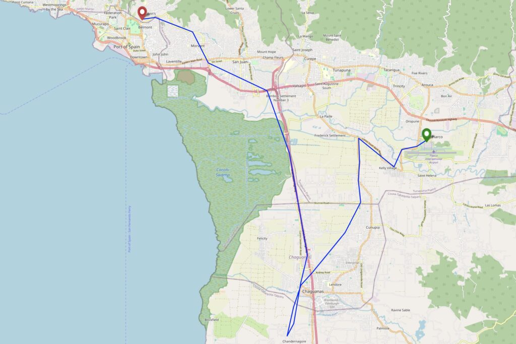
Yesterday, Ruth and I made the first ever attempt at a geohashing expedition in Trinidad & Tobago, successfully finding a hashpoint in Chase Village in the West of Trinidad!
I’ve been on holiday on the islands of Trinidad & Tobago this week. These island nations span graticules that are dominated by the Caribbean and Atlantic Oceans, so it’s little wonder
there’s never been an attempted geohashing expedition in them. So when a hashpoint popped-up in a possibly-accessible location, I had to go for it!
For additional context: Trinidad & Tobago is currently under a state of
emergency as gang warfare and an escalating murder rate has reached a peak. It’s probably ill-advised to go far off the beaten track, especially as somebody who’s clearly a foreign
tourist. The violence and danger is especially prevalent in and around parts of nearby Port of Spain.
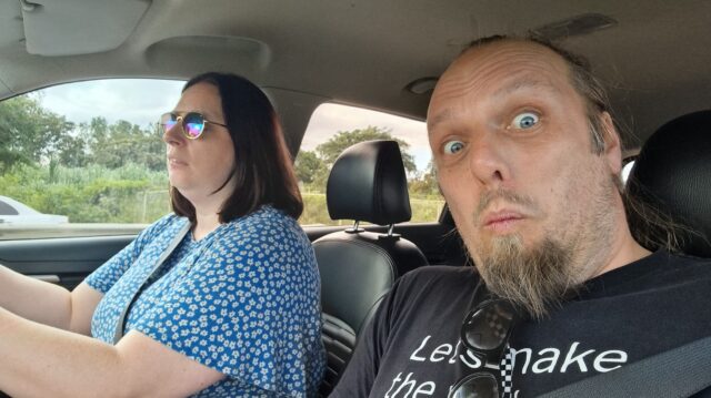
As a result, my partner Ruth (wisely) agreed to drive with me to the GZ strictly under the understanding that we’d turn back at a moment’s notice if anything looked remotely sketchy,
and we’d take every precaution on the way to, from, and at the hashpoint area (e.g. keeping car doors locked when travelling and not getting out unless necessary and safe to do so,
keeping valuables hidden out of sight, knowing the location of the nearest police station at any time, etc.).
I don’t have my regular geohashing kit with me, but I’ve got a smartphone, uLogger sending 5-minute GPS location pings (and the ability to send a location when I press a button in the
app, for proof later), and a little bravery, so here we go…
Expedition
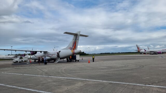
Our plane from Tobago landed around 15:20 local time, following an ahead-of-schedule flight assisted by a tailwind from the Atlantic side. We disembarked, collected our bags, and
proceeded to pick up a hire car.
Our Caribbean Airlines aircraft, landed at Piarco airport.
Our original plan for our stay in Trinidad had been to drive up to an AirBnB near 10.743817, -61.514248 on Paramin, one of Tobago’s highest summits. However,
our experience of driving up Mount Dillon on Tobago earlier in the week showed us that the rural
mountain roads around here can be terrifyingly dangerous for non-locals1,
and so we chickened out and investigated the possibility of arranging a last-minute stay at a lodge on the edge of the rainforest in Gran Couva, or else failing that a fallback plan of
a conventional tourist-centric hotel in the North of Port of Spain.
By this point, we’d determined that the hashpoint was in the old sugar growing region of Caroni, in which our originally-intended accommodation at Gran Couva could be found, and so it
seemed feasible that we might be able to safely deviate from our route only a little to get to the hashpoint before reaching our beds. We were particularly keen to be at a place of
known safety before the sun set, here in an unusual part of an unfamiliar country! So when the owner of our proposed lodge in Gran Couva called to say that he couldn’t accept our
last-minute booking on account of ongoing renovations to his property, we had to quickly arrange ourself a room at our backup hotel.
This put us in an awkward position: now the hashpoint really wasn’t anything-like on the way from the airport to where we’d be staying, and we’d doubtless be spending longer
than we’d like to be on the road and increasing the risk that we’d be out after dark. I reassured Ruth, whose appetite for risk is somewhat lower than mine, that if we set out for the
hashpoint and anything seemed “off” we could turn around at any time, and we began our journey.
Putting a brave/excited face on as we set off in our rental car.
Boosted by her experience of driving on Tobago, Ruth continued to show her rapidly-developing Trinbagonian road skills2.
Driving down a network of crisscrossing roads.
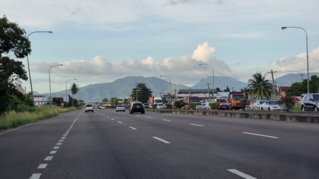
Despite increasingly heavy traffic on our minor roads, possibly resulting from a crash that had occurred on the Southbound carriageway of the nearby Uriah Butler Highway which was
causing drivers to seek a shortcut through the suburbs, we made reasonable time, and were soon in the vicinity of the hashpoint: a mixed-use residential/light commercial estate of the
kind that apparently sprung up in places that were, until very late in the 20th century, lands used for sugar cane plantations.
At this point, the maps started to become less and less useful: Google Maps, OpenStreetMap, and Bing Maps completely disagreed as to whether we were driving on Bhagan Trace, Cemetery
Street, or Roy Gobin Fifth Avenue, as well as disagreeing on whether we were driving into a cul-de-sac or whether it was possible to loop around at the end to return back to the main
roads. It was now almost 17:00 and we were greeted by a large number of cars coming out of the narrow street in the opposite direction to us, going in, and squeezing past us: presumably
workers from one of the businesses down here going home for the evening.
There are highways we’d been recommended to avoid because of the safety situation here, but this one was okay.
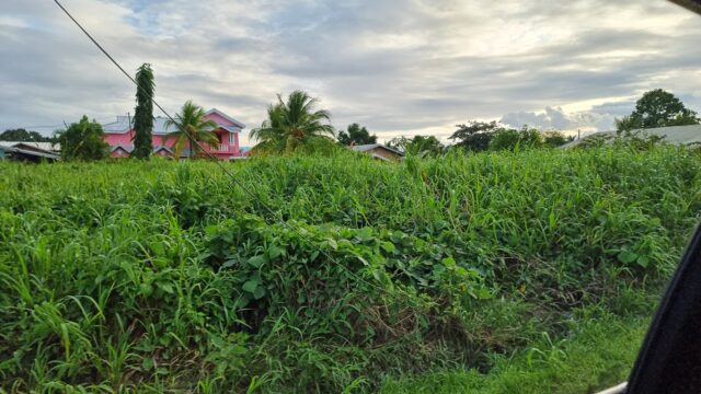
My GPS flickered as it tried to make sense of the patchwork of streets, and I asked Ruth to slow down and pull over a couple of times until I was sure that we’d gotten as close as we
could, by road. Looking out of my window, I saw the empty lot that I’d scouted from satellite photography, but it was hopelessly overgrown. If the hashpoint was within it, it’d take
hours of work and a machete to cut through. The circle of uncertainty jumped around as I tried to finalise the signal without daring to do the obvious thing of holding my phone outside
the car window. A handful of locals watched us, the strange white folks sitting in a new car, as I poked at my devices in an effort to check if we were within the circle, or at least if
we would be when, imminently, we were forced to park even closer to the side to let a larger vehicle force its way through next to us!
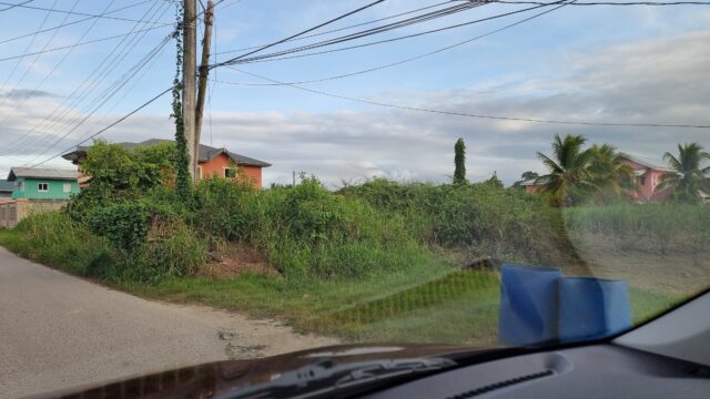
Pulled up at the hashpoint.
At the point at which I thought we’d made it, I hit the “save waypoint” at 17:06 button and instructed Ruth to drive on. We turned in the road and I started navigating us to our hotel,
only thinking to look at the final location I’d tagged later, when we felt safer. We drove back into Port of Spain avoiding Laventille (another zone we’d been particularly recommended
to stay away from) while I resisted the urge to double-check my tracklog, instead focussing on trying to provide solid directions through not-always-signposted streets: we had a wrong
turning at one point when we came off the highway at Bamboo Settlement No. 1 (10.627952, -61.429083) but thankfully this was an easy mistake to course-correct from.
View of the hashpoint again as we turn to go home
It was only when I looked at my tracklog, later, that I discovered that the point I’d tagged was exactly 8.59 metres from the hashpoint, plus or minus a circle of uncertainty of… 9
metres. Amazingly, we’d succeeded without even being certain we’d done so. Having failed to get a silly grin photo at the hashpoint, we sufficed to get one while we drank
celebratory Prosecco and ate tapas on the rooftop bar of our hotel, looking down on the beautiful bay and imposing mountains of this beautiful if intimidating island.
Silly drinky grins atop our hotel North of Port of Spain
Tracklog
I didn’t bring my primary GPSr, but my phone keeps a general-purpose tracklog at ~5min/50m
intervals, and when I prompt it to. Apologies that this makes my route map look “jumpier” than usual, especially when I’m away from the GZ.
Achievements
Footnotes
1 Often, when speaking to locals, they’d ask if it was our first time in Trinidad &
Tobago, and on learning that it was, they’d be shocked to hear that we’d opted to drive for ourselves rather than to hire drivers to take us places: it turns out that the roads are in
very-variable condition, from wonderfully-maintained highways to rural trails barely-driveable without a 4×4, but locals in both drive with the same kind of assertive and sometimes
reckless attitude.
2 tl;dr of driving in Trinidad & Tobago, as somebody who learned to drive in the UK: (1)
if you need to get out of anywhere, don’t wait for anybody to yield because they won’t, even if you theoretically have the right of way: instead, force your way out by obstructing
others, (2) drive in the middle of the road wherever possible to make it easier to dodge potholes and other hazards, which are clustered near the soft verges, and swing to your own
side of the road only at the last second to avoid collisions, and (3) use your horn as often as you like and for any purpose: to indicate that you want to turn, to warn somebody that
you’re there, to tell somebody to move, to say hello to a nearby pedestrian you recognise, or in lieu of turning on your headlights at night, for example. The car horn is a universal
language, it seems.
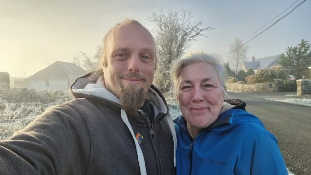
I’m leaving Ireland a day late, from the wrong airport, and with one fewer functioning arm than I anticipated. It’s been quite the ride. I’ll be glad to get home.
(for those that are concerned: I’ve damaged my shoulder, possibly while slipping down a hill in search of a geocache or geohashpoint; so, y’know, the usual reason I get injured… but
I’ve got some physio instructions I’m supposed to follow, and I’ll be okay)
A quick and easy find on our way to the airport at Knock to end our Irish adventure, this morning.
Expedition
Finding the hashpoint was easy. We drove to it, arriving at 10:31, overshooting very slightly and walking back 20 metres (we could’ve done it without even getting out of the car if we’d
cared to). Then we were done.
It’s pretty cold out.
What happened next is where things went wrong. We stopped in Ballyhaunis, half-way between the hashpoint and the airport at Knock, for a comfort break and to find a local geocache. Then
we hiked out to find a second nearby geocache, but the icy conditions on the way back slowed us down considerably (and my mother fell over at least once). We stepped into a cafe for a
quick drink, and apparently my attitude to our imminently-departing flight was so laid-back (in actual fact, I thought we had about half an hour more in-hand than we did) that my mother
decided to reflect it and play laid-back too. Sarcastically, she suggested we stay around Ballyhaunis for a round of cakes, too, and I – not recognising her tone as sarcastic – agreed.
In fact, I thought that her relaxed attitude was because we had a long time until our flight, too. (tl;dr: when two people famed for their sarcasm communicate
sarcastically with one another, they should be careful not to, y’know, completely fuck up their plans for the rest of the day by accident)
As we digested our scones and my mother prepared to pour a second mug of tea, I pulled out my phone and realised to my horror that our plane was scheduled to depart in a little over 40
minutes: I’d got the departure time wrong. She said, “I thought you knew it was close, but you knew something I didn’t, like that it was really late!?” Nope.
We ran as fast as the icy ground would permit us to back to the car and drove at great speed to the airport, just in time to miss the closure of the departure desk. We’d just missed the
last and indeed only flight out of Knock airport that day. Fuck.
Anyway, all of which is to say that we extended the rental on our car, arranged to drop it off at Dublin airport, and drove coast-to-coast across Ireland to get to a more-favourable
airport and a last-minute AirBnB, where we dropped out bags then went out for pizza in a dangerously underlit bar
before listening to some Irish folks music in a different bar and going to bed.
Tomorrow. Tomorrow… we’ll leave the country. I promise.
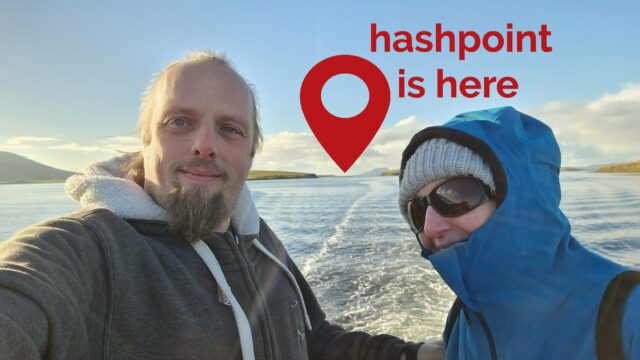
This can’t be done. Right? Right?! Except maybe it can. I’ve found a few folks with boats and I’m going to phone-around in the morning and see about chartering one.
Expedition
I left lots of voicemails and messages lots of people, but nobody could offer me a lift to this random spot on the edge of Ireland. We later took a tour boat out into the bay but it
didn’t go near it either (but was a delightful ride, and we just-about came within sight of the hashpoint).
It’s actually about 10km away at this point. We could’ve gotten closer, but we couldn’t quite get close enough.
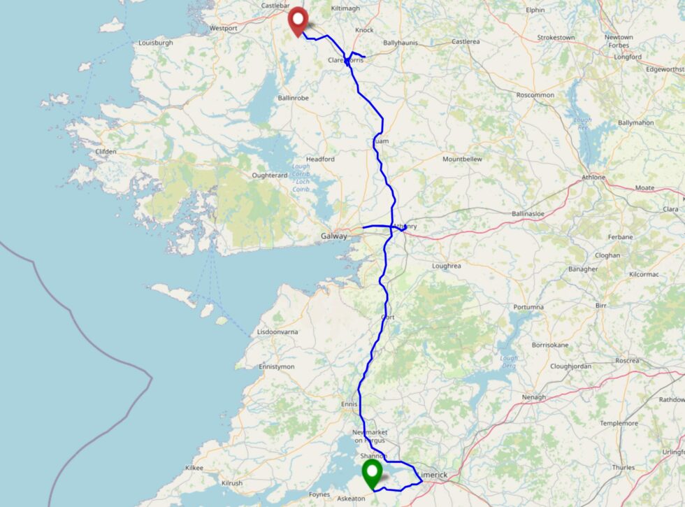
Today we need to drive North up the entire length of the M18 and M17 to get to our next accommodation. If we take only a minor diversion at Tuam we can see how accessible this hashpoint
is, on the way!
Expedition
On today’s leg of my mother and I’s expedition to go hashing around the West coast of Ireland (hampered only by the floods of Storm Bert) we were scheduled to drive a few hours up the
country to move from our old accommodation of the last few nights to our new accommodation of the next two. On our way we accidentally drove the wrong way down the M6 for a spell (as
you can see on our tracklog) as we intended to visit Athenry for some geocaching, before pushing on to the hashpoint.
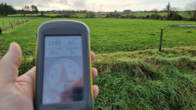
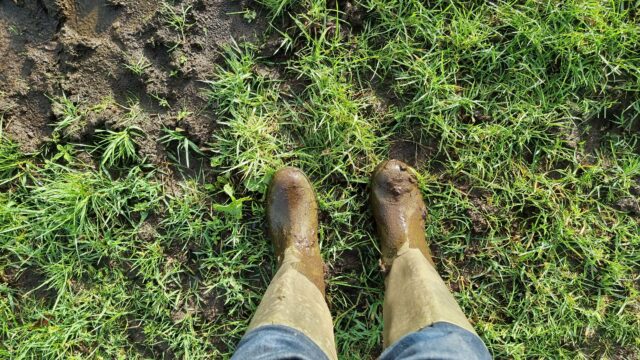
102 metres to go, but we’ll need to find a gate… and some better footwear…
We drove past the field with the hashpoint in order to dodge an incoming tractor and to scout out safe parking spaces. Finding a suitable verge, we pulled up and took a look at the
pasture with the hashpoint. The gate into it was seriously churned up with mud, so I switched to my wellies and my mother pulled on a pair of waterproof trousers, and we waded out.
Some of the early bits of the field would suck us ankle-deep, but by this point things were better.
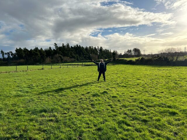
Once past the gate, it got a lot easier and we were able to quickly find our way to the hashpoint at 13:10.
One great thing about having a geohashing buddy is they can take a “victory pose” picture of you!
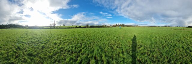
It was the middle of a muddy field. Not exciting, but a good view of rolling countryside and wind farms.
Fields as far as the eye can see. Until you hit the treeline.
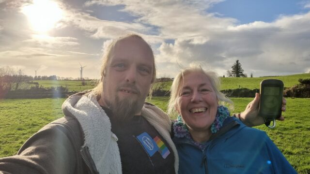
We swiftly made our way back to our car to avoid any questions from passing farmers about what we might be doing hanging our near a piece of mystery agricultural equipment we were near.
Requisite silly grins, as required by geohashing law.
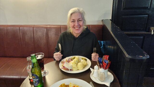
Then, after changing back into our regular footwear so we didn’t bring tonnes of mud into our rental car, made our way down into Claremorris. There, we enjoyed a celebratory carvery
lunch, toured a handful of local geocaches, explored a path that Google Maps (only) claims exists – possibly a trap street? – and walked around a lake with lots of scultpures until we discovered that the route we’d planned to take was underwater. At that point, we figured it
was time to go check-in to our new AirBnB and returned to our car to set off.
I had the curry, but my mother managed to order a portion of gammon and mash slightly larger than her own head.
A highly-successful trip.
Tracklog
Full journey
(includes drive from old
accommodation, geocaching, hiking, drive to new accommodation, etc)
It’s been a long day of driving around Ireland, scrambling through forests, navigating to a hashpoint, exploring a medieval castle, dodging the rain, finding a series of geocaches,
getting lost up a hill in the dark, and generally having a kickass time with one of my very favourite people on this earth: my mum.
And now it’s time for a long soak in a hot bath with a pint of the black stuff and my RSS reader for company. A perfect finish.
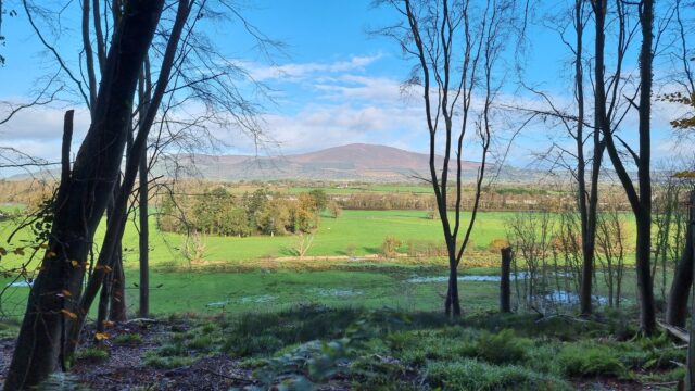
Gorgeous view of Slievenamon towering over Kilsheelan, Co. Tipperary, Ireland, as seen from Gurteen Wood, where my mother and I are just on our way back from our successful expedition
to the 2024-11-24 52 -7 geohashpoint.
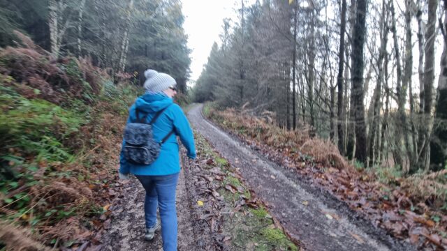
Day three of our geohashing-focussed holiday in Ireland, and the other hashpoints near us look likely to be inaccessible to owing to flooding, but this one’s in a hillside forest.
Should be easy, right?
Expedition
It took us around an hour and a half to drive from our accomodation out to Kilsheelan, from which we’d planned to cross the bridge and ascend the hill into the forest where the
hashpoint could be found.
The route up the hill into the forest wasn’t especially steep, but it seemed to take a while.
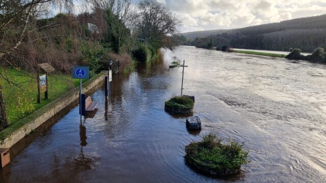
We’d originally anticipated that we’d tackle the trail of geocaches alongside the River Suir afterwards, but looking down from the bridge made it clear that this was not going to be
possible: the riverside path was completely underwater where the river had broken its banks.
Yeah, we’re not walking along that footpath.
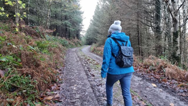
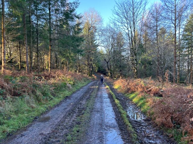
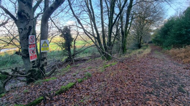
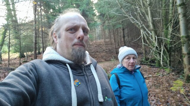
We pressed on up and into the forest. It’s mostly a managed pine forest, surrounded by pockets of native deciduous trees. The trails are, for the most part, wide enough for the forestry
vehicles to traverse, and – apart from the points at which streams has escaped their culverts and flooded the path – it was mostly dry and easy walking.
The trails were muddy, but very navigable.
The maps indicated the the fastest route to where the hashpoint could be found would have been along a road, but we opted to climb to an altitude of about 150m to take a forest trail
parallel to the road, instead, and it was certainly a more-welcome view.
Especially impressive was the view of Slievenamon across the valley, which I shared from the field.
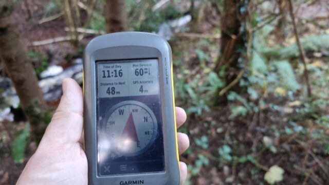
Getting closer to the cache, we found a trail leading down and began to approach it. We seemed to be endlessly stuck at around 370 metres away as our track wound back and forth with the
contours of the hill, but eventually we began to approach it. I was momentarily panicked when we disovered an area of new plantation, surrounded by a 3-metre tall wire fence, because it
looked as though the hashpoint might turn out to be inside it and therefore inaccessible, but as we continued to walk we discovered to our delight that it would, instead, be in
one of the mature parts of the managed forest instead.
Uh-oh, this fence looks like trouble.
We broke off the track with around 50 metres to go and began to hack our way through the slippery mud and tangled undergrowth.
We need to go… thisaway!
Before long, we came across a stream, converted into a torrent by the floodwater and the mountaintop’s melting snow!
This stream could be a problem…
After scouting for the narrowest point (and giving up on attempting to construct a bridge) I leapt across, and then reached back to help my mother do the same.
“You think we can jump it?” “I think I can jump it, but I don’t know about you.” “Can you… pull me over?”
“We got over it!”
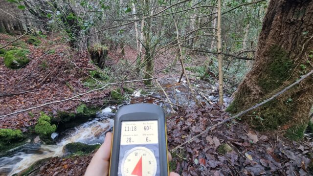
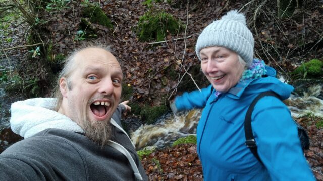
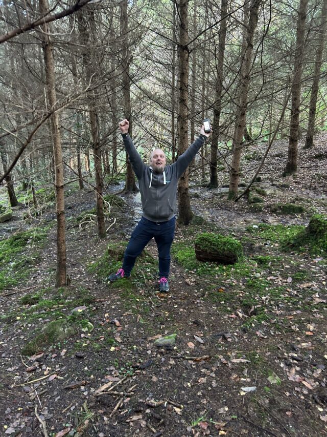
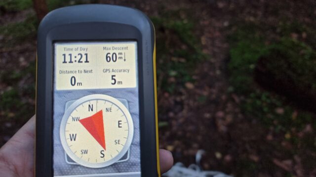
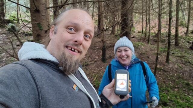
Now we were able to pick our way around decaying wood and slippery leaves to finally get to the hashpoint. We arrived at 11:20.
Victory pose!
Ground Zero!
A panorama from the hashpoint.
Requisite silly grins.
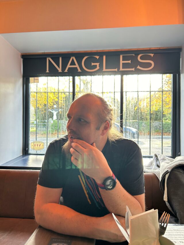
Retracing our steps to the path and continuing our descent, we returned via the road to the bridge we’d crossed at. We enjoyed a spectacular view of Slievenamon to the North, a mountain that towers over the valley. Returning to Kilsheelan, we had a great lunch at Nagle’s
Bar, then continued on our day’s adventures: taking in some history at Cahir Castle (and finding a nearby geocache), dodging the rain at coffee shop Keep Coffee, and then taking on a
challenging series of caches on the Millennium Loop of Glengarra Woods, where we almost found ourselves stranded by the setting sun, short on batteries for either GPS, phone, or torch
use, and having to carefully pick our way back to the car before a long dark drive over the winding Kilmallock road to get back to home, beer, and baths.
Lunchtime!
A wonderful adventure that’s left me heavy of foot and light of spirit.
Tracklog
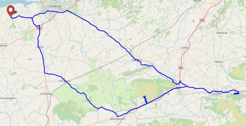
Full journey
(includes the driving sections and our other expeditions, including some lunch, touring a castle, and geocaching a valley)
(just the bit from where we parked up into the forest, to the hashpoint, and down again; minus a bit at the start where I forgot to turn my backup GPSr on)
With Storm Bert raining off our plans for geohashing in Co. Limerick, my mother and I are off into a forest in Co. Tipperary in search of a hashpoint over this way. It’s still pretty
wet though.