Geohashing Resurected

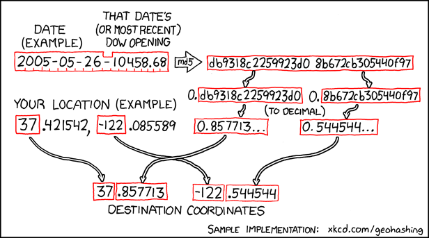
I keep my life pretty busy and don’t get as much “outside” as I’d like, but when I do I like to get out on an occasional geohashing expedition (like these ones). I (somewhat badly) explained geohashing in the vlog attached to my expedition 2018-08-07 51 -1, but the short version is this: an xkcd comic proposed an formula to use a stock market index to generate a pair of random coordinates, impossible to predict in advance, for each date. Those coordinates are (broadly) repeated for each degree of latitude and longitude throughout the planet, and your challenge is to get to them and discover what’s there. So it’s like geocaching, except you don’t get to find anything at the end and there’s no guarantee that the destination is even remotely accessible. I love it.

xkcd #426: Geohashing
My favourite kind of random pointlessness is summarised by this algorithm.

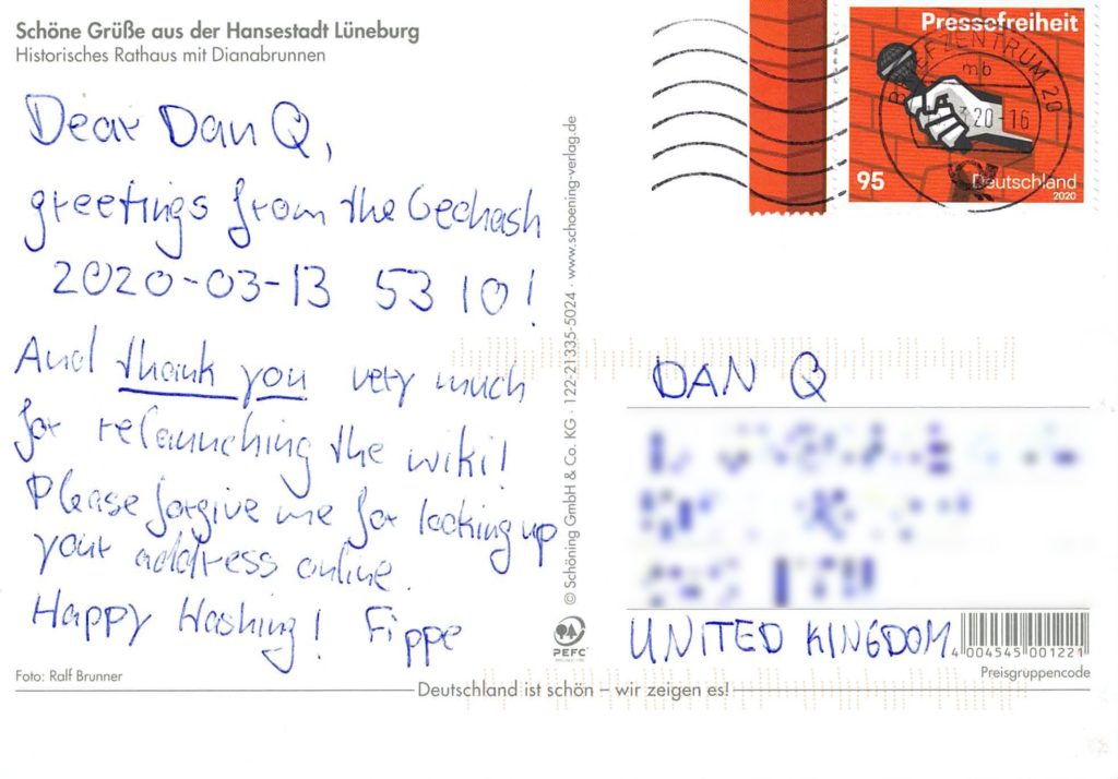
Most geohashers used to use a MediaWiki-powered website to coordinate their efforts and share their stories, until a different application on the server where it resided got hacked and the wiki got taken down as a precaution. That was last September, and the community became somewhat “lost” this winter as a result. It didn’t stop us ‘hashing, of course: the algorithm’s open-source and so are many of its implementations, so I was able to sink into a disgusting hole in November, for example. But we’d lost the digital “village square” of our community.

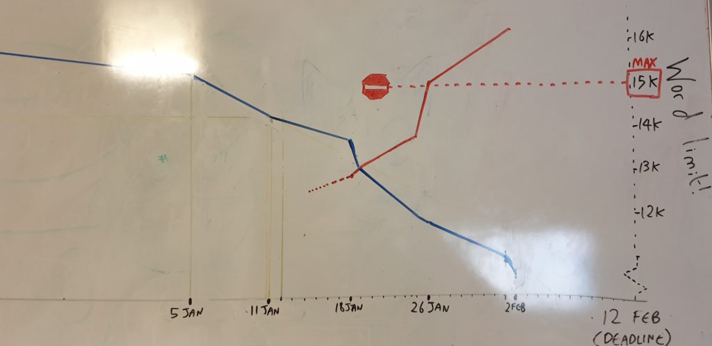
Graph of Dan's dissertation progress as the deadline creeps closer
My dissertation “burndown” is characterised on my whiteboard by two variables: outstanding issues (blue) and wordcount (red). There are… a few problems.

So I emailed Davean, who does techy things for xkcd, and said that I’d like to take over the Geohashing wiki but that I’d first like (a) his or Randall’s blessing to do so, and ideally (b) a backup of the pages of the site as it last-stood. Apparently I thought that my new job plus finishing my dissertation plus trying to move house plus all of the usual things I fill my time with wasn’t enough and I needed a mini side-project, because when I finally got the go-ahead at the end of last month I (re)launched geohashing.site. Take a look, if you like. If you’ve never been Geohashing before, there’s never been a more-obscure time to start!

geohashing.site homepage
My implementation of the site is mobile-friendly for the benefit of people who might want to use it while out in a muddy ditch. For example. Just hypothetically.

Luckily, it’s not been a significant time-sink for me: members of the geohashing community quickly stepped up to help me modernise content, fix bots, update hyperlinks and the like. I took the opportunity to fix a few things that had always bugged me about the old site, like the mobile-unfriendly interface and the inability to upload GPX files, and laid the groundwork to make bigger changes down the road (like changing the way that inline maps are displayed, a popular community request).

So yeah: Geohashing’s back, not that it ever went away, and I got to be part of the mission to make it so. I feel like I am, as geohashers say… out standing in my field.

× ×

Geohashing expedition 2019-11-29 51 -1

This checkin to geohash 2019-11-29 51 -1 reflects a geohashing expedition. See more of Dan's hash logs.

Location

Footpath connecting Ditchley, Fulwell and Cleveley, North-East of Charlbury.

Participants

Plans

The XKCD Geohashing Wiki has been down ever since the forums hosted on the same server were hacked almost three months ago. But the algorithm is functionally open-source and there’s nothing to stop an enterprising Geohasher from undertaking adventures even when the biggest silo is offline (I’m trying to negotiate a solution to that problem, too, but that’s another story).

So I planned to take a slightly extended lunch break for what looked like an easy expedition: drive up to Fullwell where it looked like I’d be able to park the car and then explore the footpath from its Western end.

Expedition

Everything went well until I’d parked the car and gotten out. We’ve had some pretty wet weather lately and I quickly discovered that my footwear was less than ideal for the conditions. Clinging to the barbed wire fence to avoid slipping over, I made my way along a footpath saturated with ankle-deep slippery mud. Up ahead, things looked better, so I pressed on…

…but what I’d initially surveyed to be a drier, smoother part of the field up ahead quickly turned out to be a thin dried crust on top of a pool of knee-to-waist-deep ooze. Letting out a smelling like a mixture of stagnant water and animal waste runoff, the surface cracked and I was sucked deep into the pit. I was glad that my boots were tied tightly or I might have lost them to the deep: it was all I could do to turn around and drag my heavy, sticky legs back to the car.

This is my first failed hashpoint expedition that wasn’t cancelled-before-it-started. It’s a little disappointing, but I’m glad I turned around when I did – when I spoke to somebody near where I’d parked, they told me that it got even worse in the next field and a farmer’s tractor had gotten briefly stuck there recently!

Tracklog

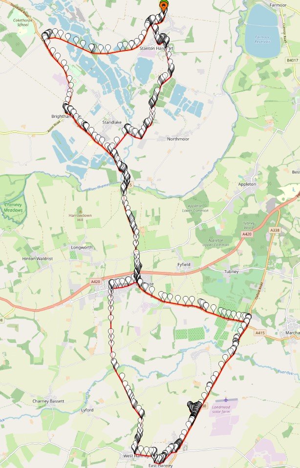
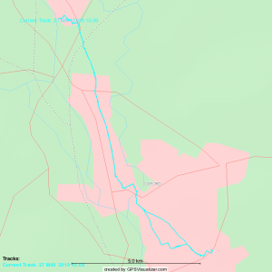
My GPSr keeps a tracklog:

Video

Having realised my imminent failure, I vlogged the experience:

You can also watch it at:

Photos

Geohashing expedition 2019-08-01 51 -1

This checkin to geohash 2019-08-01 51 -1 reflects a geohashing expedition. See more of Dan's hash logs.

Location

Edge of field near Charlbury railway station, Oxfordshire. Looks to be accessible via a narrow road connecting the B4437 to what looks like a sewage treatment plant.

Participants

Plans

Dan Q plans to cycle out to the hashpoint this morning/early afternoon, aiming to arrive around 13:00.

Expedition

A morning meeting with an estate agent wrapped-up sooner than I expected, and I found myself with enough free time to tackle a cycle out to (and back from) this hashpoint with enough time to spare to do a little freelance work and study in the afternoon. The sun beamed gloriously except during a few windy moments (as you can hear hear in the accompanying video) and a couple of points where it briefly threatened to rain before changing its mind.

I picked a route that minimised the time I would spend on major roads: I left Kidlington via the towpath alongside the Oxford Canal, taking the woodland path to Begbroke alongside the “fairy doors”, and then the cyclepath alongside the A44 into Woodstock. There, I’d planned to cut through the grounds of Blenheim Palace, but for a brief moment I worried that this might not be possible: some kind of event is taking place at the Palace this week, and it seemed possible that parts of the grounds would be inaccessible. Fortunately I was allowed through and was able to continue my adventure without venturing on the main roads, but I still wonder if my route was truly legit: when I came out of the other side of the grounds I noticed a sign indicating that the route I’d taken was not supposed to be a public right of way to the Palace I’d just come from!

Pushing on through Stonesfield and Fawler I made my way to Charlbury, dismounted twice to pick my way through the village’s confusing one-way system, found the station, and made my way down the lane behind it. There’s a lovely little nursery there called The Railway Children, which is pretty cute for a nursery alongside a station. The lane seemed to exist only for the purpose of serving the sewage treatment works at the end of it, but nobody batted an eye at my cycling down it, and I was able to park my bike up half-way and walk the remaining distance up through the grassy field to the hashpoint, arriving at about 13:30. It’s a beautiful area, but there’s not much more to say about it than that.

On the return journey I called in at geocaches GC1JMQY (log) and GC873ZQ (log), but failed to find GC87403 (log), principally because I was running out of spare time and had to cut my search short. I cycled home, logging a total journey of around 43 kilometres (around 27 miles).

Tracklog

My GPSr keeps a tracklog:

Video

I vlogged the entire experience.

Music: Pitx Remix by Martin Cee (softmartin) Copyright 2019, used under a Creative Commons Attribution (3.0) license.

You can also watch it at:
Photos

2019-08-01 51 -1 Geohashing expedition (video)

Expedition by bike from Kidlington to the to the 2019-08-01 51 -1 hashpoint in Charlbury via the Oxford Canal towpath, Begbroke, Oxford Airport, Woodstock, Blenheim Palace, and Stonesfield, and back via two geocaches.

Read the full log on this blog or at http://wiki.xkcd.com/geohashing/2019-08-01_51_-1.

This video also available at https://youtu.be/pGboZkJTm0A.

Music: Pitx Remix by Martin Cee (softmartin) Copyright 2019, used under a Creative Commons Attribution (3.0) license. http://dig.ccmixter.org/files/softmartin/59963

Geohashing expedition 2019-05-27 51 -1

This checkin to geohash 2019-05-27 51 -1 reflects a geohashing expedition. See more of Dan's hash logs.

Location

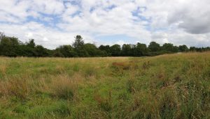
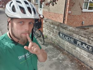
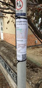
Hashpoint appears to be at the very end of Bleache Place, a suburban cul-de-sac in South-East Oxford. Looks very close to, but not on, the driveway of number 15. Possibly a convenient nearby lamp post for possibly attaching a “the Internet was here” sign?

Participants

Plans

(So long as he can get enough of his coursework done to justify taking a break), Dan Q plans to cycle out to the hashpoint at some point during the day.

Expedition

14:55 – okay, I’ve not finished as much of my coursework as I’d hoped, but I’ve finished enough that I can afford to take a break of a couple of hours to cycle out to the hashpoint, do a silly grin, put up a “The internet was here!” sign, and whatnot. Here we go!

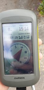
15:58 – Success! Photos, tracklog, and details to follow. I’ve put a sign up so I wanted to put a message here for anybody who happens to see it and visit this page before I get home and finish writing-up!

Came home via geocache GC6102Y, safely home by 17:15 and back to studying!

Tracklog

Photos


Dead Dad Day

I’m not sure that I process death in the same way that “normal” people do. I blame my family.

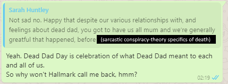
WhatsApp chat: Sarah Huntley says "Happy dead dad day x" and Doreen Huntley replies "Shouldn't it be 'sad dead dad day'"?
My sisters and I have wished one another a “Happy Dead Dad Day” every 19 February since his death.

When my grandmother died in 2006 I was just in the process of packing up the car with Claire to try to get up to visit her before the inevitable happened. I received the phone call to advise me that she’d passed, and – ten emotional minutes later – Claire told me that she’d “never seen anybody go through the five stages of grief as fast as that before”. Apparently I was a textbook example of the Kübler-Ross model, only at speed. Perhaps I should volunteer to stand in front of introductory psychology classes and feel things, or something.

My sister explains what Dead Dad Day means to her, and I explain what it means to me: a celebration of the relationship we each got to have with our father.
I guess there isn’t actually a market for Happy Dead Dad Day greetings cards?

Since my dad’s death seven years ago, I’ve marked Dead Dad Day every 19 February a way that’s definitely “mine”: with a pint or three of Guinness (which my dad enjoyed… except if there were a cheaper Irish stout on draught because he never quite shook off his working-class roots) and some outdoors and ideally a hill, although Oxfordshire makes the latter a little difficult. On the second anniversary of my dad’s death, I commemorated his love of setting out and checking the map later by making my first geohashing expedition: it seemed appropriate that even without him, I could make a journey without either of us being sure of either the route… or the destination.

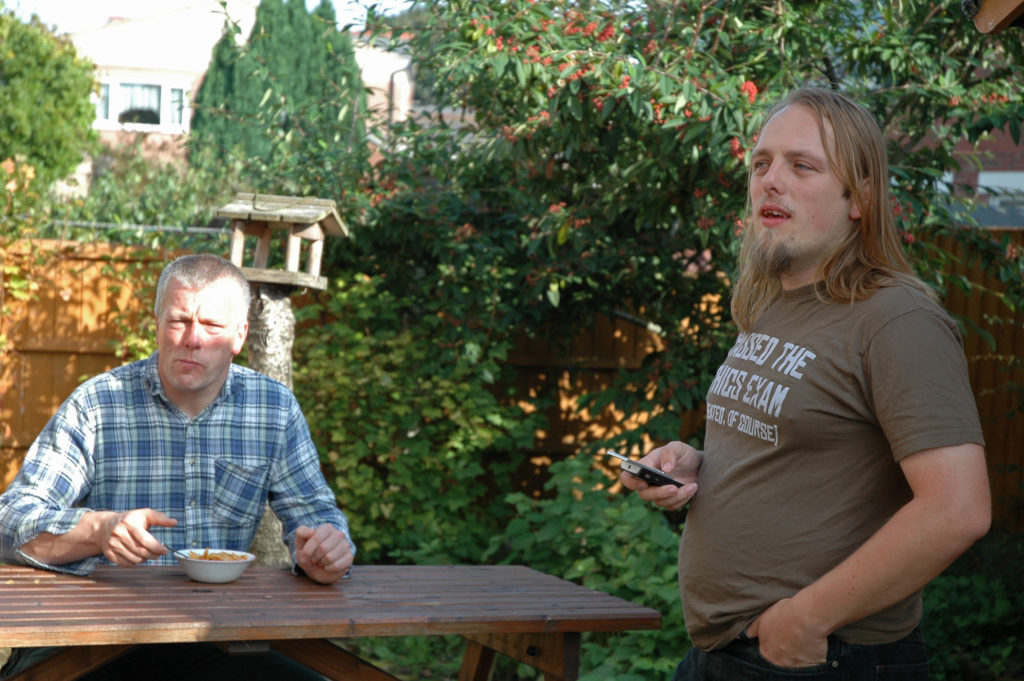
Dan and his dad have breakfast in the garden.
Eating cornflakes together in the garden was a tradition of my dad and I’s since at least 23 years before this photo was taken.

As I implied at his funeral, I’ve always been far more-interested in celebrating life than mourning death (that might be why I’m not always the best at supporting those in grief). I’m not saying that it isn’t sad that he went before his time: it is. What’s worst, I think, is when I remember how close-but-not-quite he came to getting to meet his grandchildren… who’d have doubtless called him “Grandpeter”.

We all get to live, and we’re all going to die, and I’d honestly be delighted if I thought that people might remember me with the same kind of smile (and just occasionally tear) that finds my face every Dead Dad Day.

× × ×

Geohashing expedition 2019-01-08 51 -1

This checkin to geohash 2019-01-08 51 -1 reflects a geohashing expedition. See more of Dan's hash logs.

Location

A34 near Peartree Interchange, Oxford.

Participants

  • Dan Q (whose birthday it is!)

Plans

It’s my birthday on YYYY-01-08 (Birthday geohash achievement, here I come!), and even though I have to go into work (boo!), I note that my graticule’s geohashpoint falls only about a kilometre and a half of a diversion from my usual cycle route to work. The A4260 and A34 are basically a deathtrap for cyclists, so depending on conditions and traffic I’ll probably divert via the Oxford Canal towpath from Kidlington to Peartree, park up near Peartree Services, and then finish on foot. And then go to work, I guess.

Expedition

Success! A relatively easy (but sometimes scary: the traffic’s a bit nuts on some of the major roads that provided the shortest route) journey to the hashpoint area, followed by a slightly-scary crossing of the road to the hashpoint, which turned out to be right by the crash barriers at the central reservation. The crash barriers provided a great place to tie a “The Internet Was Here” sign.

On my way away from the hashpoint, at 09:19, I hid a geocache: (“2019-01-08 51 -1, 09:19”, OK049E, GC827X6). The geocache is of the “puzzle” variety – the person looking for it is likely to discover geohashing (if they haven’t already) as part of their research into the secret location of the cache.

Achievements

Birthday Achievement
Dan Q earned the Birthday Geohash Achievement
by reaching the (51, -1) geohash on his 38th birthday, 2019-01-08.

Geohashing expedition 2019-01-08 51 -1 (video)

On the morning of my 38th birthday I set out on an expedition to the geohashpoint in my graticule as a diversion from my way to work: read my full hash log for details (or on the geohashing wiki). Inspired by a spot near the hashpoint, I also hid a geocache (“2019-01-08 51 -1, 09:19”, OK049E, GC827X6). You can download my tracklog [GPX] here.

Also available on YouTube and on QTube.

Geohashing expedition 2018-11-09 51 -3

This checkin to geohash 2018-11-09 51 -3 reflects a geohashing expedition. See more of Dan's hash logs.

Location

Field near Whitefield Rocks, Langley Marsh. Google Maps says its a nowhere-place but OpenStreetMap suggests there’s a footpath right by the hashpoint.

Participants

Plans

Okay, I’m going for it! I’m driving from Oxford to Penzance this morning and having just watched the sun rise over Sedgemoor Services off the M5 I’ve determined that I’m ahead of schedule by enough that I can justify a diversion, so I’m going to try for this hashpoint as I “pass”. Typing from mobile, apologies for lack of formatting ans any spelling errors; I’ll fix them later.

Expedition

Driving from Oxford to Penzance in the world’s-smallest-rental-car isn’t a fun adventure. What is fun, though, is hitting up a graticule I’ve never hashed in before to see if I can find the day’s hashpoint while en-route.

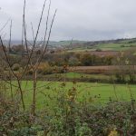
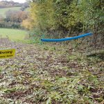
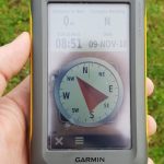
Parking the awfulmobile in a country lane, I followed the road and then a country footpath towards the hashpoint. I say “footpath”, but the public right of way was in dire need of maintenance and the nettles and hedges were encroaching badly upon it. Which was troublesome, because the other side of the footpath was marked by an electric fence that I didn’t want to touch, and so I had to shuffle sideways-at-times through the first field. The second field was easier-going, and I got a great view of the distant storm beginning to roll in which would soak me later, as I hid adventure-game clues atop a cliff near Penzance. The third field appeared to be where the hashpoint would be, and it was crossed by the public right of way, but I was surprised to find that the electric fence returned and now barred my way. Luckily its owner had seen fit to put a length of plastic piping around the live wire so it was possible to jump over without burning my crotch, but this seemed a little not-the-done-thing regardless.

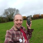
The hashpoint was right in the middle of the field and an easy find. Certainly easier than the short-but-exciting hike there and back.

Photos

Geohashing expedition 2018-10-16 52 -0

This checkin to geohash 2018-10-16 52 -0 reflects a geohashing expedition. See more of Dan's hash logs.

Location

Alongside a lane that runs through the Quinton Green Business Park, South of the village of Quinton.

Participants

Plans

I’ve got an exam in Milton Keynes in the afternoon, so it’d be only a minor diversion for me to come and try to visit this roadside hashpoint. I hope to be there about 10:30.

Expedition

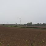
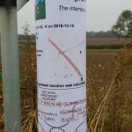
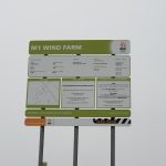
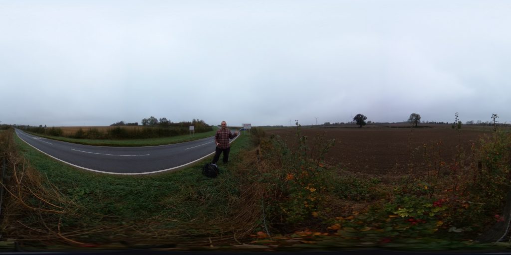
Failed to turn on the tracklogger on my GPS, but I remembered to get photos at least. This was a quick and easy run, although I did get accosted by a local who saw me hanging around near the wind farm and putting up a sign… I think that after the controversy these epic windmills caused he might have thought that I was putting up a planning notice to erect some more or something. Once I explained what I was doing he seemed happy enough.

Used my new 360° full-panoramic camera to take a picture at the hashpoint; I’ll put a VR-ready version on my website and link it here when I get the chance.

Panoramic 360° VR-ready wraparound of the hashpoint

Photos

×

Geohashing near Winchester (2018-08-23 50 -1)

My original plan to divert to the 2018-08-23 51 -1 hashpoint during my planned journey North-to-South along almost the entire length of the 51 -1 graticule was ruined somewhat by the hashpoint turning out be farther North than my starting point! So I changed plans and overshot my destination in order to visit the 50 -1 hashpoint, instead (and find a couple of geocaches on the way). Here’s how that went.

Also available on YouTube and on QTube.

Geohashing expedition 2018-08-23 50 -1

This checkin to geohash 2018-08-23 50 -1 reflects a geohashing expedition. See more of Dan's hash logs.

Location

Hyden Wood, near Chidden. The woods look to be criss-crossed with footpaths, so this might be pretty achievable.

Participants

Plans

I’d originally planned on heading to 2018-08-23 51 -1 because I anticipated that it’d be on or near my route travelling South along almost the entire length of the 51 -1 graticule, but I didn’t bargain on such a Northerly hashpoint so I’ve changed plans and am now aiming to get to this one some time in the morning (I’m hoping to be in Winchester by lunch).

Expedition

The full story’s in vlog format, but here’s the summary:

  • Wasn’t originally planning to come to this graticule but instead was going to go to the 51 -1 graticule where I live ([2018-08-23 51 -1 see here]): I was going to be driving almost the entire length of 51 -1 on a journey from Oxford to Winchester anyway, so I figured it’d be easy to divert to any hashpoint. But when the Dow numbers came out, it turned out that the hashpoints in this quadrant of the Earth are all in the North-East corner, and so my journey would be in the opposite direction. Oh no! So instead I decided to “overshoot” and go for this graticule instead, and thus (if successful) expand my Minesweeper Achievement level.
  • Hashpoint deep in woodland in the beautiful South Downs National Park. Parked at The Sustainability Centre (and later made a donation via their website in thanks for the use of their car park despite not using their other facilities) and walked initially through woodland they manage and use for natural burials: this was really cool – I’ve always been a fan of body disposal in a low-environmental-impact, no-permanent-markers kind-of way, so I’m going to look more into what they offer. I was really interested to see that many families had left “named” bird nesting boxes in memory of their loved ones, which is awesome too.
  • Found geocache GC2X5BJ just outside the burial area and close to a point that gave me a great view across a valley towards the woods in which I believed I’d find the hashpoint.
  • Had to go some way off track to get to the hashpoint, but discovered a network of old, overgrown, long-abandoned (and not on any map I can find) trails in-between the thicket. In fact, the hashpoint eventually turned out to be on the edge of such a track, which I was able to follow to help me find my way back to a road.
  • Found a sign pointing to “Droxford”. Oxford is so-named because its location coincides with the most-downstream point on the Thames at which it’s possible to ford the river while driving cattle (i.e. “ox ford”) – incidentally, I’m told, the ford was at the point that Folly Bridge now stands. But what’s the etymology of Droxford, I wonder. What the hell is a drox???
  • On the way back, diverted by geocache GC5P5KN and found it: this was a great cache with the best-made variant of the particular kind of container it used that I’ve ever seen.
Update: A little research later, it seems that the “ox” in each of Oxford and Droxford have completely different etymological roots! Droxford is derived from an ancient name for the area from some time prior to the Middle Ages: Drocenesforda. “Drocen” means “dry”: the name means “dry ford”. The River Meon, which flows through the area, flows shallow over a chalky bed and is easily forded in many places, as these motorcyclists show. The things you learn!

Tracklog

Video

Photos

Geohashing expedition 2018-08-22 52 -1

This checkin to geohash 2018-08-22 52 -1 reflects a geohashing expedition. See more of Dan's hash logs.

Location

Field with public footpath, East Adderbury.

Participants

Plans

I’m keen to get to level 2 of the Minesweeper Geohash achievement, and this far-South-of-graticule hashpoint represents an opportunity to achieve that. I’ll be at work during the day, but – energy levels permitting after what’ll have been a long day! – I’ll find a way to get up here and see if I can get to the hashpoint, aiming to arrive probably around 18:30.

Expedition

It had been a long day at work, but it looked to be a beautiful evening and I promised myself a pub dinner if I made it to the hashpoint, so I set out by car and by foot to East Adderbury, the village nearest to the hashpoint. The village itself is stunning: lots of old stone buildings, a very traditional bridge, and beautiful green spaces. I spotted not one but two candidate pubs (The Red Lion and The Coach & Horses) as I passed through the village, which was a reassuring start, and then pressed on down a lane which quickly became a narrow trail, waving to some cows along the way (why do I always seem to meet cattle on my hashing adventures?).

The trail was full of blackberries so I wasn’t short of a snack, but it soon became clear that it wouldn’t get me any closer than 35m to the hashpoint. I returned to the entrance to the cows’ field and, hopping a stile, crossed it. The cows looked puzzled as I paced around, getting to ground zero, but didn’t object. After shooting the traditional silly grin, I turned tail and headed back into the village and to the Coach & Horses, which proved to be the very essence of a British village pub: a husband and wife couple running it, dogs everywhere, a jar of pickled onions behind the bar, and more beers than you can shake a stick at.

I did enjoy a rather unusual conversation at the bar, though –

 Me: Can I get a ham, egg, and chips please. And a pint of bitter shandy.
 Barman: One egg or two?
 Me: Oh! Two, please.
 Barman: (Pause) We haven't got any eggs.
 Me: Uhh. Okay; no eggs then.
 Barman's wife: We've got one egg.
 Barman: We've got one egg.
 Me: I'll have one egg, then.
 
 (I go and sit outside; after a while, my meal arrives. There are two eggs.)
 
 Barman's wife: I found another egg.
 Me: ...

A fuller description of the entire adventure can found in the vlog I made along the way.

Tracklog

Video

I filmed my adventure in a vloggy format, complete with doubling-back, talking to cows, and anecdotes about pub food. Watch it on YouTube or on QTube.

Photos

Achievements

Minesweeper geohash empty.png Minesweeper geohash flag.png Minesweeper geohash empty.png
Minesweeper geohash empty.png Minesweeper geohash 2.png Minesweeper geohash flag.png
Minesweeper geohash empty.png Minesweeper geohash empty.png Minesweeper geohash empty.png
Dan Q achieved level 2 of the Minesweeper Geohash achievement
by visiting coordinates in Swindon, United Kingdom and 2 of the surrounding graticules.

How Much of My Graticule is Covered With Water?

I’m a moderately-keen geohasher, as you might be aware if you follow my geohashing logs or you saw that video of me going ‘hashing earlier this month.

For those that don’t know, the skinny version is this: in May 2008 an XKCD comic was published proposing (or at least joking about) a new game with a name reminiscient of geocaching. To play the game, participants use a mathematical hashing function on the current date and the most recent Dow Jones Industrial Average opening value to generate sets of random coordinates around the globe and then try to find their way to them, hopefully experiencing adventures along the way. The nature of stock markets and hashing functions means that the coordinates for any given day are effectively random and impossible to predict (far) in advance, so it’s sometimes described as a spontaneous adventure generator.

XKCD comic #426, "Geohashing"
The XKCD comic that started it all.

Recently, I found myself wondering about how much of a disadvantage players are at if they live in very “wet” graticules. Residents of the Channel Islands graticule (49 -2), for example, are confined to two land masses surrounded entirely by water. And while it’s true that water hashpoints can be visited if you’re determined enough, it’s still got to be considered to be playing at a disadvantage compared to those of us lucky ones in landlocked graticules like mine (51 -1).

And because I’m me and so can’t comfortably leave a question unanswered, I wrote a program to try to answer it! It’s among the hackiest, dirtiest software solutions I’ve ever written, so if it works for you then it’s a flipping miracle. What it does is:

  1. Determines which OpenStreetMap tiles (the image files served to your browser when you use OpenStreetMap) cover the graticule in question, and downloads them.
  2. Extracts information about the colour of each pixel in each tile.
  3. Counts the proportion of “water blue” pixels to other pixels (this isn’t perfect, because it trips over things like ferry lines on the map as being “not water”, especially at low zoom-levels).
Extreme zoom-in on Worcester College Lake, on OpenStreetMap.
Some parts of Worcester College Lake are identified as “not water” on account of the text overlay.

I mentioned it was hacky, right?

You can try it for yourself, if you’d like. You’ll need NodeJS, wget, wc, and ImageMagick – all pretty standard or easy-to-get things on a typical Linux box. Run with node geohash-pcwater.js 51 -1, where 51 -1 is the identifier for the graticule you’re interested in. And in case you’re interested – the Swindon graticule (where I live) is about 0.68% water, but the Channel Islands graticule is closer to 93.13% water. That’s no small disadvantage: sorry, Channel Islands geohashers!

Update 2018-08-22: discovered some prior art that takes a somewhat-similar approach.

×