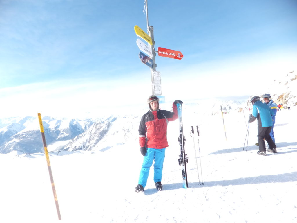
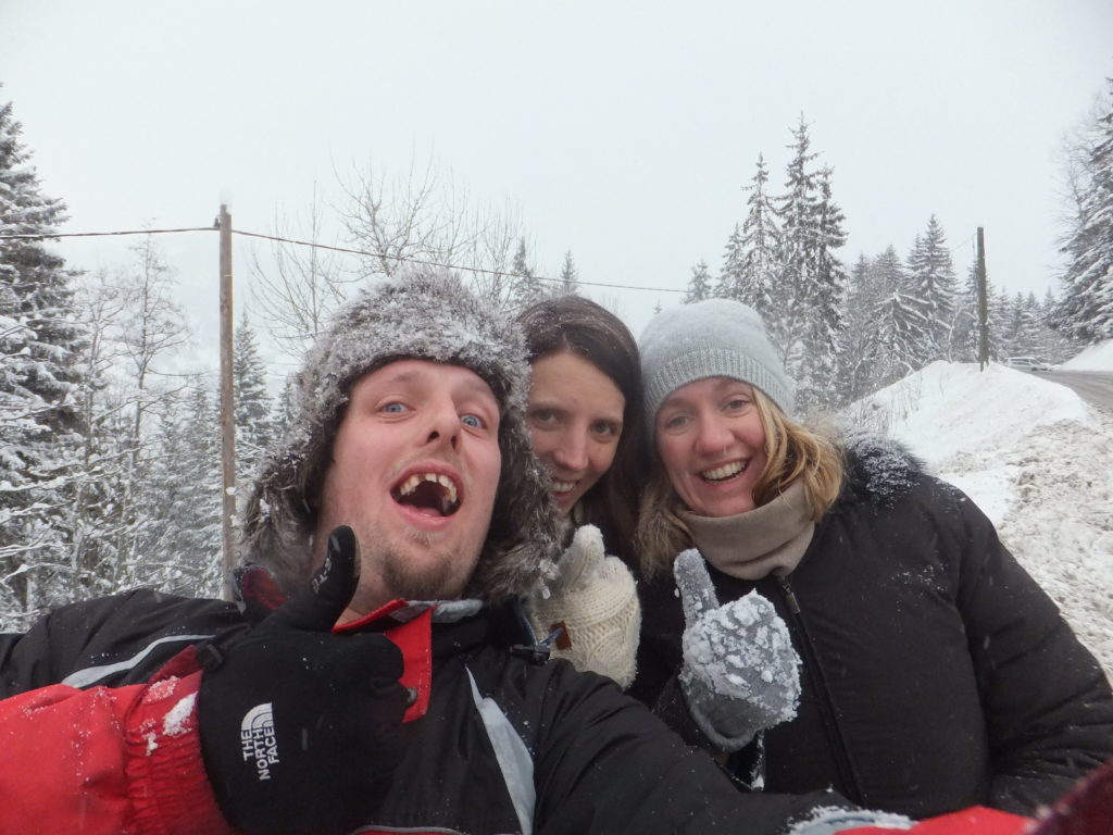
I spent last week in the French Alps with JTA, Ruth, Annabel, and some hangers-on. It was great to get out onto the snow again for some skiing as well as some ski-based geocaching, but perhaps the most remarkable events of the trip happened not on the pistes but on an “afternoon off” that I decided to take after a rather jarring 42km/h (26mph) faceplant earlier in the day.
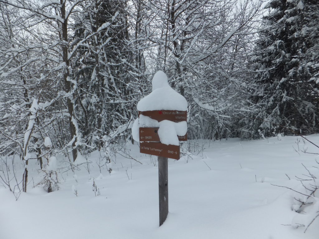
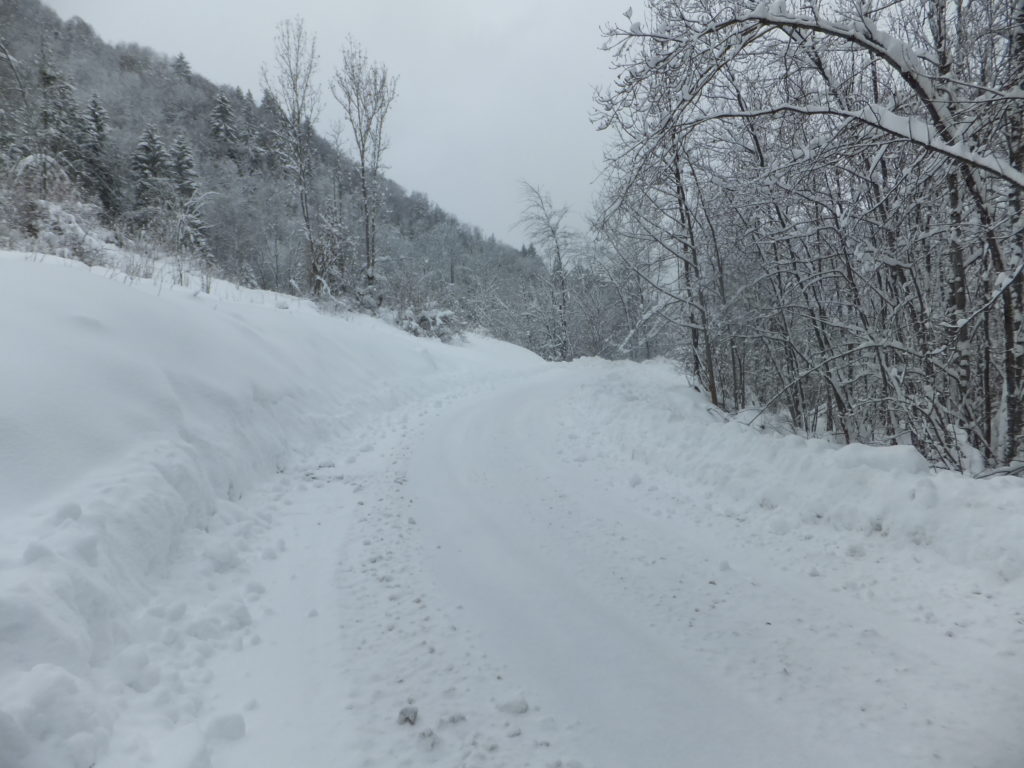
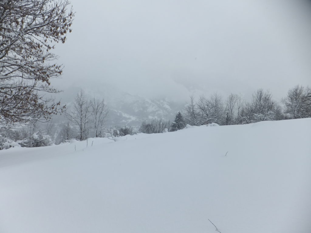
Not to be deprived of the opportunity for some outdoors, though, I decided to spend the afternoon hiking out to villaflou, a geocache only about a kilometre and a half away from our chalet. Well: a kilometre and a half as the crow flies: it was also some distance down the steep-sided Doron de Bozel valley, through a wooded area. But there was, in theory at least, a hiking trail winding its way down the valley. The trail was clearly designed for summer use, but it was a trail nonetheless, so I ate a hearty lunch with Ruth and then set out from La Tania to explore.
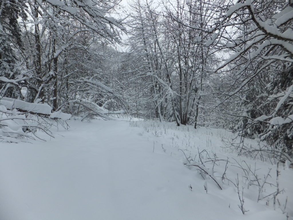
It quickly became apparent that I was underequipped for the journey ahead. With the freshly-fallen soft snow routinely knee-deep and sometimes deeper still, I would have done well to have taken at the very least snow shoes (and, I’d later conclude, perhaps also poles and rope). I was, however, properly dressed with thermal layers, salopettes, multiple pairs of gloves, hat, etc., and – unlike Rory when he got caught out by snow the other year – was at least equipped with two fully-charged GPS devices (and spare batteries), tightly-fitted boots, a first aid kit and emergency supplies. And as the only hiker foolish enough to cut my way through this freshly-fallen snow, my tracks would be easy to follow back, should I need to.
Nonetheless, it’s quite an isolating feeling to be stranded from civilization… even if only by half a kilometre… surrounded by snowy mountains and silent woodland. If you’re approaching the hike in a safe and sane way – and you should be – then it makes you especially careful about even the simplest of obstacles. Crossing a small stream whose bridge is completely concealed beneath the snow becomes a careful operation involving probing the snow and testing the support it provides before even beginning to ford it: a turned ankle could lead to at the very least an incredibly painful hike back!
Needless to say, my caution around snow and mountains has been expanded by not only Rory’s scary experience, linked above, but also of course by my dad’s death almost three years ago, who slipped on snow and fell off a cliff. And he was hiking in Britain!
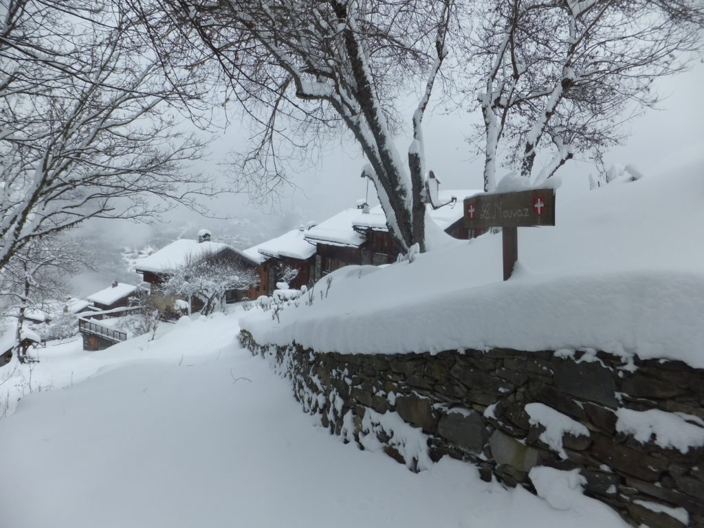
The village of La Nouvaz, half-way as the crow flies between my accommodation and the geocache (and over half-way by my planned route), was beautiful to behold: a sign of civilization after about an hour of hard wading through snow. Even when you’ve used satellites to know your location accurate to a metre, it’s nice to be reassured that your expedition really is panning out as you’d planned.
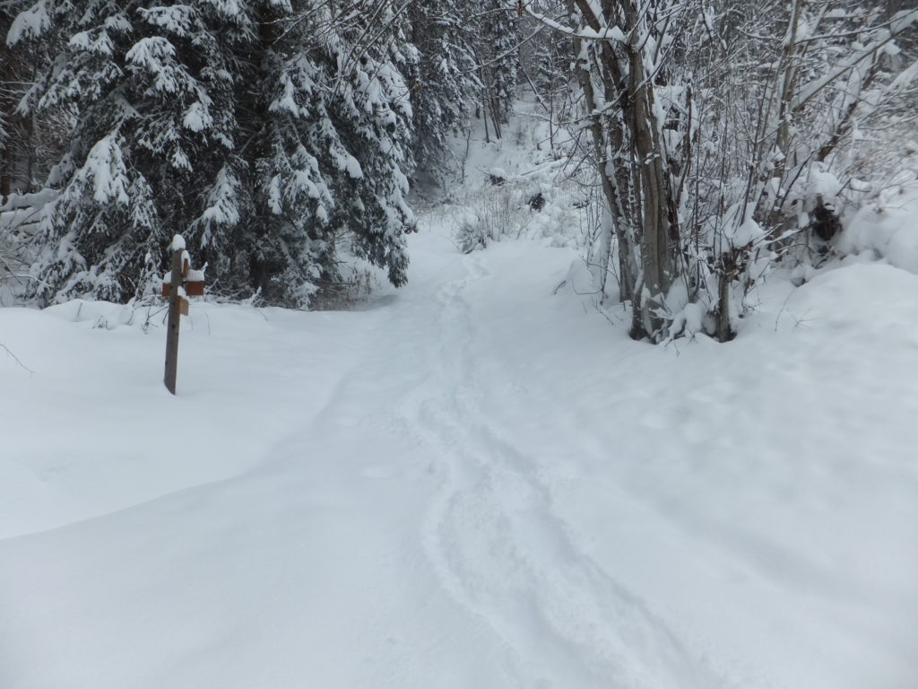
I also now had a metric to translate the journey time estimates that I’d seen on the signs: it was taking me about three times as long as they said, presumably because they’d been written for summer hikers. The segment that had been advertised as 20 minute walk was taking me an hour: that was useful information – I sat with a friendly dog while I recalculated my travel time with this new data. There was a blizzard blowing across the mountaintops (which had been partially-responsible for my faceplant in the morning!) and I’d heard that it was expected to descend into the valley in the early evening, so I wanted to make sure I wasn’t out in the open when that happened! But everything was okay, and I had time to complete my expedition with two hours to spare (which I reasoned could be used hunting for the geocache, as well as a emergency reserve), so I pressed on.
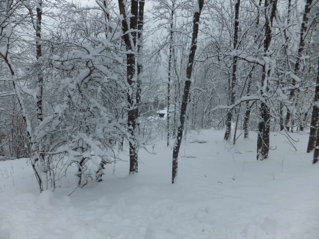
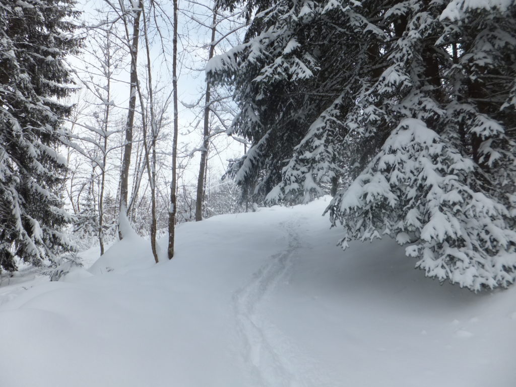
After La Nouvaz, the path became even harder to navigate, and in the thinner tree cover huge drifts formed where underneath there were presumably walls and fences. At one point, I slipped through snow that came up to my waist, and had to dig my way out. At another, I’d deviated from the path and was only able to get back on course by sliding down a snowbank on my bum. And honestly, I can’t think of a more fun way than that to spend a Narnian hiking trip.
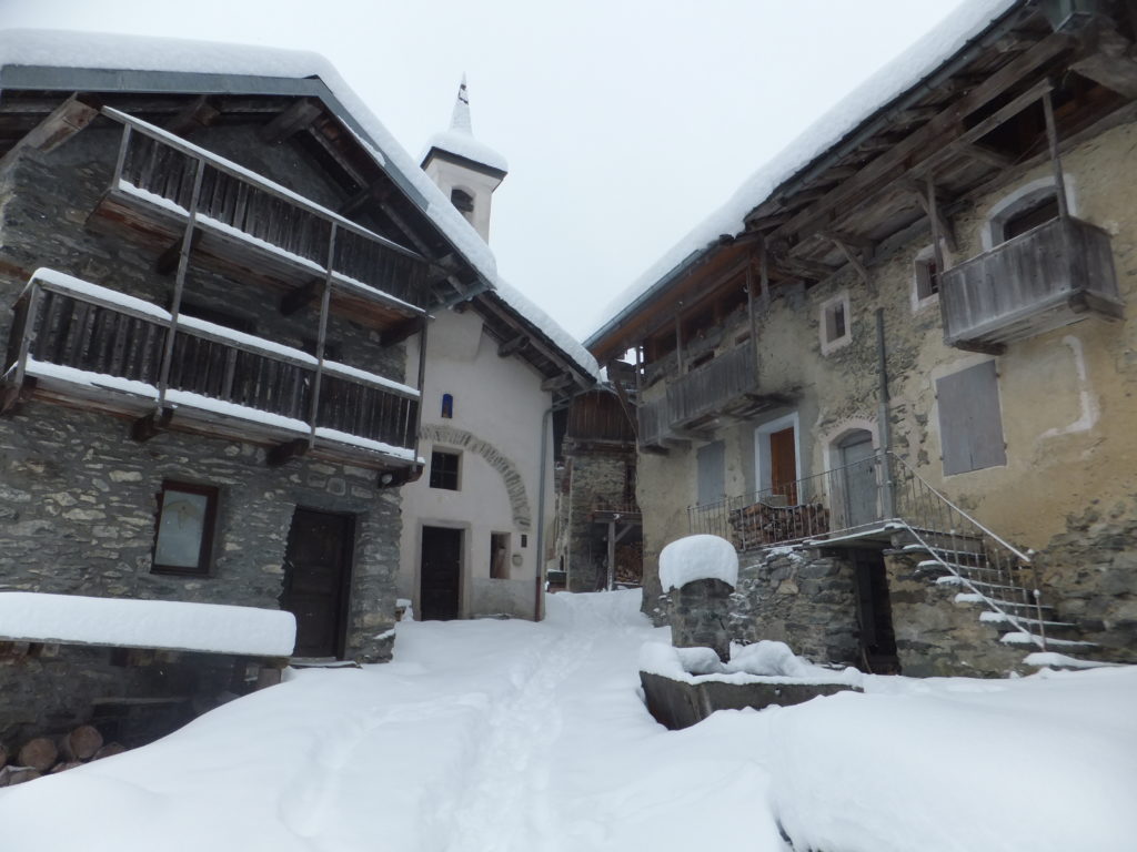
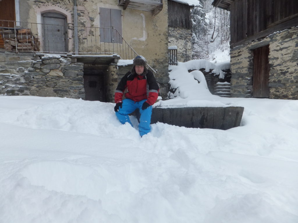
My GPS coordinates took me directly to the pump and trough in the square at Villaflou, and I spent some time (in my thinner pair of gloves) feeling around its metal edges in an effort to find the small magnétique geocache that was allegedly there. But that’s not where it was at all, and honestly, if I hadn’t just spent two hours hiking through deep snow I might now have had the drive to search for as long as I did! As I hunted, I thought back to my GCSE in French and tried to work out how I’d explain what I was doing to anybody who came by, but I never saw another soul. Eventually, my efforts paid off, as I discovered a small metal plate in a cunning hiding place, disguised to make it look like it belonged to the thing it was attached to… and behind it, a log with just four names. And now: mine was fifth!
I texted my revised travel times to Ruth, and then set off back. Following my footsteps made the journey less-arduous, but this was compensated for in equal measure by the fact that I was now heading uphill instead of down.
As I passed through La Nouvaz, I noticed two strange things –
- Firstly: looking back up at the route I’d come down, from La Tania, I saw that there was a signpost that indicated that the recommended route back wasn’t the route that I’d come to begin with. The recommended route was the other way, to the left, and would only take me about 30 minutes (or, based on my recalculation, about an hour and a half).
- And secondly: looking along this proposed new route, I observed that somebody had taken it since I passed this way last. There had been no tracks on that route before, but now there were, and looking up the mountainside I could make out the heads of two hikers bobbing away over a rise.
I followed in the footsteps of the other hikers: it’s a great deal easier to follow than to lead, in deep snow, and I was glad to be able to save the energy. I treated myself to a swig from my hip flask as congratulations on finding the geocache and my good fortune in being able to tail some other hikers heading my way. But my celebration was perhaps premature! About twenty minutes later, I caught up with the two women ahead, and they clearly weren’t doing very well.
They’d come up to La Tania from Paris, accompanied by some friends, for a long weekend. Their friends had gone off skiing, but they hadn’t been able to join them because they were both pregnant (four months and six months), and no doctor on Earth would recommend skiing after the first trimester, so instead they’d decided to go out for a walk. There was a circular walk on a map that they’d seen, which looked like it’d take about an hour, so they’d set out (wearing little more snow protection than wellington boots, and one of them without even a hat), following what looked to be a well-trodden footpath: in fact, it was probably the first part of my outbound journey, from La Tania to La Nouvaz, that they’d followed, “overtaking” me when I left the route to head on to Villaflou and the geocache.
On the ascent back up they’d gotten lost – there are no good waypoints, the path is unclear, and the encroaching blizzard hampering the ability to pick out distance landmarks. They’d wandered – it turned out – several hundred metres off where the path should have gone, and I’d made the mistake of assuming that they knew what they were doing and followed them the same way. Worse yet, this ‘alternative’ path back to La Tania didn’t feature on any of my digital maps, and these two severely-underequipped mothers-to-be were struggling with inadequate grip on the slippy ground beneath the snow. When I first encountered them, one of them had slid into and was trapped in a snowdrift, and the other called me over to help her pull her friend free.
Between them, they had a paper map designed for casual summer use, and they’d realised their predicament. Were I not there, they confessed (once we’d established a dialogue somewhere between their shaky English and my very shaky French), they were about to start trying to find sufficient landmarks that they could summon rescue. Instead, now, they’d put themselves into my care. “We do not want to die,” said the one I later learned was called Vicki, after a few seconds consideration of the translation.
I plotted us a new course, cross-country up an aggressive slope towards the nearest road and thus, I hoped, towards civilization. I lead the way, tamping down the snow ahead as best I could into steps, and bemoaned my lack of a rope. I texted updates to Ruth, advising her of the situation and in each one establishing when I’d next be in contact, and as the women began to tire, prepared for the possibility that I might need to eventually relay coordinates to a rescue team: I practised my French numbers, under my breath, as we weaved our way up the steep mountainside.
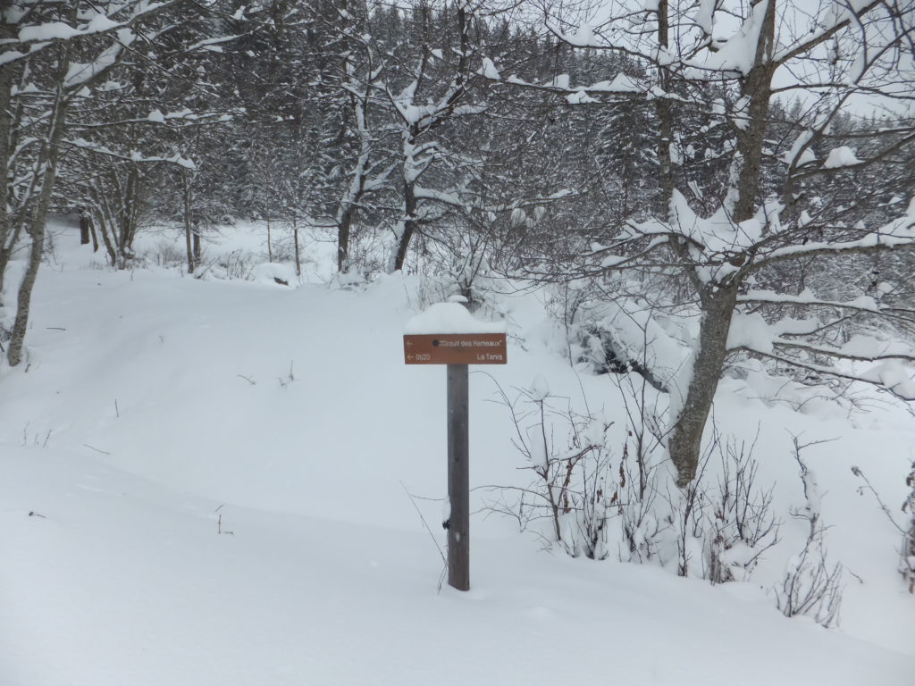
A hundred metres from the road the gradient became worse and we were unable to climb any higher, so we turned towards La Tania and tacked alongside it. There, about an hour and a half after I first met them, we found a signpost that indicated that we were back on the footpath: the footpath that they’d originally hoped to follow but found themselves unable to spot, and which – by following in their footsteps – I too had failed to spot.
Following that, we got back to the road to La Tania and to safety.
I find myself wondering many things. For one: who, at six months pregnant, thinks it’s a wise idea to trek through deep snow, underequipped, from a bad map, over an Alp? But I also wonder what might have happened if I’d have taken the same route back as I’d taken out to my geocache (and thus never bumped into them)? Or even if I’d not have faceplanted earlier in the day and thus decided to take the afternoon off from skiing at all? They weren’t ever far from safety, of course, and while the weather was rapidly becoming hostile to helicopters, they’d have probably been rescued so long as they’d been able to describe their position adequately (and so long as they didn’t keep wandering in the direction they’d been wandering when I met them, which would ultimately have taken them to a sheer cliff), but still…
So yeah: on my holidays, I rescued two lost pregnant hikers from an Alpine blizzard, while returning from a geocaching expedition. I think I win today’s “badass point”.
0 comments