Hurrah! I just made my first successful submission to Curious Cones, a weblog collecting photographs of traffic cones spotted in unusual places.
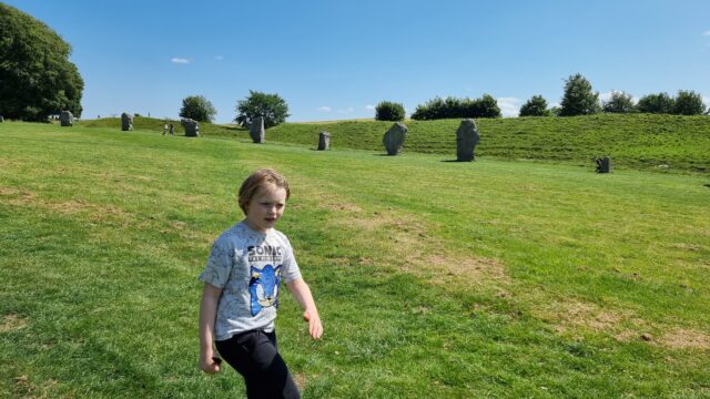
I spotted this cone while the younger child and I took a walk to the next-nearest village to our temporary accommodation, in order to find a geocache, tag some benches for OpenBenches, and have a cafe brunch.
Anyway: if you’re not following Curious Cones, it’s exactly as delightful as you might expect.
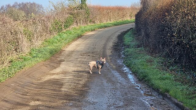
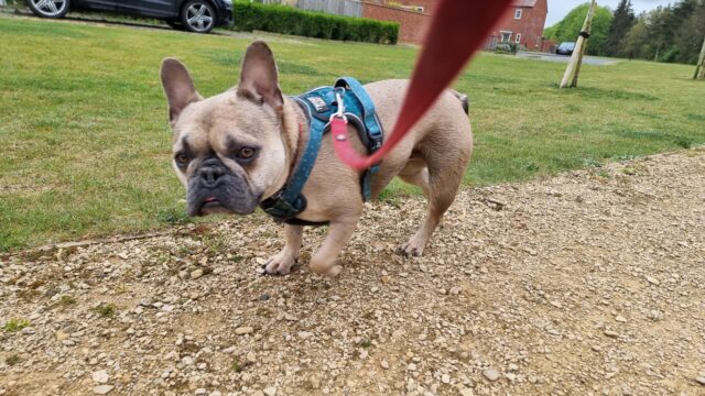
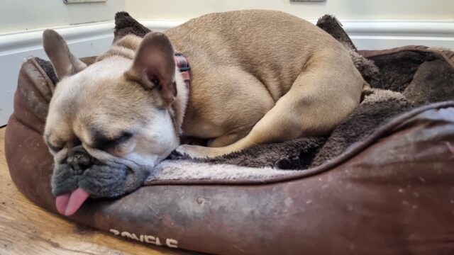
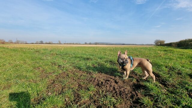
As the UK’s heatwave continues, the dog and I were delighted that this morning was sufficiently overcast that we could manage a proper walk without completely melting.
Her breed copes badly with the heat and we’ve lately had to keep her indoors or in the shade more than she’d like, so a chance to run around among the trees was very welcome!
Saw GCB61ZC “Mossy” appear yesterday, but I’d already had an Easter Sunday beer or two and couldn’t drive out here… in fact, I
realised, I probably wasn’t in a state to cycle out here either and so I resolved that I’d come out the following morning – that is, today – by car and give the dog a walk while finding
GL1E5FYX0 and its year-older sibling GCAR5HV “Ivy”.
But early this morning the dog had been poorly and was still needing to relieve herself with little to no notice, so I didn’t want to risk putting her in the car! Though… I did want to
keep her outdoors! It was time for a change in plan: instead of driving to near the cache then taking a walk… we’d attempt the whole thing on foot, perhaps taking the opportunity to
explore some of the back footpaths that we’d not yet had a chance to try. We’d now missed
our chance for the FTF at “Mossy”, but we could still enjoy a walk (and hopefully give the dog a chance to feel better).
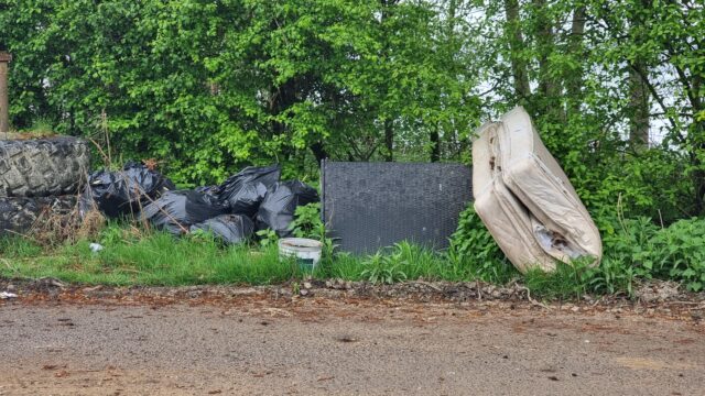
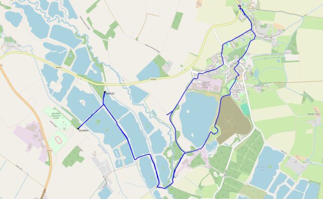
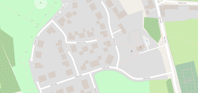
We cut through fields at Sutton, past The Fox and Blackditch Farm, to brush against the side of Lakeside Industrial Estate and head down Dix Pit. After a brief pause to report fly
tipping at 51.745311, -1.412871 (why would anybody fly tip literally just down the road from the recycling centre? it boggles my mind), we decided to duck off the road and take the
parallel public footpath for a bit (OSM Way #204829432, trailhead 51.742330, -1.416563).
To our surprise, the public footpath was fenced off. I thought we might instead be able to take the track to the West and intersect with the nearby bridleway (OSM Way #1129092587) but it was marked as private, so we continued down Dix Pit. How DOES one get to that bridleway, I wondered? Just
out of curiosity we tried to join it via the footpath (OSM Way #1129092588) at 51.737047, -1.412766, but it, too, lacked a
usable gate (and looked severely overgrown!), although the public footpath signs within the mess were still visible. I suspect that this public footpath has been long neglected by the
landowner and is quickly becoming lost to the world.
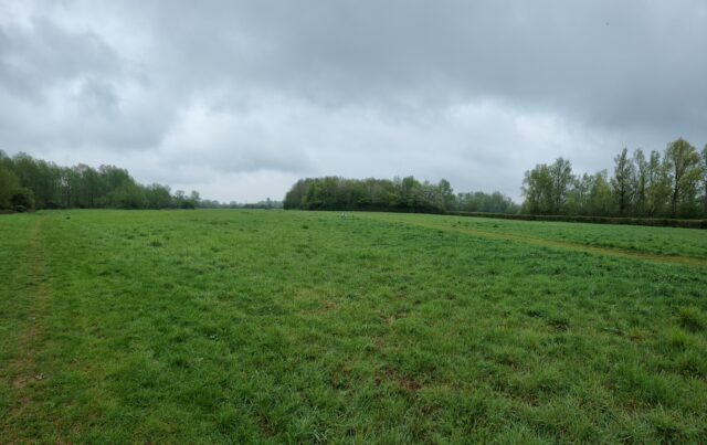
Instead, then, we passed Cutmill Farm and took the footpath through the woods that straddle the boundary line between Stanton Harcourt and Standlake, crossing the Windrush at a bridge
that seemed to serve as the meeting point for a great multitude of dog walkers. My geopup, who’s not always the friendliest with new dogs, enjoyed greeting a few of them while warily
watching the others.
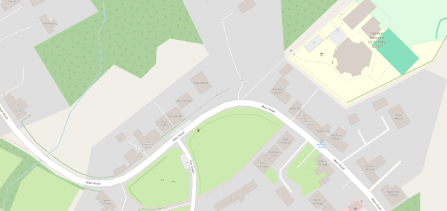
We looped around Oxlease Lake in a clockwise direction, crossed Standlake Brook (the dog was very keen to get a drink of water, and in trying to do so made herself exceptionally muddy),
and began working our way up the long driveway past the swimmers and anglers and sailors assembling and preparing for their bank holiday activities. I recalled that I’d been up this way about a year ago to find GCAQJN1 “Hardwick park 1”: I got the FTF on that, but it proved to be a short-lived
cache, getting retired only three or four months later when park owners cut back the trees that had been its host. But I’d actually been here much earlier, too – over a decade ago –
long before I moved to the local area, to find the much-more long-lived GC1TPFY “Constellations 4”. Strange to hunt for
caches in places that I’ve walked past at least twice before, before those caches were hidden!
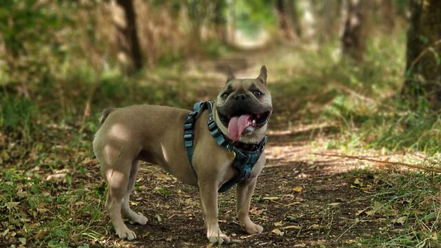
First up was “Mossy” (GCB61ZC). The dog – who was by now feeling herself again and happy to lead the way – struggled with the narrow kissing-gate to get onto the trail (she’s not so
bright and doesn’t understand that she needs to make room for me to join her before I can open the gate) but soon we were on the path. The hiding place leapt out at me and soon the
cache was in hand, the log signed (right behind Mad H@ter, whose Leafield series I was just attempting five days ago), and the cache returned to its hiding spot beneath its excellent
camoflage. I hope the container survives the winter rains!
Second was “Ivy” (GCAR5HV): a brief walk through the holiday park away (via a glance at the watersports centre, which by the looks of things have paddleboards for rent: I first tried
paddleboarding on the sea and figure it might be easier on a lake, so perhaps I’ll find an excuse to come down here and have a go at some point). The host was easy to find, but it took
some searching to put my hand on the container because I started at the “wrong” side. It looks like it’s had (unlogged?) maintenance done since BusyLittleGeo’s visit last week: the
cache was in perfect condition and the logbook was empty.
Now it was time to return home and give this happy (but mucky) dog a bath. We retraced our steps until Dix Pit, but then cut through the Devils’ Quoits and out through Hayfield Green to
return to Stanton Harcourt, and from there picked our way back through the fields at Sutton to return home.
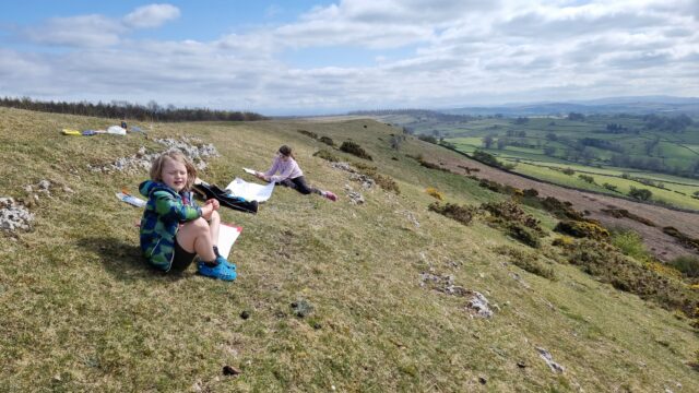
Brought the kids up Knipe Scar with limited and challenging art materials (huge sheets of paper and thick marker pens) for a lesson in drawing what a landscape makes you feel, rather
than focusing on what you can actually see.
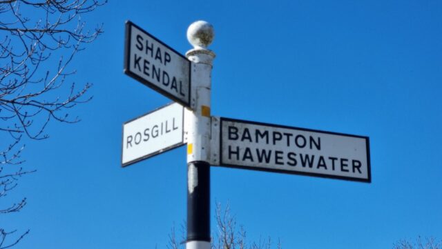
I’m in an extremely rural area and I needed a phone call with my lawyer about my recent redundancy. Phone signal was very bad, so I resolved to
climb a nearby hill and call him back.
“I’m at a crossroads,” I said, when I finally found enough bars to have a conversation with him.
“In your life?” he asked.
“I guess,” I replied, “But also, y’know, literally.”
The phone signal is so shit at this year’s 3Camp venue that I’ve had to climb a hill to take a call from a lawyer (whom I’m speaking to about my recent
redundancy). Nice to be outdoors, though!
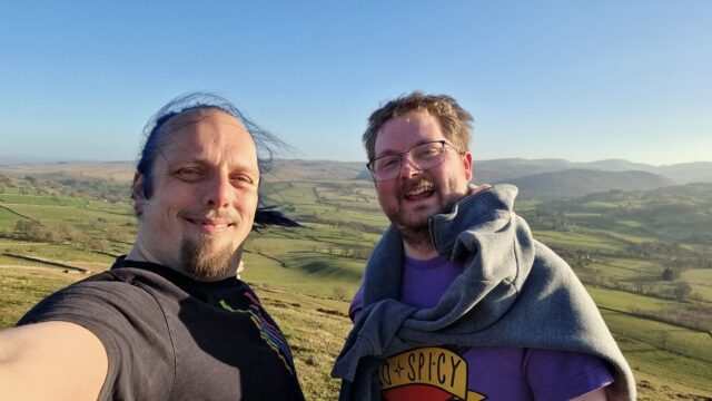
A swift uphill scramble for my friend and fellow volunteer John and I, before dinner. We’re staying in a nearby farmhouse for a week of volunteer work, writing software to help charities. Beautiful view from the summit this evening! SL, TNLN, TFTC!
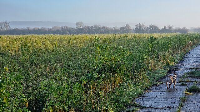
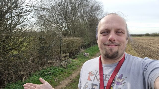
It wasn’t until I made time for myself to get out into the countryside near my home and take the dog for a walk that I realised how much stress I’d been putting myself under during my
team meetup, this week.
Istanbul was enjoyable and fascinating, and I love my team, but I always forget until after the fact how much a few days worth of city crowds can make me feel anxious and trapped.
It’s good to get a mile or two from the nearest other human and decompress!
Especially outside of urban centres, and especially if you’re on foot, OpenStreetMap is way better than Google Maps, Bing Maps,
Apple Maps, or what-have-you.
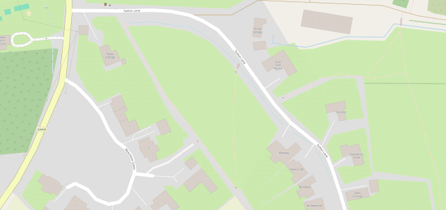
The area at the North end of Sutton Lane, near where I live, is mostly just a huge expanse of nothing in Google Maps, but OpenStreetMap shows footpaths, gates, bridges, house names,
driveways, and land use indicators.
OpenStreetMap is especially good for walkers, with its more-comprehensive coverage of public footpaths as well as the ability to drill-down for accessibility information: whether a path
ends in a gate or a stile matters a lot if you can’t climb the latter (or you’re walking with a small-but-muddy dog who’ll need lifting over).
Sure, you don’t get (as much) street view photography. But how often do you use that, anyway?1
Of course, some of the places near me at which OpenStreetMap especially excels are… because of me! A little amateur cartography can go a long way.
I’ve heard it argued that OpenStreetMap, with its Wikipedia-like “anybody can edit it” model, cannot be relied upon. And sure, if you’re looking for an “official” level of accuracy and
the alternative is an Ordinance Survey map, then that’s what you should go for.
But there’s nothing specific to, say, Google Maps that makes it fundamentally more “accurate” for most2
geographic features than OpenStreetMap. The vast of cartographic data on Google Maps is produced by humans, looking at satellite photos, and then tracing the features on them, probably
with AI assistance. And the vast majority of cartographic data on OpenStreetMap is produced… exactly the same way, although without the AI “helping”.
Google Maps has mistakes, just like every map3. And it’s
got trap streets, like most commercially-produced maps (including the Ordinance Survey). Google Maps’ mistakes tend to be made by somebody on the other side of the world
from the feature, doing a bad job of tracing what they think might be a road… while OpenStreetMaps’ mistakes are for the most part omissions in areas that are under-explored by
local contributors. And there are plenty of areas – like those near where I live, especially if you’re on foot – where the latter mistakes are much less-troublesome.
If you’re looking to make a delivery to my village, where most buildings are named rather than numbered, postcode areas are broad, and it’s not always clear where it’ll be safe to
park… you’d do a lot better to use OpenStreetMap than any other digital map.
I fixed a couple of omissions on OpenStreetMap just earlier today. While I was out walking the dog, earlier, I added the names of two houses whose identities weren’t specifically marked on the map, and I
added detail to the newly-constructed Deansfield estate. Google Maps shows there being only
two houses on Deansfield Estate, among other inaccuracies, even though they’ve got up-to-date aerial and street photography.
Google Maps is fine if you want to drive to Sheffield, you need public transport connections to Plymouth4, or you’re looking for a restaurant nearby and you want
the data about them to be accurate. But next time you’re walking somewhere, or when you’re looking for a specific address… I’d suggest you give OpenStreetMap a go. You
might be pleasantly surprised.
Footnotes
1 I say that as somebody who uses street view and satellite photography a more
than average amount, for geohashing purposes. But I can switch mapping software on-the-fly; nobody’s stopping me looking at “ostrich” photos when I need them.
2 The place that Google Maps really beats OpenStreetMap, in my mind, is in the integration
of its business directory. If you search for a business in Google Maps, you’ll probably find it and get reasonably-accurate opening hours and contact details. But that’s a
factor of two things: the Google My Business directory, and – more importantly – the popularity of the application and the fact that the mobile app “nudges” people to check on the
places around them. By the way: if you want to contribute to making maps better in that way without becoming an unpaid researcher working to line Google’s pockets, StreetComplete is an app that helps fill-out business and related information on OpenStreetMap!
A lunchtime dog walk was made especially delightful by the growing warmth of the approaching British springtime. It’s really bright and pretty out, this afternoon!
On Wednesday, Vodafone
announced that they’d made the first ever satellite video call from a stock mobile phone in an area with no terrestrial signal. They used a mountain in Wales for their experiment.
It reminded me of an experiment of my own, way back in around 1999, which I probably should have made a bigger deal of. I believe that I was the first person to ever send an email from
the top of Yr Wyddfa/Snowdon.
Nowadays, that’s an easy thing to do. You pull your phone out and send it. But back then, I needed to use a Psion 5mx palmtop, communicating over an infared link using a custom driver
(if you ever wondered why I know my AT-commands by heart… well, this isn’t exactly why, but it’s a better story than the truth) to a Nokia 7110 (fortunately it was cloudy enough to not
interfere with the 9,600 baud IrDA connection while I positioned the devices atop the trig point), which engaged a GSM 2G connection, over which I was able to send an email to myself,
cc:’d to a few friends.
It’s not an exciting story. It’s not even much of a claim to fame. But there you have it: I was (probably) the first person to send an email from the summit of Yr Wyddfa. (If you beat
me to it, let me know!)