Skip to content

Dan Q

    • Articles
    • Everything
    • Notes
    • Reposts (shares)
    • Checkins (geo*)
    • Videos
    • Reviews
    • Comics
    • Tags
    • Stats
    • Subscribe
    • Blogroll
  • About
    • Semi-standard "slash pages" you might like to explore:
    • /about
    • /blank
    • /blogroll
    • /colophon
    • /contact
    • /cv
    • /license
    • /postcards
    • /privacy
    • /salary
    • /shh
    • /slashes
    • /stats
    • /subscribe
    • /where
    • Hide posts of type:
    • Choose how Dan's dressed:
    • Hair
    • T-Shirt
  • Contact
  • Podcast

Tag: cartography

  • In preparation for Family D&D Night (and with thanks to my earlier guide to splicing maps together!), I've finally completed an expanded "overworld" map for our game world. So far, the kids have mostly hung around on the North coast of the Central Sea, but they're picked up a hook that may take them all the way across to the other side... and beyond?

    Banana for scale.

    (If your GMing for kids, you probably already know this, but "feelies" go a long way. All the maps. All the scrolls. Maybe even some props. Go all in. They love it.)
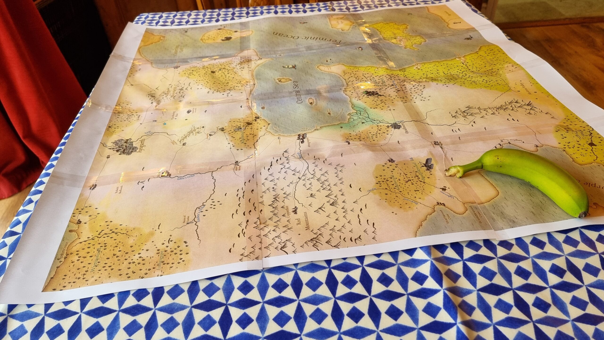
    Full image of On a dining table lies a old-style map comprised of 12 sheets of A4 paper, sellotaped together. The map shows the 'Central Sea', an inlet from the 'Terminic Ocean', around which various settlements, forests, mountain ranges, and swamps can be found. An underripe banana sits in one corner of the map, weighing it down.
    Alt

    On a dining table lies a old-style map comprised of 12 sheets of A4 paper, sellotaped together. The map shows the 'Central Sea', an inlet from the 'Terminic Ocean', around which various settlements, forests, mountain ranges, and swamps can be found. An underripe banana sits in one corner of the map, weighing it down.

    • Note
    • 2 comments
    • posted 18 April, 2025
  • Image representing post: Geohashing expedition 2023-03-10 51 -1

    Geohashing expedition 2023-03-10 51 -1

    The dog needed a walk, so we explored North Leigh Common in the dark and found a hashpoint.

    Read more (301 words)

    • Checkin
    • to 2023-03-10 51 -1
    • posted 10 March, 2023
  • Dan, in the dark and wearing a cycle helmet, holds up a GPS receiver.

    Geohashing expedition 2022-12-05 51 -1

    A cycle in the dark leads to a hashpoint on a bridleway and the opportunity to improve OpenStreetMap.

    Read more (294 words)

    • Checkin
    • to 2022-12-05 51 -1
    • 2 comments
    • posted 5 December, 2022
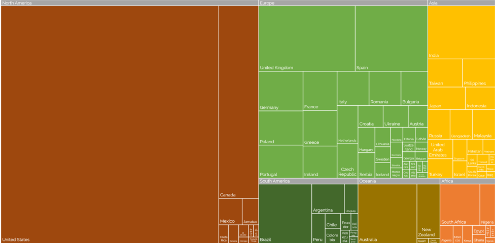
  • Treemap showing countries of Automatticians. North America and specifically the USA dominates, the UK has the most in Europe, etc.

    Automattic International

    Off the back of a colleague's throwaway comment, Dan makes cartograms showing how his coworkers' countries proportionally dominate their world map.

    Read more (470 words)

    • Article
    • 8 comments
    • posted 14 February, 2022
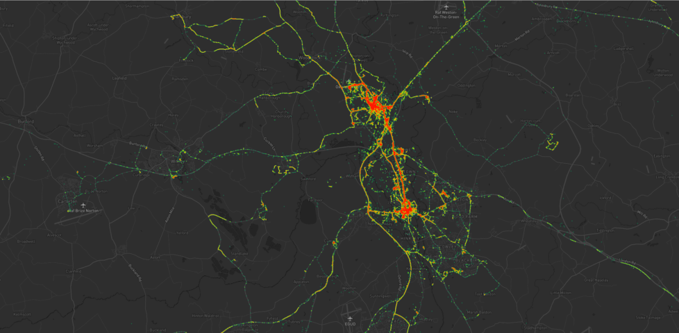
  • Heatmap showing Dan's movements around Kidlington, including a lot of time in the village and in Oxford City Centre, as well as hotspots at the hospital, parks, swimming pools, and places that Dan used to volunteer. Individual expeditions can also be identified.

    Heatmapping my Movements

    Leveraging a decade of past GPS data, Dan draws heatmaps of his movements around Oxfordshire.

    Read more - about 6 minutes (1395 words)

    • Article
    • 4 comments
    • posted 22 August, 2021
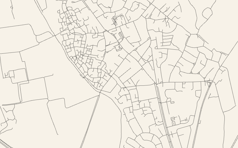
  • Map of Kidlington's roads

    City Roads

    City Roads, by Andrei Kashcha, is an open source project for extracting highway data from OpenStreetMap and rendering it as simplistic SVG files.

    Read more (87 words)

    • Repost
    • posted 31 January, 2020
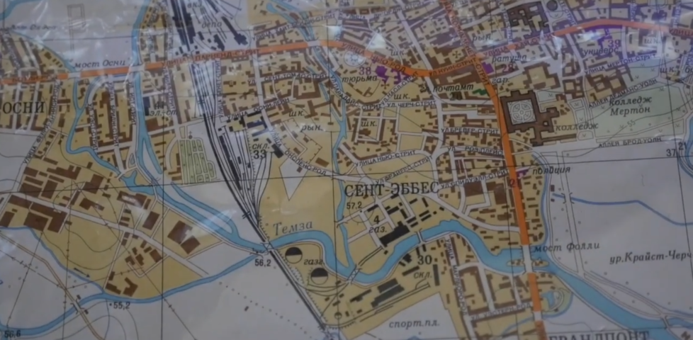
  • Image representing post: Maps that Talk

    Maps that Talk

    Dan's former colleague Nick Millea shows off some artefacts that didn't make it into the Bodleian's Talking Maps exhibition.

    Read more (106 words)

    • Repost
    • posted 27 January, 2020
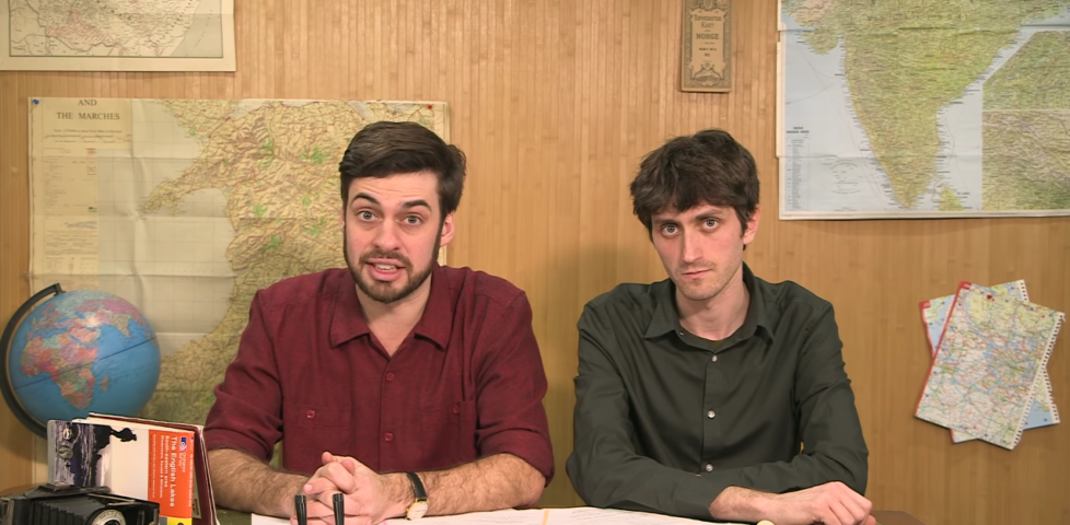
  • Map Men in France

    The family that shrank France

    Another video from the Map Men, this time about the Cassini map of France and its legacy on contemporary cartography, presented in their usual hilarious style.

    Read more (30 words)

    • Repost
    • posted 23 August, 2019
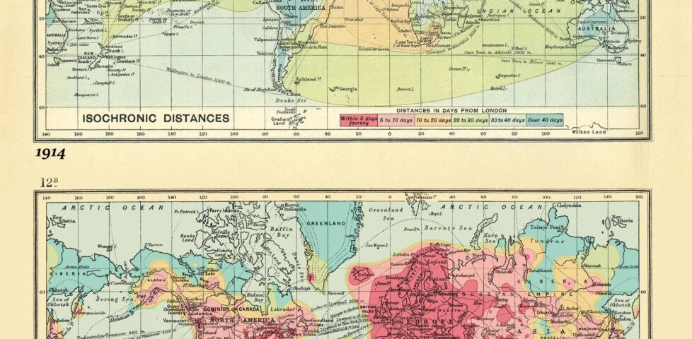
  • Isochronic map of world travel from London in 1914 and 2016.

    A 2016 version of the 1914 Isochronic London/World travel times map


    Imgur

    Read more - about 1 minutes (1 words)

    • Repost
    • 1 comment
    • posted 28 October, 2018
  • Extreme zoom-in on Worcester College Lake, on OpenStreetMap.

    How Much of My Graticule is Covered With Water?

    How much of an advantage do inland geohashers have over island ones? Dan attempts to quantify the answer in the hackiest way he can think of.

    Read more (466 words)

    • Article
    • 2 comments
    • posted 21 August, 2018
  • Maps Showing California as an Island ย– The Public Domain Review

    http://publicdomainreview.org/collections/maps-showing-california-as-an-island/ (publicdomainreview.org) If California were a country its economy would be the fifth largest in the world (just ahead of the UK). Yet the tech boom is not the starkest way California has ever stood apart from its neighbours. That would surely be the maps depicting it as an island, entire of itself. Below we โ€ฆ

    Read more (123 words)

    • Repost
    • posted 22 May, 2018
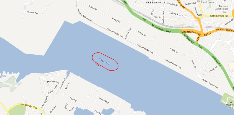
  • "River Test" highlighted on a map

    I found a debugging river that the mods left in by accident!

    Alt"River Test" highlighted on a map

    Read more - about 0 minutes (0 words)

    • Repost
    • posted 1 June, 2013
  • Image representing post: Roadspotters

    Roadspotters

    Dan learns about the way that road numbers are organised around the UK and speculates about the existence of a new kind of nerd, the "roadspotter". And then, a short Internet search later, realises that this unusually hobby actually exists...

    Read more (371 words)

    • Article
    • 1 comment
    • posted 5 February, 2011

Get in Touch

I'd love to hear from you! Why not...

  • email me on blog@danq.me?
    (my spam filter is aggressive, so use a good subject line, i.e. not just "hello"; encrypt your email if you like)
  • say hi on Mastodon, where I'm @dan@danq.me?
  • send a letter or postcard to
    Dan Q, Unit 159610, PO Box 7169, Poole, BH15 9EL, UK
  • reach out some other way?
  • ยฉ Dan Q 1998-2026
  • Creative CommonsAttributionNon-Commercial except where stated (how to use)
  • powered by BloqClassicPressHTML5CSS3
  • privacy
  • Read articles, checkins, notes, reposts, and more...
  • @dan@danq.me
  • contact
  • subscribe
  • Dan Q
  • Creative Commons Attribution Non-Commercial license
  • ClassicPress
  • CSS is awesome
  • Created by a human, not by AI
  • LGBTQ+ pride flag (2018 progress variant)
  • Polyamory flag
  • Say no to Web3
  • Mastodon (it's like email... no, come back!)
  • Tested on Firefox
  • Best viewed on the Internet
  • PHP
  • Ruby
  • Debian
  • Caddy (webserver)
  • Find me on Melonland
  • Check out my GitHub
  • Three Rings - by volunteers, for volunteers, since 2002
  • I'm a fucking webmaster
  • Looks best at: any resolution!