As I worked my way to this, the third cache in my tour for today, I realised that my local sparrowhawk – who lives up a tree behind my house in Sutton – seemed to be following me. I’d
seen him atop a couple of telegraph poles earlier on and I’d heard him screech a few times, and when I looked up I saw that he was still above me. Perhaps he’d decided to come on this
expedition too?
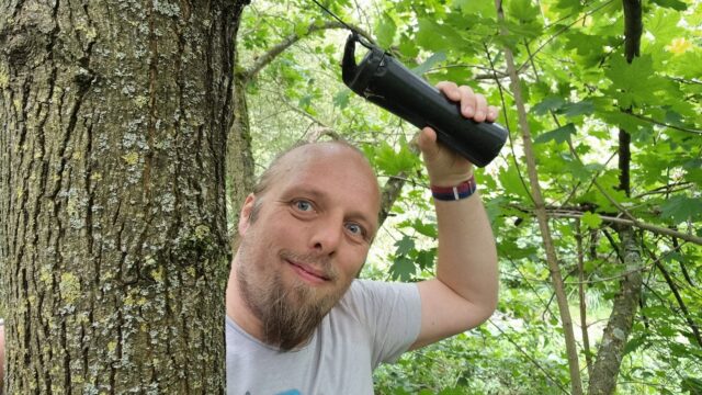
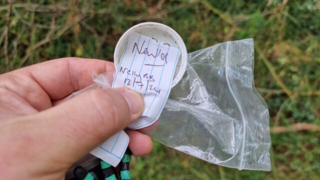
One of the things that I love most about this series is the diversity of quirky and unusual cache containers, of which this was no exception. I was also pleased to find a fresh, clean
log sheet, and added my name as the first on the list. TFTC, and FP for the
surprise!
Deer were prancing around the fields as I came through, and I realised that the hiding place for this cache must be near a place I’d thought about once as a possible hiding place
myself, when I first moved to the area and took a walk this way (before I’d looked at the local caches!). While retrieving the cache a dog walker came the other way and, seeing a
cyclist on a not-entirely-cycle-friendly path, probing around looking for something, asked about my activity. He’d never heard of geocaching, but he’d heard of hide-and-seek and he’d
heard of orienteering, and seemed happy enough to accept that it was some combination of these two.
Came out for a cycle tour today to complete the loop: I covered the first half – with the exception of a DNF at #9 – last month, and I was itching to get out and complete the second half. (Having gotten home
after this second expedition I see that #9 has been repaired/improved, so I’ll fly by and give that another go sometime soon!)
I was glad to have brought my bike lights: even though it’s a while until sunset it was helpful to find my way in the wooded area that surrounds this cache. Great hiding place for this
one: the only cache I’ve come across of a remotely similar design was my own GC7R0HB (which sadly got muggled one too many times and had to be archived a few years ago).
“I like travelling by public transport and by bus; I think it’s a great way to see the country,” Mr Kibble explains.
..
Mr Kibble figured the furthest he could get in one day would be Morecambe in Lancashire – some 260 miles from Charing Cross, the geographical centre of London.
…
I’m sure that many of you, like me, really enjoyed The Political Travelling Animal‘s Twitter adventure up the country, last week. If you missed it (and you should really go read it if you did): Jo decided to see how far he could get from London within 24 hours via local bus routes only,
and live-tweeted the entire experience for the world to enjoy too. Perhaps unsurprisingly, I particularly enjoyed that fact that he gave a nod to Preston’s unusual and iconic bus
station.
Reading it, though, I found myself reminded of a time, long ago, that I planned (although never took) a similar journey. In 1999 I moved
away from my family in Preston to Aberystwyth to go to university.
Before he became a bus my father was a bus industry professional and at a rest stop during the journey to Aberystwyth as he dropped me off,
he and I perused the (paper) timetables to explore a hypothesis that the pair of us had come up with.
Our question: Is it possible to travel from Aberystwyth to Preston, in a single day, using local bus routes only?
After much consideration, we determined that yes, it was possible, but better than that: it was possible to do so (at the time) entirely on Arriva buses. This presented an
unexploited opportunity: for the price of an “all day” Arriva ticket (£2.20, IIRC), an enterprising and poor student could, in
a pinch, find their way back from Aberystwyth to Preston over the course of about 16 hours for only a fraction more than the price of a pint of beer.
This was utterly academic: in the years that followed, I would almost invariably leave Aberystwyth by train. Sometimes I’d do this to go
to London: a route for which, I discovered, I could catch the 6am train, hide aboard it as it was vacated at its Birmingham New Street terminus and take a nap, safe in the knowledge
that the same rolling stock would subsequently become a train to London Euston! Other times I’d return to Preston; a journey for which not even floods could stop me.
But regardless, for my first full term at university I kept on the corner of the desk in my study room the sum of £2.20, as an “insurance policy”. No matter what happened in this new
phase of my life, that small pile of coins could, at a stretch, get me back “home”.
By Christmas 1999 I’d re-purposed the coins to do my laundry (the washing machines in the halls’ laundrette took pound coins and the dryers 20p pieces, so this was a far more-valuable
use of spare change in those denominations). By this point I’d settled in and had become confident that Aberystwyth was likely to be my home almost year-around, and indeed I’d go on to
live there another decade before saying goodbye for Oxfordshire.
But we answered the question, at least in theory: a hypothetical but symbolic question about the versatility and utility of an interconnected network of local bus routes. And that’s
just great.
As I mentioned last year, for several years I’ve collected pretty complete historic location data from GPSr devices I carry with me everywhere, which I collate in a personal μlogger server.
Going back further, I’ve got somewhat-spotty data going back a decade, thanks mostly to the fact that I didn’t get around to opting-out of Google’s location tracking until only a few years ago (this data is now
also housed in μlogger). More-recently, I now also get tracklogs from my smartwatch, so I’m managing to collate more personal
location data than ever before.
The blob around my house, plus some of the most common routes I take to e.g. walk or cycle the children to school.
A handful of my favourite local walking and cycling routes, some of which stand out very well: e.g. the “loop” just below the big blob represents a walk around the lake at Dix Pit;
the blob on its right is the Devils Quoits, a stone circle and henge that I thought were sufficiently interesting that
I made a virtual geocache out of them.
The most common highways I spend time on: two roads into Witney, the road into and around Eynsham, and routes to places in Woodstock and North Oxford where the kids have often had
classes/activities.
I’ve unsurprisingly spent very little time in Oxford City Centre, but when I have it’s most often been at the Westgate Shopping Centre,
on the roof of which is one of the kids’ favourite restaurants (and which we’ve been able to go to again as Covid restrictions have lifted, not least thanks to their outdoor seating!).
One to eight years ago
Let’s go back to the 7 years prior, when I lived in Kidlington. This paints a different picture:
This heatmap highlights some of the ways in which my life was quite different. For example:
Most of my time was spent in my village, but it was a lot larger than the hamlet I live in now and this shows in the size of my local “blob”. It’s also possible to pick out common
destinations like the kids’ nursery and (later) school, the parks, and the routes to e.g. ballet classes, music classes, and other kid-focussed hotspots.
I worked at the Bodleian from early 2011 until late in 2019, and so I spent a lot of time in
Oxford City Centre and cycling up and down the roads connecting my home to my workplace: Banbury Road glows the brightest, but I spent some time on Woodstock Road too.
For some of this period I still volunteered with Samaritans in Oxford, and their branch – among other volunteering hotspots
– show up among my movements. Even without zooming in it’s also possible to make out individual venues I visited: pubs, a cinema, woodland and riverside walks, swimming pools etc.
Less-happily, it’s also obvious from the map that I spent a significant amount of time at the John Radcliffe Hospital, an unpleasant reminder of some challenging times from that
chapter of our lives.
The data’s visibly “spottier” here, mostly because I built the heatmap only out of the spatial data over the time period, and not over the full tracklogs (i.e. the map it doesn’t
concern itself with the movement between two sampled points, even where that movement is very-guessable), and some of the data comes from less-frequently-sampled sources like Google.
Eight to ten years ago
Let’s go back further:
Before 2011, and before we bought our first house, I spent a couple of years living in Kennington, to the South of Oxford. Looking at
this heatmap, you’ll see:
I travelled a lot less. At the time, I didn’t have easy access to a car and – not having started my counselling qualification yet – I
didn’t even rent one to drive around very often. You can see my commute up the cyclepath through Hinksey into the City Centre, and you can even make out the outline of Oxford’s Covered
Market (where I’d often take my lunch) and a building in Osney Mead where I’d often deliver training courses.
Sometimes I’d commute along Abingdon Road, for a change; it’s a thinner line.
My volunteering at Samaritans stands out more-clearly, as do specific venues inside Oxford: bars, theatres, and cinemas – it’s the kind of heatmap that screams “this person doesn’t
have kids; they can do whatever they like!”
Every map tells a story
I really love maps, and I love the fact that these heatmaps are capable of painting a picture of me and what my life was like in each of these three distinct chapters of my life over
the last decade. I also really love that I’m able to collect and use all of the personal data that makes this possible, because it’s also proven useful in answering questions like “How
many times did I visit Preston in 2012?”, “Where was this photo taken?”, or “What was the name of that place we had lunch when we got lost during our holiday in Devon?”.
There’s so much value in personal geodata (that’s why unscrupulous companies will try so hard to steal it from you!), but sometimes all you want to do is use it to draw pretty heatmaps.
And that’s cool, too.
How these maps were generated
I have a μlogger instance with the relevant positional data in. I’ve automated my process, but the essence of it if you’d like to try it yourself is as follows:
First, write some SQL to extract all of the position data you need. I round off the latitude and longitude to 5 decimal places to help “cluster” dots for frequency-summing, and I raise
the frequency to the power of 3 to help make a clear gradient in my heatmap by making hotspots exponentially-brighter the more popular they are:
This data needs converting to JSON. I was using Ruby’s mysql2 gem to
fetch the data, so I only needed a .to_json call to do the conversion – like this:
db =Mysql2::Client.new(host: ENV['DB_HOST'], username: ENV['DB_USERNAME'], password: ENV['DB_PASSWORD'], database: ENV['DB_DATABASE'])
db.query(sql).to_a.to_json
Approximately following this guide and leveraging my Mapbox
subscription for the base map, I then just needed to include leaflet.js, heatmap.js, and leaflet-heatmap.js before writing some JavaScript code
like this:
body.innerHTML ='<div id="map"></div>';
let map = L.map('map').setView([51.76, -1.40], 10);
// add the base layer to the map
L.tileLayer('https://api.mapbox.com/styles/v1/{id}/tiles/{z}/{x}/{y}?access_token={accessToken}', {
maxZoom:18,
id:'itsdanq/ckslkmiid8q7j17ocziio7t46', // this is the style I defined for my map, using Mapbox
tileSize:512,
zoomOffset:-1,
accessToken:'...'// put your access token here if you need one!
}).addTo(map);
// fetch the heatmap JSON and render the heatmap
fetch('heat.json').then(r=>r.json()).then(json=>{
let heatmapLayer =new HeatmapOverlay({
"radius":parseFloat(document.querySelector('#radius').value),
"scaleRadius":true,
"useLocalExtrema":true,
});
heatmapLayer.setData({ data: json });
heatmapLayer.addTo(map);
});
Visited to check on this new cache: especially as the container is a new design I wanted to do an early checkin to ensure it’s bedded in nicely. Glad to say all is well! Also dropped
off Paul The Sea Horse, a Travel Bug I found up in Derbyshire who’s still got a
couple of years exploring left in him before he completes his ten year mission! Please help him move along if you can.
Dropped by to check in on this new cache (always worth checking that a new cache is settling in alright!) and to dip a TB. All is well. Also discovered that
through the kissing gate on the opposite side of the road there’s a crop of the plumpest and brightest sloes I’ve seen in years. So if you’re in the vicinity and fancy a lip-curling
snack (or you’ve plans to adulterate some gin!) take a look!
If I get out early, before I start work, I (Dan Q) might be able to make it to the hashpoint by bike before
about 9am. Most of the fields round here have already been harvested and so nobody’s likely to object if I step into this one for a couple of minutes (it looks like there’s a promising
looking gate at N 51°43.2′, W 1°29.722′).
Expedition
I was out and about anwyay, dropping my kids off at rehearsals for a play they’re in later this week, so I figured it’d do no harm to swing by Cote – the settlement nearest the hashpoint – this morning. Cote turns out to be a delightful and quaint little
hamlet, and when I passed through everybody and their dog seemed to be out on a morning constitutional and I got a few odd looks from the locals who are, on account of their hamlet’s
location, probably unused to “through” traffic and so may well have been wondering who exactly I was visiting!
Round here most of the farms grow wheat, and it’s harvest season. I had to pull aside on one of the narrow roads that criss-cross this part of Oxfordshire to allow a combine harvester –
fully the width of the entire road! – to pass in the opposite direction. It was followed closely by a line of impatient drivers crawling along behind the enormous mechanical beast, and
I was glad to be going the other way! When I first saw that the hashpoint appeared to be in a field I was optimistic that it might be one that had been recently harvested, like all the
ones near my house, or else left fallow, and I’d be able to get close to the hashpoint without causing any disruption.
Unfortunately, the field with the hashpoint was very-much still growing, full of corn for harvesting later in the season, so my expedition ended abruptly at the gate. I took a sad-face
photo and attached a “The Internet Was Here” sign to the gate, for good measure (and perhaps as an explanation to the locals who looked at me curiously as I passed!), then continued my
journey home.
For GC9EXXX Church Micro 14129…Sutton, a geocache I recently set up, I wanted to use a “pole topper”
style cache. I’ve always felt slightly let down by finding yet another magnetic nano stuck inside a pipe, so I wanted to do something better. You can watch the video here or on YouTube, or scroll down for written instructions.
Sand down the lid and the inside of the pole topper so the glue adheres to it better.
Mix up your 2-part epoxy in the pole topper. Don’t use too much or it’ll overflow and block the lid from closing.
Put the lid into the pole topper and press down firmly and evenly to squeeze out any air bubbles.
While you’re waiting for the epoxy to set, file off the flange around the edge of the tub. It’s there to catch drips but
you’re not going to be storing food anyway! The lid is easier to take on and off with the flange filed away.
Finally, roughen the bottom edge of the tub with some sandpaper to make it easier to grip when opening and closing the
container.
Music:
For Lorilyn by Casey LaLonde, used under a CC-NC Creative Commons License.
We’ve missed out on or delayed a number of trips and holidays over the last year and a half for, you know, pandemic-related reasons. So this summer, in addition to our trip to Lichfield, we arranged a series of back-to-back expeditions.
1. Alton Towers
The first leg of our holiday saw us spend a long weekend at Alton Towers, staying over at one of their themed hotels in between days at the water park and theme park:
2. Darwin Forest
The second leg of our holiday took us to a log cabin in the Darwin Forest Country Park for a week:
3. Preston
Kicking off the second week of our holiday, we crossed the Pennines to Preston to hang out with my family (with the exception of JTA,
who had work to do back in Oxfordshire that he needed to return to):
4. Forest of Bowland
Ruth and I then left the kids with my mother and sisters for a few days to take an “anniversary mini-break” of glamping in the gorgeous Forest of Bowland:
The children, back in Preston, were apparently having a whale of a time:
6. Suddenly, A Ping
The plan from this point was simple: Ruth and I would return to Preston for a few days, hang out with my family some more, and eventually make a leisurely return to Oxfordshire. But it
wasn’t to be…
I got a “ping”. What that means is that my phone was in close proximity to somebody else’s phone on 29 August and that other person subsequently tested positive for COVID-19.
My risk from this contact is exceptionally low. There’s only one place that my phone was in close proximity to the phone of anybody else outside of my immediate family, that
day, and it’s when I left it in a locker at the swimming pool near our cabin in the Darwin Forest. Also, of course, I’d been double-jabbed for a month and a half and I’m more-cautious
than most about contact, distance, mask usage etc. But my family are, for their own (good) reasons, more-cautious still, so self-isolating at Preston didn’t look like a possibility for
us.
As soon as I got the notification we redirected to the nearest testing facility and both got swabs done. 8 days after possible exposure we ought to have a detectable viral
load, if we’ve been infected. But, of course, the tests take a day or so to process, so we still needed to do a socially-distanced pickup of the kids and all their stuff from Preston
and turn tail for Oxfordshire immediately, cutting our trip short.
The results would turn up negative, and subsequent tests would confirm that the “ping” was a false positive. And in an ironic twist, heading straight home actually put us
closer to an actual COVID case as Ruth’s brother Owen turned out to have contracted the bug at almost exactly the same time and had, while we’d been travelling down
the motorway, been working on isolating himself in an annex of the “North wing” of our house for the duration of his quarantine.
7. Ruth & JTA go to Berwick
Thanks to negative tests and quick action in quarantining Owen, Ruth and JTA were still able to undertake the next part of this three-week holiday period and take
their anniversary break (which technically should be later in the year, but who knows what the situation will be by then?) to Berwick-upon-Tweed. That’s their story to tell, if
they want to, but the kids and I had fun in their absence:
8. Reunited again
Finally, Ruth and JTA returned from their mini-break and we got to do a few things together as a family again before our extended holiday drew to a close:
9. Back to work?
Tomorrow I’m back at work, and after 23 days “off” I’m honestly not sure I remember what I do for a living any more. Something to do with the Internet, right? Maybe ecommerce?
I’m sure it’ll all come right back to me, at least by the time I’ve read through all the messages and notifications that doubtless await me (I’ve been especially good at the discipline,
this break, of not looking at work notifications while I’ve been on holiday; I’m pretty proud of myself.)
But looking back, it’s been a hell of a three weeks. After a year and a half of being pretty-well confined to one place, doing a “grand tour” of so many destinations as a family and
getting to do so many new and exciting things has made the break feel even longer than it was. It seems like it must have been months since I last had a Zoom meeting with a
work colleague!
For now, though, it’s time to try to get the old brain back into work mode and get back to making the Web a better place!
When I first placed this cache I failed to accommodate for how high the river might get during summer floods. I’d chained it to the bridge to help stop it from disappearing, but that
instead introduced a new problem: after a flood it’d be left hanging in a highly-visible spot and attract muggle vandalism. The net result is I’ve had to retire this cache.
Visited to check on this container and can confirm that it’s completely seized and unopenable. The end cap that used to provide it with cover (and a hiding place for a pencil) is gone,
too, and this (combined with the fact that I no longer live around the corner) feels like a sign that this one needs archiving.
Following a run of DNFs I drove over here to check on this cache but it is indeed missing. As this location is no longer in walking
distance of my home I’m retiring it to free up what is a pretty convenient hook for some other cacher!