
I nerdsniped myself today when, during a discussion on the potential location of a taekwondo tournament organised by our local martial arts school, somebody claimed that Scotland would be "nearer" than Ireland.
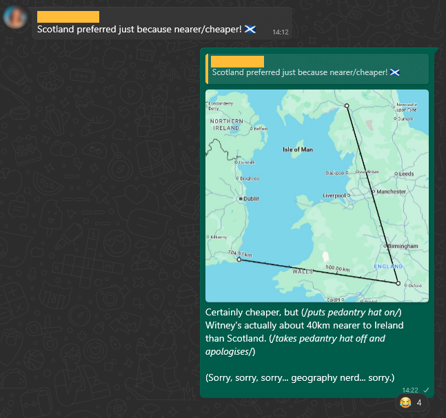
Alt
WhatsApp conversation. Somebody says "Scotland preferred just because nearer/cheaper!", to which Dan replies, with a map showing rulers connecting Witney to the nearest relevant borders, "Certainly cheaper, but (/puts pedantry hat on/) Witney's actually about 40km nearer to Ireland than Scotland. (/takes pedantry hat off and apologises/) (Sorry, sorry, sorry... geography nerd... sorry.)"
But the question got me thinking:
Could I plot a line across Great Britain, showing which parts are closer to Scotland and which parts are closer to Ireland?
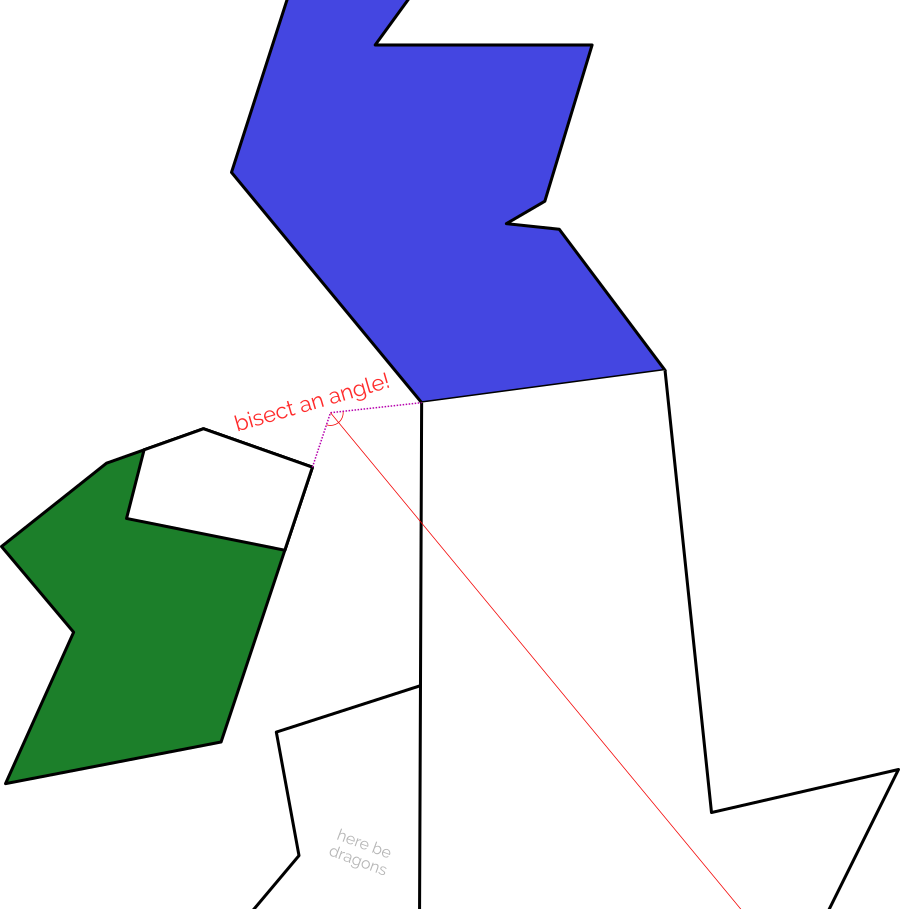
If the England-facing Irish and Scottish borders were completely straight, one could simply extend the borders until they meet, bisect the angle, and we'd be done.
Alt
Extremely simplified hand-drawn map of the British Isles, with the (artificially-straight) borders of Scotland and Ireland extended to meet and then their angle bisected to produce a line that splits England by proximity to each country.
In reality, the border between England and Scotland is a winding mess, shaped by 700 years of wars and treaties1. Treating the borders as straight lines is hopelessly naive.
What I'm really looking for... is a Voronoi partition...

Alt
Animation showing colours gradually expanding from points on a plane, carving out borders along their edges.
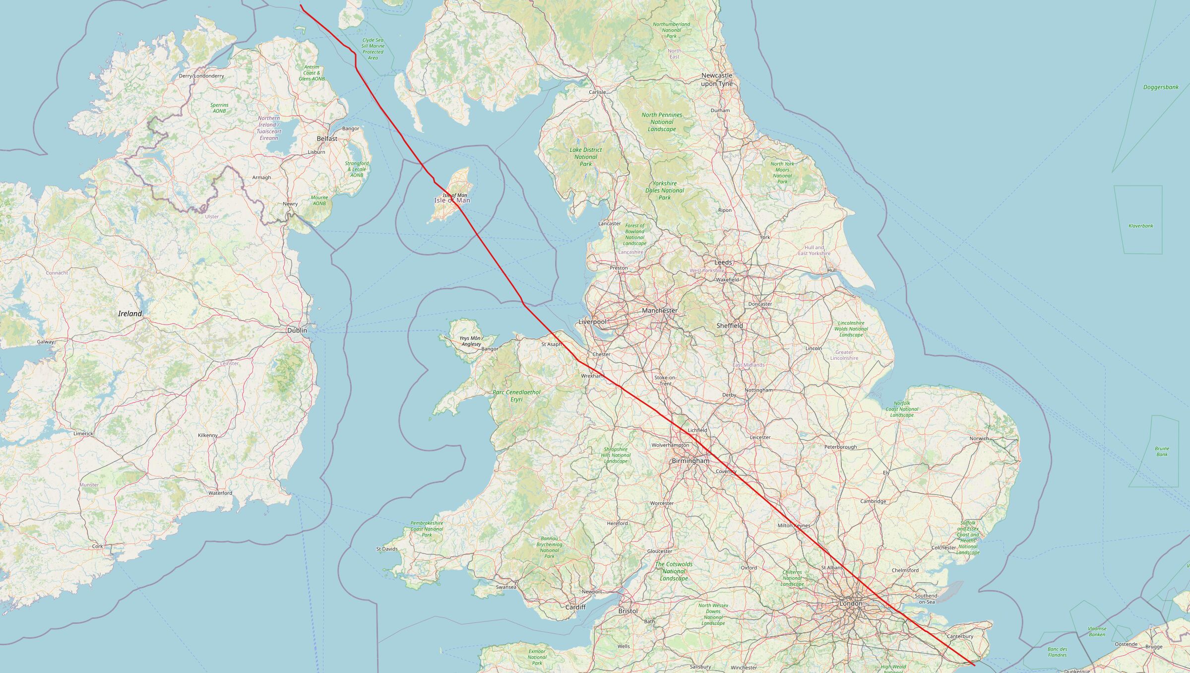
My Python skills are pretty shit, but it's the best tool for the job for geohacking2. And so, through a combination of hacking, tweaking, and crying, I was able to throw together a script that produces a wonderful slightly-wiggly line up the country.
Alt
A line cuts from North-West to South-East through England and Wales.
Once you've bisected England in this way - into parts that are "closer to Ireland" versus parts that are "closer to Scotland", you start to spot all kinds of interesting things3.
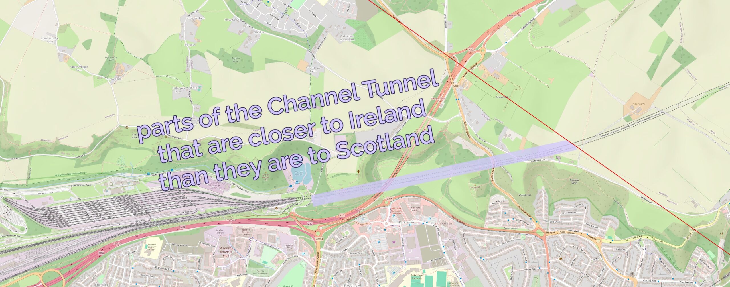
Like: did you know that the entire subterranean part of the Channel Tunnel is closer to Scotland than it is to Ireland... except for the ~2km closest to the UK exit.
Alt
Map showing the Le Shuttle terminal and the entrance to the Channel Tunnel, marked up to show how the first 2km of the underground part (only) are closer to Ireland than to Scotland.
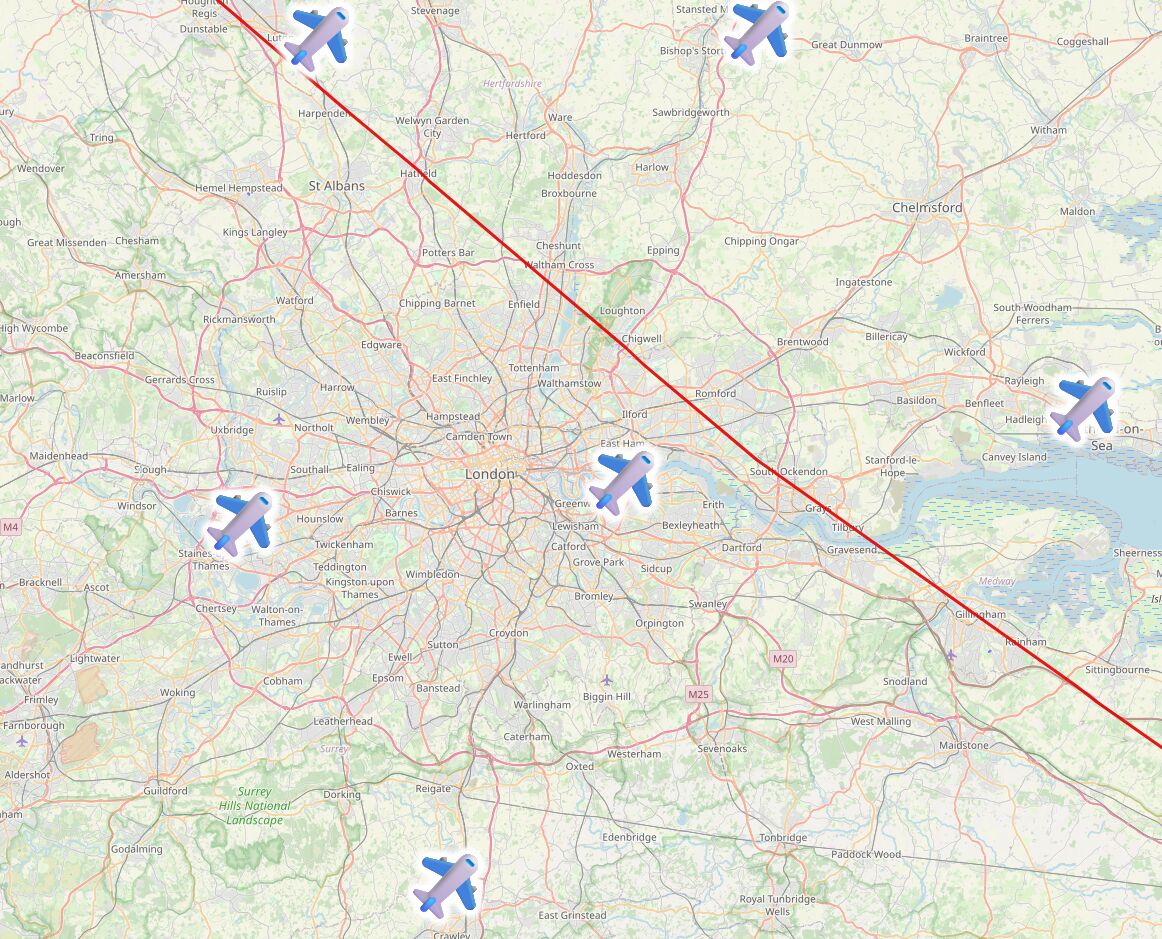
A little further North: London's six international airports are split evenly across the line, with Luton, Stansted and Southend closer to Scotland... and City, Heathrow and Gatwick closer to Ireland.
Alt
Map showing the locations of London's six major airports: three North-East of the line, three South-West of it.
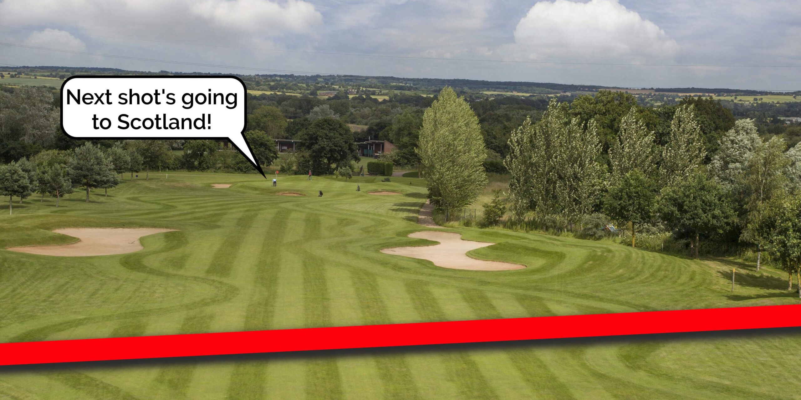
The line then pretty-much bisects Milton Keynes, leaving half its population closer to Scotland and half closer to Ireland, before doing the same to Daventry, before - near Sutton Coldfield - it drives right through the middle of the ninth hole of the golf course at the Lea Marston Hotel.
Players tee off closer to Ireland and - unless they really slice it - their ball lands closer to Scotland:
Alt
Aerial photograph of a golf course with a red line superimposed across it. Near the green, a speech bubble has a golfer saying "Next shot's going to Scotland!"
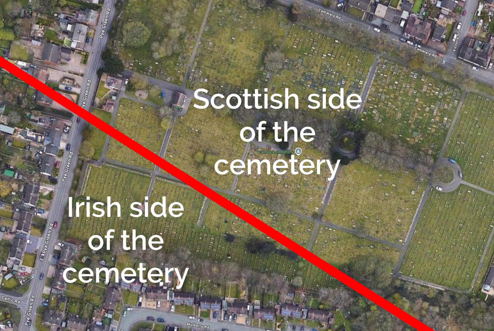
In Cannock, it bisects the cemetery, dividing the graves into those on the Scottish half and those in the Irish half:
Alt
Aerial photography of Cannock Cemetery, bisected with a thick red line.
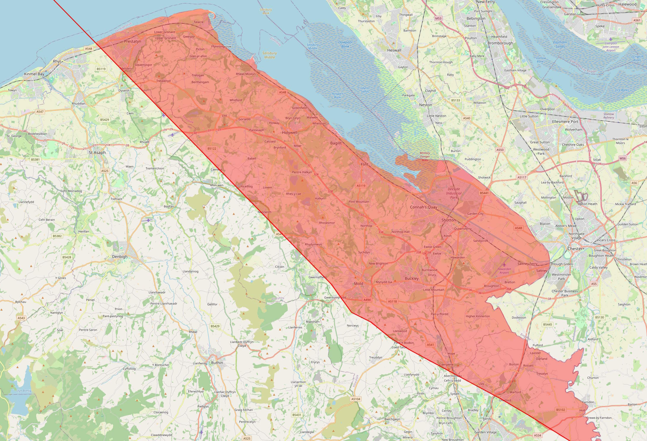
The line crosses the Welsh border at the River Dee, East of Wrexham, leaving a narrow sliver of Wales that's technically closer to Scotland than it is to Ireland, running up the coastline from Connah's Quay to Prestatyn and going as far inland as Mold before - as is the case in most of Wales - you're once again closer to Ireland:
Alt
Highlighted fragment of Wales along the West bank of the River Dee and stretching about 10-12km inland.
I'd never have guessed that there were any parts of Wales that were closer to Scotland than they were to Ireland, but the map doesn't lie4
Anyway: that's how I got distracted, today. And along the way I learned a lot about geodata encoding, a little about Python, and a couple of surprising things about geography5.
Footnotes
1 Not to mention the crazy history of places like Berwick-upon-Tweed, which has jumped the border several times, and Ba Green, ownership of which has traditionally been decided by game of football.
2 Or, at least: it's the one that's most-widely used and so I could find lots of helpful StackOverflow answers when I got stuck!
3 Interesting... if you're specifically looking for some geographical trivia, that is!
4 Okay, the map lies a little. My program was only simple so it plotted everything on a flat plane, failing to accommodate for Earth's curvature. The difference is probably marginal, but if you happen to live on or very close to the red line, you might need to do your own research!
5 Like: Chester and Rugby are closer to Scotland than they are to Ireland, and Harpenden and Towcester are closer to Ireland than they are to Scotland! Who knew?
The wobbliness of the line got me thinking about the inverse problem: for anywhere on the line, what points in Ireland and Scotland are closest?
When you are sufficiently far away, these must settle on two stable points (maybe Rosslare and Gretna?), resulting in a straight line. Further north, the "closest point" on each side must jump between protuberances irregularly. I wonder if there's a good way to visualize that.
If it's a small enough number of points, perhaps colour? Colour in the areas are are closer to Gretna, etc.?