This checkin to geohash 2025-01-15 10 -61 reflects a geohashing expedition. See more of Dan's hash logs.
Location
Empty lot off Bhagan Trace, Chandernagore, near Chase Village, Trinidad.
Participants
Plans
I’ve been on holiday on the islands of Trinidad & Tobago this week. These island nations span graticules that are dominated by the Caribbean and Atlantic Oceans, so it’s little wonder there’s never been an attempted geohashing expedition in them. So when a hashpoint popped-up in a possibly-accessible location, I had to go for it!
For additional context: Trinidad & Tobago is currently under a state of emergency as gang warfare and an escalating murder rate has reached a peak. It’s probably ill-advised to go far off the beaten track, especially as somebody who’s clearly a foreign tourist. The violence and danger is especially prevalent in and around parts of nearby Port of Spain.
As a result, my partner Ruth (wisely) agreed to drive with me to the GZ strictly under the understanding that we’d turn back at a moment’s notice if anything looked remotely sketchy, and we’d take every precaution on the way to, from, and at the hashpoint area (e.g. keeping car doors locked when travelling and not getting out unless necessary and safe to do so, keeping valuables hidden out of sight, knowing the location of the nearest police station at any time, etc.).
I don’t have my regular geohashing kit with me, but I’ve got a smartphone, uLogger sending 5-minute GPS location pings (and the ability to send a location when I press a button in the app, for proof later), and a little bravery, so here we go…
Expedition
Our plane from Tobago landed around 15:20 local time, following an ahead-of-schedule flight assisted by a tailwind from the Atlantic side. We disembarked, collected our bags, and proceeded to pick up a hire car.

Our original plan for our stay in Trinidad had been to drive up to an AirBnB near 10.743817, -61.514248 on Paramin, one of Tobago’s highest summits. However, our experience of driving up Mount Dillon on Tobago earlier in the week showed us that the rural mountain roads around here can be terrifyingly dangerous for non-locals1, and so we chickened out and investigated the possibility of arranging a last-minute stay at a lodge on the edge of the rainforest in Gran Couva, or else failing that a fallback plan of a conventional tourist-centric hotel in the North of Port of Spain.
By this point, we’d determined that the hashpoint was in the old sugar growing region of Caroni, in which our originally-intended accommodation at Gran Couva could be found, and so it seemed feasible that we might be able to safely deviate from our route only a little to get to the hashpoint before reaching our beds. We were particularly keen to be at a place of known safety before the sun set, here in an unusual part of an unfamiliar country! So when the owner of our proposed lodge in Gran Couva called to say that he couldn’t accept our last-minute booking on account of ongoing renovations to his property, we had to quickly arrange ourself a room at our backup hotel.
This put us in an awkward position: now the hashpoint really wasn’t anything-like on the way from the airport to where we’d be staying, and we’d doubtless be spending longer than we’d like to be on the road and increasing the risk that we’d be out after dark. I reassured Ruth, whose appetite for risk is somewhat lower than mine, that if we set out for the hashpoint and anything seemed “off” we could turn around at any time, and we began our journey.
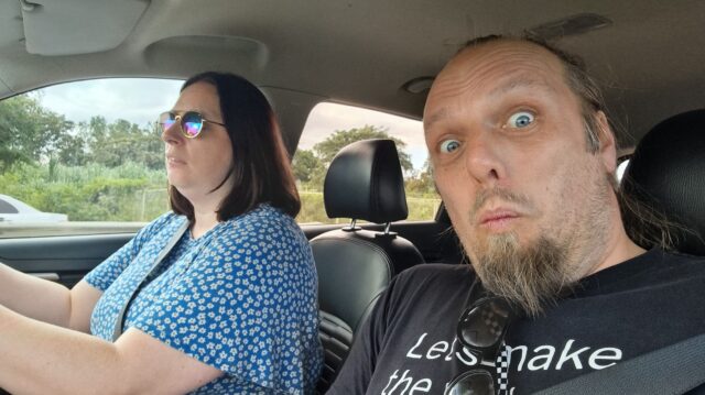
Boosted by her experience of driving on Tobago, Ruth continued to show her rapidly-developing Trinbagonian road skills2.
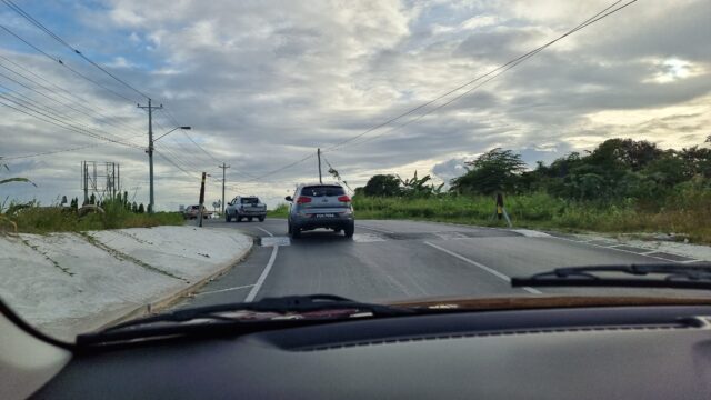
Despite increasingly heavy traffic on our minor roads, possibly resulting from a crash that had occurred on the Southbound carriageway of the nearby Uriah Butler Highway which was causing drivers to seek a shortcut through the suburbs, we made reasonable time, and were soon in the vicinity of the hashpoint: a mixed-use residential/light commercial estate of the kind that apparently sprung up in places that were, until very late in the 20th century, lands used for sugar cane plantations.
At this point, the maps started to become less and less useful: Google Maps, OpenStreetMap, and Bing Maps completely disagreed as to whether we were driving on Bhagan Trace, Cemetery Street, or Roy Gobin Fifth Avenue, as well as disagreeing on whether we were driving into a cul-de-sac or whether it was possible to loop around at the end to return back to the main roads. It was now almost 17:00 and we were greeted by a large number of cars coming out of the narrow street in the opposite direction to us, going in, and squeezing past us: presumably workers from one of the businesses down here going home for the evening.
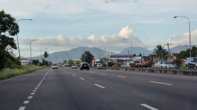
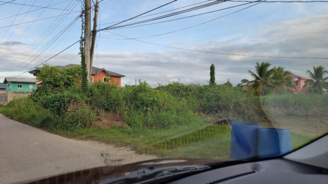
My GPS flickered as it tried to make sense of the patchwork of streets, and I asked Ruth to slow down and pull over a couple of times until I was sure that we’d gotten as close as we could, by road. Looking out of my window, I saw the empty lot that I’d scouted from satellite photography, but it was hopelessly overgrown. If the hashpoint was within it, it’d take hours of work and a machete to cut through. The circle of uncertainty jumped around as I tried to finalise the signal without daring to do the obvious thing of holding my phone outside the car window. A handful of locals watched us, the strange white folks sitting in a new car, as I poked at my devices in an effort to check if we were within the circle, or at least if we would be when, imminently, we were forced to park even closer to the side to let a larger vehicle force its way through next to us!

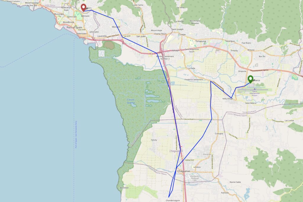
At the point at which I thought we’d made it, I hit the “save waypoint” at 17:06 button and instructed Ruth to drive on. We turned in the road and I started navigating us to our hotel, only thinking to look at the final location I’d tagged later, when we felt safer. We drove back into Port of Spain avoiding Laventille (another zone we’d been particularly recommended to stay away from) while I resisted the urge to double-check my tracklog, instead focussing on trying to provide solid directions through not-always-signposted streets: we had a wrong turning at one point when we came off the highway at Bamboo Settlement No. 1 (10.627952, -61.429083) but thankfully this was an easy mistake to course-correct from.
It was only when I looked at my tracklog, later, that I discovered that the point I’d tagged was exactly 8.59 metres from the hashpoint, plus or minus a circle of uncertainty of… 9 metres. Amazingly, we’d succeeded without even being certain we’d done so. Having failed to get a silly grin photo at the hashpoint, we sufficed to get one while we drank celebratory Prosecco and ate tapas on the rooftop bar of our hotel, looking down on the beautiful bay and imposing mountains of this beautiful if intimidating island.

Tracklog
I didn’t bring my primary GPSr, but my phone keeps a general-purpose tracklog at ~5min/50m intervals, and when I prompt it to. Apologies that this makes my route map look “jumpier” than usual, especially when I’m away from the GZ.
Achievements

Footnotes
1 Often, when speaking to locals, they’d ask if it was our first time in Trinidad & Tobago, and on learning that it was, they’d be shocked to hear that we’d opted to drive for ourselves rather than to hire drivers to take us places: it turns out that the roads are in very-variable condition, from wonderfully-maintained highways to rural trails barely-driveable without a 4×4, but locals in both drive with the same kind of assertive and sometimes reckless attitude.
2 tl;dr of driving in Trinidad & Tobago, as somebody who learned to drive in the UK: (1) if you need to get out of anywhere, don’t wait for anybody to yield because they won’t, even if you theoretically have the right of way: instead, force your way out by obstructing others, (2) drive in the middle of the road wherever possible to make it easier to dodge potholes and other hazards, which are clustered near the soft verges, and swing to your own side of the road only at the last second to avoid collisions, and (3) use your horn as often as you like and for any purpose: to indicate that you want to turn, to warn somebody that you’re there, to tell somebody to move, to say hello to a nearby pedestrian you recognise, or in lieu of turning on your headlights at night, for example. The car horn is a universal language, it seems.
Other Trinbagonian driving rules:
* Speed limits are completely optional, regardless of whether police are around.
* One way systems don’t apply if your quickest route involves ignoring them.
* If you drive by someone coming the other way who you recognise, you should both stop, wind down your windows and have a lovely chat.
* So long as there’s at least 2mm of space, you can totally get past that parked vehicle while someone is driving the other way.
* The best way to reverse out of a driveway with no visibility is just to start reversing. At speed, to show you mean it.
* The best place to turn round is wherever you happen to be when you realise you want to be going a different direction.
* Unlike the horn, indicators should never be used if possible. Certainly not for anything as minor as telling people you’re switching lanes, making a turn or stopping your vehicle.
This may explain why many of the cars here are dented all to heck. Also why the lady at the car hire place told me with a note of alarm to watch out for the Trinidadian drivers.
I especially enjoyed the fact that you commented to the car rental assistant that we’d been driving on Tobago and found the way other people drove to be… challenging. And then she immediately explained that things would be much worse for you on Trinidad! 🤣
This is funny, but I’m confident Wrexham’s potholes have nothing on the Trinbagonian ones I’ve been experiencing all week, which have sometimes spanned most of the width of a road or been deep enough that dipping a wheel into them would strike the road with your underchassis!
Read more →