A quick and easy find in spite of the growing dark, significantly helped by my having correctly interpreted the name of the cache and knew exactly at I was looking for TFTC.
This cache’s siblings might have to wait until another day, when I have the light on my side, though!
Third time was the charm for me with this elusive cache! On this and my last visit the coords kept pointing me to the centre of the road, giving me a pretty big search radius.
Eventually found it – with the help of properly interpreting the hint – at N 51 46.314, W 001 25.758. Hope this helps anybody else with the same problem! TFTC, and once again for an excellent series.
Attached image is from my second visit, when I was trying to look unsuspicious and like I had a different reason to be hanging around here!
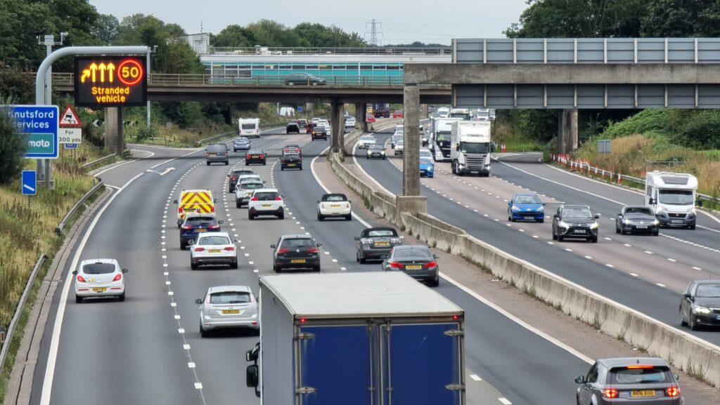
I was heading South on the M6 when my phone beeped to warn me that the road was blocked, ahead. Turns out there had been some sort of crash, and traffic was being directed into
Knutsford Services. Naturally, I used the break as an excuse to park up and hike out to this and another local cache.
As I came over this bridge, it looked like traffic was flowing again, albeit slowly and with a lane closed, so I’m going to complete my loop and get back on the road. Thanks for the
distraction while I was stranded!
The M6 Southbound got blocked by a crash this afternoon so I diverted to Knutsford Services and took a walk out to the local caches while I waited for it to clear. I had a feeling what
kind of thing I’d be looking for when I got here and I turned out the be right, making this a much quicker search than the 20 minutes or so it took me to walk up here! I possibly wasn’t
helped by my choice of route, though: thanks to a badly signed footpath through the lower part of Tabley Hill Farm I ended up off-course and found myself in the cattle yard at N 53º
18.345′ W 002º 24.147’… right as the cows were heading to the milking parlour! Got there in the end, though. TFTC!
I was in the vicinity of this cache while taking a rest break on a long journey South down the M6. Coordinates seemed off by about 8m but the hint quickly set me straight and after that
it was an easy find. SL, TFTC!
Came as a mini layover during a long drive South down the M6; specifically picked this cache because it fulfils a Wonder collection for me. ;-) A quick and easy find, once I got past
the cache’s spooky guardian! TFTC!
After failing to find GC2AJVT Cow Hill earlier we were really hoping to find this, but alas no. The entire area
seems to have been torn up for building works and the footpath moved, so we couldn’t get within 20m of GZ. Strongly suspect this one’s a
goner.
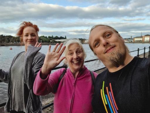
What an excellent cache container! I immediately spotted it but then disregarded it when I couldn’t see an obvious ingress. My sister Sarah, though, whom I’m visiting in Preston, tried
touching it a different way and soon discovered how to get at the cache. Log almost full – space only for one or two more entries.
Found with my mother and sister while visiting Preston on my way back to Oxfordshire after helping my partner’s brother move to Cumbria. Spotted part of the retrieval mechanism right
away and soon the cache was in hand. TFTC!
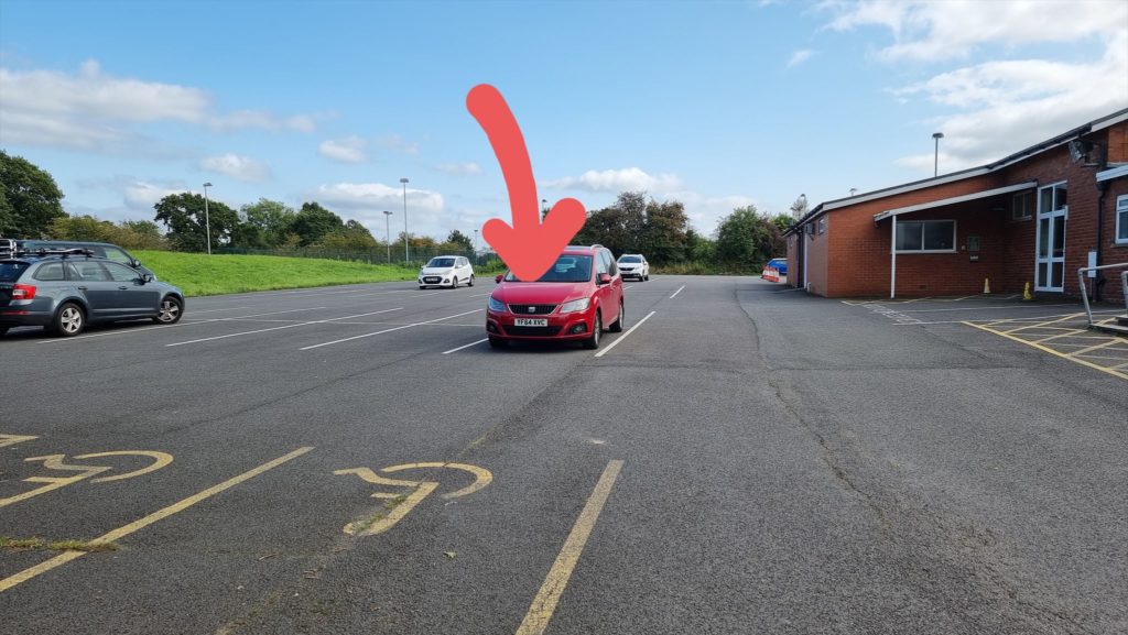
Found as a quick cache-n-dash while in the vicinity. One developed a pretty sharp eagle-eyed for caches over the years, and I was able to spot this one from my parking spot (pictured)
before I even got out of the car! TFTC.
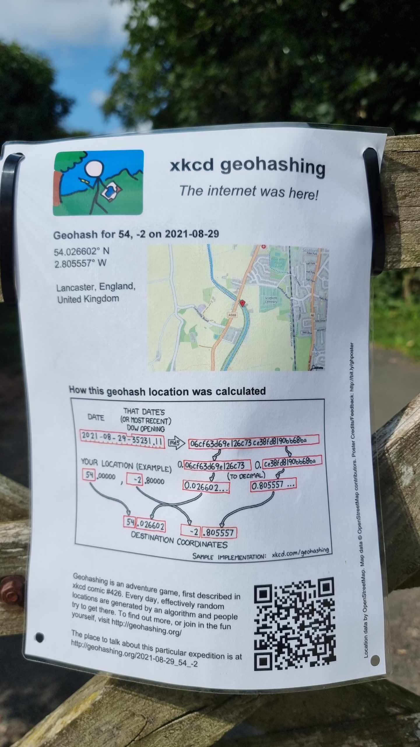
Broke my journey up the M6 to find the 2021-08-29 54 -2 geohashpoint, which was deep in the brambles alongside the
towpath about 90m South East of the cache location. On the way back up to the road, quickly stopped to find this cache. SL, TFTC!
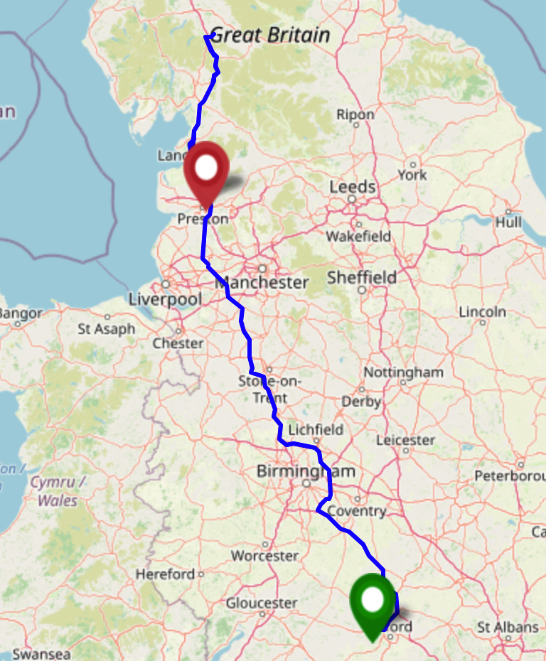
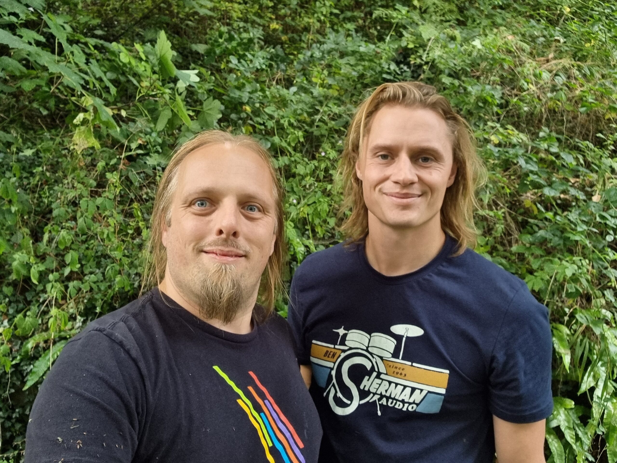
I (Dan Q) am driving my partner’s brother Robin from near Oxford to near Penrith on this day, so I expect to
pass close by this geohashpoint on the M6 twice; at around 13:00 going North then about 15:00 going South. It looks like there’s on-street parking on nearby Ashford Avenue (N 54° 1.71′,
W 2° 48.370′), so I’m thinking we can pull over there, walk to Deep Cutting Bridge, follow a path about 700m Northwest down into the canal cutting, then follow the canal back Southeast
to the hashpoint. Robin’s never been geohashing before, so we’ll see what he makes of it.
The biggest risks to this plan are likely to be (a) if we run late setting off, hit traffic, or are otherwise delayed then we may have to cancel our plans in order to stay on-schedule,
and (b) based on local photos it looks like the towpath floods and/or gets incredibly boggy in wet weather!
Expedition
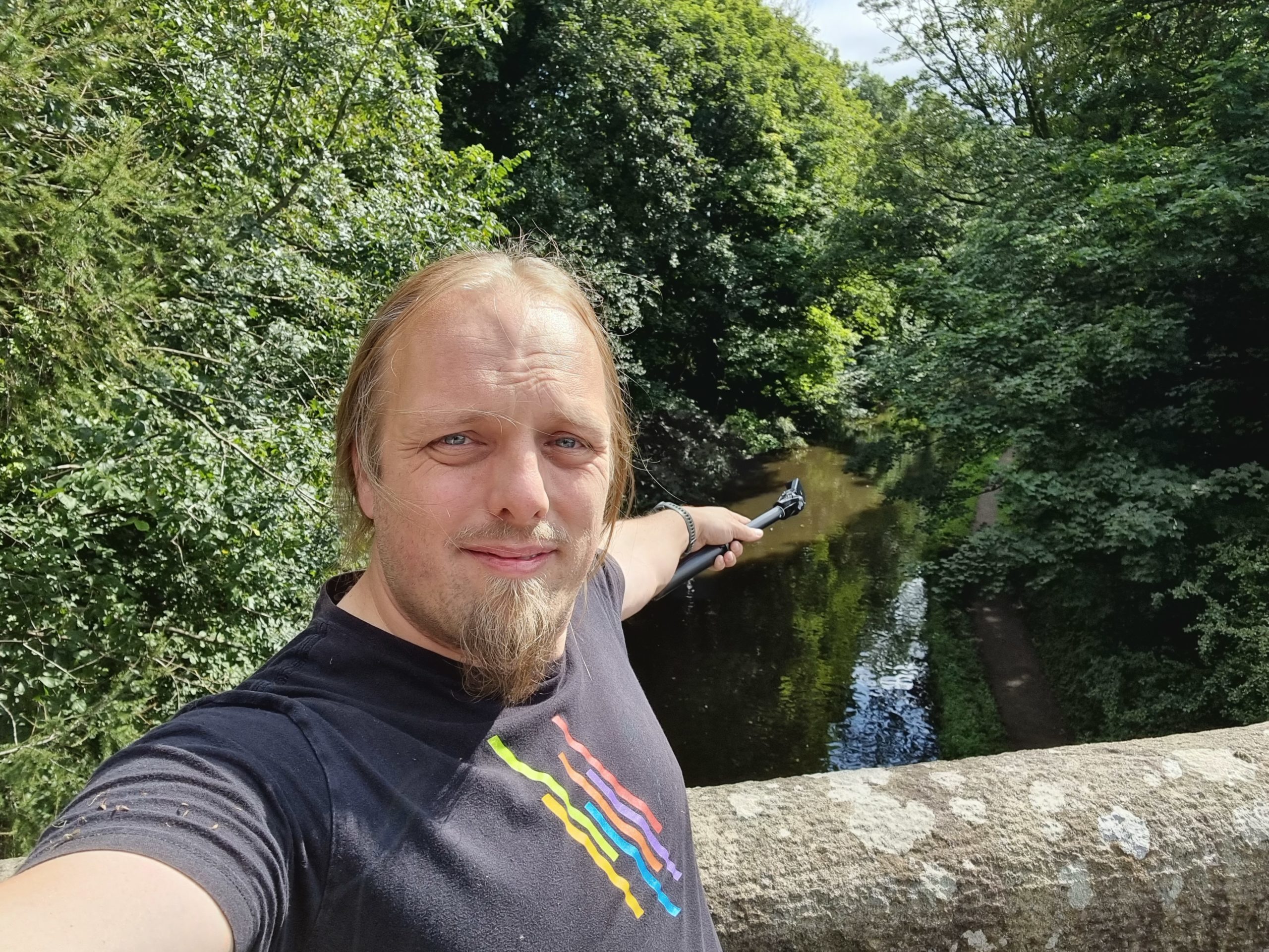
This all went pretty-much to plan. We parked on Ashford Avenue and walked to the bridge, then onto the long path down. We soon got bored of this trail and took a short-cut down the
cutting slope, then proceeded back under the bridge while Robin told me about how he rowed along this stretch of canal during his recent Lands End to John O’Groats journey.
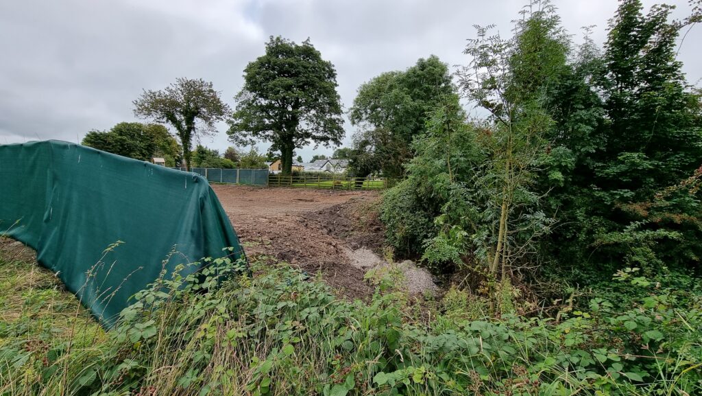
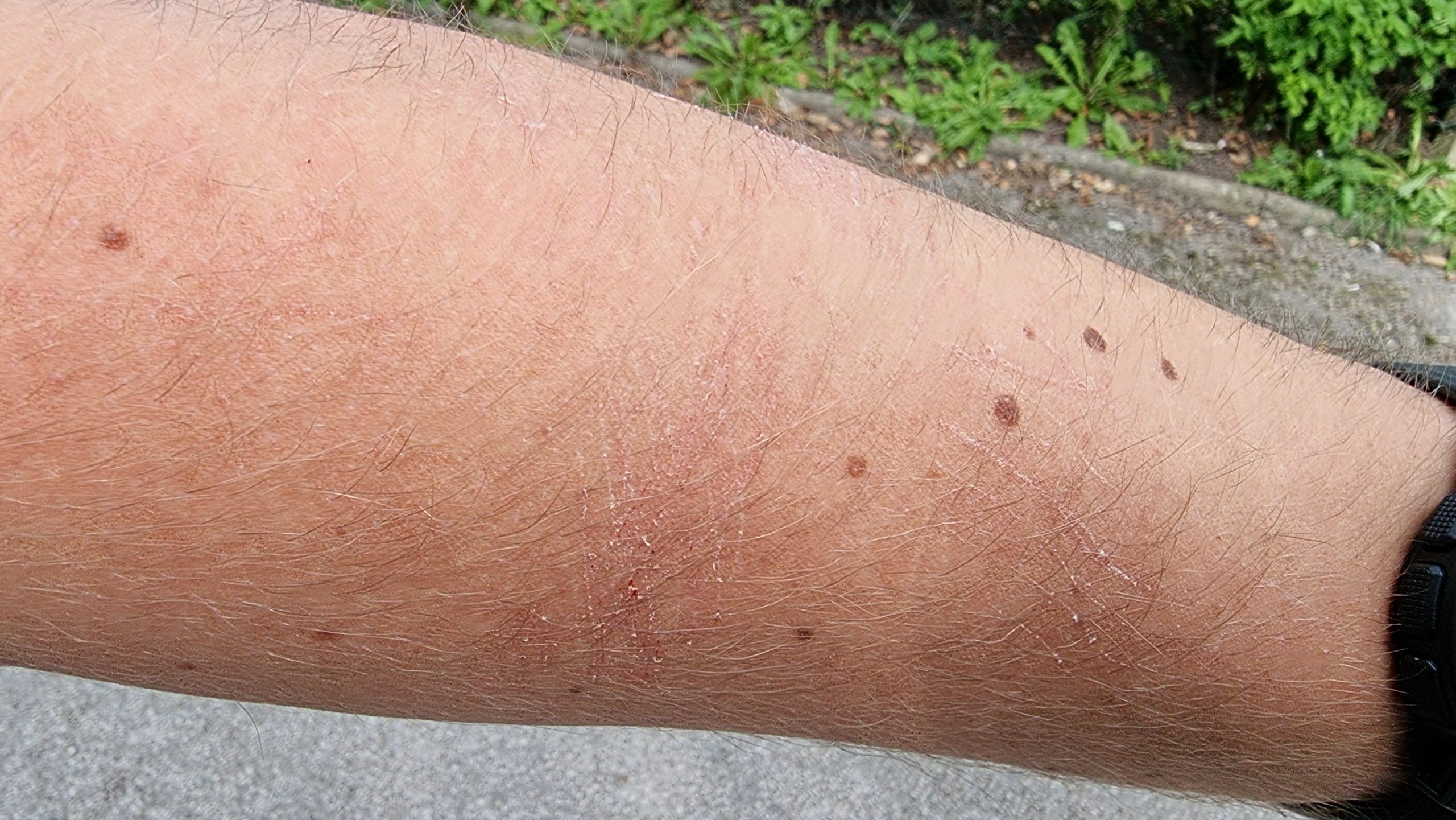
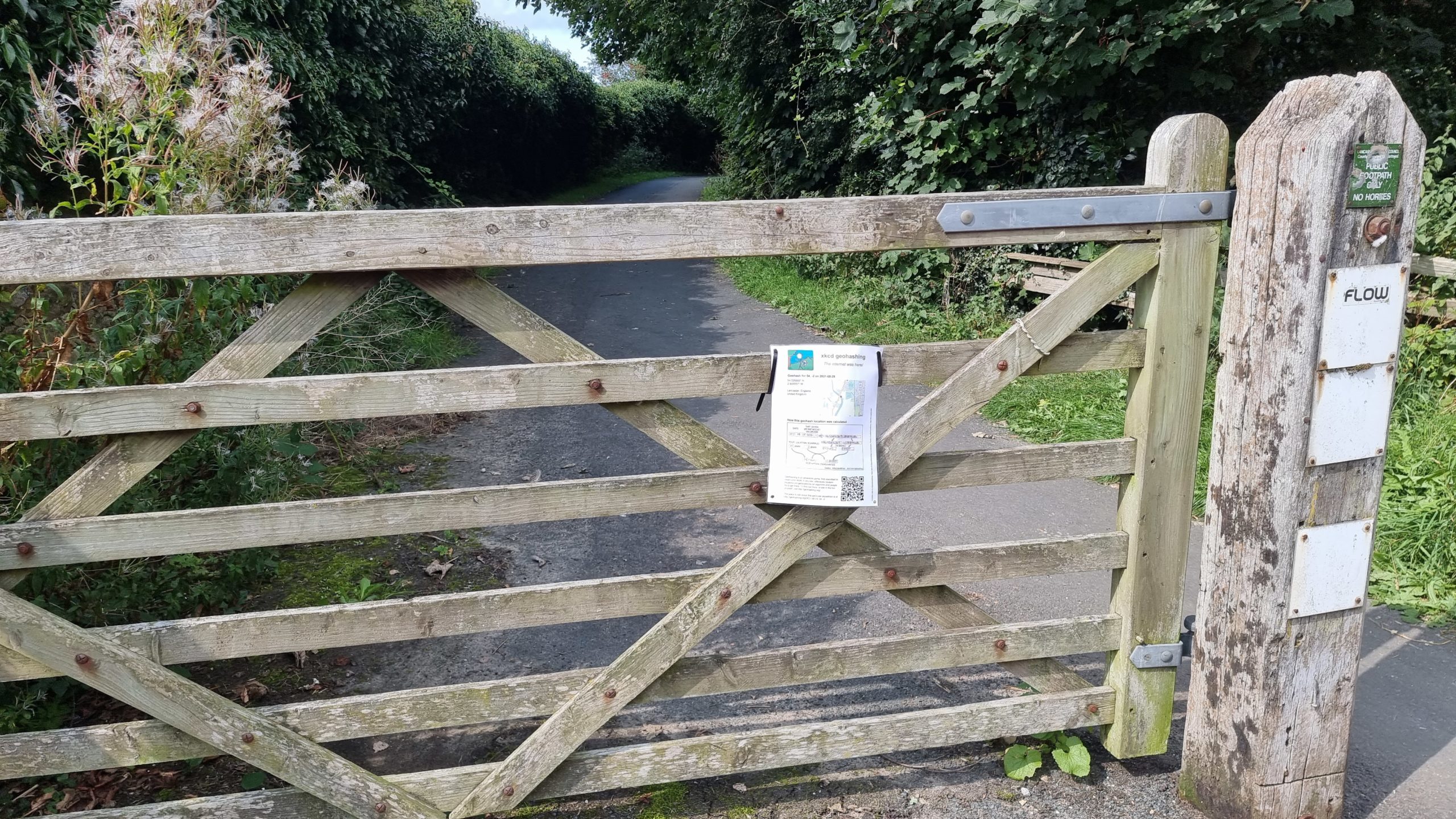
On the other side of the bridge we discovered that the hashpoint was about 25 metres up a steep bank covered with thorny plants. Not wanting to be defeated at this point, Robin boosted
me up onto the bank and I scrambled painfully through the brambles to reach the hashpoint, which coincided with a tree overlooking the cutting.
Returning to the car we stopped by geocache GC6WMEW, from whose GZ one can just about see the tree that
marks the hashpoint. We added a “The Internet Was Here” sign to the gate at the path down to the towpath and continued our long journey North-and-back-again.