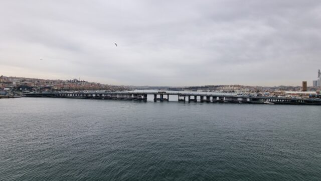
Istanbul is… sprawling. I stood on this footbridge, over the water, to try to comprehend the scale of the place, but it’s just massive. The hills, which help the tall buildings to tower
over you no matter where you stand, only serve to exaggerate the effect. Quite the spectacle of human settlement.
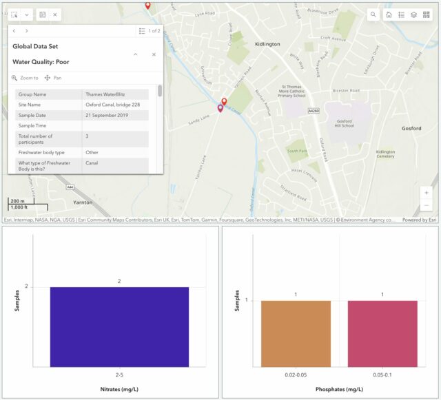
It really is “open data”. Look: I found the record that was created as a result of the kids’ and my participation back in 2019!
We’ve moved house since then, but we’re still within the Thames basin and can provide
value by taking part in this weekend’s sampling activity. The data that gets collected on nitrate and phosphate levels in local water sources – among other observations – gets fed
into an open dataset for the benefit of scientists and laypeople.
The kids were smaller last time we did this.
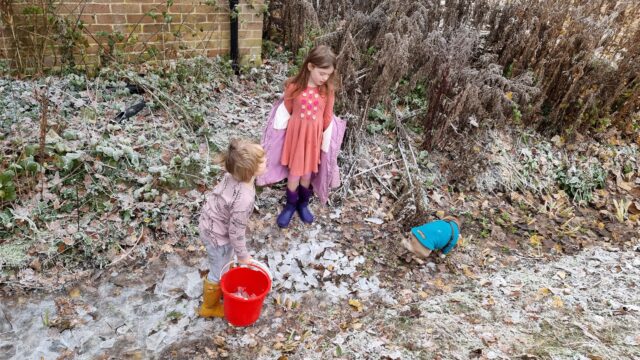
It’d have been tempting to be exceptionally lazy and measure the intermittent water course that runs through our garden! It’s an old, partially-culverted drainage ditch1,
but it’s already reached the “dry” part of its year and taking a sample wouldn’t be possible right now.
The ditch in our garden is empty 75% and full of water 25% of the time. Oh, and full of ice for a few days each winter, to the delight of children who love smashing things. (It’s also
full of fallen wood and leaf detritus most of the year and JTA spends a surprising amount of time dredging it so that it drains
properly into its next section.)
But more-importantly: the focus of this season’s study is the River Evenlode, and we’re not in its drainage basin! So we packed up a picnic and took an outing to the
North Leigh Roman Villa, which I first visited last year when I was supposed to be on the Isle of Man with Ruth.
“Kids, we’re going outside…” / “Awww! Noooo!” / “…for a picnic and some science!” / “Yayyy!”
Our lunch consumed, we set off for the riverbank, and discovered that the field between us and the river was more than a little waterlogged. One of the two children had been savvy
enough to put her wellies on when we suggested, but the other (who claims his wellies have holes in, or don’t fit, or some other moderately-implausible excuse for not wearing them) was
in trainers and Ruth and I needed to do a careful balancing act, holding his hands, to get him across some of the tougher and boggier bits.
Trainers might not have been the optimal choice of footwear for this particular adventure.
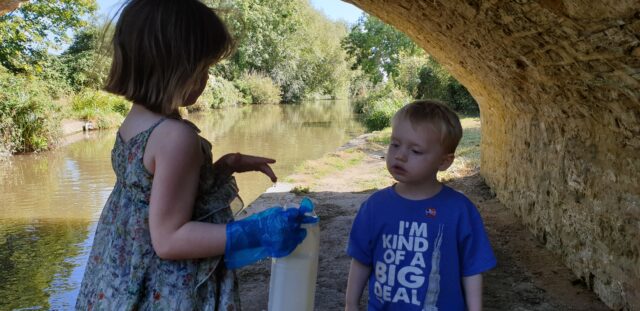
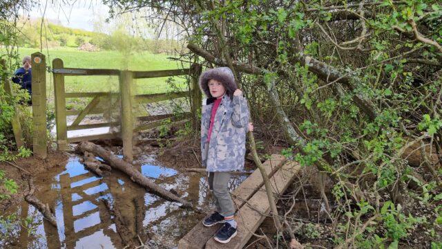
Eventually we reached the river, near where the Cotswold
Line crosses it for the fifth time on its way out of Oxford. There, almost-underneath the viaduct, we sent the wellie-wearing eldest child into the river to draw us out a sample of
water for testing.
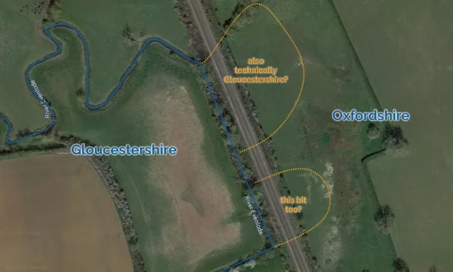
As far as Moreton-in-Marsh, the Cotswold Line out of Oxford essentially follows the River Evenlode. In some places, such as this one near Kingham, the river was redirected to
facilitate the construction of the railway. Given that the historic Gloucestershire/Oxfordshire boundary was at this point defined by the river, it’s not clear whether this
represents the annexation of two territories of Gloucestershire by Oxfordshire. I doubt that anybody cares except map nerds.
Looking into our bucket, we were pleased to discover that it was, relatively-speaking, teeming with life: small insects and a little fish-like thing wriggled around in our water
sample2.
This, along with the moorhen we disturbed3 as we tramped into the reeds, suggested that the river is at least in some level of good-health
at this point in its course.
I’m sure our eldest would have volunteered to be the one to traipse through the mud and into the river even if she hadn’t been the only one of that was wearing wellies.
We were interested to observe that while the phosphate levels in the river were very high, the nitrate levels are much lower than they were recorded near this spot in a previous year.
Previous years’ studies of the Evenlode have mostly taken place later in the year – around July – so we wondered if phosphate-containing agricultural runoff is a bigger problem later in
the Spring. Hopefully our data will help researchers answer exactly that kind of question.
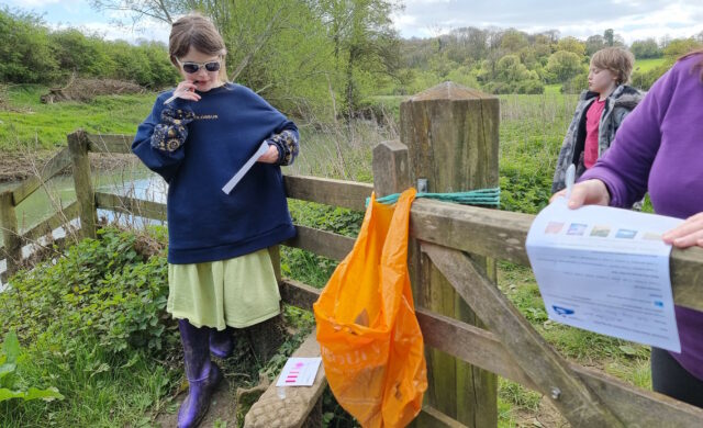
The chemical experiments take up to 5 minutes each to develop before you can read their colours, so the kids had plenty of time to write-up their visual observations while they
waited.
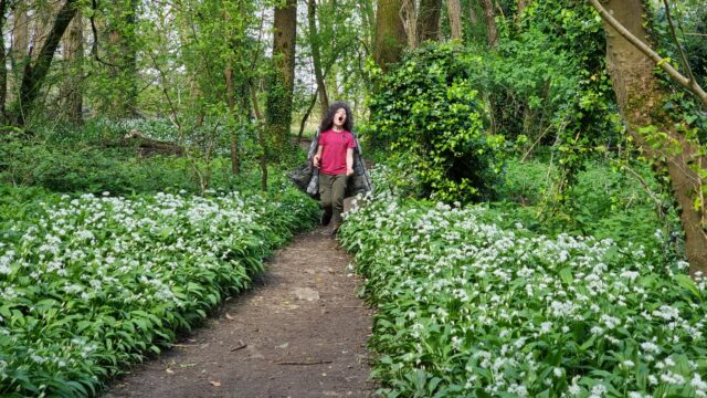
Regardless of the value of the data we collected, it was a delightful excuse for a walk, a picnic, and to learn a little about the health of a local river. On the way back to the car, I
showed the kids how to identify wild garlic, which is fully in bloom in the woods nearby, and they spent the rest of the journey back chomping down on wild garlic leaves.
Seriously, that’s a lot of wild garlic.
The car now smells of wild garlic. So I guess we get a smelly souvenir from this trip, too4!
Footnotes
1 Our garden ditch, long with a network of similar channels around our village, feeds into
Limb Brook. After a meandering journey around the farms to the East this eventually merges with Chill Brook to become Wharf Stream. Wharf Stream passes through a delightful nature
reserve before feeding into the Thames near Swinford Toll Bridge.
2 Needless to say, we were careful not to include these little animals in our chemical
experiments but let them wait in the bucket for a few minutes and then be returned to their homes.
3 We didn’t catch the moorhen in a bucket, though, just to be clear.
4 Not counting the smelly souvenir that was our muddy boots after splodging our way
through a waterlogged field, twice
On our first day‘s walking along the
Thames Path, Robin and I had trouble finding any evidence of water for some time. On our second day, we did not have this problem.
After weeks of sustained rain, the fields we walked over as we left Cricklade behind were extremely soggy. On our way out of town we passed Cricklade Millennium Wood, I took a
picture for the purpose of mocking it for being very small but later discovered it’s too small to appear on Google Maps and became oddly defensive of it – it’s trying, damn it, we
should at least acknowledge its existence.
…
Ruth and her brother Robin (of Challenge Robin/Challenge Robin II fame on this blog, among manyothercrazyadventures) have taken it upon themselves to walk the entirety of the Thames Path from the source of the river (or rather, one of
the many symbolic sources) to the sea, over the course of a series of separate one-day walks. I’ve mostly been acting as backup-driver so far, but I might join them for a leg or two
later on.
In any case, Ruth’s used it as a welcome excuse to dust off her blog and write about the experience, and it’s fun and delightful and you should follow along and give her a digital
cheer. The first part is here; the second part landed
yesterday.
Parts of Oxford have been flooded for the last few
days, and apparently the worst is yet to come. I worked from home yesterday, intimidated by the available choices
of traversing flooded roads or else taking the hilly 3+ mile diversion around the problem areas, but today: I decided that it was time to man up and cycle in to the office.
Here’s where I forded Kennington Road. Yes, I just used the word “forded” to describe crossing the road.
Conveniently, we’ve somewhere along the way acquired a large pair of Wellington boots (we think they might have been Paul‘s, but as he’s now left Oxford without them, they’ve been sitting in our charity-shop-box). So I booted up
and set out. I was yawning all the way:
Police direct traffic away from a waterlogged Abingdon Road.
I had to weave my way back and forth around the cyclepaths nearest my house, and – on a couple of ocassions – get off the bike and wade it through: I’d considered riding through some of
the larger puddles – my mean pedal-ground clearance is about as high as the top of my boots, anyway – until I met a soaked cyclist coming the other way: he’d become disbalanced going
over a submarine kerbstone and fallen into the freezing water. Seeing that quickly made me choose the safer strategy!
Near Hinksey Lake, serious flood defences have been hastily erected and pumping operations are underway to clear gardens and footpaths.
Alongside the lake was one of the most flood-damaged areas, but heavy barriers had been erected and pumping engines were working at returning the water to the “right” side of them. The
lake bridge was completely closed off: it looked like it might be traversable, but if the water gets any higher, it won’t be.
In Hinksey Park, the playing fields and cycle path are completely underwater.
I took the cycle route through Hinksey Park in order to avoid the flooded parts of Abingdon Road, which runs parallel, but I’m not sure that it was much better. In the photo above,
you’d be forgiven for thinking that you’re looking at the lake… but in actual fact, the lake is behind me: that’s the playing fields. You can just about make out the line
down the middle of the cycle path, through the murky water.
Between Hinksey Lake and the Thames there are flooded driveways and gardens. The sign on the gate reads “No parking. Keep entrance clear at all times.”, in case anybody was thinking
of parking in this waist-deep water.
Pressing on, I came to the Thames Path, which my route typically follows for a short distance to the footbridge into the city centre. And that’s when I realised quite how high the river
really is.
To the right of the bush – the river. To the left – the footpath. You’d be forgiven if you can’t tell the difference.
By the time I found myself on a footpath with a current, I realised that my route might need a little bit of a rethink. With the bridge I was aiming for just ahead,
though, I was able to double-back and cut through an alleyway (between some seriously at-risk houses), duck under a couple of “footpath closed” barriers, and splash out to the
bridgehead.
From the bridge, it’s clear how much the waters have risen. The path on the left continues to get deeper and deeper underwater: when I’m working in a different office or running
training, that’s the route I take to work!
By the time I was on the higher, better-reinforced East bank for the river, things began to improve, and within a few minutes I was right in the city centre. There, you wouldn’t know
that, only a short distance away, a significant number of streets were underwater. To sit in the dry, on Broad Street, in the middle of Oxford, it seems strange to think that on the
edge of town, people are being evacuated from their homes.
Further reading:
Flood warning for Kennington, from the
Environment Agency (looks like we’re just on the right side of the road not to be included in the “flood warning area”).
“Live”upstreamanddownstreamwater level measurements at nearby Iffley Lock (there’s a beautiful moment in the graphs
for yesterday morning when they clearly started using the lock itself to “dump” water downstream, occasionally bringing the level to within the typical range.
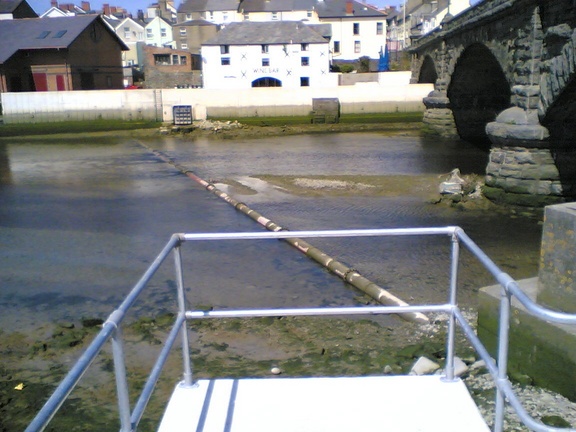
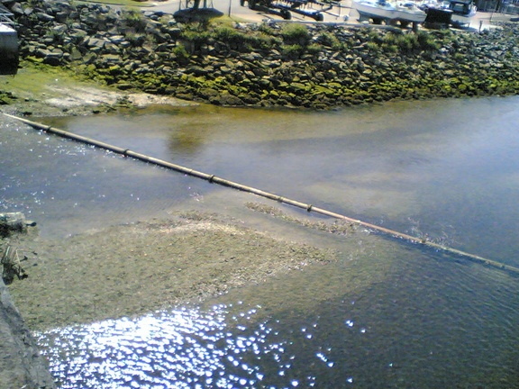
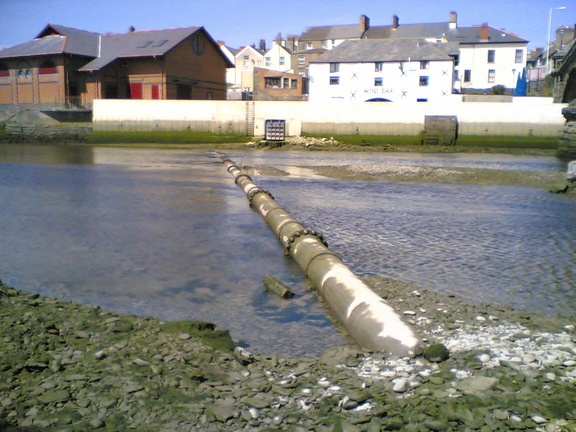
Tide permitting, I’ve been taking a new route home from work. It’s not much of a shortcut, not even taking 30 seconds off my time to get home, but it’s certainly a lot more fun than the
regular route. Of course; it’s only accessible at high tide, and it does take a little bit of balancing…
Looking across the pipe.
Looking down on the pipe from the bridge.
The ladder up the sea defences can be seen at the other end.
There’s a convenient ladder at the Aberystwyth side of the river, that can be seen up the side of the sea defences in the third photo.