A quick and easy find (though I was glad of the hint when I approached the obstacle at the GZ) while travelling from Oxford to Cornwall to
dump my partner’s brother in the sea for the start of his personal challenge to row the length
of the UK. (Photo of our boat in tow attached!)
I was in the area anyway so, following a recent DNF, I checked up on this cache. It’s in perfect condition (though I did have to empty a woodlouse out of the outer cache container) and ready to find
(previous logger was probably looking in the wrong place: there’s no risk of touching a stinging plant to get this cache!).
Had to search for an embarrassingly long time before finding this one. The coordinates and the hint agreed with the (obvious) location I was looking, but I just couldn’t see it. I
expanded my search to nearby candidates too before giving up and moving on with my walk.
On the way back, I decided to have another quick search before calling it a DNF… and found it straight away. I was kicking myself to not
have seen it before, especially given that I’d looked at past log photos and knew exactly what I was looking for! I’ll tell you what; if either of my kids had been here today they’d
have spotted it instantly! (But then… they’re about the perfect height for it…)
Thanks for the distraction while I waited to collect from the river my partner’s brother, who’s been rowing down from Bablock Hythe since yesterday.
Field behind Hill Barn, near the Gom’s Hole public footpath, in the valley beneath the hamlet of Clapton-on-the-Hill. About 4km outside the village of Bourton-on-the-Water,
Gloucestershire.
(Retro) Participants
Dan Q (as a retrohash on the same date but 19 years later, on 2021-02-19)
(Retro)Plans
On the second anniversary of the death of my father, a man who loved to get out into the world and get lost, I undertook my
first geohashing expedition. As this seemed to be a good way to remember him I decided to repeat the experience on this, the ninth anniversary of his death, but the actual
hashpoints for the day didn’t look interesting… so I opted to make my way to what would have been my nearest hashpoint on the day he died.
(Retro)Expedition
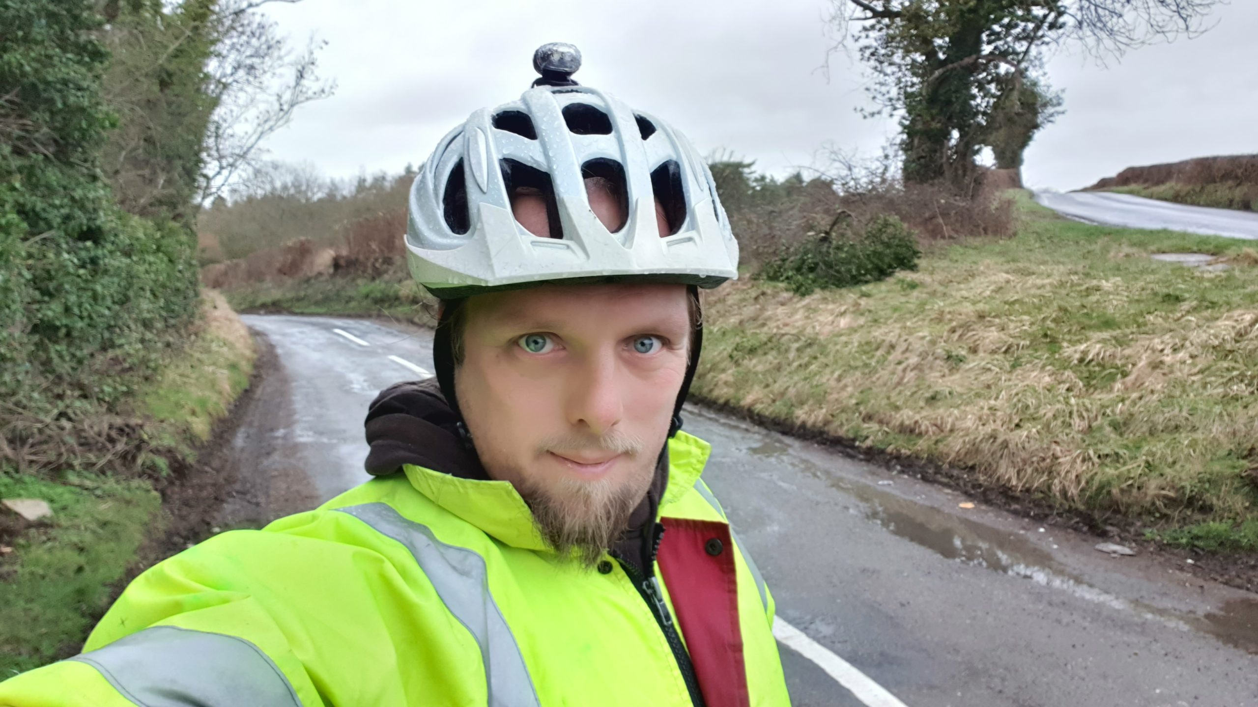
The weather looked horrible and the COVID lockdown (and working from home in general in recent years) has put me out of practice at
cycling, so I thought a 40-50 mile round trip through the rolling hills of the Cotswolds was just the thing. This may have been a mistake, as my aching legs were able to testify for
several days.
Cycling through Witney, over the hills behind Burford, and then across the Windrush valley and into Gloucestershire was a long, arduous, and damp journey, but what really got me was the
wind picking up in the afternoon and giving me a headwind to fight against all the way back home.
Near the hashpoint I was able to lock my bike up at the junction between Sherbourne Street and Bourton Hill – a place shown on my map as “Gom’s Hole” which sounds exactly like what a
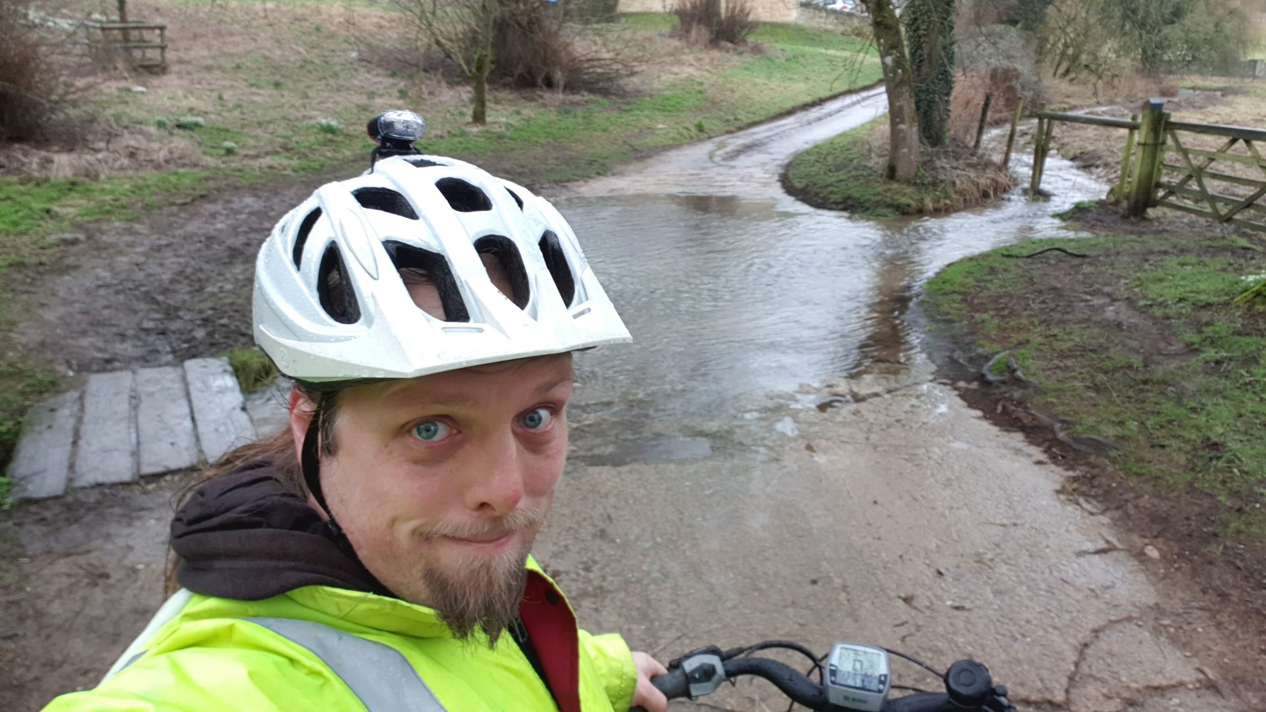
D&D dungeon master would have a goblin would name his bar. From there I followed the footpath towards Farringdon. As the hashpoint drew closer I began to suspect that it would be
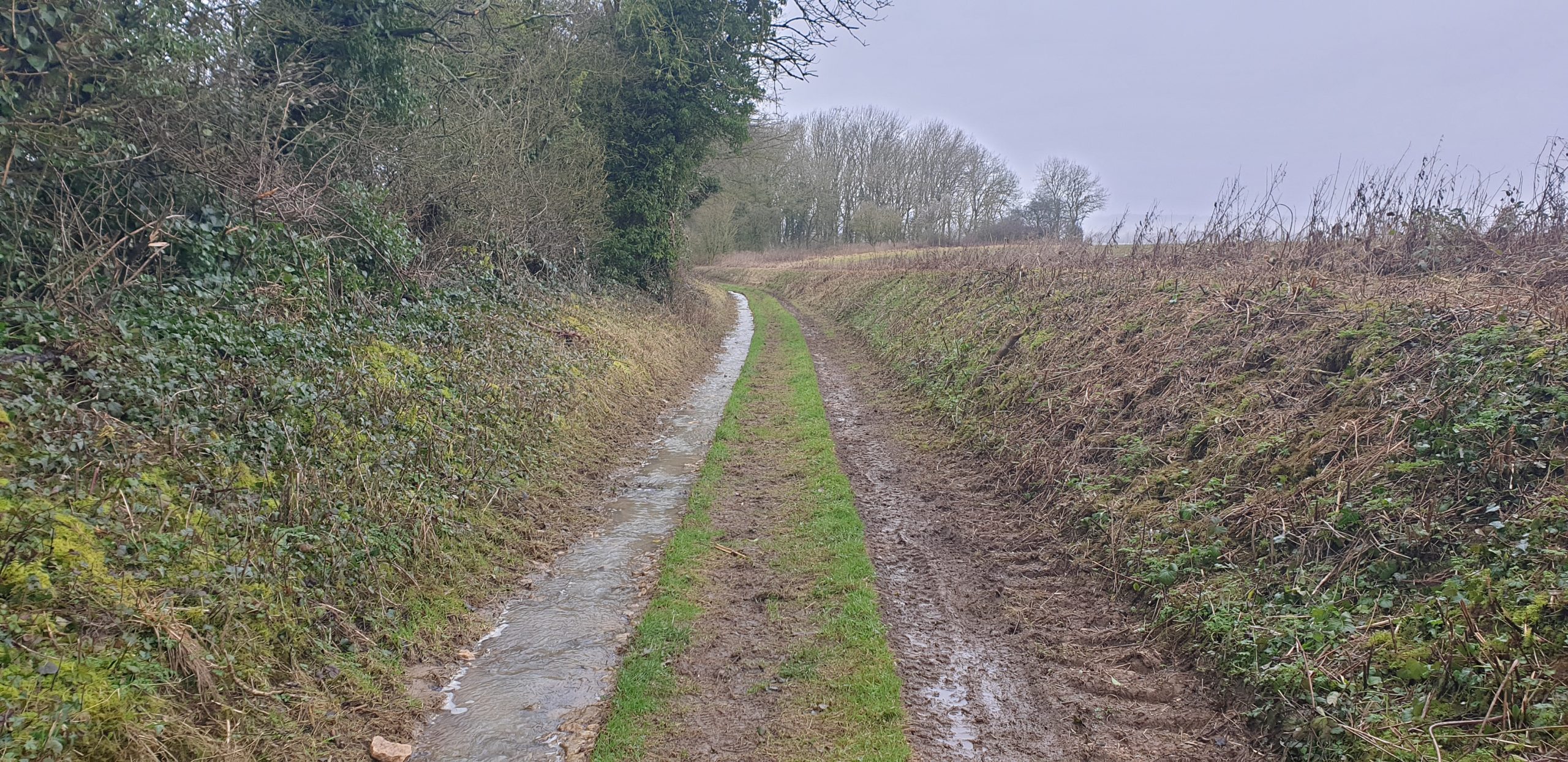
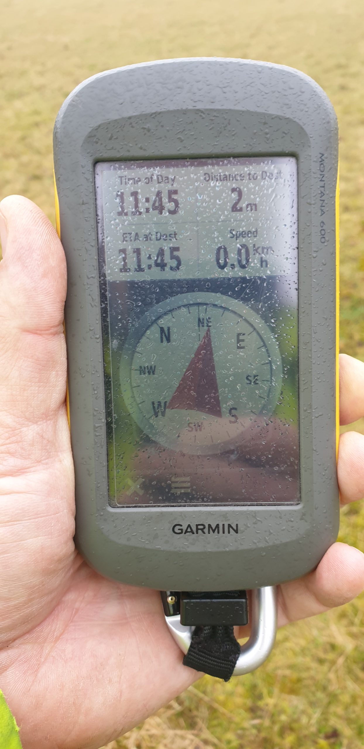
unreachable: tall walls, fences, and hedges stood on both sides of the (flooded) footpath, but at the last minute they gave way to wide meadows. I turned off the path and crossed a dyke
to the hashpoint, where I had a great view of hares and deer in the valley below. Minutes later, the owner of Hill Barn came over with her dog and asked what I was doing around the back
of her land and why I was taking pictures, so I explained that I’d strayed from the footpath (true) because my GPS had told me too (technically true) but I was heading back down to what
I could see was the path, now (true, if misleading).
She continued to watch me all the way back to my bike, so I changed my plans (which had been to eat a sandwich lunch and drink a pint of Guinness: my dad’s beer of choice) near the
hashpoint and instead I cycled away to a nearby layby to have my lunch.
After a 48.3 mile round trip I got back home aching and exhausted, but pleased to have made it to this damp hashpoint.
Checked up following a recent DNF. Cache had been re-hidden in a slightly different spot but is otherwise okay. Returned to the correct
location. Good to go!
Checked up on this cache as it’s been a long time without a find. All stages and the final cache are intact and well! Final stage easier to reach than during the summer, but long
trousers still pretty essential! Log book still 50% “me”.
Like the previous logger, I find evidence of the cache (see photo) but no cache. Unlike the previous logger, I’m not going to claim that as a “find”. Which it clearly isn’t, and
claiming that it is makes it harder for volunteer community moderators to identify problem caches.
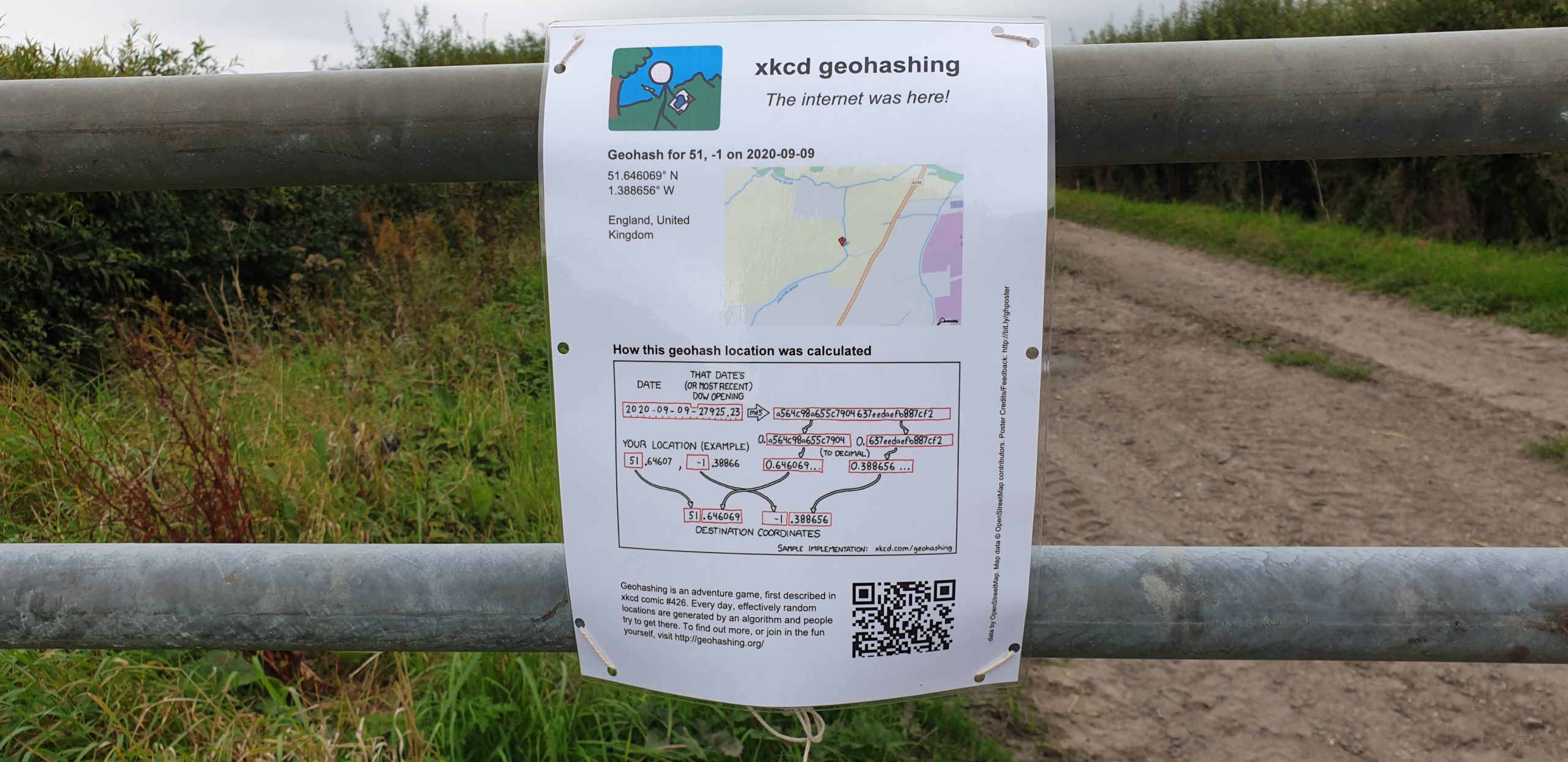
We’re discussing the possibility of a Subdivision geohash achievement for people who’ve reached every “X in a
Y”, and Fippe pointed out that I’m only a hash in the Vale of White Horse from being able to claim such an
achievement for Oxfordshire’s regions. And then this hashpoint appears right in the Vale of White Horse: it’s like it’s an omen!
Technically it’s a workday so this might have to be a lunchtime expedition, but I think that might be workable. I’ve got an electric vehicle with a hundred-and-something miles
worth of batteries in the tank and it looks like there might be a lay-by nearby the hashpoint (with a geocache in it!): I can drive down there at lunchtime, walk carefully back up the main road, and try to
get to the hashpoint!
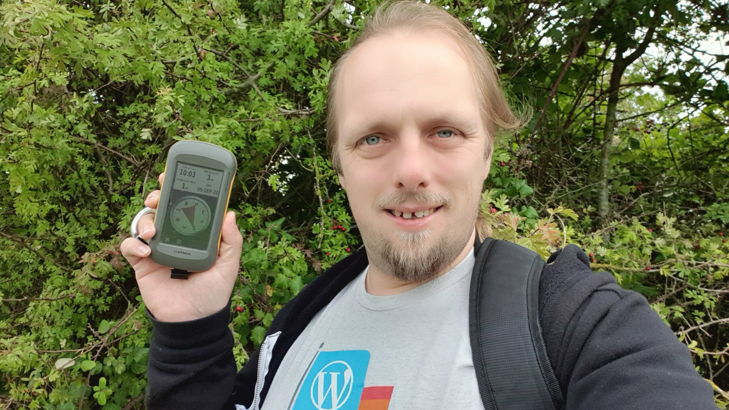
Expedition
I worked hard to clear an hour of my day to take a trip, then jumped in my (new) electric car and set off towards the hashpoint. As I passed Newbridge I briefly considered stopping and
checking up on my geocache there but feeling pressed for time I decided to push on. I parked in the lay-by where
GC5XHJG is apparently hidden but couldn’t find it: I didn’t search for long because the farmer in the adjacent field
was watching me with suspicion and I figured that anyway I could hunt for it on the way back.
Walking along the A338 was treacherous! There are no paths, only a verge covered in thick grass and spiky plants, and a significant number of the larger vehicles (and virtually all of
the motorbikes) didn’t seem to be obeying the 60mph speed limit!
Reaching the gate, I crawled under (reckoning that it’s probably there to stop vehicles and not humans) and wandered along the lane. I saw a red kite and a heron doing their thing
before I reached the bridge, crossed Letcombe Brook, and followed the edge of the field. Stuffing my face with blackberries as I went, it wasn’t long before I reached the hashpoint on
one edge of the field.
I took a short-cut back before realising that this would put me in the wrong place to leave a The Internet Was Here sign, so I doubled-back to place it on the gate I’d crawled under.
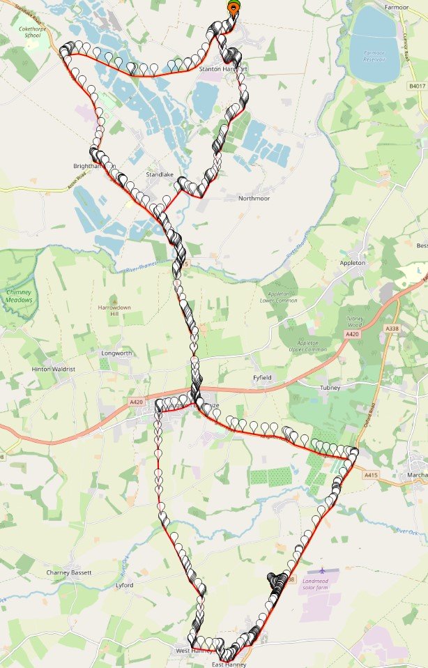
Then I returned to the lay-by, where another car had just pulled up (right over the GZ of the geocache I’d hoped to find!) and didn’t seem to be going anywhere. Sadly I couldn’t wait
around all day – I had work to do! – so I went home, following the satnav in the car in a route that resulted in a figure-of-eight tracklog.