I was pretty ill yesterday. It’s probably a combination of post-flood stress and my shitty lungs’ ability to take a sore throat and turn it into something that leaves me lying in bed and groaning.
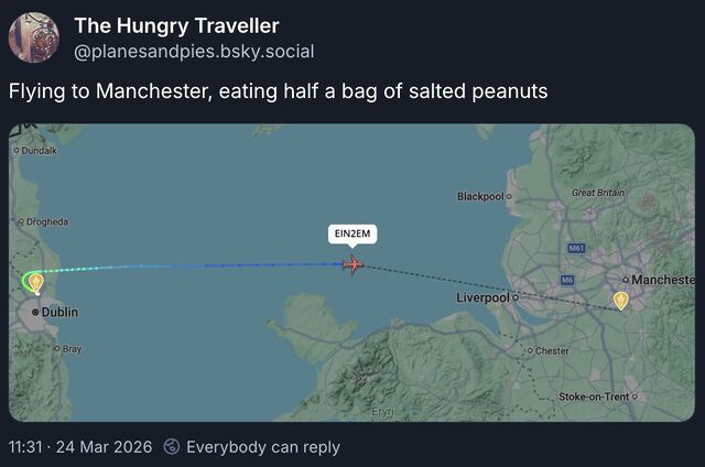
I spent most of the morning in and out of a fitful sleep, during which I dreamed up the most-bizarre application: a GPS tracker app that, after being told your destination and what you were eating, reported your journey progress to social media by describing where you were going and how much of your food was left1.
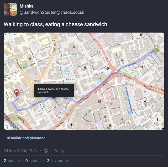
I should be clear that in the dream, I wasn’t the one that invented this concept; in fact, I didn’t even understand it at first (maybe I still don’t!). In the dream I was at some kind of unconference event with a variety of “make art with the Web” types, and I missed a session by falling asleep2. I woke (within the dream) right before the session ended and rushed in to see what was being presented, and only got the tail-end of the explanation of how a project – this project – worked, after which I felt rushed to try to understand it before somebody inevitably tried to talk to me about it.
But it could work, couldn’t it? If you’re one of those people who routinely tracks and shares their location (like Aaron Parecki, whose heatmapping inspired my own) or journeys (like Jeremy Keith does), it’s a way to add a bit of silliness to that sharing.
I’m probably not going to implement this. It is, in the end, the kind of stupidity that could (should?) only appear in the dreams of somebody who’s got a bad head cold.
But if you manage to take this idea and turn it into something… actually good?… let me know!
Or if you’ve just got a cool, “Web 2.0-ey” idea for the name of an app that tracks both your journey progress and your meal consumption, I’d love to hear that too.
Footnotes
1 Under the assumption that its consumption would be evenly distributed throughout the journey. Because everybody does that, right? Counting the number of steps they make before taking another equal-sized bite. Right?
2 Even in my dreams, I can dream of falling asleep. And, sometimes, of dreaming. A fever probably helps.