Especially outside of urban centres, and especially if you’re on foot, OpenStreetMap is way better than Google Maps, Bing Maps, Apple Maps, or what-have-you.
OpenStreetMap is especially good for walkers, with its more-comprehensive coverage of public footpaths as well as the ability to drill-down for accessibility information: whether a path ends in a gate or a stile matters a lot if you can’t climb the latter (or you’re walking with a small-but-muddy dog who’ll need lifting over).
Sure, you don’t get (as much) street view photography. But how often do you use that, anyway?1
I’ve heard it argued that OpenStreetMap, with its Wikipedia-like “anybody can edit it” model, cannot be relied upon. And sure, if you’re looking for an “official” level of accuracy and the alternative is an Ordinance Survey map, then that’s what you should go for.
But there’s nothing specific to, say, Google Maps that makes it fundamentally more “accurate” for most2 geographic features than OpenStreetMap. The vast of cartographic data on Google Maps is produced by humans, looking at satellite photos, and then tracing the features on them, probably with AI assistance. And the vast majority of cartographic data on OpenStreetMap is produced… exactly the same way, although without the AI “helping”.
Google Maps has mistakes, just like every map3. And it’s got trap streets, like most commercially-produced maps (including the Ordinance Survey). Google Maps’ mistakes tend to be made by somebody on the other side of the world from the feature, doing a bad job of tracing what they think might be a road… while OpenStreetMaps’ mistakes are for the most part omissions in areas that are under-explored by local contributors. And there are plenty of areas – like those near where I live, especially if you’re on foot – where the latter mistakes are much less-troublesome.
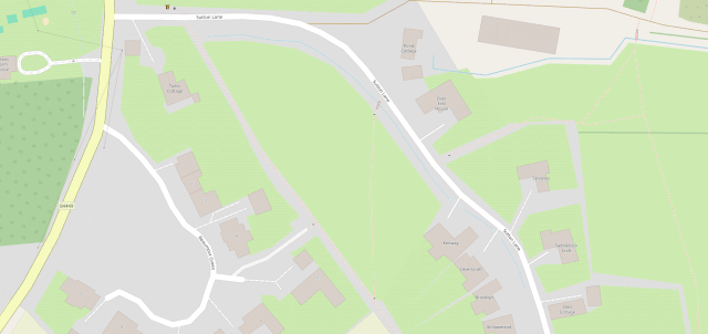
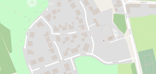
I fixed a couple of omissions on OpenStreetMap just earlier today. While I was out walking the dog, earlier, I added the names of two houses whose identities weren’t specifically marked on the map, and I added detail to the newly-constructed Deansfield estate. Google Maps shows there being only two houses on Deansfield Estate, among other inaccuracies, even though they’ve got up-to-date aerial and street photography.
Google Maps is fine if you want to drive to Sheffield, you need public transport connections to Plymouth4, or you’re looking for a restaurant nearby and you want the data about them to be accurate. But next time you’re walking somewhere, or when you’re looking for a specific address… I’d suggest you give OpenStreetMap a go. You might be pleasantly surprised.
Footnotes
1 I say that as somebody who uses street view and satellite photography a more than average amount, for geohashing purposes. But I can switch mapping software on-the-fly; nobody’s stopping me looking at “ostrich” photos when I need them.
2 The place that Google Maps really beats OpenStreetMap, in my mind, is in the integration of its business directory. If you search for a business in Google Maps, you’ll probably find it and get reasonably-accurate opening hours and contact details. But that’s a factor of two things: the Google My Business directory, and – more importantly – the popularity of the application and the fact that the mobile app “nudges” people to check on the places around them. By the way: if you want to contribute to making maps better in that way without becoming an unpaid researcher working to line Google’s pockets, StreetComplete is an app that helps fill-out business and related information on OpenStreetMap!
3 Google Maps used to show Vauxhall tube station on entirely the wrong side of the River Thames, for example.
4 Public transport’s another thing Google Maps does very well.