Nineteen years ago, the British government passed one of its periodic laws to manage how people move through the countryside. The Countryside and Rights of Way Act created a new
“right to roam” on common land, opening up three million acres of mountains and moor, heath and down, to cyclists, climbers, and dog walkers. It also set an ambitious goal: to record
every public path crisscrossing England and Wales by January 1, 2026. The British Isles have been walked for a long time. They have been mapped, and mapped again, for centuries. But
that does not mean that everything adds up, or makes sense. Between them, England and Wales have around a hundred and forty thousand miles of footpaths, of which around ten per cent
are impassable at any time, with another ten thousand miles that are thought to have dropped off maps or otherwise misplaced. Finding them all again is like reconstructing the roots
of a tree. In 2004, a government project, named Discovering Lost Ways, was given a fifteen-million-pound budget to solve the problem. It ended four years later, overwhelmed. “Lost
Footpaths to Stay Lost,” the Daily Telegraph reported. Since then, despite the apparent impossibility of the task, the 2026 cutoff has remained on the statute books,
leaving the job of finding and logging the nation’s forgotten paths to walkers, horse people, and other obsessives who can’t abide the muddled situation.
A couple of days into the New Year, with the deadline now only seven years off, I met Bob Fraser, a retired highway engineer, in a parking lot a few miles outside Truro, in Cornwall,
in the far west of England. Fraser grew up in Cornwall and returned about thirty years ago, which is when he noticed that many footpaths were inaccessible or ended for no reason. “I
suppose that got me interested in trying to get the problem sorted out,” he said. Since he retired, seven years ago, Fraser has been researching and walking more or less full time; in
the past three years, he has applied to reinstate sixteen lost paths.
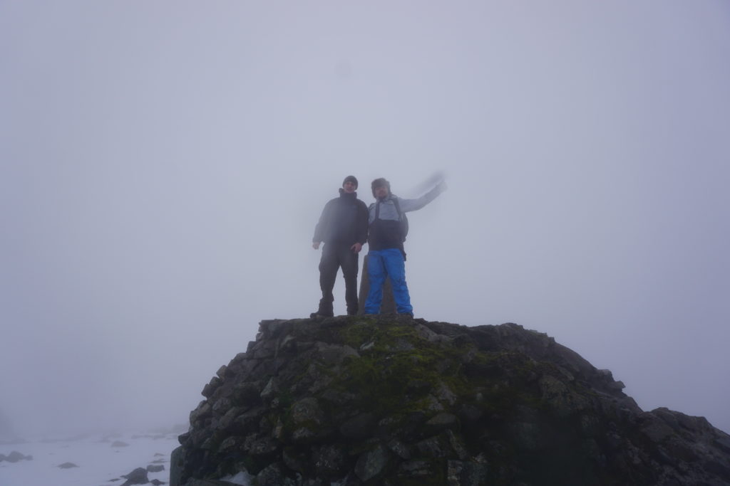
Somehow in the intervening years I’ve gotten way out of practice and even more out of shape because our expedition was hard. Partly that was our fault for choosing to climb on
one of the shortest days of the year, requiring that we maintain a better-than-par pace throughout to allow us to get up and down before the sun set (which we actually managed with
further time in-hand), but mostly it’s the fact that I’ve neglected my climbing: just about the only routine exercise I get these days is cycling, and with changes in my work/life
balance I’m now only doing that for about 40 miles in a typical week.
For the longest time my primary mountaineering-buddy was my dad, who was – prior to his death during a hillwalking accident – a bigger climber and
hiker than I’ll ever be. Indeed, I’ve been “pushed on” by trying to keep up with my father enough times that fighting to keep up with Robin at the weekend was second nature. If I want
to get back to the point where I’m fit enough for ice climbing again I probably need to start by finding the excuse for getting up a hill once in a while more-often than I do, first,
too. Perhaps I can lay some of the blame for my being out of practice in the flat, gentle plains of Oxfordshire?
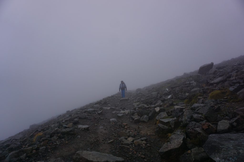
I’d have loved to have gotten a shot of me actually managing to get some use out of my crampons, but by that point visibility wasn’t great and we were rather cold and wet to be
stopping in a wind to take photographs. So this rocky stretch will have to do.
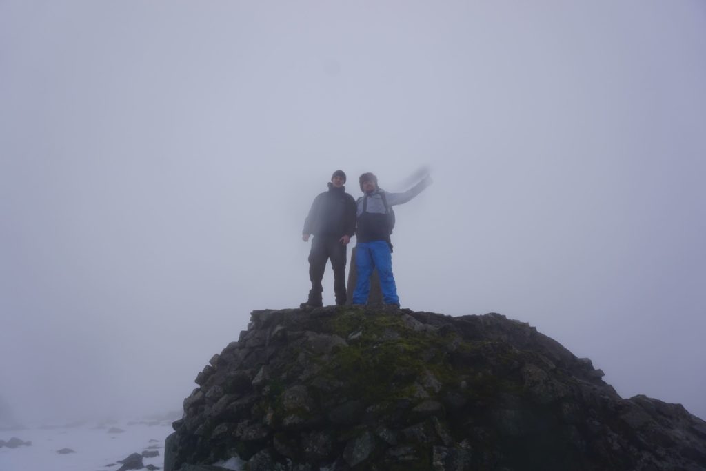
In any case, it was a worthwhile and enjoyable treat to be able to be part of Robin’s final reflection as well as to end the year somewhat-literally “on a high” by seeing off 2018 in
the Scottish Highlands. If you’ve not read his blog about his adventures of the last 52 weekends, you should: whether taking a Boris Bike from Brixton to Brighton (within the rental window) or hitching a ride on an aeroplane, he’s provided a year’s worth of fantastic stories accompanied by some great photography.
After the success of Challenge Robin this summer – where Ruth and I blindfolded her brother
Robin and drove him out to the middle of nowhere without his phone or money and challenged him to find his way home – Robin’s been angling for a sequel. He even went so far as to suffix the title
of his blog post on the subject “(part 1)”, in the hopes perhaps that we’d find a way to repeat the experience.
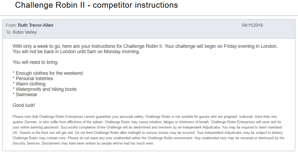
I gather that Robin was particularly concerned by the combination of the recommendation to bring swimwear and the warning that he may have to leave mainland UK… especially given that
the challenge takes place in November.
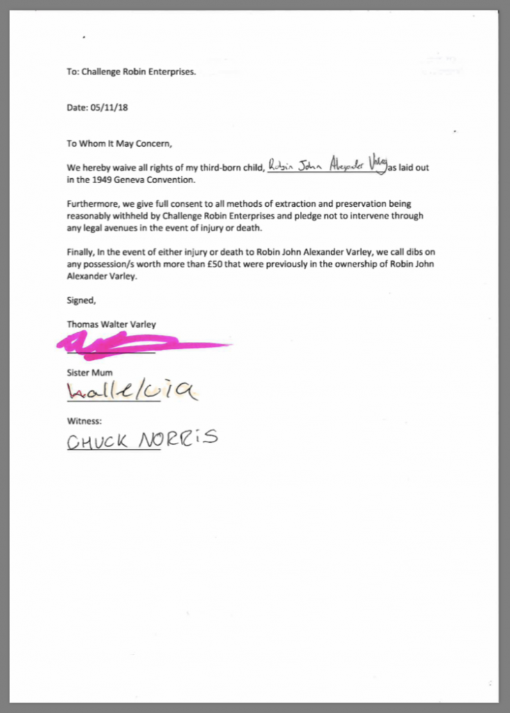
In response to an email sent a week in advance of the challenge, Robin quickly prepared and returned a “permission slip” from his parents, although I’m skeptical that either of them
actually saw this document, let alone signed it.
I’m told that the “signatures” on this document accurately replicate the signature styles of Robin’s parents. I’m guessing he forged a lot of these kinds of notes.
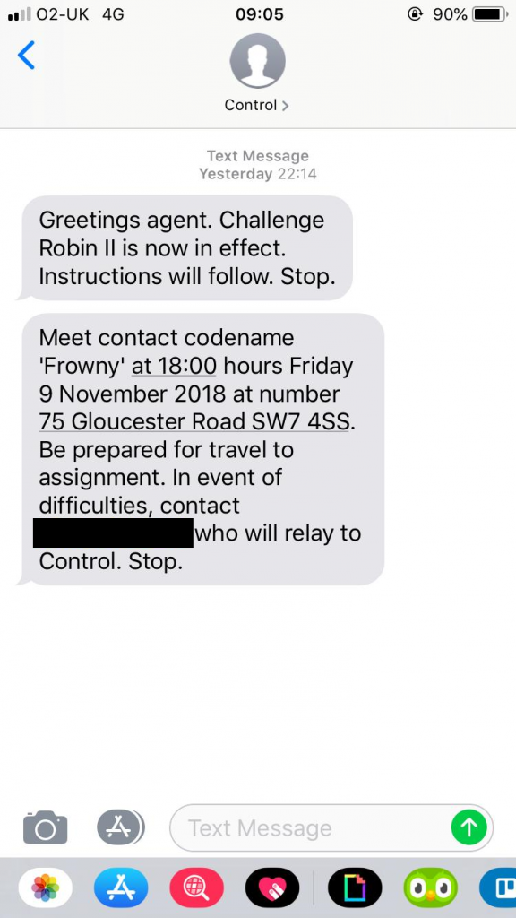
With about a day to go before the challenge began, Robin’s phone will have received a number of instructional messages from a sender-ID called “Control”, instructing him of his first
actions and kicking off his adventure. He’d already committed to going to work on Friday with a bag fully-packed for whatever we might have in store for him, but he doubtless wouldn’t
have guessed quite how much work had been put into this operation.
We considered giving Robin’s contact the alias ‘Smiler’, but ‘Frowny’ seemed more-fitting for the part.
By 18:06 he still hadn’t arrived to meet his contact. Had this adventure fallen at the first hurdle? Only time would tell…
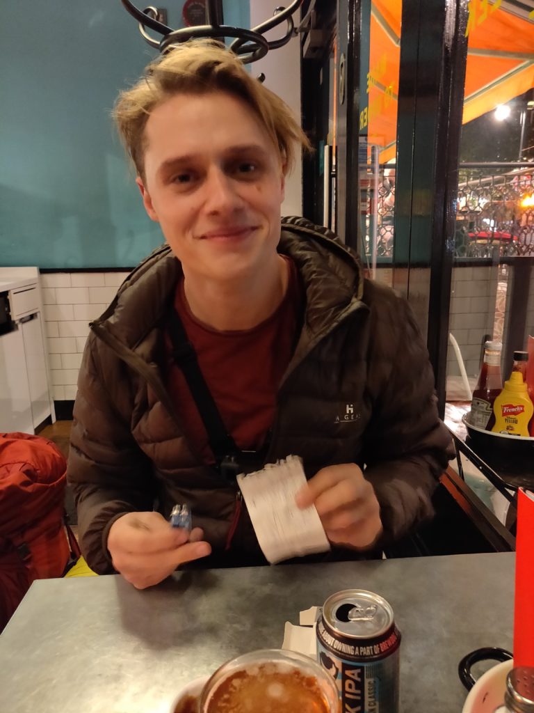
Update – Friday 9 November 18:45: Robin arrived late and apologetic to find his contact, “Frowny”, at the GBK at that address, was played by JTA.
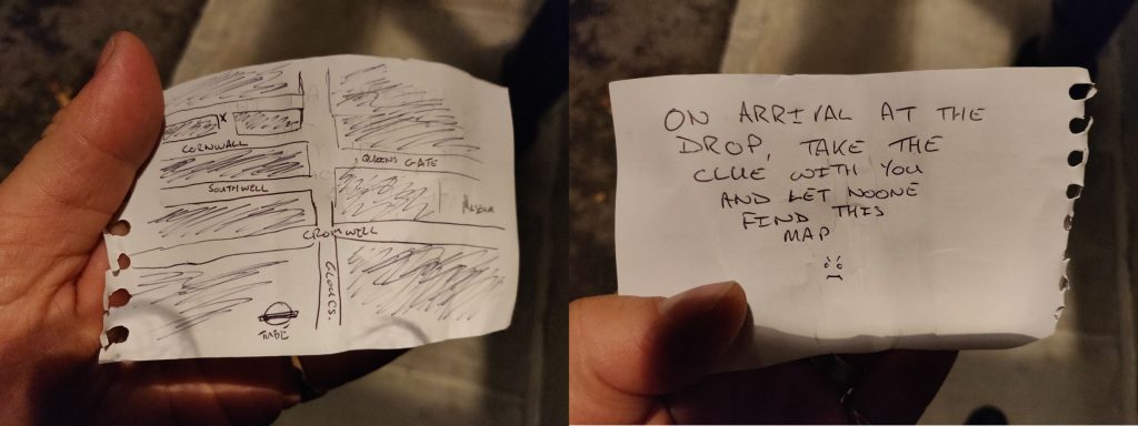
After sufficient apologies he was allowed to be granted the clue we’d expected to give him earlier…
The pair ate and drank and “Frowny” handed Robin his first clue: a map pointing to Cornwall Gardens in Kensington and instructions on where to find the next clue when he got there. The
game was afoot!
I love the little “Frowny” face; it really make this prop.
Clearly he’d taken the idea of being prepared for anything to a level beyond what we’d expected. Among his other provisions, he was carrying a tent, sleeping bag, and passport!
“Clearly my mistake,” he told his contact, “Was giving intelligent people a challenge and then leaving them three months to plan.”
Update – Friday 9 November 19:53: In Cornwall Gardens, Robin found the note (delayed somewhat, perhaps by the growing dark) and began his treasure
trail.
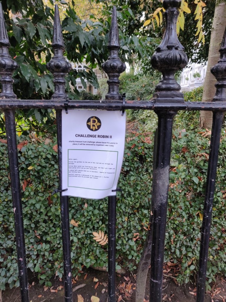
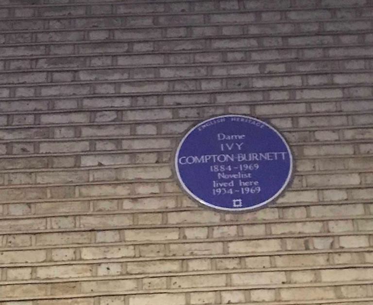
The sign at Cornwall Gardens kickstarted a journey visiting a thematic series of blue plaques around London before eventually leading to the Paddington Bear statue at Paddington
Station…
Soon after, though, things started to go very wrong…
I’m not sure that this was even one of the ones he was supposed to photograph, but anyway…
Update – Friday 9 Novembr 20:40: Let’s take a diversion, and I’ll rely on JTA to keep Robin’s eyes away from this post for a bit. Here’s what was
supposed to happen:
Robin would follow a trail of clues around London which would give him key words whose names alluded to literature about Paddington (station) and Penzance. Eventually he’d find a
puzzle box and, upon solving it, discover inside tickets for the Paddington-to-Penzance overnight sleeper train.
Meanwhile, I’ve been rushing around the countryside near Penzance setting up an epic extension to the previous trail complete with puzzles, mixed-terrain hikes, highlands, islands,
lions, tigers and bears (oh my). Some of those might not really have been in the plan.
The storm was just starting as I climbed up to a cliff edge for an as-yet-undisclosed reason; it’s already looking pretty wild and getting wilder all the time!
So now we’re working out what to do next. Right now I’m holed-up in an undisclosed location near Penzance (the ultimate target of the challenge) and Robin’s all the way over in London.
We’re working on it, but this hasn’t been so successful as we might have liked.
Update – Saturday 10 November 07:58: We’ve managed to get Robin onto a series of different trains rather than the sleeper, so he’ll still get to
Penzance… eventually! Meanwhile, I’m adjusting the planned order of stages at this end to ensure that he can still get a decent hike in (weather permitting).
Update – Saturday 10 November 10:45: Originally, when Robin had been expected to arrive in Penzance via a sleeper train about three hours ago, he’d
have received his first instruction via The Gadget, which JTA gave him in London:
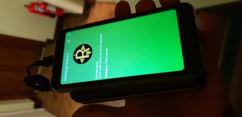
The Gadget is a cheap Android smartphone coupled to a beefy battery pack and running custom software I wrote for the challenge.
The Gadget’s primary purpose is to send realtime updates on Robin’s position so that I can plot it on a map (and report it to you guys!) and to issue him with hints so that he knows
where he’s headed next, without giving him access to a phone, Internet, navigation, maps, etc. The first instruction would be to head to Sullivan’s Diner for breakfast (where
I’ve asked staff to issue him with his first clue): cool eh? But now he’s only going to be arriving in the afternoon so I’m going to have to adapt on-the-fly. Luckily I’ve got a plan.
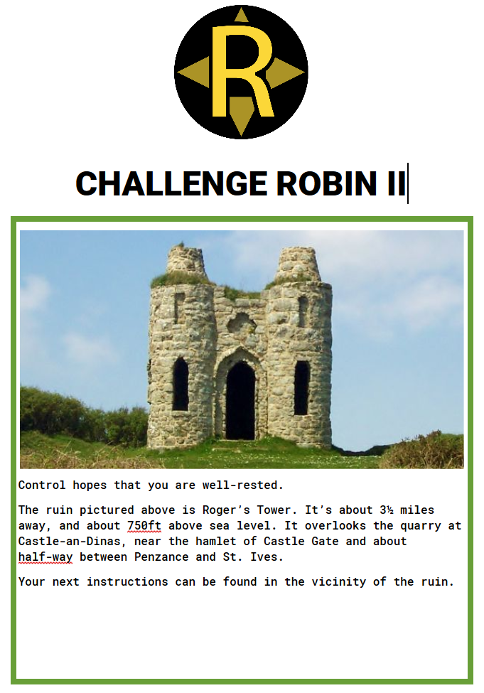
The first clue has a picture of the ruin of a hill fort a few miles away and vauge instructions on how to find it.
I’m going to meet Robin off his train and suggest he skips this first leg of the challenge, because the second leg is… sort-of time-critical…
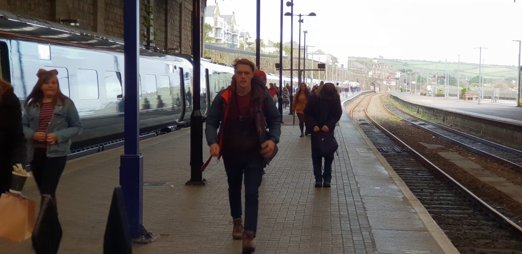
Update – Saturday 10 November 13:29: Robin finally arrives in Penzance on a (further-delayed) train. I’ve given him a sausage sandwich at
Sullivan’s Diner (who then gave him the clue above), turned on The Gadget (so I’ve got live tracking of his location), and given him the next clue (the one he’d have gotten at
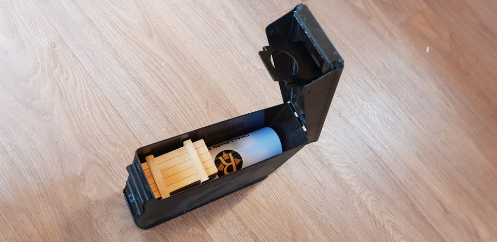
Roger’s Tower) and its accompanying prop.
Rushing off the train, carrying his tent, sleeping bag, clothes…
Armed with the clue, Robin quickly saw the challenge that faced him…
The second clue SHOULD have been read at Roger’s Tower and so the photo would have made more sense.
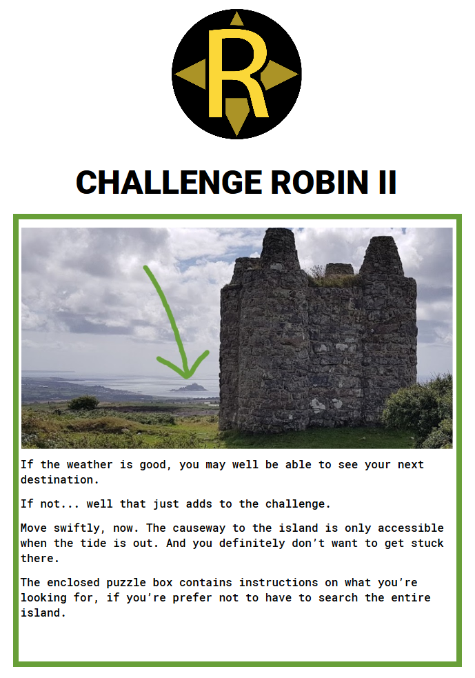
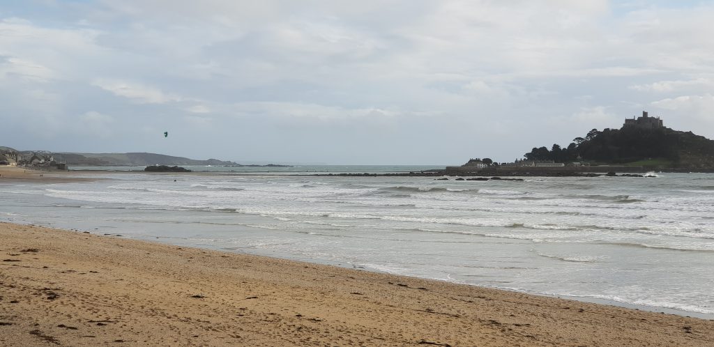
After all of these delays, there’s only about an hour and a half until the tide comes in enough to submerge the causeway to St. Michael’s Mount: the island he’s being sent to. And he’s
got to get there (about an hour’s walk away), across the causeway, find the next clue, and back across the causeway to avoid being stranded. The race is on.
He WOULD have found this at Roger’s Tower. Why yes, I am a geocacher: why do you ask?
Luckily, he’d been able to open the puzzle box and knows broadly where to look on the island for the next clue. How will he do? We’ll have to wait and see…
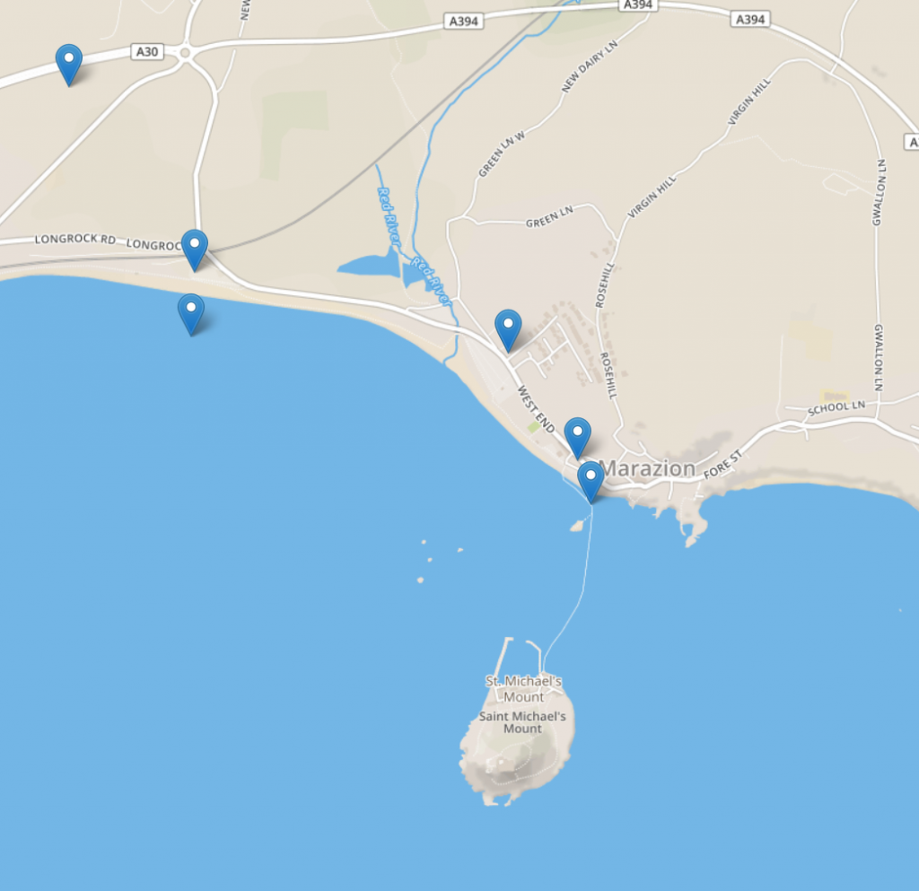
Update – Saturday 10 November 14:18: Robin made spectacular time sprinting along the coast to Longrock (although his route might have been
suboptimal). At 14:18 he began to cross to the island, but with only a little over half an hour until the tide began to cover the causeway, he’d have to hunt quickly for the password he
needed.
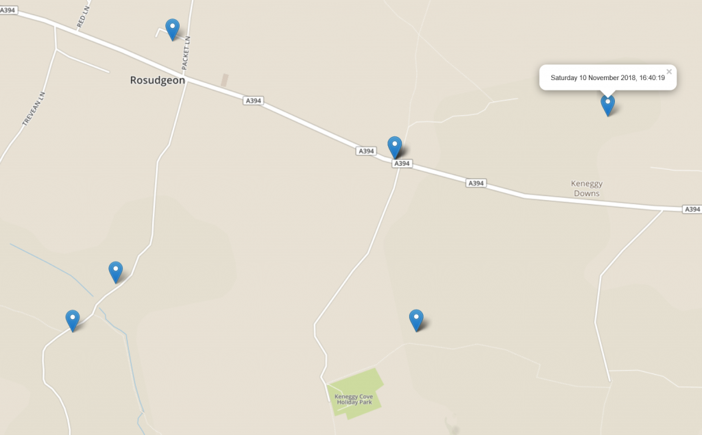
Each pin is 3 minutes apart. You do the maths.
At 14:22 he retreived the clue and put the password into The Gadget: now he had a new set of instructions – to get to a particular location without being told what it was… only a
real-time display of how far away it was. 7.5km and counting…
I THINK he’s the rightmost blob. I wish I’d brought a telephoto lens.
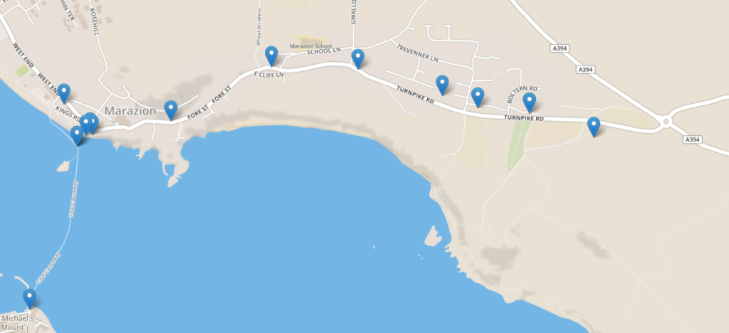
Update – Saturday 10 November 14:57: Robin’s making his way along the coast (at a more-reasonable pace now!). He’s sticking to the road rather
than the more-attractive coast path, so I’ve had “Control” give him a nudge via The Gadget to see if he’d prefer to try the more-scenic route: he’ll need to, at some point, if he’s to
find his way to the box I’ve hidden.
While not as steep as the gradient to Roger’s Tower would’ve been, the coast path isn’t without its steep bits, too.
Update – Saturday 10 November 16:50: No idea where Robin is; The Gadget’s GPS has gone all screwy.
One of these pins is probably right, right?
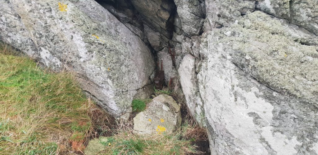
But it looks like he probably made it to Cudden Point, where the final clue was hidden. And then kept moving, suggesting that he retreived it without plunging over the cliff
and into the sea.
It’s not VERY well hidden, but it only had to survive a day. A stormy day, mind…
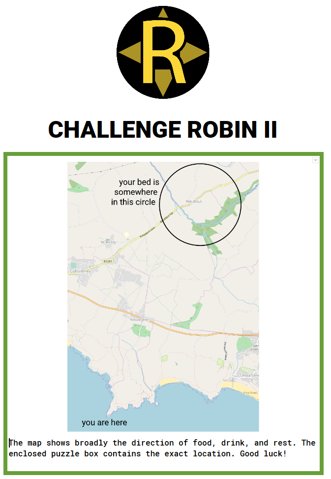
In it, he’ll have found a clue as to broadly where his bed is tonight, plus a final (very devious) puzzle box with the exact location.
The fourth clue basically says “your bed is THAT way, but you need to open THIS puzzle box to know exactly where”. Evil.
The sun is setting and Robin’s into the final stretch. Will he make it?
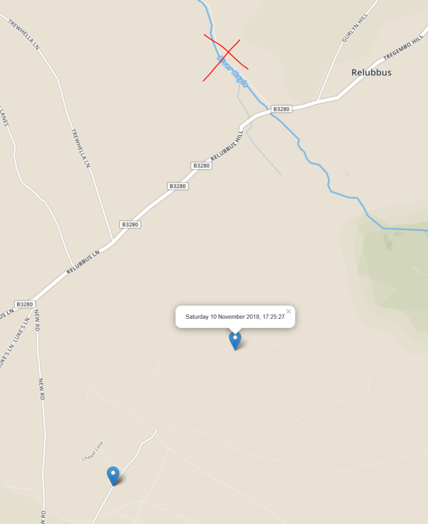
Update – Saturday 10 November 17:25: He’s going to make it! He’s actually going to make it! Looks like he’s under a mile away and heading in the
right direction!
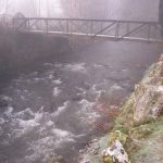
It might not be clear to him yet that there’s a river in the way, but I’m sure he’ll find a bridge. Or swim.
Update – Saturday 10 November 17:55: He made it!
Success!
We’ve both got lots to say, so a full debrief will take place in a separate blog post.
Do you remember Challenge Anneka? It aired during the late 1980s and early 1990s and basically involved TV
presenter Anneka Rice being dropped off somewhere “random” and being challenged to find and help people in sort-of a treasure-trail activity; sort of a game show but with only one
competitor and the prizes are community projects and charities. No? Doesn’t matter, it’s just what I was thinking about.
“Hey, I’ve got an idea,” said Robin, shortly before we stole his phone and wallet and dumped him in the countryside.
Ruth‘s brother Robin is doing a project this year that he calls 52 Reflect (you may recall I shared his inaugural post) which sees him leaving London to visit a different place every weekend, hike around, and take some photos. This last weekend,
though, he hadn’t made any plans, so he came up to Oxford and asked us to decide where he went: we were to pick a place between 10 and 15 miles away, blindfold him, and drop
him off there to see if he could find his way home. Naturally he’d need to be deprived of a means of navigation or communication, so we took his phone, and to increase the challenge we
also took his wallet, leaving him with only a tenner in case he needed to buy a packet of crisps or something.
I had a friendly assistant test out a variety of blindfolds for me: this wasn’t the one we eventually used.
After much secretive discussion, we eventually settled on N 51° 50.898′, W 001° 28.987′: a
footpath through a field in the nothingness to the West of Finstock, a village near the only-slightly-larger town of Charlbury. Then the next morning we bundled Robin into a car (with a blindfold on), drove him out to near the spot, walked him the rest of
the way (we’d been careful to pick somewhere we believed we could walk a blindfolded person to safely), and ran quietly away while he counted to 120 and took off his blindfold.
We selected a location based on a combination of its distance, natural beauty, and anticipated difficulty in determining the “right” direction to walk in after being abandoned.
Unfortunately it rained on the day itself, so the beauty was somewhat muted.
I also slipped a “logging only” GPS received into his backpack so that we’d be able, after the fact, to extract data about his journey – distance, speeds, route etc.. And so when he
turned up soaking wet on our door some hours later we could look at the path he took at the same time as he told us the story of his adventure. (If you’re of such an inclination, you
can download the GPX file.)
His route might not have been the most direct, but he DID manage to hitch a lift for the first leg.
For the full story of his adventure, go read Robin’s piece about it (the blog posts of his
other adventures are pretty good too). Robin’s expressed an interest in doing something similar – or even crazier – in future, so you might be hearing more of this kind of thing.
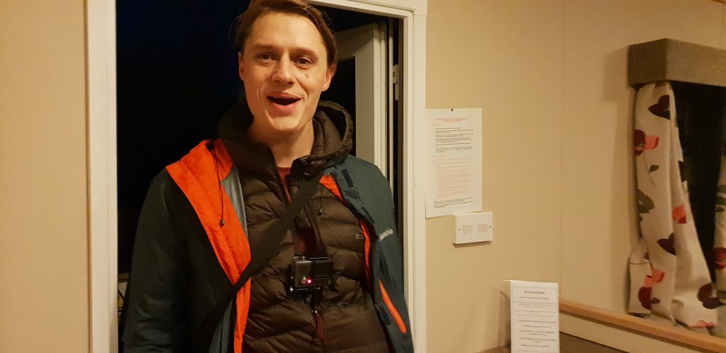
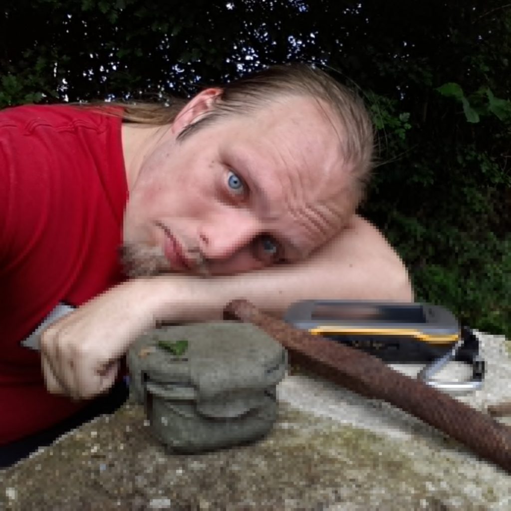
I spent last week in the French Alps with JTA, Ruth, Annabel, and some hangers-on. It was great to get out onto the snow again for some skiing as well as some ski-based geocaching, but perhaps the most remarkable events of the trip happened not on the pistes but on
an “afternoon off” that I decided to take after a rather jarring 42km/h (26mph) faceplant earlier in the day.
A great thing about taking a GPSr for snowsports is that you know exactly how fast you were going (my record is 101km/h!) when you crash. Thankfully my faceplant was at a mere 42km/h.
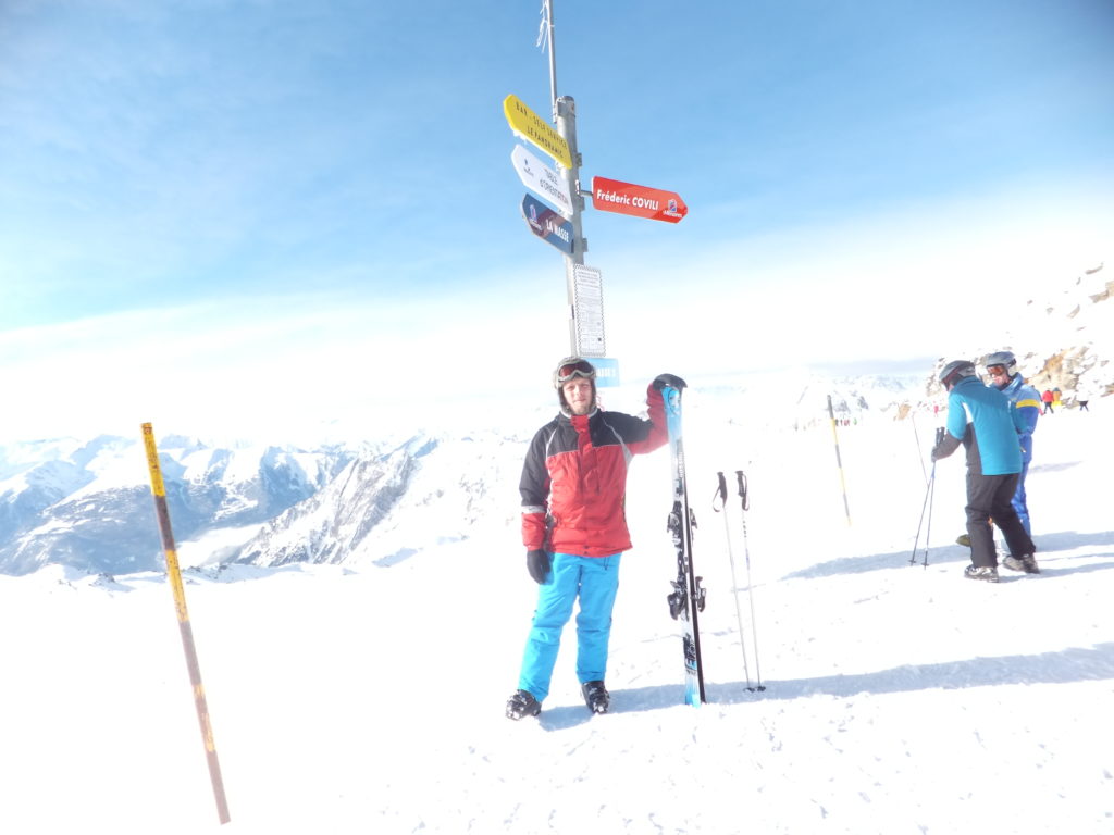
Not to be deprived of the opportunity for some outdoors, though, I decided to spend the afternoon hiking out to villaflou, a geocache only about a kilometre and a half away from our chalet. Well: a kilometre and a half as the crow
flies: it was also some distance down the steep-sided Doron de Bozel valley, through a wooded area. But there was, in theory at least, a hiking trail winding its way down
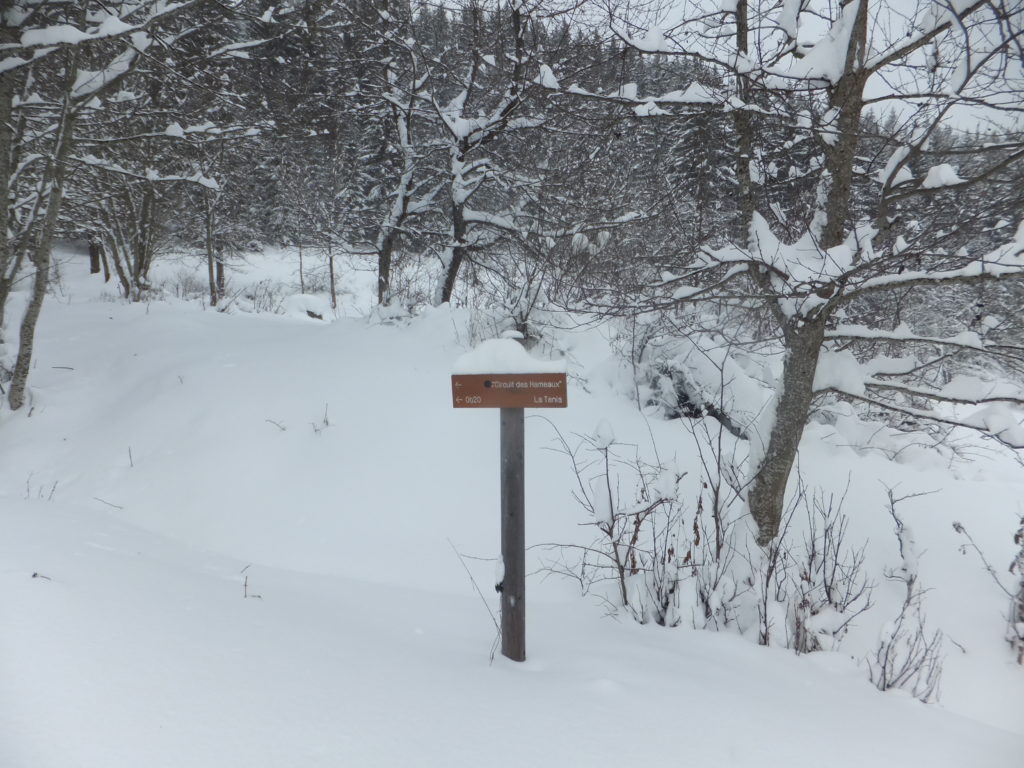
the valley. The trail was clearly designed for summer use, but it was a trail nonetheless, so I ate a hearty lunch with Ruth and then set out from La Tania to explore.
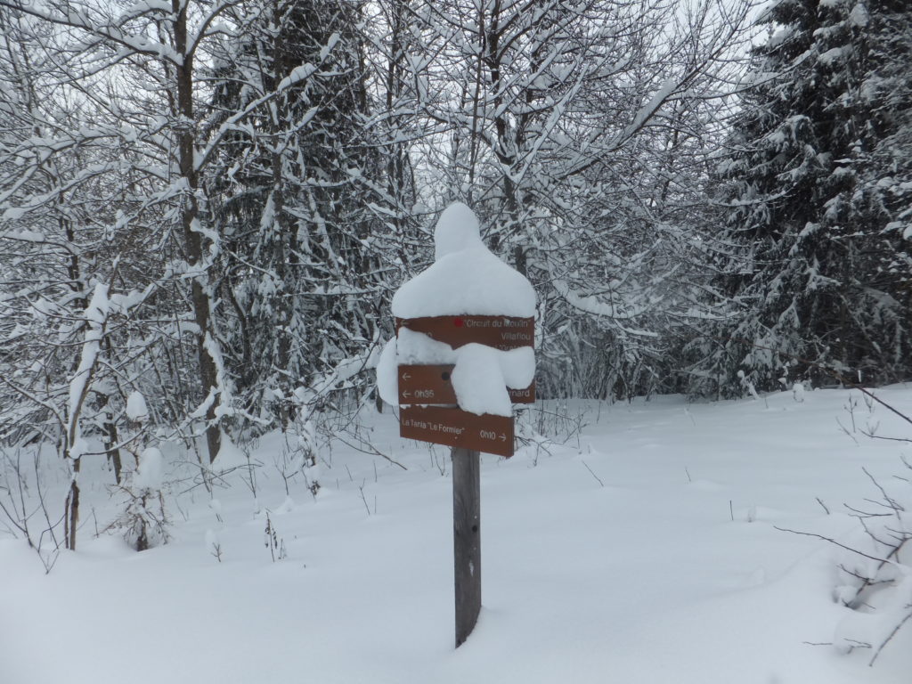
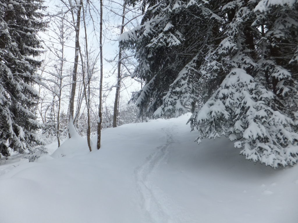
Signposts marking the trail were supposed to stand six feet tall, but barely stuck out atop the drifts… where I could find them at all!
It quickly became apparent that I was underequipped for the journey ahead. With the freshly-fallen soft snow routinely knee-deep and sometimes deeper still, I would have done well to
have taken at the very least snow shoes (and, I’d later conclude, perhaps also poles and rope). I was, however, properly dressed with thermal layers, salopettes, multiple
pairs of gloves, hat, etc., and – unlike Rory when he got caught out by snow the other year – was at least equipped with two
fully-charged GPS devices (and spare batteries), tightly-fitted boots, a first aid kit and emergency supplies. And as the only hiker foolish enough to cut my way through this
freshly-fallen snow, my tracks would be easy to follow back, should I need to.
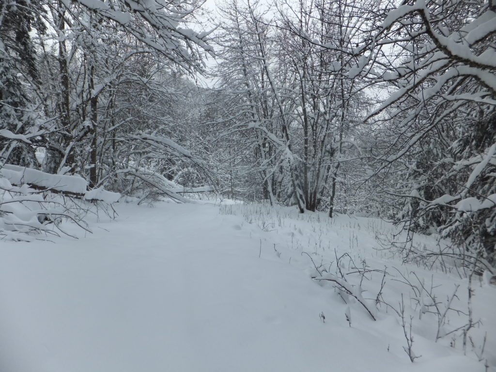
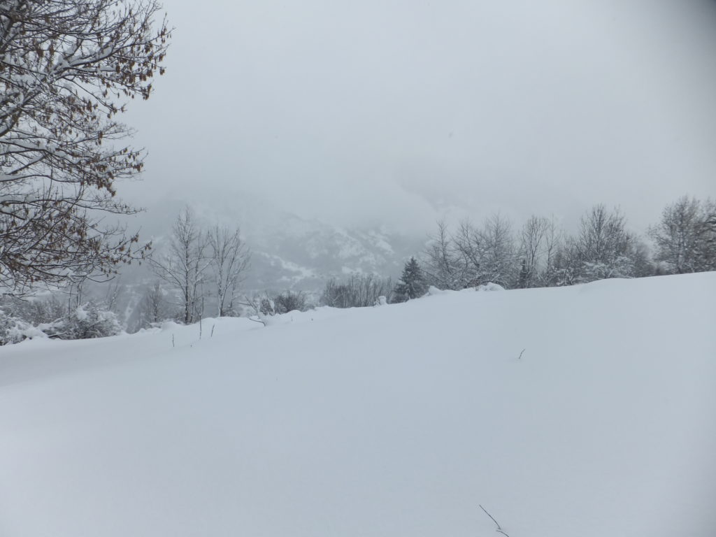
Walking through knee-deep snow is tiring, even downhill! Beautiful, though!
Nonetheless, it’s quite an isolating feeling to be stranded from civilization… even if only by half a kilometre… surrounded by snowy mountains and silent woodland. If you’re approaching
the hike in a safe and sane way – and you should be – then it makes you especially careful about even the simplest of obstacles. Crossing a small stream whose bridge is completely
concealed beneath the snow becomes a careful operation involving probing the snow and testing the support it provides before even beginning to ford it: a turned ankle could lead to at
the very least an incredibly painful hike back!
Needless to say, my caution around snow and mountains has been expanded by not only Rory’s scary experience, linked above, but also of course by my dad’s death almost three years ago, who slipped on snow and fell off a cliff. And he was hiking in Britain!
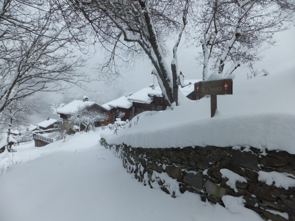
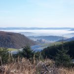
After my hike down from La Tania, I was pleased to pass through La Nouvaz, a small alpine village that indicated that I was over half-way to my destination.
The village of La Nouvaz, half-way as the crow flies between my accommodation and the geocache (and over half-way by my planned route), was beautiful to behold: a sign of civilization
after about an hour of hard wading through snow. Even when you’ve used satellites to know your location accurate to a metre, it’s nice to be reassured that your expedition really is
panning out as you’d planned.
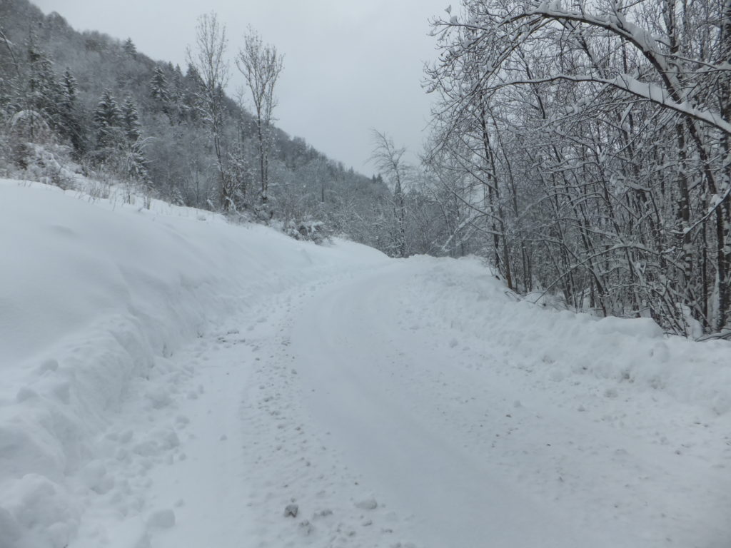
The “road” into La Nouvaz had been ploughed that morning, but was already becoming treacherous.
I also now had a metric to translate the journey time estimates that I’d seen on the signs: it was taking me about three times as long as they said, presumably because they’d been
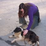
written for summer hikers. The segment that had been advertised as 20 minute walk was taking me an hour: that was useful information – I sat with a friendly dog while I
recalculated my travel time with this new data. There was a blizzard blowing across the mountaintops (which had been partially-responsible for my faceplant in the morning!) and I’d
heard that it was expected to descend into the valley in the early evening, so I wanted to make sure I wasn’t out in the open when that happened! But everything was okay, and I had time
to complete my expedition with two hours to spare (which I reasoned could be used hunting for the geocache, as well as a emergency reserve), so I pressed on.
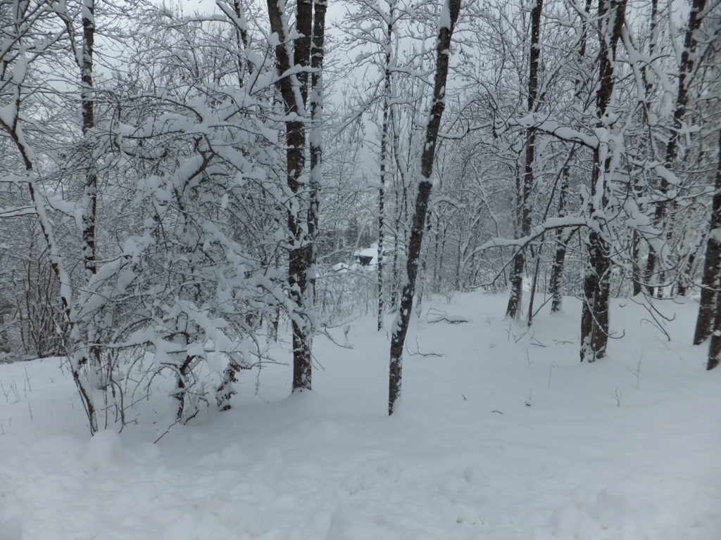
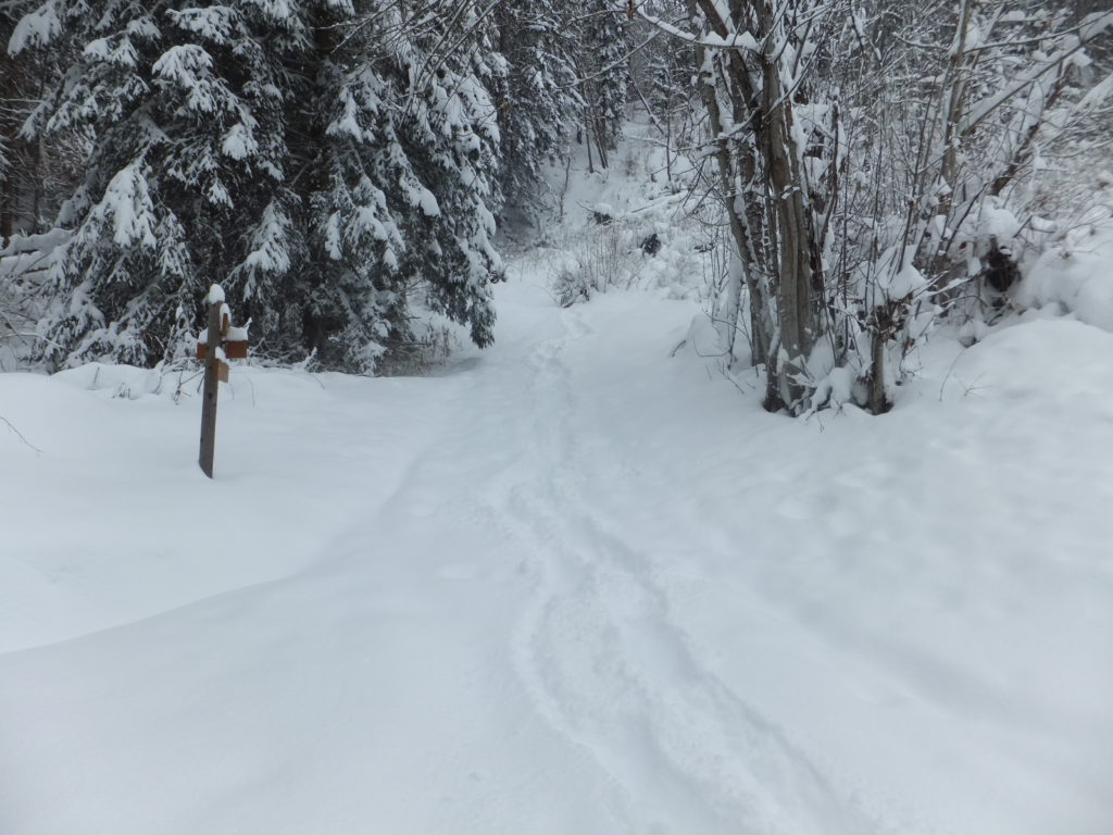
The trail become more well-concealed as I pressed on. Here was my first sight of the hamlet of Villaflou, ahead.
After La Nouvaz, the path became even harder to navigate, and in the thinner tree cover huge drifts formed where underneath there were presumably walls and fences. At one point, I
slipped through snow that came up to my waist, and had to dig my way out. At another, I’d deviated from the path and was only able to get back on course by sliding down a snowbank on my
bum. And honestly, I can’t think of a more fun way than that to spend a Narnian hiking trip.
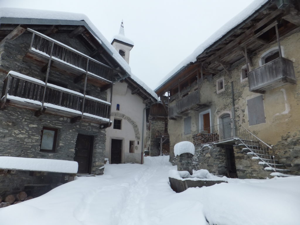
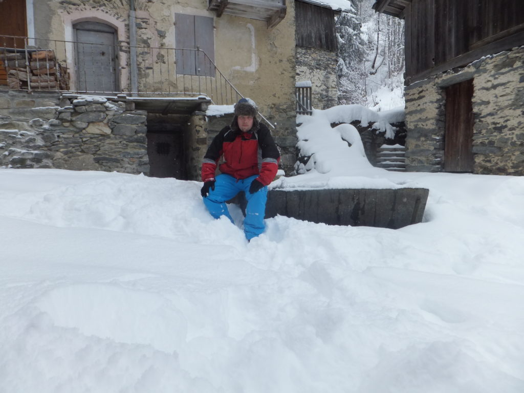
The hamlet at Villaflou – nothing more than a couple of buildings clustered around a chapel – is as picturesque as it is remote.
My GPS coordinates took me directly to the pump and trough in the square at Villaflou, and I spent some time (in my thinner pair of gloves) feeling around its metal edges in an
effort to find the small magnétique geocache that was allegedly there. But that’s not where it was at all, and honestly, if I hadn’t just spent two hours hiking through
deep snow I might now have had the drive to search for as long as I did! As I hunted, I thought back to my GCSE in French and tried to work out how I’d explain what I was doing to
anybody who came by, but I never saw another soul. Eventually, my efforts paid off, as I discovered a small metal plate in a cunning hiding place, disguised to make it look like it
belonged to the thing it was attached to… and behind it, a log with just four names. And now: mine was fifth!
The snow was a lot less-deep in Villaflou itself, and had clearly been stamped down by locals moving around.
I texted my revised travel times to Ruth, and then set off back. Following my footsteps made the journey less-arduous, but this was compensated for in equal measure by the fact that I
was now heading uphill instead of down.
As I passed through La Nouvaz, I noticed two strange things –
Firstly: looking back up at the route I’d come down, from La Tania, I saw that there was a signpost that indicated that the recommended route back wasn’t the route that I’d
come to begin with. The recommended route was the other way, to the left, and would only take me about 30 minutes (or, based on my recalculation, about an hour and a half).
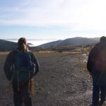
And secondly: looking along this proposed new route, I observed that somebody had taken it since I passed this way last. There had been no tracks on that route before,
but now there were, and looking up the mountainside I could make out the heads of two hikers bobbing away over a rise.
Meanwhile, the blizzard was starting to descend into the valley, so I was certainly keen to try the “preferred” route.
I followed in the footsteps of the other hikers: it’s a great deal easier to follow than to lead, in deep snow, and I was glad to be able to save the energy. I treated myself to a swig
from my hip flask as congratulations on finding the geocache and my good fortune in being able to tail some other hikers heading my way. But my celebration was perhaps premature! About
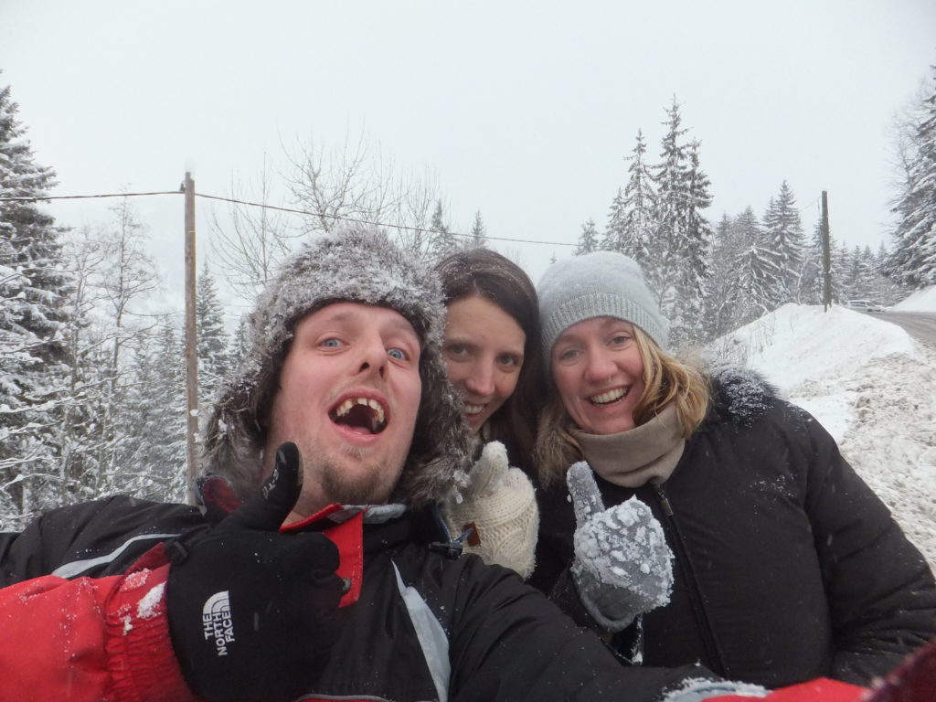
twenty minutes later, I caught up with the two women ahead, and they clearly weren’t doing very well.
They’d come up to La Tania from Paris, accompanied by some friends, for a long weekend. Their friends had gone off skiing, but they hadn’t been able to join them because they were both
pregnant (four months and six months), and no doctor on Earth would recommend skiing after the first trimester, so instead they’d decided to go out for a walk. There was a circular walk
on a map that they’d seen, which looked like it’d take about an hour, so they’d set out (wearing little more snow protection than wellington boots, and one of them without even a hat),
following what looked to be a well-trodden footpath: in fact, it was probably the first part of my outbound journey, from La Tania to La Nouvaz, that they’d followed, “overtaking” me
when I left the route to head on to Villaflou and the geocache.
The two women had been taking turns to lead, having also discovered how much easier it is to follow in somebody else’s footsteps, but I wonder how well-equipped to ‘lead’ either of
them really were.
On the ascent back up they’d gotten lost – there are no good waypoints, the path is unclear, and the encroaching blizzard hampering the ability to pick out distance landmarks. They’d
wandered – it turned out – several hundred metres off where the path should have gone, and I’d made the mistake of assuming that they knew what they were doing and followed them the
same way. Worse yet, this ‘alternative’ path back to La Tania didn’t feature on any of my digital maps, and these two severely-underequipped mothers-to-be were struggling with
inadequate grip on the slippy ground beneath the snow. When I first encountered them, one of them had slid into and was trapped in a snowdrift, and the other called me over to help her
pull her friend free.
Between them, they had a paper map designed for casual summer use, and they’d realised their predicament. Were I not there, they confessed (once we’d established a dialogue somewhere
between their shaky English and my very shaky French), they were about to start trying to find sufficient landmarks that they could summon rescue. Instead, now, they’d put themselves
into my care. “We do not want to die,” said the one I later learned was called Vicki, after a few seconds consideration of the translation.
Is this a path? Was it?
I plotted us a new course, cross-country up an aggressive slope towards the nearest road and thus, I hoped, towards civilization. I lead the way, tamping down the snow ahead as best I
could into steps, and bemoaned my lack of a rope. I texted updates to Ruth, advising her of the situation and in each one establishing when I’d next be in contact, and as the women
began to tire, prepared for the possibility that I might need to eventually relay coordinates to a rescue team: I practised my French numbers, under my breath, as we weaved our way up
the steep mountainside.
After hours out on a mountainside, not sure exactly where you are in relation to a safe route home, this is a sight for sore eyes.
A hundred metres from the road the gradient became worse and we were unable to climb any higher, so we turned towards La Tania and tacked alongside it. There, about an hour and a half
after I first met them, we found a signpost that indicated that we were back on the footpath: the footpath that they’d originally hoped to follow but found themselves unable to spot,
and which – by following in their footsteps – I too had failed to spot.
Finally reaching the main road, Vicki and Marine were pleased to be able to get back to their hotel and not die out on a mountainside.
Following that, we got back to the road to La Tania and to safety.
I find myself wondering many things. For one: who, at six months pregnant, thinks it’s a wise idea to trek through deep snow, underequipped, from a bad map, over an Alp? But I also
wonder what might have happened if I’d have taken the same route back as I’d taken out to my geocache (and thus never bumped into them)? Or even if I’d not have faceplanted earlier in
the day and thus decided to take the afternoon off from skiing at all? They weren’t ever far from safety, of course, and while the weather was rapidly becoming hostile to
helicopters, they’d have probably been rescued so long as they’d been able to describe their position adequately (and so long as they didn’t keep wandering in the direction they’d been
wandering when I met them, which would ultimately have taken them to a sheer cliff), but still…
So yeah: on my holidays, I rescued two lost pregnant hikers from an Alpine blizzard, while returning from a geocaching expedition. I think I win today’s “badass point”.
Update: following feedback from folks who found this post from Twitter, I just wanted to say at the top of this post – we’re all okay.
Our holiday in Devon last week turned out to be… memorable… both for happy holiday reasons and for somewhat more-tragic ones. Selected features of the trip included:
Croyde
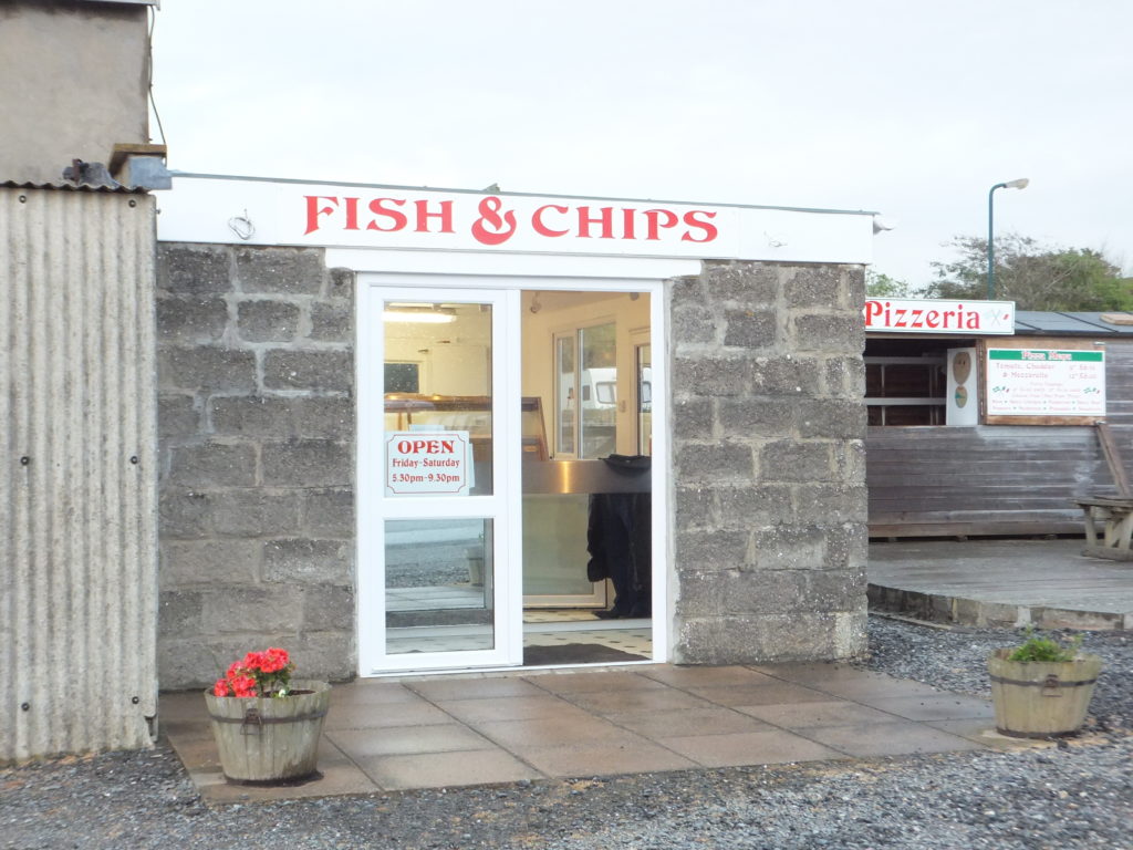
This pile of breezeblocks on the edge of a camp site was perhaps the sketchiest fish & chip shop we’d ever seen. Not bad grub, though!
We spent most of the week in Croyde, a picturesque and tourist-centric village on Devon’s
North coast. The combination of the life of a small village and being at the centre of a surfer scene makes for a particularly eccentric and culturally-unusual place. Quirky
features of the village included the bakery, which seemed to only bake a half-dozen croissants each morning and sell out shortly after they opened (which was variably between 8am and
9am, pretty much at random), the ice cream shop which closed at lunchtime on the hottest day of our stay, and the fish & chip shop that was so desperate to “use up their stock”, for
some reason, that they suggested that we might like a cardboard box rather than a carrier bag in which to take away our food, “so they could get rid of it”.
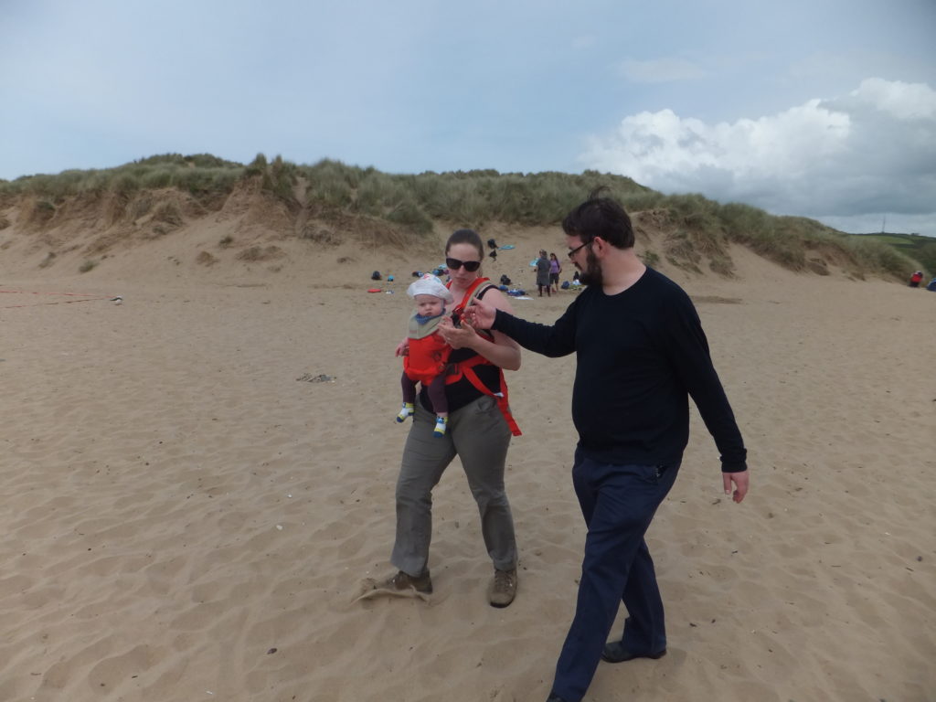
“You’ve never seen a beach before, have you? Isn’t this exciting?” /stares in wonderment at own thumbs/
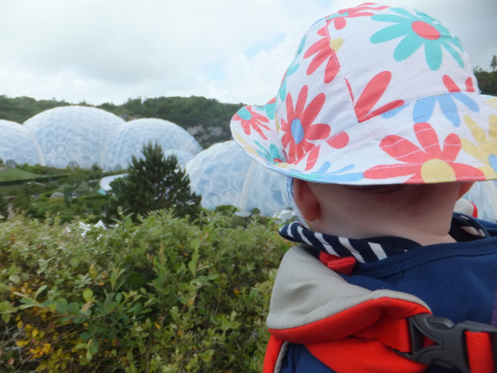
The Eden Project
In the right dome, a Mediterranean climate. In the left, a jungle. In both, lots of things for Annabel to try to grab hold of and put in her mouth.
Ever since it opened in the early 2000s, I’d always wanted to visit The Eden Project – a group of biome
domes deep in the valley of a former Cornish quarry, surrounded by gardens and eco-exhibitions and stuff. And since we’d come all of the way to Devon (via Cardiff, which turns out
to be quite the diversion, actually!), we figured that we might as well go the extra 90 miles into Cornwall to visit the place. It was pretty fabulous, actually, although the heat and
humidity of the jungle biome really did make it feel like we were trekking through the jungle, from time to time.
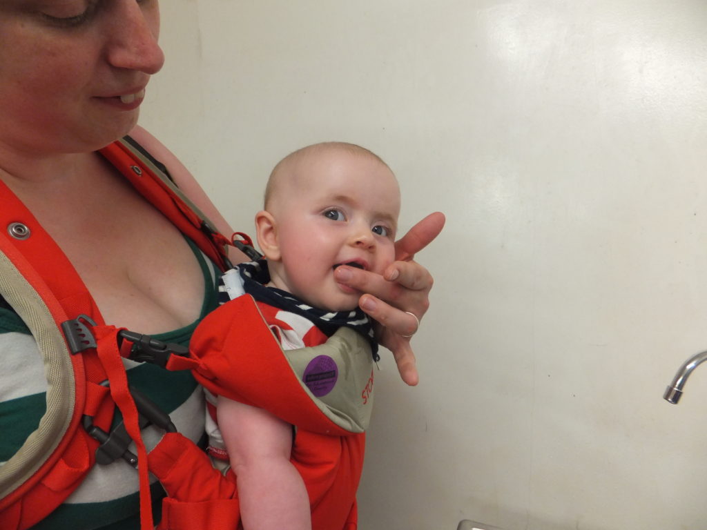
The jungle biome was a little hot for poor Annabel, and she was glad to get into the cool room and have a drink of water.
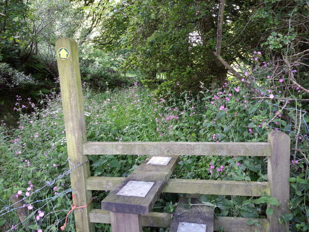
Geocaching
In Devon, nipple-high grass counts as a “footpath”.
On one day of our holiday, I took an afternoon to make a 6½ mile hike/jog around the Northern loop of the Way Down West series of geocaches, which turned out to be somewhat gruelling on account of the ill-maintained rural footpaths of North
Devon and taking an inadequate supply of water for the heat of the afternoon.
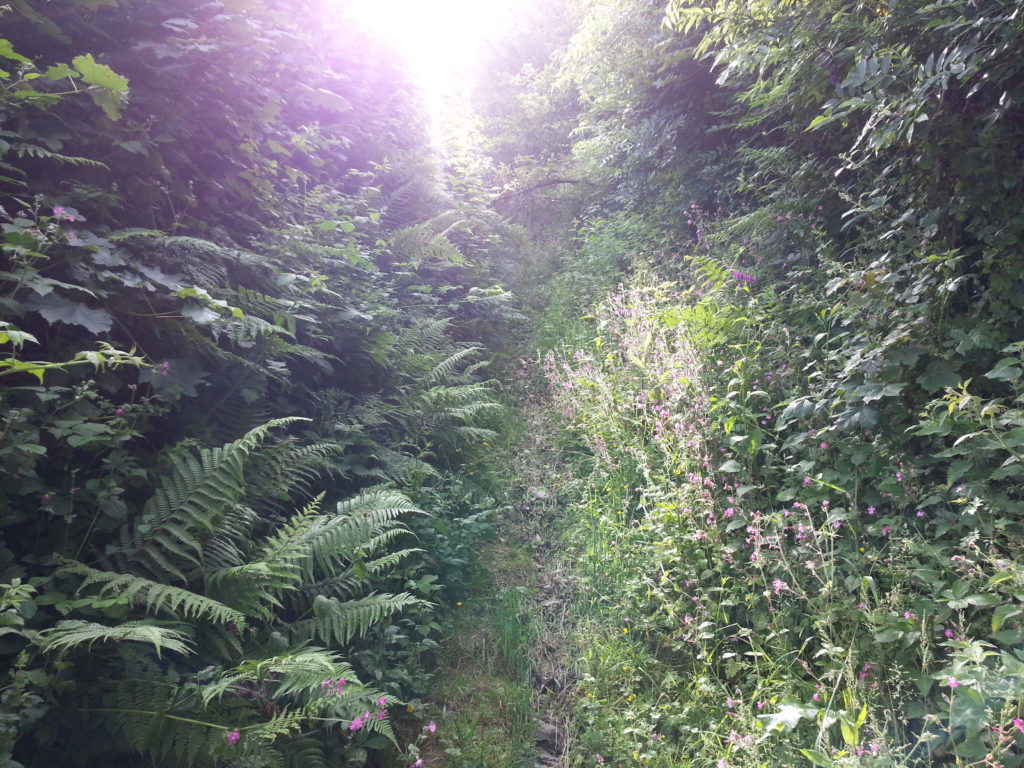
Seriously, Devon: if I need to bring a machete, it’s not a footpath.
On the upside, though, I managed to find 55 geocaches in a single afternoon, on foot, which is more than three times my previous best “daily score”, and took me through some genuinely
beautiful and remote Devon countryside.
GC24YCW (“Way Down West 105”) was the last in my 55-cache series, and my body was glad of it.
Watermouth Castle
We took an expedition out to Watermouth Castle, which turned out to be an
experience as eccentric as we’d found Croyde to be, before it. The only possible explanation I can think of for the place is that it must be owned by a child of a hoarder, who inherited
an enormous collection of random crap and needed to find a way to make money out of it… so they turned it into something that’s 50% museum, 50% theme park, and 100% fever dream.
A group of animatronic robots playing automatic-organ versions of ABBA songs greet you at Watermouth Castle. And then things get weird.
There’s a cellar full of old bicycles. A room full of old kitchen equipment. A room containing a very large N-gauge model railway layout. Several rooms
containing entertainments that would have looked outdated on a 1970s pier: fortune tellers, slot machines, and delightfully naïve peep-show boxes. A hedge maze with no exit. A
disturbingly patriotic water show with organ accompaniment. A garden full of dancing gnomes. A hall of mirrors. A mock 1920s living room. A room full of primitive washing
machines and their components. The whole thing feels schizophrenic, but somehow charming too: like a reminder of how far entertainment and conveniences have come in the last hundred
years.
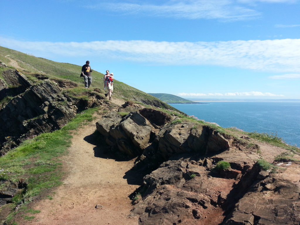
Baggy Point
The tip of Baggy Point gave me vibes of Aberystwyth’s own Constitution Hill, with the exception that it was sunny at Baggy Point.
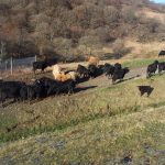
We took a hike out to beautiful Baggy Point, a beautiful headland stretching
out into the Atlantic to make it the Easternmost point in North Devon. It was apparently used by soldiers training for the D-Day landings, but nowadays it seems mostly to be used to
graze goats. The whole area made me reminisce about walks to Borth along the Ceredigion coast. Unfortunately for Ruth and
JTA, who headed back to our accommodation before me, I’d failed to hand them the key to the front door before we
parted ways and I went off to explore the rest of the headland, and in my absence they had to climb in through the window.
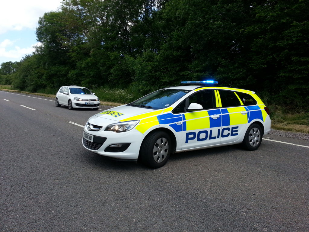
The Collision
For all of the wonderful things we got up to in Devon, though – everything above and more besides – the reason that we’ll no-doubt never forget this particular trip came as we set off
on our way home.
[spb_message color=”alert-warning” width=”1/1″ el_position=”first last”]Warning: this section discusses a tragic car accident.[/spb_message]
About an hour after we set off for home on our final day in Devon, we ended up immediately behind a terrible crash, involving two cars striking one another head-on at an incredible
speed. We saw it coming with only seconds to spare before both vehicles smashing together, each thrown clear to a side of the road as a cloud of shattered glass and metal was
flung into the air. JTA was driving at this point, and hit the brakes in time to keep us clear of the whirling machines, but it was immediately apparent that we were right in the middle
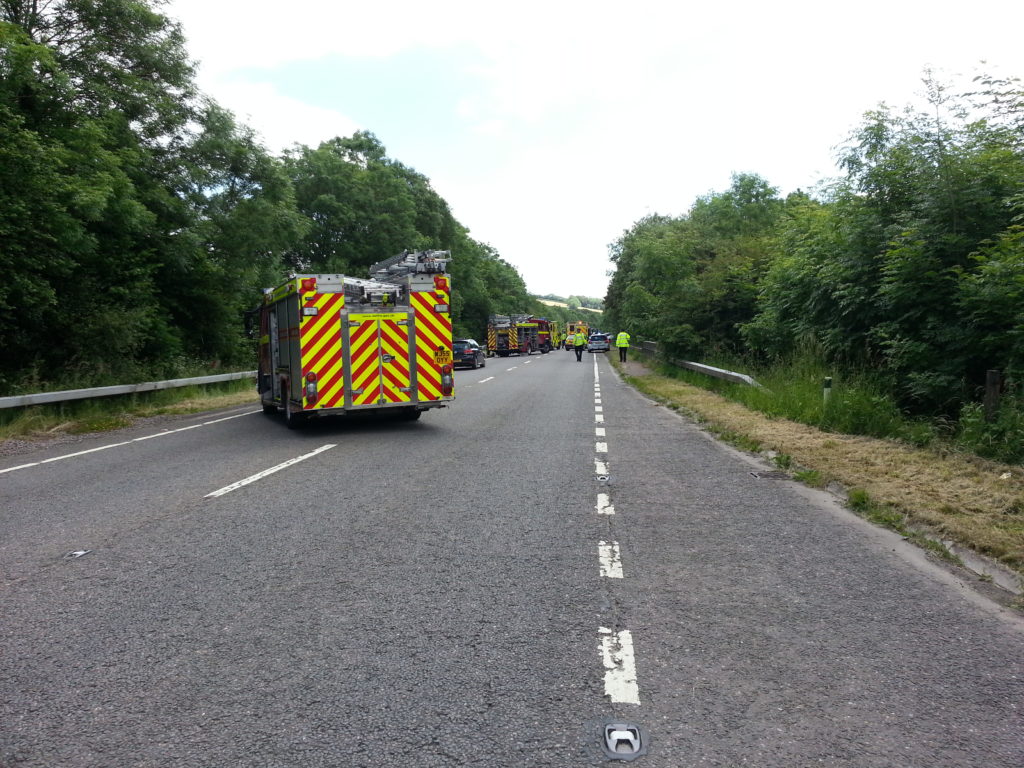
of something awful. I shouted for Ruth and JTA to see what they could do (they’re both Red Cross first aiders, after all) as I phoned the emergency services and extracted our
location from the SatNav, then started working to ensure that a path was cleared through the traffic so that the ambulances would be able to get through.
Ambulances, fire engines, and police cars arrived quickly, or so it felt: honestly, my perception of time at this point was completely shaken.
A passer-by – an off-duty police officer – joined Ruth and I in performing CPR on one of the drivers, until paramedics arrived. My first aid training’s rusty compared to Ruth and
JTA’s, of course, but even thinking back to my training so long ago, I can tell you is that doing it with a real person – surrounded by glass and oil and blood – is
a completely different experience to doing it on a dummy. The ambulance crew took over as soon as they arrived, but it seems that it was too late for her. Meanwhile the driver of the
other car, who was still conscious and was being supported by JTA, hung on bravely but, local news reported, died that afternoon in hospital. Between the two cars, two people were killed; the third person
– a passenger – survived, as did a dog who was riding in the back of one of the cars.
Once we’d handed over to the emergency services, we retreated to a safe distance and, for perhaps the first time, began to contemplate what we’d seen.
I am aware that I’ve described the incident, and our participation in its aftermath, in a very matter-of-fact way. That’s because I’m honestly not sure what I mean to say,
beyond that. It’s something that’s shaken me – the accident was, as far as I could see, the kind of thing that could happen to any of us at any time, and that realisation forces
upon me an incredible sense of my own fragility. Scenes from the experience – the cars shattering apart; the dying driver; her courageous passenger – haunt me. But it feels unfair to
dwell on such things: no matter what I feel, there’s no way to ignore the stark truth that no matter how much we were affected by the incident… the passenger, and the families and
friends of those involved, will always have been affected more.
It took hours for us to get back on the road again, and the police were very apologetic. But honestly: I don’t think that any of us felt 100% happy about being behind the wheel of
a car again after what had just happened. Our journey back home was slow and cautious, filled with the images of the injuries we’d seen and with a newly acute awareness of the
dangers of the glass-and-metal box we sat inside. We stopped at a service station part-way home, and I remarked to Ruth how surreal it felt that everybody around us was
behaving so normally: drinking a coffee; reading a paper; oblivious to the fact that just a few tens of miles and a couple of hours away, people just like them had lost
their lives, doing exactly what they were about to go and do.
It’s all about perspective, of course. I feel a deep sorrow for the poor families of the people who didn’t make it. I feel a periodic pang of worry that perhaps there were things I
could have done: What if I’d have more-recently practised first aid? What if I’d more-quickly decoded our position and relayed it to the operator? What if I’d have offered to help Ruth
immediately, rather than assuming that she had sufficient (and the right kind of) help and instead worked on ensuring that the traffic was directed? I know that there’s no
sense in such what-if games: they’re just a slow way to drive yourself mad.
Maybe I’m just looking for a silver lining or a moral or something in this story that I just can’t find. For a time I considered putting this segment into a separate blog post: but I
realised that the only reason I was doing so was to avoid talking about it. And as I’m sure you all know already, that’s not a healthy approach.
Right now, I can only say one thing for certain: our holiday to Devon is a trip I’ll never forget.
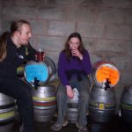
In case you hadn’t guessed, the destroyed tent I posted a picture of to my blog a few days ago wasn’t Jimmy‘s at all, but another tent we saw while on the Abnib Real Ale Ramble. Jimmy has since gotten his
revenge by ensuring I play Medieval II: Total War, which has occupied most of my life since we got back. Pictures from the entire weekend, mostly taken on JTA‘s (borrowed) camera, which
had a habit of turning itself off without warning, are available on Abnib Gallery.
In the end, it was only Ruth, JTA, Claire and I that went to Llanwrtyd Wells for the Real Ale Ramble this year. Claire
and I borrowed Jimmy’s tent and camped on the local rugby pitch, where the toilet/shower block (which doubles as the local scout troop hut) was unlocked for us. Of the three nights we
camped, there were only other people camping there on one night: three tents appeared a little way from ours during our first day’s rambling, and disappeared again the following
morning. The temperature was tolerable, given our heavy-duty sleeping bags, but the torrential hailstorms made camping a more exciting experience than we had anticipated, and it almost
became necessary to re-peg the tent during one of the more violent storms.
Ruth & JTA, meanwhile, set themselves up at Ardwyn House, a B&B near the self-catering cottage in which we stayed last year.
I’ll leave it to them to describe the comparative life of luxury they were allowed to live there. Still; it must be said that our campsite had a higher showers-to-guest ratio than them,
so perhaps we win after all. On our final night, after returning from the pub, we all had a great and very tense game of Illuminati in
the library (yes, their B&B had a library) and drank champagne to celebrate Ruth & JTA having been together for approximately three years. Again, suppose that’s more something for
them to blog about.
We did the 15-mile ramble on the first day, which remains, like last year, about twice as hard or more as the 10-mile walk (which we
did on the second), even without a broken foot. The pouring rain of the previous few days – accompanied by scattered showers on the first day – resulted in very wet conditions, and at
times the mudslides made it difficult to stay in the same place, never mind making progress up an embankment. On several humorous occasions one or another of us would lose our balance
and hurtle down into the mud, but we were prepared for this with waterproof or semi-waterproof clothing pretty-much all round. The number of “beer tokens”, each worth half a pint of
beer (also exchangeable for hot and cold drinks and, sometimes, soup) was reduced this year to three per day, but the enforcement had been relaxed, and on the second day I recall that
Ruth drank three pints of Cambrian Ale without handing over a single token while we sat at a picnic bench by a river.
The evenings took us, predictably, to the Neuadd Arms, for a great number of interesting beers (Over The Edge, Red Dragon, Cambrian Ale,
Russian Stoat, and a few others come to mind as being well-worth-tasting) – and some equally interesting conversation with strange and unusual people: we met a man who’s life was taken
over by bonsai trees, a woman who graduated in Biology from Aberystwyth in 1985, and a lecturer who’d “disappeared” from his classes to come along to the festival, among others – but
also, this year, to the Stonecroft Inn, where, in a gazebo out the back of the pub, they had a fabulous selection of ales, ciders and perries
to try, as well as a flamethrower-like space heater that felt wonderful to stand in front of after a wet day in the hills.
Norman, the 70-something old man who beat us around both walks last year, was around again, and still
managed to get around the walk faster than us, although we might have beaten him on the second day were it not for the abandoned beer tent at Station 1 and, therefore, the temptation to
hang around for a second drink before hitting the trail again. He is, as I put it at the time, “a one-man walking machine,” before I realised how stupid that sounded. A few other
familiar faces were to be seen, too: folks we’d seen last year giving knowing nods as if to say, “Ah, it’s you again.” Although, more often, they were saying things like “You’re
camping? In this?”
One final highlight of the weekend that I’ll share with you is of a meal at the Neuadd Arms. On their menu they list a number of curry dishes, all rated by heat with a series of
“radiation” symbols by each, from one to three. Except for their Phaal, which has five, and promises a medal to anybody who can clear their plate. Claire, being Claire, tried it. She
didn’t manage to clear her plate, but that’s probably for the best, because the room was starting to feel warm and tingly as a result of the heat exuded by the dish. We all
tried a taste of it, once she’d admitted defeat, which was quite painful – but tasty. Claire’s promised to get herself into “curry training” for next year.
Right; time to start planning the Abnib Real Ale Ramble 2007!
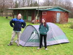
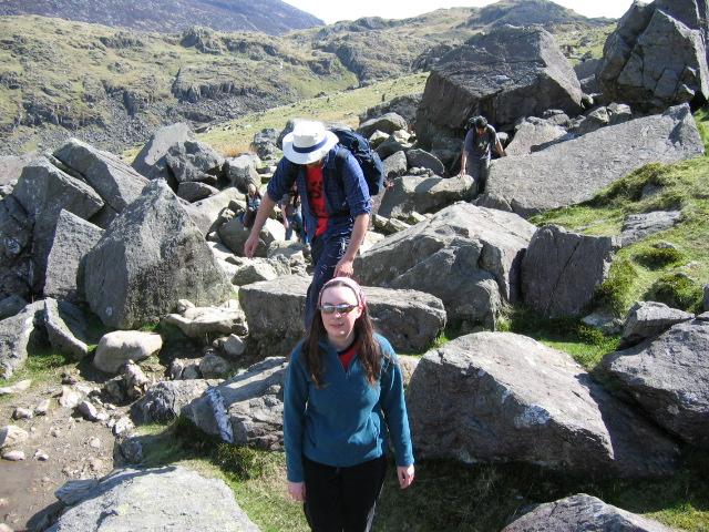
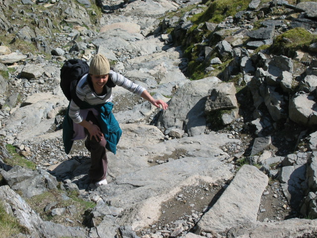
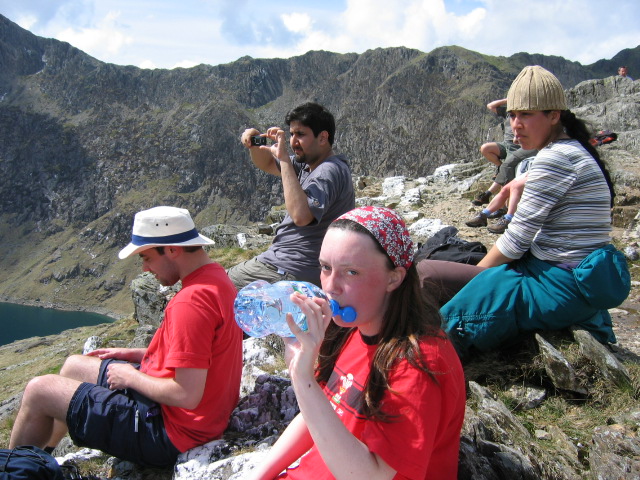
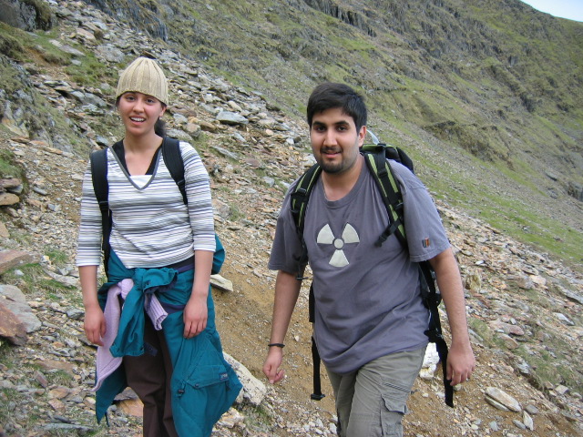
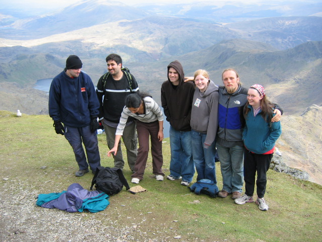
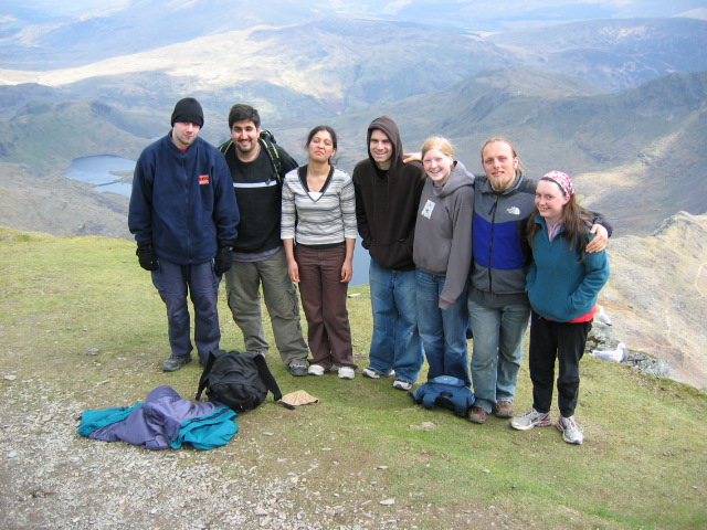
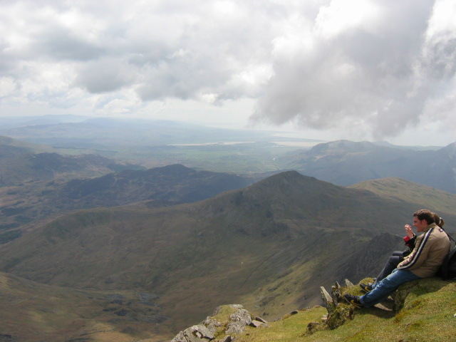
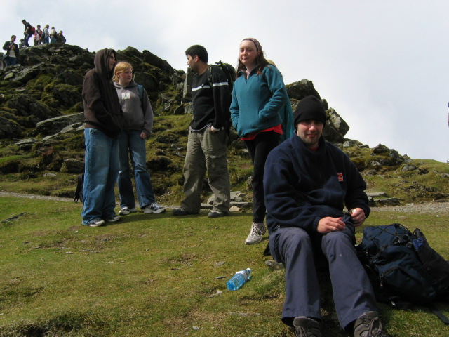
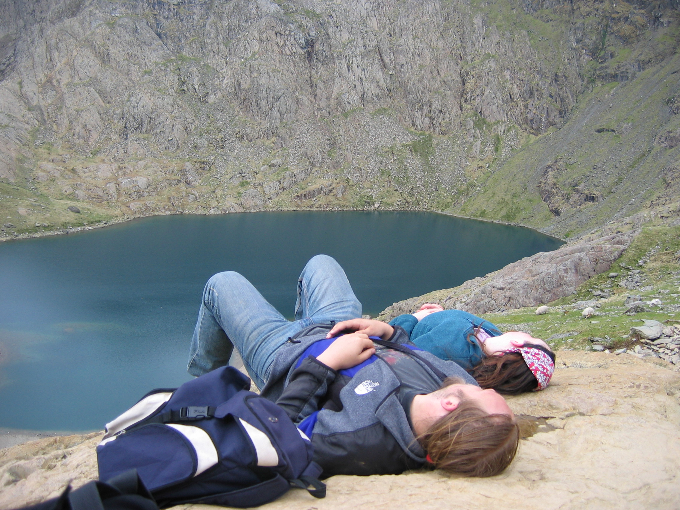
Sundeep had decided that we were to celebrate her birthday by climbing Snowdon, so
that’s what we did. My legs are sore now, not least because I thought it would be wise to jog most of the way back down again.
Here’s the piccies. As before, if you read this on my blog rather than on
Abnib or in your RSS reader or whatever then clicking on the pictures will start a slideshow-like pop-up thingy that’s ever so cool.
Well, Claire, JTA, Jimmy and I made it
back safely from our weekend of rambling across the mountains of mid-Wales and participating in one of the biggest Real Ale festivals
in the UK. Some photos are up on Abnib Gallery: all from my mobile, so far, but I’m sure that JTA and Claire will add a few that they took, soon. I’ve also put together a comic-book-esque collage of some of our activities [354K, JPEG], for if you just want the highlights and can’t even be bothered to read on.
Highlights (and other bits-of-interest) included:
Llanwrtyd Wells is even smaller than the maps imply. Jimmy went exploring, and 15 minutes later he’d seen pretty much the whole town. On another occassion he wandered into an
unstaffed bookshop (breaking the door handle on the way) and took a book, leaving some money on the counter for the shopkeeper upon his return. Nevertheless, even with Jimmy’s
directions, Claire and I couldn’t find the chemist.
We managed to have not only a “Geek Night On Location”, playing two games of Scotland Yard (a copy of which was conveniently left
in the chalet we rented) but a “Troma Night On Location” too, watching The Machinist and
Sin City.
Our preferred drinking establishment, the Neaudd Arms, had, at one point, 74 different ales on. There were closer to 40 by the time we got there, but several other ‘regular’ ales
were also available on tap.
I think I’ve broken a bone in my foot (one of the ones from where my little toe connects to).
We did the 10-mile walk on the first day, and (with the exception of Jimmy, who wasn’t well) the 15-mile one on the second. Thanks to my limping, mostly, we ran late on the second
day, and this, coupled with the bitter cold in the valleys, meant that the beer station operators had given up and gone home, leaving us to drink as much as we liked (rather than having
to trade in tokens, as was expected of us). So we did.
On our first night, the chalet was so cold that we all repeatedly woke up shivering. Claire solved this, in a dream, by imagining some HTML tags helping to tuck in her duvet, and slept soundly thereafter. Jimmy – not knowing HTML, presumabley – had to suffice with turning on the fire.
For the weekend, we played “Jimmy’s Game”, who’s rules were as follows: none of us were to make any “another game, with the
inevitable consequence that we all spent the entire weekend “out of The Game”.
We all want to go again next year, if not before!
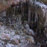
The second day was so cold that beer left standing would begin to freeze after a few minutes.
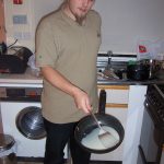
We’d finish each day – perhaps in order to undo what health benefits might have been given by the walking – with a huge fried supper: sausages, eggs, bacon, mashed potato loaded
with cheese, tomatoes, baked beans, and mushrooms. Plus desert of swiss roll or sweets. I’ve never seen Claire eat such a full plate before. Perhaps I need to make her climb hills more
often.
That’ll do for the highlights. I’m sure you’ll be able to read more on other people’s weblogs soon.
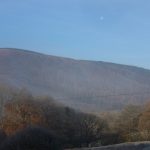
Well, the clocks have gone forward and the sun has come out. Something tells me there’ll be no more snow for a while. Yesterday, Dan, Paul, Bryn and I went up Pen Dinas (large hill
south of aber with monument atop it) and had a picnic. The food was good, the company better and the sunset… well it was just another sunset really. I’ve realised that i can’t
remember ever having seen a sunrise. Maybe one of these days I’ll be up early enough, and up a hill, and I’ll see one. Ah well.
After the picnic we went down the hill to Rummers, where we played silly games, first Cluedo(Paul won), then a game called Ntropy where the aim is to place sticks on a stick structure
without any sticks falling off. Sounds simple but it got really tactical during the second game. Two random people joined us that time, so we had six players and only a few sticks
each. It was tense, but Bryn won (again). We are goin to have to find a copy of that game so that we can finally beat bryn!
Then the last orders bell rang, and we returned to the flat, where we played Lord Of The Rings: the board game. It’s surprisingly good, given that you play cooperatively against the
rules to try to get the ring to Mordor. I was Pippin – impetuous.
Now it’s morning and I have a headache from all the beer and a backache from the rolling down hills head over heels. Nevertheless, it was a good day.


