Review of Kidlington Green Gardens

This review of Kidlington Green Gardens originally appeared on Google Maps. See more reviews by Dan.

Basic green space unfortunately bordered on all sides by moderately-busy roads, giving the area the feel of a traffic island. Trees are decorated each Christmas, and cycle racks are available, but no other amenities to speak of. More a passing-through place than anything else.

Review of Gosford Hill [bus stop]

This review of Gosford Hill originally appeared on Google Maps. See more reviews by Dan.

No shelter or seating, but this is principally a “dropping-off” point for passengers coming from Oxford and so that’s fine. Bus stop is in layby to mitigate disruption to other traffic.

Review of Gosford Hill [bus stop]

This review of Gosford Hill originally appeared on Google Maps. See more reviews by Dan.

Shelter, but no seating. No digital display board, and it could really benefit from one. Bus stopping area is a layby in order to reduce impact on traffic. Rubbish bin, but no recycling facilities.

Review of Osborne Close [bus stop]

This review of Osborne Close originally appeared on Google Maps. See more reviews by Dan.

Convenient dropping-off point for buses from Oxford. No shelter or seating, but for most people this is a disembarking point anyway. Recycling and waste bins nearby.

Review of Broad Close [bus stop]

This review of Broad Close originally appeared on Google Maps. See more reviews by Dan.

Somewhat awkwardly-placed bus stop: already-narrow footpath on this side of the road ends just a little to the South-West of this bus stop, and there are few convenient crossing points.

Review of Broad Close [bus stop]

This review of Broad Close originally appeared on Google Maps. See more reviews by Dan.

Shelter, but no seating. Digital display board showing next up-to-three buses due, with reasonable accuracy. Recycling bins adjacent, but you’ll need to cross the road for a non-recyclable waste bin.

Review of Osborne Close [bus stop]

This review of Osborne Close originally appeared on Google Maps. See more reviews by Dan.

Shelter, but no seating. No digital display board (go around the corner to Yarnton Road if you want to know how soon your bus is coming). Note that coming from Oxford the 2A takes a circuitous route to get to this end of Grovelands: you’re usually faster to catch a 2, 2B or 2C even if you have to wait longer for it.

Review of Oxford University Security Services, OUSS

This review of Oxford University Security Services, OUSS originally appeared on Google Maps. See more reviews by Dan.

Ever wonder what happens to those bikes which get abandoned locked to University bike racks? These guys happen to them. I’m sure they do other useful things, too, but clearing up precious bike storage space is what wins my love.

Review of Sheldonian Theatre [bus stop]

This review of Sheldonian Theatre originally appeared on Google Maps. See more reviews by Dan.

Check carefully before you travel: the 11 (formerly T1) doesn’t usually turn around on Broad Street at all but instead terminates on St. Aldates! This bus stop is not clearly marked, when it’s in use at all.

Dan Q couldn’t find GC87403 CR#2 Crossroads

This checkin to GC87403 CR#2 Crossroads reflects a geocaching.com log entry. See more of Dan's cache logs.

Searched at the GZ for about 10 minutes but then had to give up owing to a tight schedule (I was on my way back from my expedition to the 2019-08-01 51 -1 geohashpoint but only had limited time before I had to get on with some work in the afternoon).

Dan Q found GC873ZQ CR#1 Wood path

This checkin to GC873ZQ CR#1 Wood path reflects a geocaching.com log entry. See more of Dan's cache logs.

Amazed that this hasn’t seen more footfall in its 3-month life, but part of the reason might be the inaccurate coordinates: I searched in vain for some time before reading walk tall’s log which suggested that I ought to look closer to N 51° 51.882′ W 001° 28.304′, where I found it quite quickly – suggest that the cache is moved or the coordinates amended!

Dan Q found GC1JMQY SideTracked – Charlbury

This checkin to GC1JMQY SideTracked - Charlbury reflects a geocaching.com log entry. See more of Dan's cache logs.

A moderately easy find this afternoon while on my way back from my expedition to the nearby 2019-08-01 51 -1 geohashpoint; I needed the hint to reassure me that I was looking in the right place before I pushed my hand through the prickly bushes at the GZ. TFTC.

Geohashing expedition 2019-08-01 51 -1

This checkin to geohash 2019-08-01 51 -1 reflects a geohashing expedition. See more of Dan's hash logs.

Location

Edge of field near Charlbury railway station, Oxfordshire. Looks to be accessible via a narrow road connecting the B4437 to what looks like a sewage treatment plant.

Participants

Plans

Dan Q plans to cycle out to the hashpoint this morning/early afternoon, aiming to arrive around 13:00.

Expedition

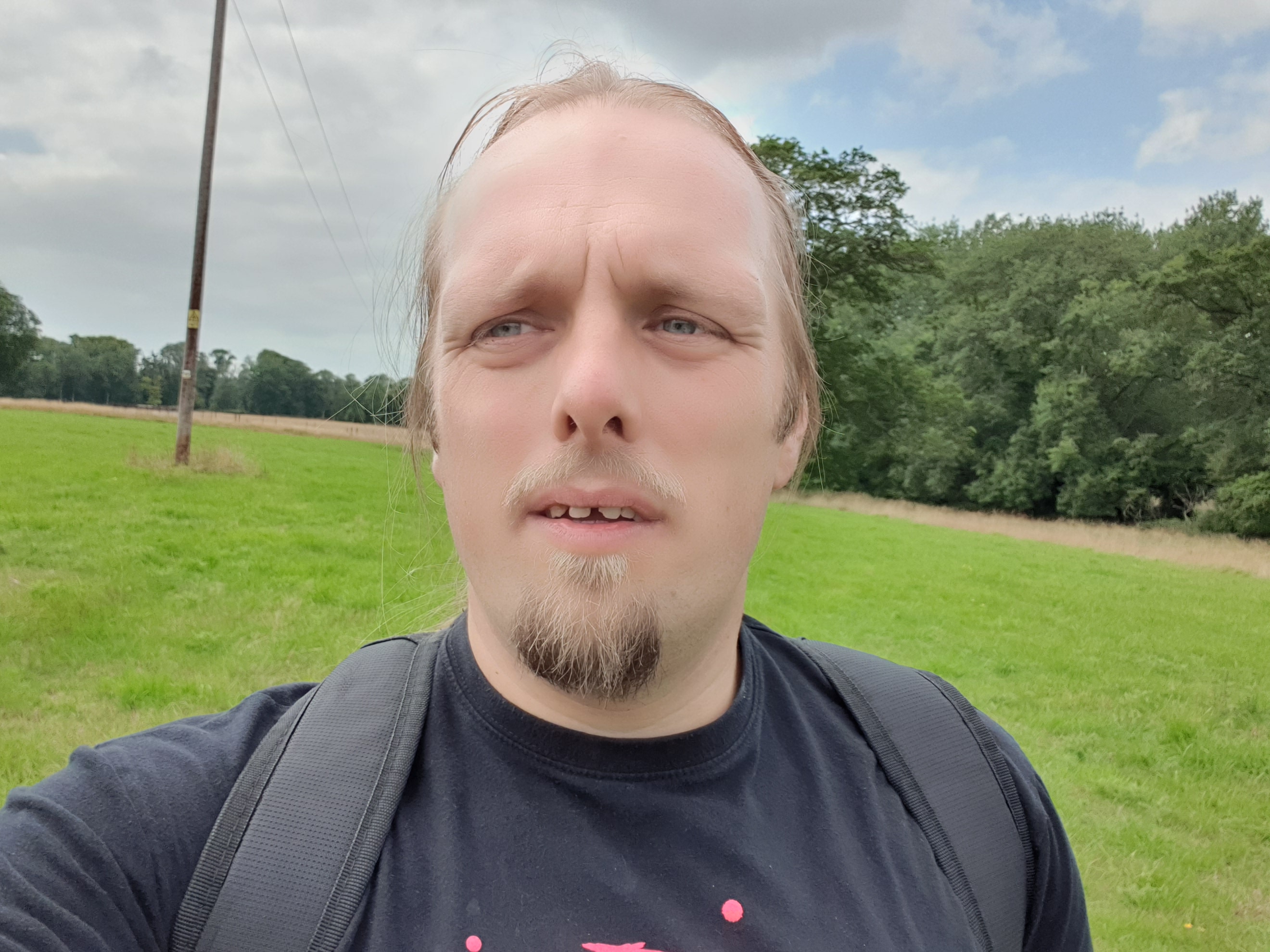
A morning meeting with an estate agent wrapped-up sooner than I expected, and I found myself with enough free time to tackle a cycle out to (and back from) this hashpoint with enough time to spare to do a little freelance work and study in the afternoon. The sun beamed gloriously except during a few windy moments (as you can hear hear in the accompanying video) and a couple of points where it briefly threatened to rain before changing its mind.

I picked a route that minimised the time I would spend on major roads: I left Kidlington via the towpath alongside the Oxford Canal, taking the woodland path to Begbroke alongside the “fairy doors”, and then the cyclepath alongside the A44 into Woodstock. There, I’d planned to cut through the grounds of Blenheim Palace, but for a brief moment I worried that this might not be possible: some kind of event is taking place at the Palace this week, and it seemed possible that parts of the grounds would be inaccessible. Fortunately I was allowed through and was able to continue my adventure without venturing on the main roads, but I still wonder if my route was truly legit: when I came out of the other side of the grounds I noticed a sign indicating that the route I’d taken was not supposed to be a public right of way to the Palace I’d just come from!

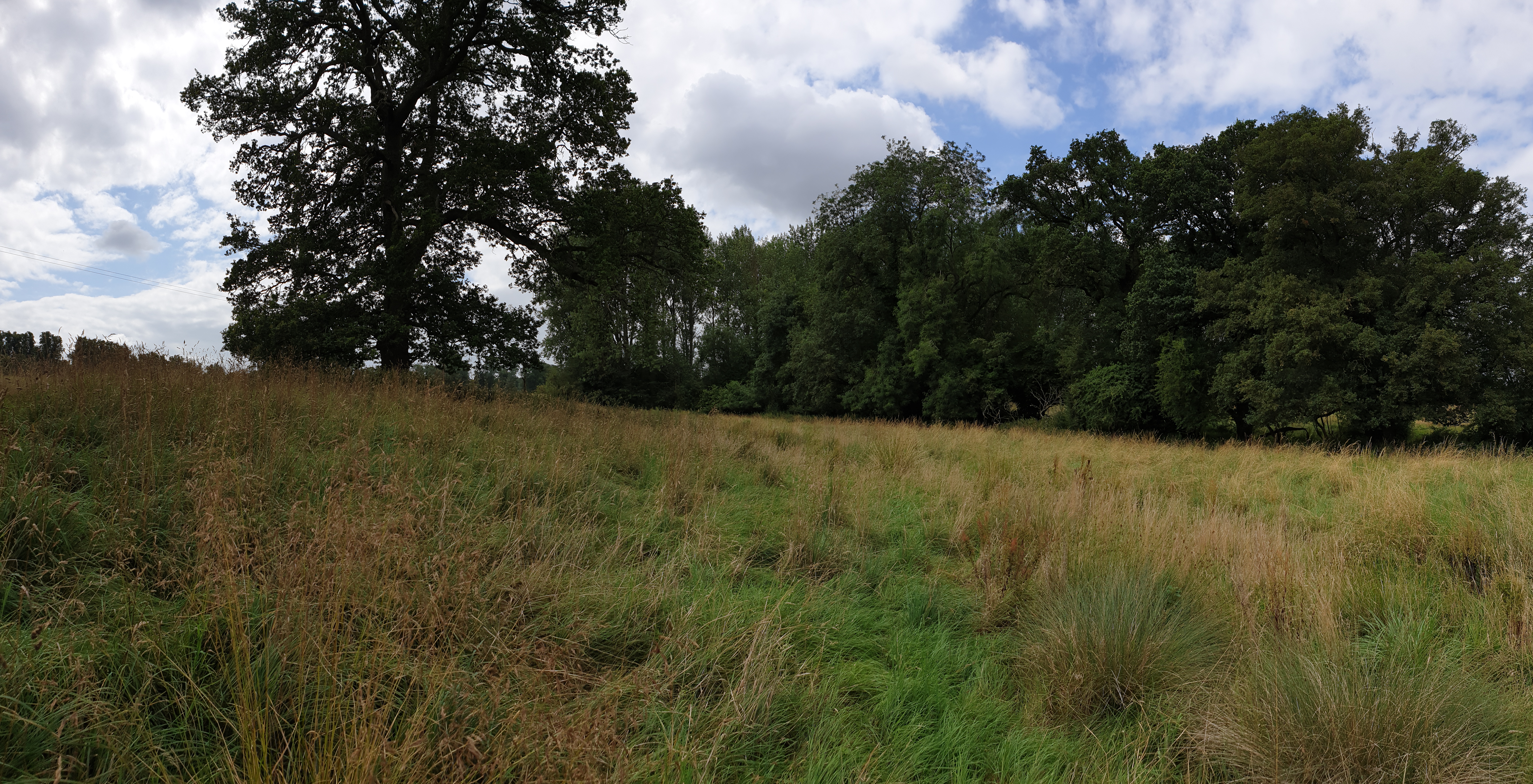
Pushing on through Stonesfield and Fawler I made my way to Charlbury, dismounted twice to pick my way through the village’s confusing one-way system, found the station, and made my way down the lane behind it. There’s a lovely little nursery there called The Railway Children, which is pretty cute for a nursery alongside a station. The lane seemed to exist only for the purpose of serving the sewage treatment works at the end of it, but nobody batted an eye at my cycling down it, and I was able to park my bike up half-way and walk the remaining 
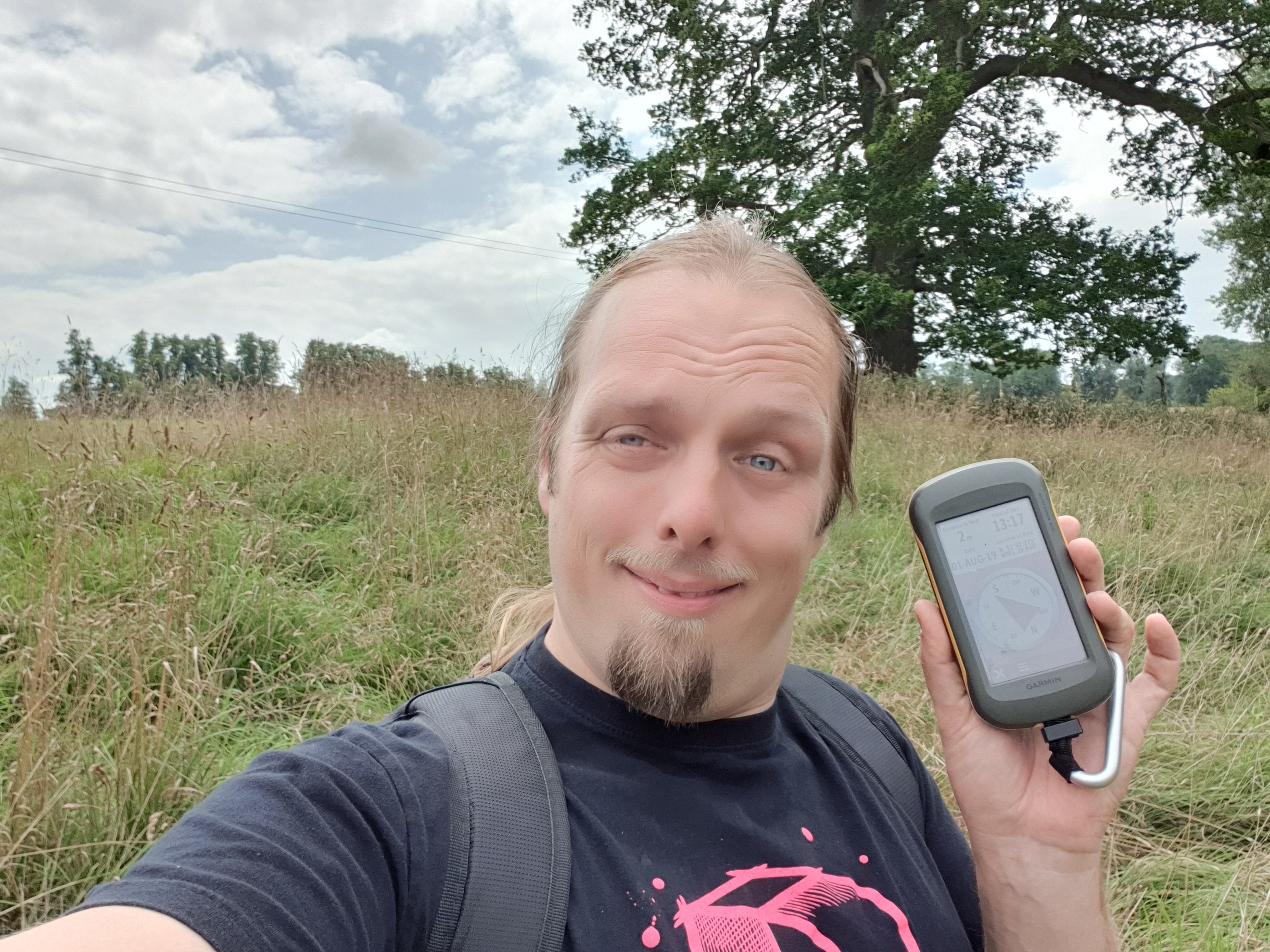
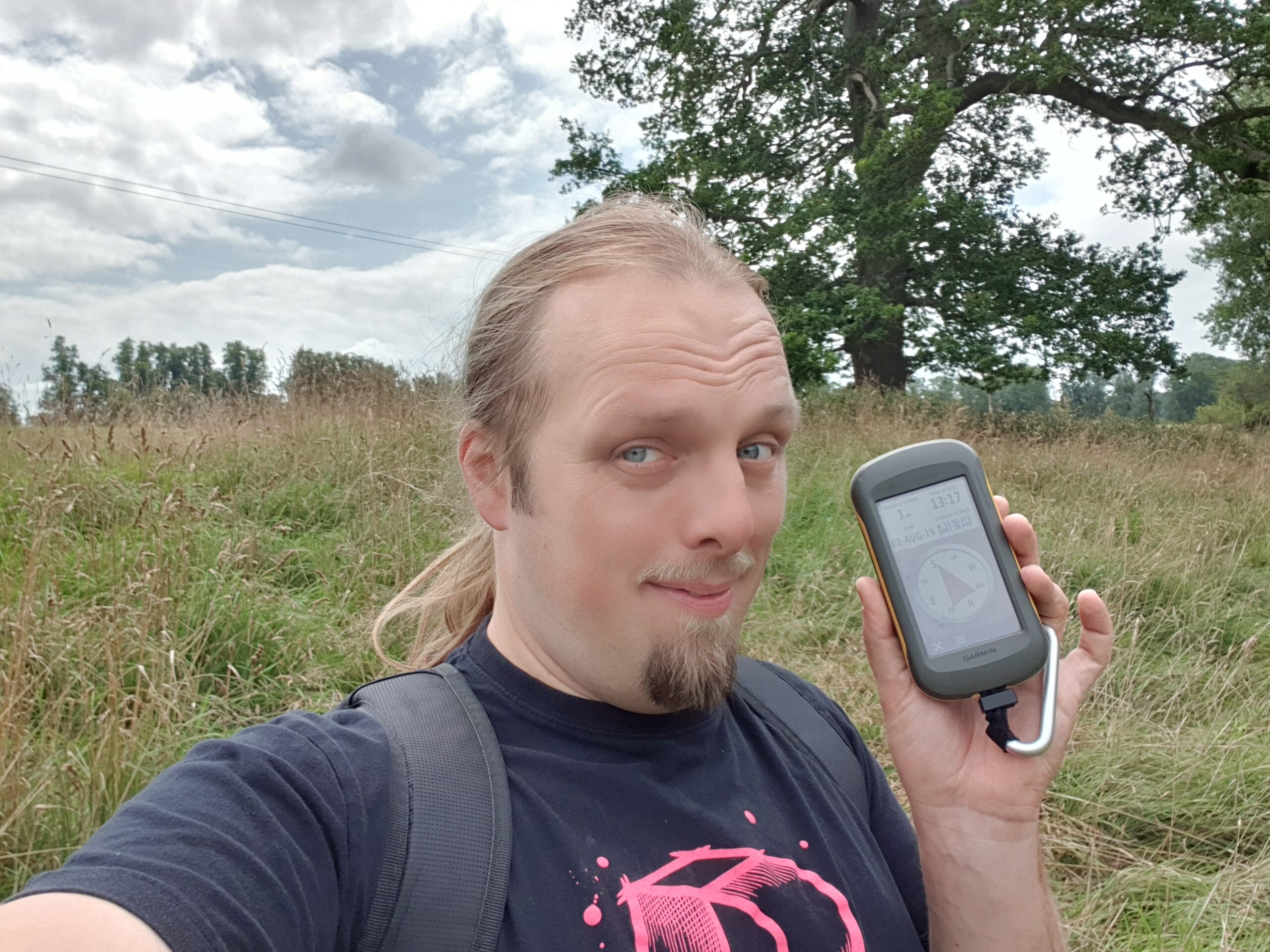
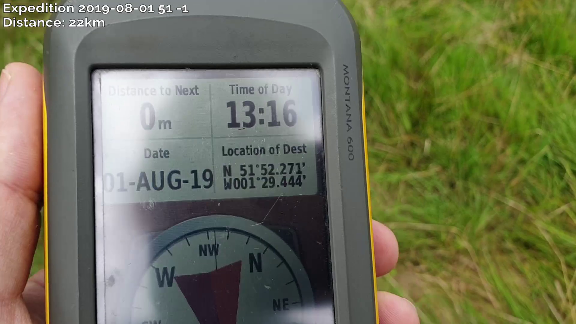
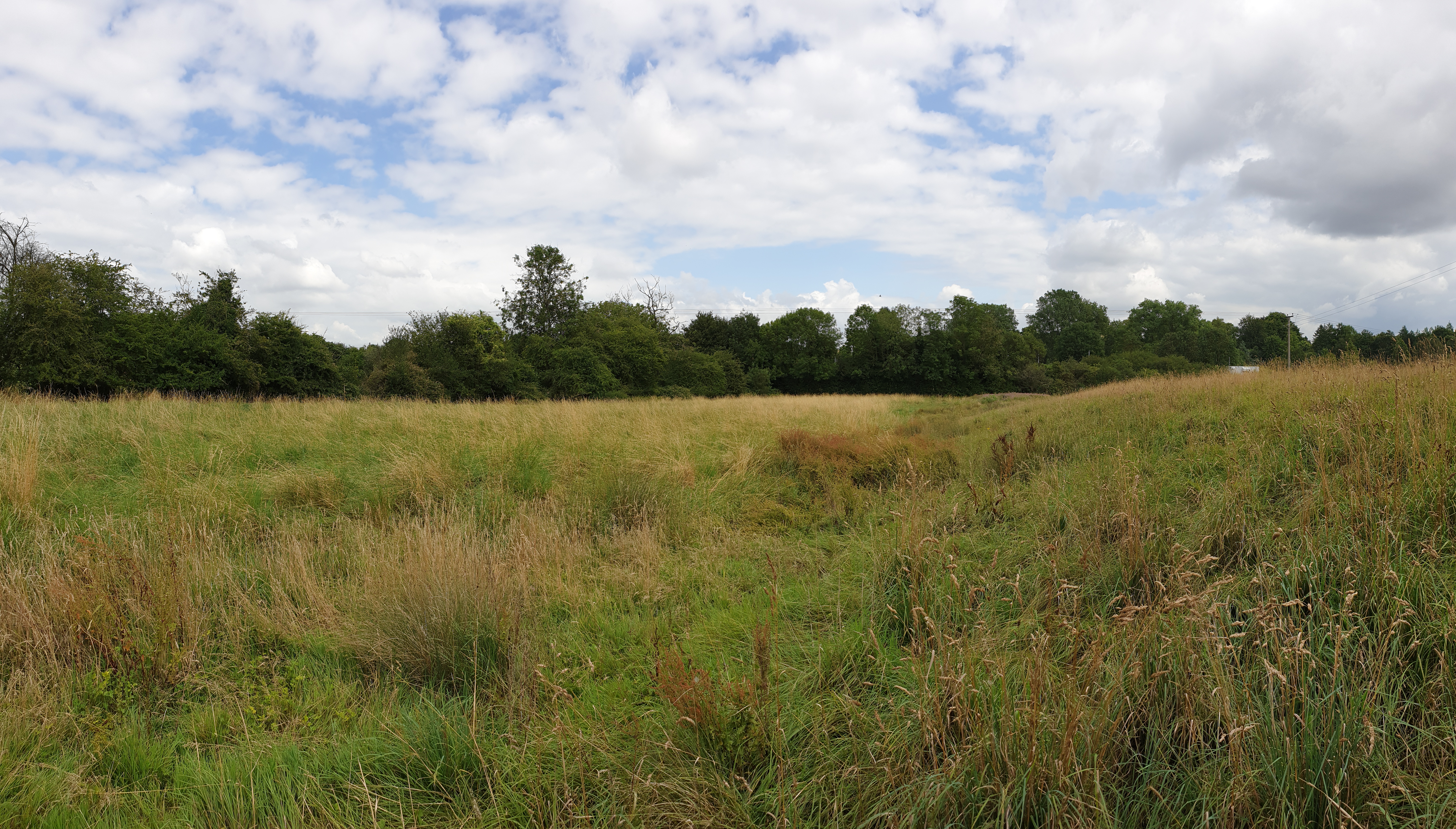
distance up through the grassy field to the hashpoint, arriving at about 13:30. It’s a beautiful area, but there’s not much more to say about it than that.

On the return journey I called in at geocaches GC1JMQY (log) and GC873ZQ (log), but failed to find GC87403 (log), principally because I was running out of spare time and had to cut my search short. I cycled home, logging a total journey of around 43 kilometres (around 27 miles).

Tracklog

My GPSr keeps a tracklog:

Video

I vlogged the entire experience.

Music: Pitx Remix by Martin Cee (softmartin) Copyright 2019, used under a Creative Commons Attribution (3.0) license.

You can also watch it at:

Photos

2019-08-01 51 -1 Geohashing expedition (video)

Expedition by bike from Kidlington to the to the 2019-08-01 51 -1 hashpoint in Charlbury via the Oxford Canal towpath, Begbroke, Oxford Airport, Woodstock, Blenheim Palace, and Stonesfield, and back via two geocaches.

Read the full log on this blog or at http://wiki.xkcd.com/geohashing/2019-08-01_51_-1.

This video also available at https://youtu.be/pGboZkJTm0A.

Music: Pitx Remix by Martin Cee (softmartin) Copyright 2019, used under a Creative Commons Attribution (3.0) license. http://dig.ccmixter.org/files/softmartin/59963