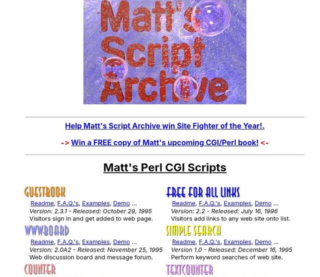
Around 1995 or so, a high schooler named Matt Wright decided to launch a website that shared some basic website tools that he programmed. Many of these were dead-simple, things like contact forms, guestbooks, and web counters.
…
OMG I remember Matt’s Script Archive. I taught myself Perl with (among other things) his scripts.
I took his Counter/ImageCounter script and adapted it into my own FireCounter, which stitched together (non-animated) GIFs of digits (which I made using a filter in Corel Photo-Paint, I think) into the kinds of edgy hit counter I was into, back in the day.
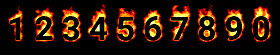
Later, I even added parameter handling to allow the webmaster to specify a different set of digit images, and referrer detection so that it could track different sites: each got its own text file with its count in it! For a while, a dozen or so of my friends had my counter visible on their Geocities and Angelfire pages!
I’m sure that my script had many, if not more, of the kinds of security vulnerabilities discussed in the linked article. But man, it felt like magic at the time!