Geohashing expedition 2020-09-09 51 -1

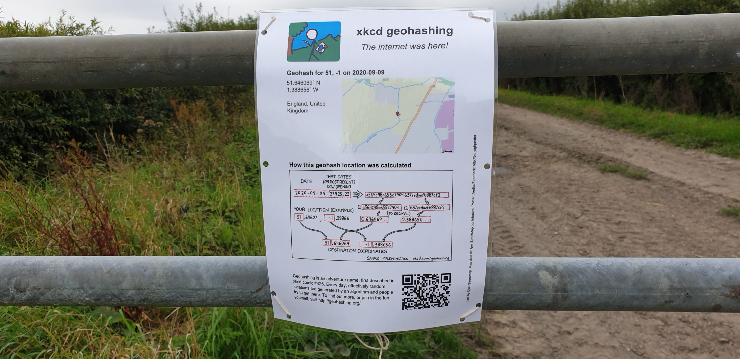
This checkin to geohash 2020-09-09 51 -1 reflects a geohashing expedition. See more of Dan's hash logs.

Location

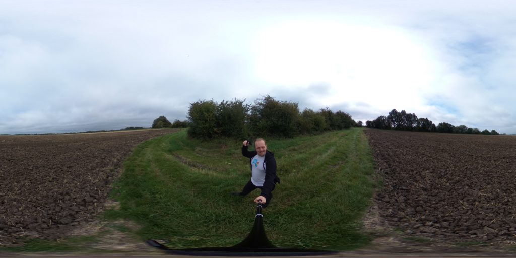
Edge of a field bounded by Letcombe Brook, over the A338 from Landmead Solar Farm.

Participants

Plans

We’re discussing the possibility of a Subdivision geohash achievement for people who’ve reached every “X in a Y”, and Fippe pointed out that I’m only a hash in the Vale of White Horse from being able to claim such an achievement for Oxfordshire’s regions. And then this hashpoint appears right in the Vale of White Horse: it’s like it’s an omen!

Technically it’s a workday so this might have to be a lunchtime expedition, but I think that might be workable. I’ve got an electric vehicle with a hundred-and-something miles worth of batteries in the tank and it looks like there might be a lay-by nearby the hashpoint (with a geocache in it!): I can drive down there at lunchtime, walk carefully back up the main road, and try to get to the hashpoint!

Expedition

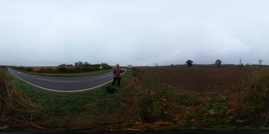
I worked hard to clear an hour of my day to take a trip, then jumped in my (new) electric car and set off towards the hashpoint. As I passed Newbridge I briefly considered stopping and checking up on my geocache there but feeling pressed for time I decided to push on. I parked in the lay-by where GC5XHJG is apparently hidden but couldn’t find it: I didn’t search for long because the farmer in the adjacent field was watching me with suspicion and I figured that anyway I could hunt for it on the way back.

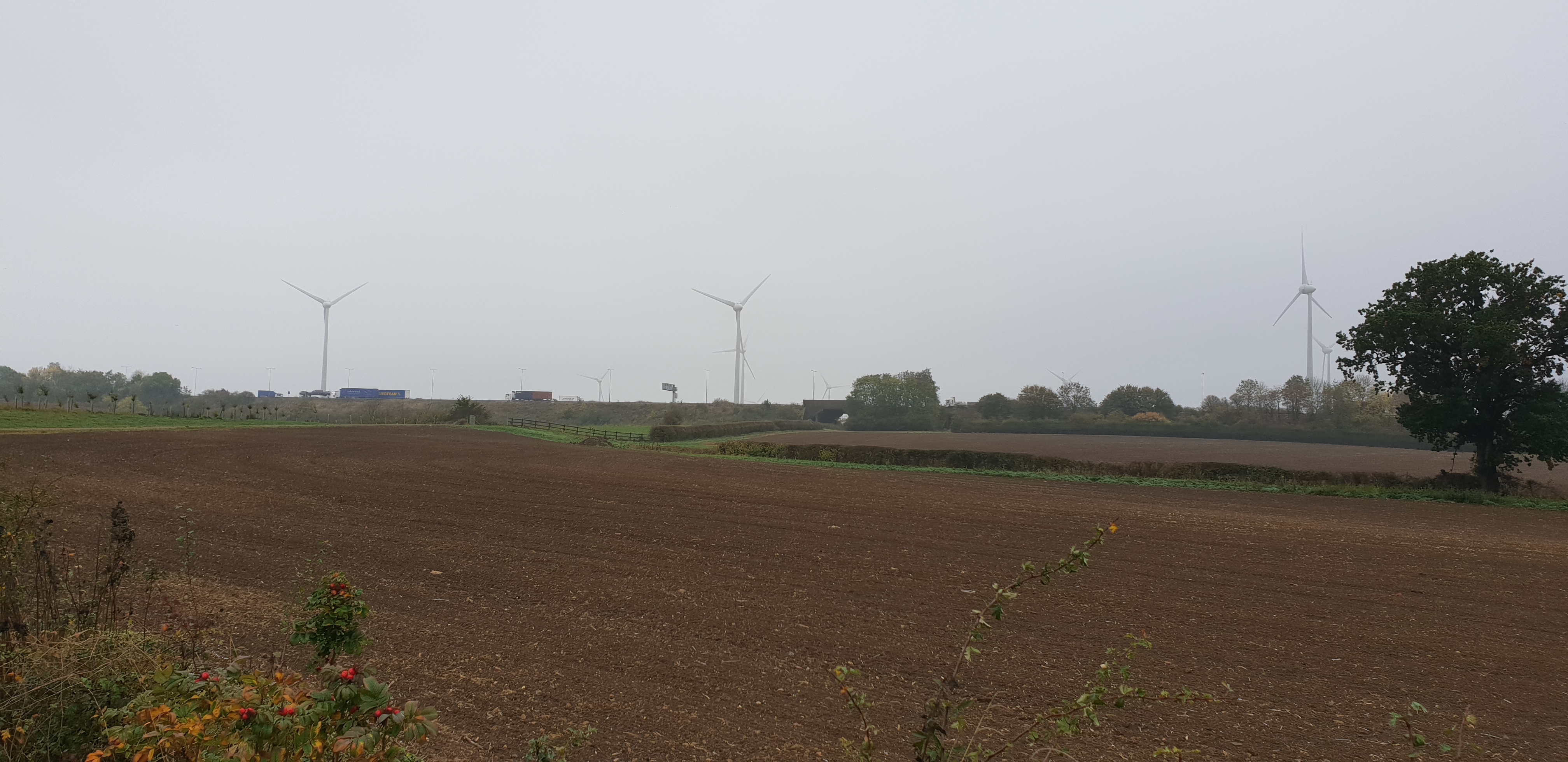
Walking along the A338 was treacherous! There are no paths, only a verge covered in thick grass and spiky plants, and a significant number of the larger vehicles (and virtually all of the motorbikes) didn’t seem to be obeying the 60mph speed limit!

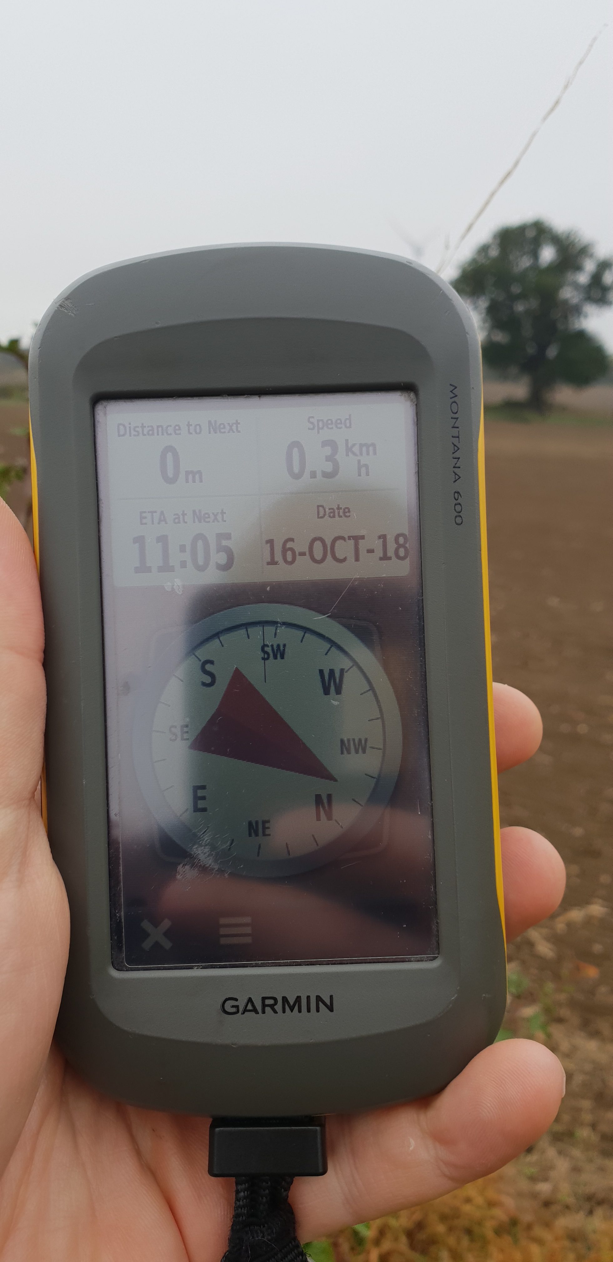
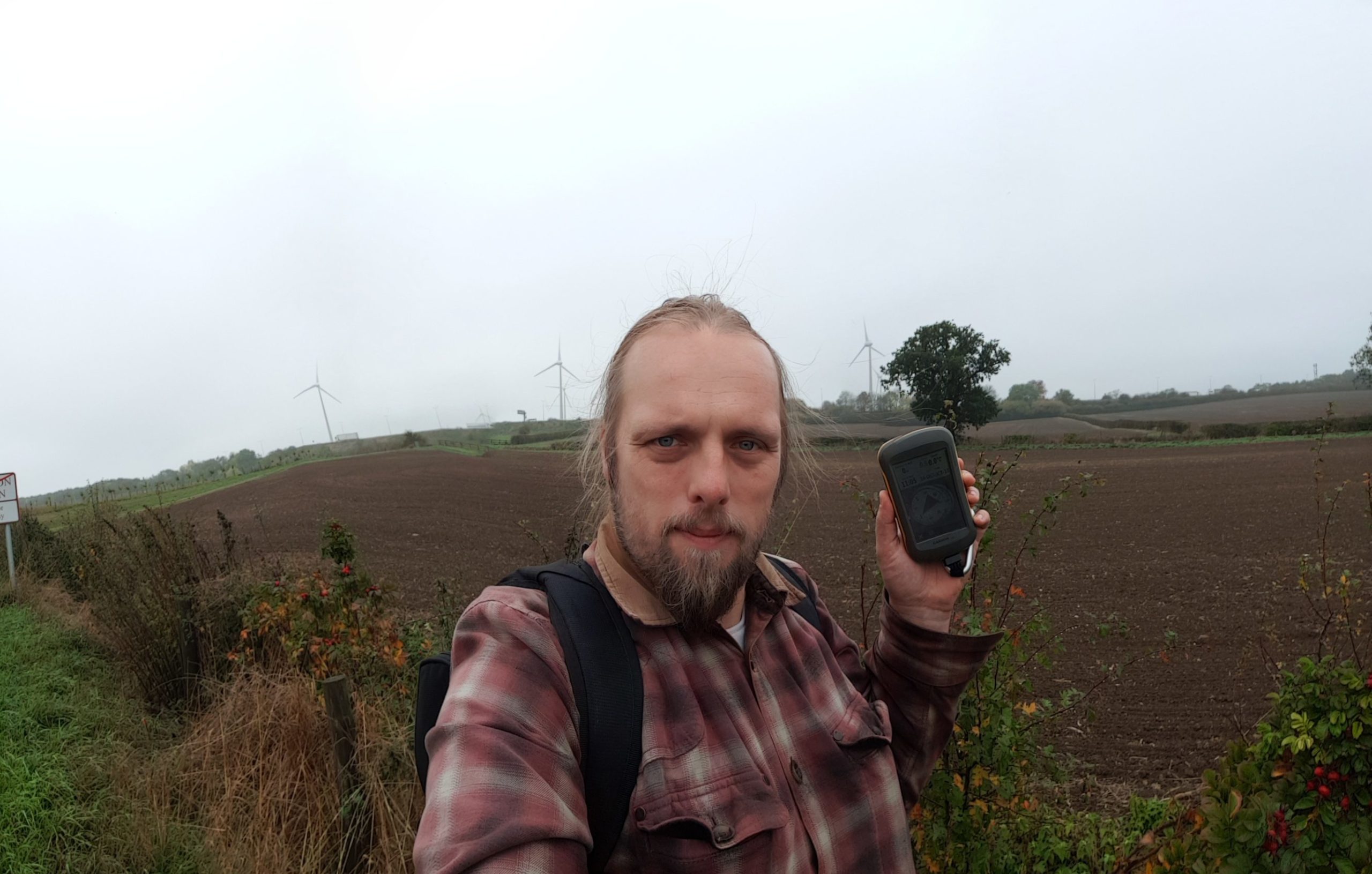
Reaching the gate, I crawled under (reckoning that it’s probably there to stop vehicles and not humans) and wandered along the lane. I saw a red kite and a heron doing their thing before I reached the bridge, crossed Letcombe Brook, and followed the edge of the field. Stuffing my face with blackberries as I went, it wasn’t long before I reached the hashpoint on one edge of the field.

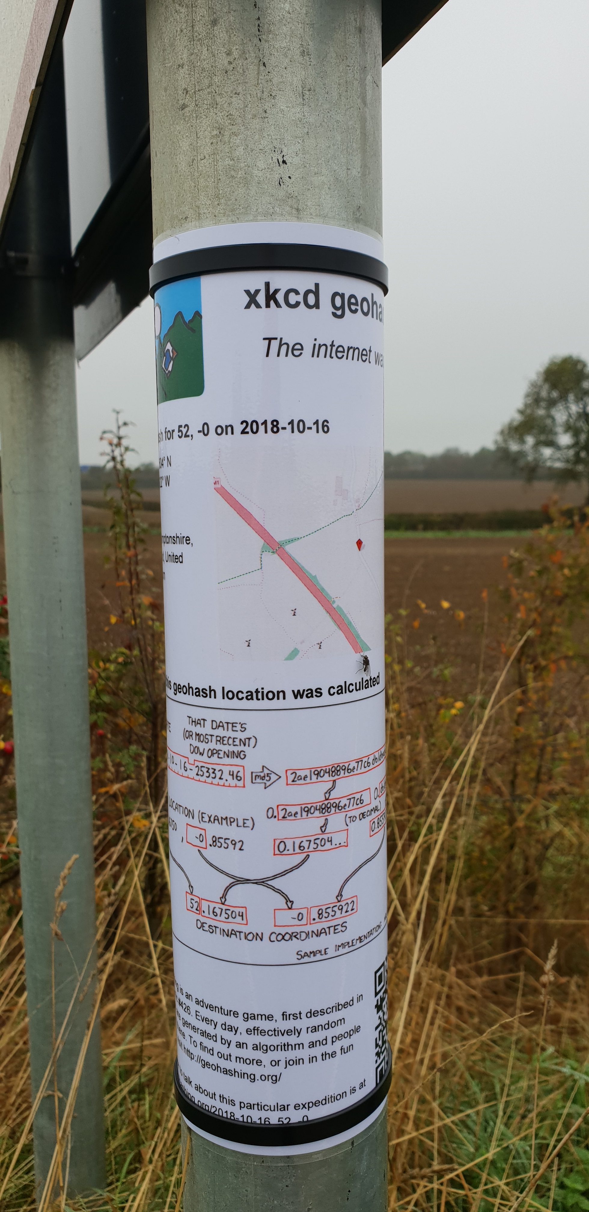
I took a short-cut back before realising that this would put me in the wrong place to leave a The Internet Was Here sign, so I doubled-back to place it on the gate I’d crawled under. Then I returned to the lay-by, where another car had just pulled up (right over the GZ of the geocache I’d hoped to find!) and didn’t seem to be going anywhere. Sadly I couldn’t wait around all day – I had work to do! – so I went home, following the satnav in the car in a route that resulted in a figure-of-eight tracklog.
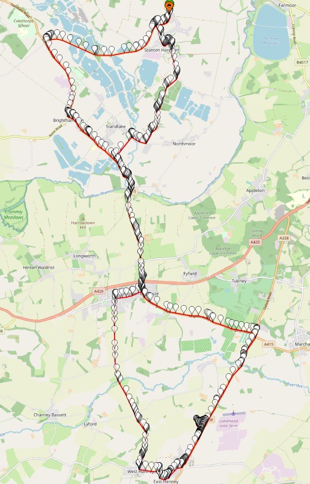
Tracklog

My GPS keeps a tracklog. Here you go:

Geohashing expedition 2020-09-09 51 -1 tracklog map

Video

You can also watch it at:

Photos

360° panoramic VR photo of the 2020-09-09 51 -1 geohashpoint

Geohashing expedition 2020-09-09 51 -1 tracklog map× 360° panoramic VR photo of the 2020-09-09 51 -1 geohashpoint×

Geohashing expedition 2018-10-16 52 -0

This checkin to geohash 2018-10-16 52 -0 reflects a geohashing expedition. See more of Dan's hash logs.

Location

Alongside a lane that runs through the Quinton Green Business Park, South of the village of Quinton.

Participants

Plans

I’ve got an exam in Milton Keynes in the afternoon, so it’d be only a minor diversion for me to come and try to visit this roadside hashpoint. I hope to be there about 10:30.

Expedition

Failed to turn on the tracklogger on my GPS, but I remembered to get photos at least. This was a quick and easy run, although I did get accosted by a local who saw me hanging around near the wind farm and putting up a sign… I think that after the controversy these epic windmills caused he might have thought that I was putting up a planning notice to erect some more or something. Once I explained what I was doing he seemed happy enough.

Used my new 360° full-panoramic camera to take a picture at the hashpoint; I’ll put a VR-ready version on my website and link it here when I get the chance.

Panoramic 360° VR-ready wraparound of the hashpoint

Photos

Panoramic 360° VR-ready wraparound of the hashpoint×

Note #10601

Oh, go on, one more 360° photo: view from @NuffieldCollege’s (library) tower, ten stories above the #Oxford castle quarter.

View from Nuffield College library tower.

Note #10598

One last @NuffieldCollege 360° photo on my lunchtime walk. Cool archway!

Nuffield College - archway

Note #10596

Walking around @NuffieldCollege at lunchtime: love this long pond.

Note #10594

Lunchtime at @NuffieldCollege gave me another excuse to snap some 360° photos; this one’s part of the quad.

Nuffield College quad

Note #10589

The @bodleianlibs Comms Team Away Day at @NuffieldCollege provides yet another excuse to play with 360° photography.

IndieWebCamp Oxford

This weekend, I attended part of Oxford’s first ever IndieWebCamp! As a long (long, long) time proponent of IndieWeb philosophy (since long before anybody said “IndieWeb”, at least) I’ve got my personal web presence pretty-well sorted out. Still, I loved the idea of attending and pushing some of my own tools even further: after all, a personal website isn’t “finished” until its owner says it is! One of the things I ended up hacking on was pretty-predictable: enhancements to my recently-open-sourced geocaching PESOS tools… but the other’s worth sharing too, I think.

Hacking and learning at IndieWebCamp Oxford
Some of IndieWebCamp Oxford’s attendees share knowledge and hack code together.

I’ve recently been playing with WebVR – for my day job at the Bodleian, I swear! – and I was looking for an excuse to try to expand some of what I’d learned into my personal blog, too. Given that I’ve recently acquired a Ricoh Theta V I thought that this’d be the perfect opportunity to add WebVR-powered panoramas to this site. My goals were:

  • Entirely self-hosted; no external third-party dependencies
  • Must degrade gracefully (i.e. even if you’re using an older browser, don’t have Javascript enabled, etc.) it should at least show the original image
  • In plain-old browsers should support mouse (or touch) control to pan the scene
  • Where accelerators are available (e.g. mobiles), “magic window” support to allow twist-to-explore
  • And where “true” VR hardware (Cardboard, Vive, Rift etc.) with WebVR support is available, allow one-click use of that
IndieWebCamp Oxford attendees at the pub
It wouldn’t be a geeky hacky camp thingy if it didn’t finish at a bar.

Hopefully the images above are working for you and are “interactive”. Try click-and-dragging on them (or tilt your device), try fullscreen mode, and/or try WebVR mode if you’ve got hardware that supports it. The mechanism of operation is slightly hacky but pretty simple: here’s how it works:

  1. The image is inserted into the page as normal but with an extra CSS class of “vr360” and a data attribute pointing to the full-resolution image, e.g.:
    <img class="vr360" src="/uploads/2018/09/R0010005_20180922182210-1024x512.jpg" alt="IndieWebCamp Oxford attendees at the pub" width="640" height="320" data-vr360="/uploads/2018/09/R0010005_20180922182210.jpg" />
  2. Some Javascript swaps-out images with this class for an iframe of the same size, showing a special page and passing the image filename after the hash, e.g.:
    for(vr360 of document.querySelectorAll('.vr360')){
    const width = parseInt(vr360.width);
    const height = parseInt(vr360.height);
    if(width == 0) width = '100%'; // Fallback for where width/height not specified,
    if(height == 0) height = '100%'; // needed because of some quirks with Dan's lazy-loader
    vr360.outerHTML = `<iframe src="/q23-content/themes/q18/vr360/#${vr360.dataset.vr360}" width="${width}" height="${height}" class="aligncenter" class="vr360-frame" style="min-width: 340px; min-height: 340px;"></iframe>`;
    }
  3. The iframe page loads this Javascript file. This loads three.js (to make 3D things easy) and WebVR-polyfill (to fix browser quirks). Finally (scroll to the bottom of the code), it creates a camera in the centre of a sphere, loads the image specified in the hash, flips it, and paints it onto the inside surface of the sphere, sets up controls, and turns the user loose on it. That’s all there is to it!

You’re welcome to any of my code if you’d like a drop-in approach to hosting panoramic photographs on your own personal site. My solution’s pretty extensible if you want e.g. interactive hotspots or contextual overlays – in fact, that – plus an easy route to editing the content for less-technical users – is pretty-much exactly what I’m working on for my day job at the moment.

Note #10533

Listening to @garrettc kick us off at @indiewebcamp #oxford! #indieweb

IndieWebCamp Oxford